
Introduction
Langley Park is an 18th-century landscape park with woodland, with additional 19th- and 20th-century plantations. At its most extensive the park covered 193 hectares. It is now in divided use, with about 52 hectares designated as a country park and open to the public.
Terrain
The land is largely flat, sloping up in the north-east corner.www.historicengland.org.uk/listing/the-list
An C18 landscape park by Lancelot Brown on the site of a medieval deer park, surrounding an C18 country house with C18/C19 pleasure grounds and C19 gardens.
DESCRIPTION
LOCATION, AREA, BOUNDARIES, LANDFORM, SETTING
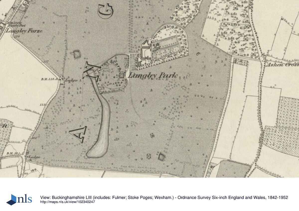
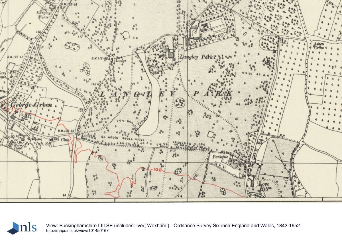
Langley Park lies on the north-east edge of Slough, 3km from the town centre, and 5km south-west of Uxbridge. The 160ha site is bounded to the west and north by the A412 Slough to Uxbridge road, to the south-west by Coronation Avenue, to the east by Billett Lane and agricultural land and to the south by a public footpath and remains of a deer fence separating the site from further agricultural land. The land is largely flat, sloping up in the north-east corner. The setting is mainly rural, with the heath and woodland of Black Park to the north and agricultural land to the south and east, and to the south-west the suburbs of Slough, relatively unobtrusive despite their close proximity.
ENTRANCES AND APPROACHES
The main, north drive enters 900m north of the house, off the Uxbridge Road, giving direct access from London and Slough, past rusticated stone gate piers with large ball finials and iron gates and railings (mid C18, listed grade II, moved 5m south in 1996); the C18, single-storey lodge on the west side was demolished in the 1950s. The drive, slightly raised above the surrounding ground, runs due south, flanked by an avenue of mature oak trees of mixed ages, with views into the west park and woodland and rides to the east. Some 100m north of the house a short spur from the north drive runs east to the stables; also at this point the south-west drive meets the north drive from the west parkland. The north drive continues south through a set of elegant iron gates to arrive at a broad flight of stone steps connecting the east front of the house and the gravel sweep in front of it. The drive continued to curve south-east across the park (OS 1881-2) to the single-storey, octagonal, rendered Park Stile Lodge (C18, listed grade II) 700m south-east of the house, but the northern end of the drive has recently been covered with soil and is not visible, effectively cutting off the Lodge from the house and park surrounding it. The Lodge may have been one of the medieval deer park lodges. The south-west drive enters 700m south-west of the house, off Middle Green lane, giving access from Langley village to the south and historically used as a service entrance. Passing between the low, curved flanking walls and rendered piers with wrought-iron railings and gates (C18, listed grade II), past the single-storey, square, rendered George Green Lodge (C18, listed grade II), the south-west drive curves north to run parallel with the lake before curving east north of the lake to meet the main drive north of the house. Traces survive of another slightly raised drive, running south beyond the garden across the south park and becoming a public footpath south of the site boundary, said to be (Pat Honey pers comm, 1997) the remains of the Marlborough Way, built by the Duke of Marlborough c 1740s to connect the estate with Windsor Castle via a bridge at Datchet to the south.
PRINCIPAL BUILDING
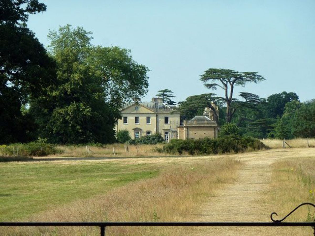
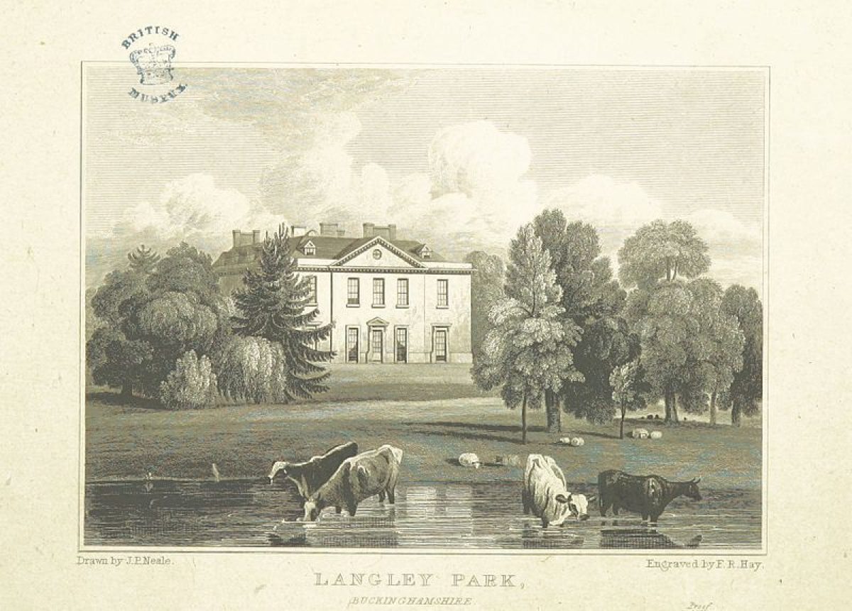
The house (Stiff Leadbetter 1755(8, listed grade II*) lies at the centre of the site, built as a hunting lodge for the third Duke of Marlborough c 100m south of the C17 Kederminster house. The design was innovative, producing a compact villa-type house, ashlar faced in brownish Woodstock stone. The otherwise simple east, entrance front is embellished by mid to late C19 blank-walled quadrant wings ending in square pavilions with angle towers in the manner of Vanbrugh, added for Robert Bateson-Harvey. A large rectangular orangery, also dating from this period, is attached to the north-west corner of the building; this has been converted to office accommodation, with a mezzanine floor. The view east from the entrance front crosses level parkland, with the remains of a line of Wellingtonias beginning 200m east, on an axis with this front. The views south and west from the house overlook the park and lake beyond the garden. From the north front a long view north crosses the car park in the garden, along an open area of park, parallel with the north avenue, to the northern woodland belt.
The red-brick stables (C18, listed grade II) lie 100m north-east of the house, a three-sided range with the fourth, east side consisting of a 6m high red-brick wall and central doorway into the kitchen garden to the east. The west range, facing the house and north drive, is the most ornamental, having a central pediment over an arched carriageway into the courtyard beyond, now formally laid out as a garden with a central pond. On the south side of the stable court a red-brick orangery and range of outbuildings (C18, listed grade II) has been converted to three dwellings.
GARDENS AND PLEASURE GROUNDS
The garden lies close to the house, encircling it on the north, west and south sides, with straight, formal gravel paths, terracing connected by short flights of stone steps and level lawns near to the south and west fronts. Closer to the perimeter is less formal lawn with mature trees and shrubs and curved paths. The north and south boundaries are largely separated from the park by a brick ha-ha, with the west boundary formed by the lake. The formal areas were created between 1882 and 1899 (OS), replacing an informal layout of trees and lawn. A car park has been built in the area north of the house. A small, rectangular rock garden lies in front of the main, west front of the brewery block (C18, listed grade II), at the south-west corner of the stables, divided in half by the path to the brewery main door.
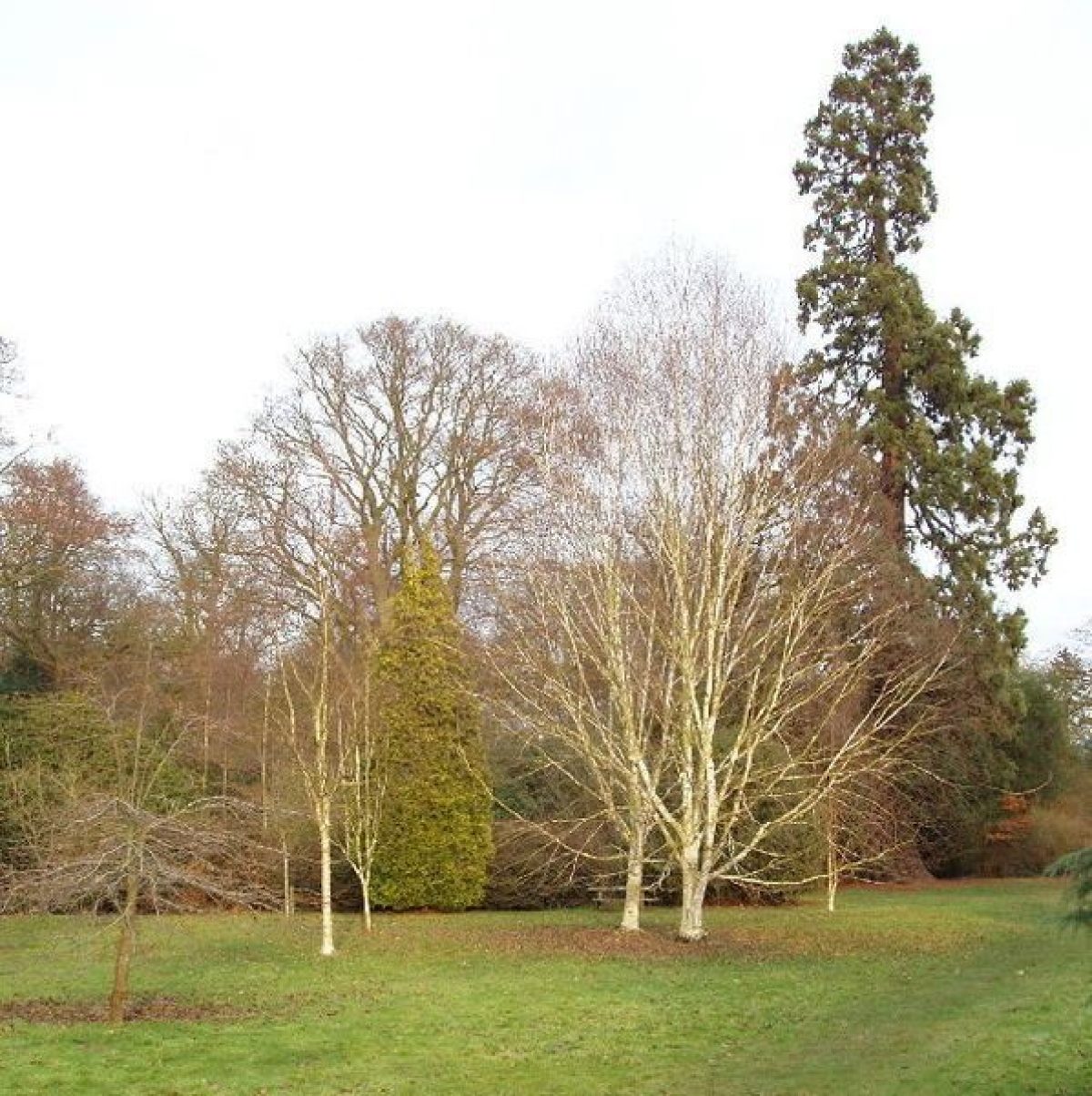
In the north-east corner of the park, created amongst heathy woodland, lies the pleasure grounds, based around the site of a 30m high monumental memorial column in oriental style (F P Cockerell 1864, demolished c 1960). The column replaced an elaborate, domed, octagonal Palladian temple, c 1740, by Roger Morris (demolished mid C19). The column's stone platform remains c 1km north-east of the house, surrounded by a rhododendron garden with mature standard trees, mostly oaks, above the shrubs, and bounded on the south and west by a 300m long, semicircular, red-brick ha-ha (c 1743, restored 1997). The area is at the highest point of the site, with a view from the temple/column site across the lawn to the south-west, along a park ride, and across the north drive and house to Windsor Castle 7km away.
PARK
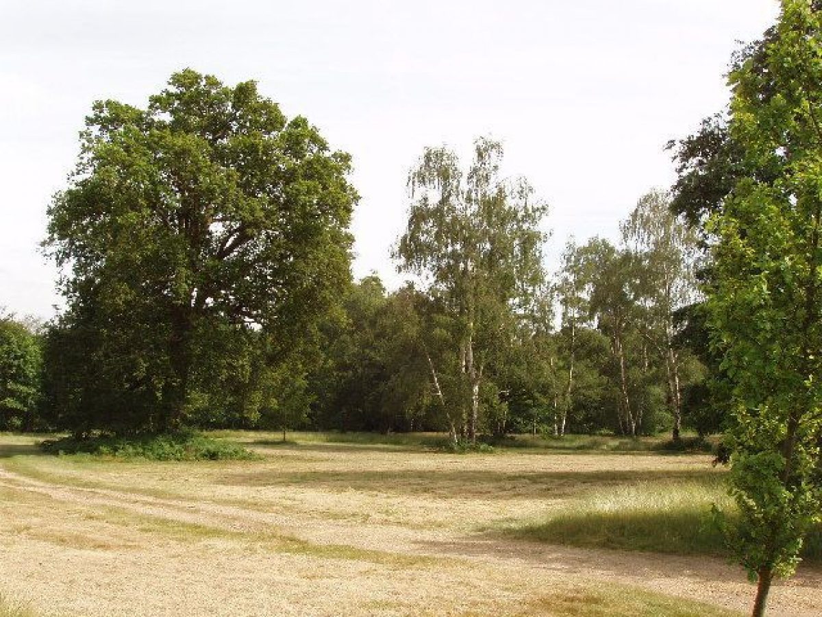
The park surrounds the house and gardens. The land falls from the high point at the north-east corner through heathy woodland with rides cut through, to the more open parkland in the rest of the site. The main feature in the park is the long, sinuous lake south and west of the house, created from a brook, possibly part of Brown's plan, and visible from the house above it to the north-east, and surrounding park. The majority of the park is pasture, or mown (south and east of the house), with some arable, together with single trees, and clumps, and narrow belts around much of the perimeter. The remains of an avenue runs from west to east along the south boundary, parallel with the remains of the deer fence. An area at the west corner was probably incorporated in 1937 when the old road was moved west to Coronation Avenue.
KITCHEN GARDEN
The rectangular kitchen garden covers c 1ha in two sections, divided by a 6m high brick wall which supported glasshouses. The garden, attached to the east end of the stables, is entered from the stable courtyard, and is surrounded by C18 red-brick walls (listed grade II) with a restored C19 glasshouse at the west end. It is now an ornamental garden.
REFERENCES
N Pevsner and E Williamson, The Buildings of England: Buckinghamshire (1994), p 742
History of Langley Park, (Bucks County Council management document 1997)
Maps
OS 6" to 1 mile:
2nd edition published 1900
3rd edition published 1925
OS 25" to 1 mile:
1st edition published 1881-2
2nd edition published 1899
Archival items
Lady Diana Balfour's Photograph Album, 1920s (private collection)
Description written: 1997 Amended: April 1999
Register Inspector: SR
Edited: October 1999
- Visitor Access, Directions & Contacts
Telephone
01753 511060Access contact details
The site is open daily, from 8.15am to around dusk. Please telephone 01 753 511060
Directions
The site is off the A412 to Slough.
- History
The following is from the Register of Parks and Gardens of Special Historic Interest. For the most up-to-date Register entry, please visit the The National Heritage List for England (NHLE):
www.historicengland.org.uk/listing/the-list
HISTORIC DEVELOPMENT
A deer park is first mentioned at Langley Marish in 1202, continuing in use throughout the Middle Ages. In 1603 Sir John Kederminster was appointed Chief Steward of the Manor of Langley Park, and shortly after replaced the hunting lodge with a house, red-brick stables and outbuildings. In 1626 the park and manor were granted to Sir John, ceasing to be Crown property. The park was sold in 1738 to Charles Spencer, third Duke of Marlborough who used it as a hunting lodge until, in 1756, he commissioned Stiff Leadbetter to build the present house, finished in 1760. His son George, the fourth Duke, succeeded in 1758 and commissioned Lancelot Brown (1716-83) to landscape Langley Park during his time working at Blenheim (qv). In Brown's account book under Blenheim an entry reads 'A plan for some alterations for Langley. The contract £2,810' (quoted in Bucks County Council 1997). There may be further evidence for Brown's involvement held in the archives at Blenheim Palace, Oxfordshire. In 1788 Robert Bateson-Harvey bought the estate which remained in the family until 1945 when it was sold to Buckinghamshire County Council. The house is currently (1997) in commercial use.
Period
18th Century (1701 to 1800)
- Associated People
- Features & Designations
Designations
The National Heritage List for England: Register of Parks and Gardens
- Reference: GD1593
- Grade: II
Features
- Specimen Tree
- Description: 800 year old yew tree.
- House (featured building)
- Earliest Date:
- Latest Date:
- Lake
- Tree Feature
- Description: Arboretum
- Key Information
Type
Park
Purpose
Recreational/sport
Principal Building
Recreational
Period
18th Century (1701 to 1800)
Survival
Extant
Hectares
193
Open to the public
Yes
Civil Parish
Wexham
- References
References
- {English Heritage Register of Parks and Gardens of Special Historic Interest} (Swindon: English Heritage 2008) [on CD-ROM] Historic England Register of Parks and Gardens of Special Historic Interest
- Pevsner, N and WIlliamson, E {The Buildings of England: Buckinghamshire} (1994) p 742 The Buildings of England: Buckinghamshire