Introduction
Harewood House has gardens and pleasure grounds of the 18th century with elements designed by Richard Woods and Thomas White. There is also a terraced garden of 1844-51 designed by Charles Barry with a planting scheme possibly by William Andrews Nesfield. The parkland was laid out to designs by Lancelot Brown during the period 1772-80 with alterations and additions of around 1800, some of which were executed to proposals by Humphry Repton.
Terrain
Rolling landscapeThe following is from the Register of Parks and Gardens of Special Historic Interest. For the most up-to-date Register entry, please visit The National Heritage List for England (NHLE):
Gardens and pleasure grounds of the C18 with elements designed by Richard Woods and Thomas White and a terraced garden of 1844-51designed by Charles Barry with a planting scheme possibly by William Andrews Nesfield. Parkland laid out to designs by Lancelot Brown during the period 1772-80 with alterations and additions of c 1800, some of which were executed to proposals by Humphry Repton.
Location, Area, Boundaries, Landform and Setting
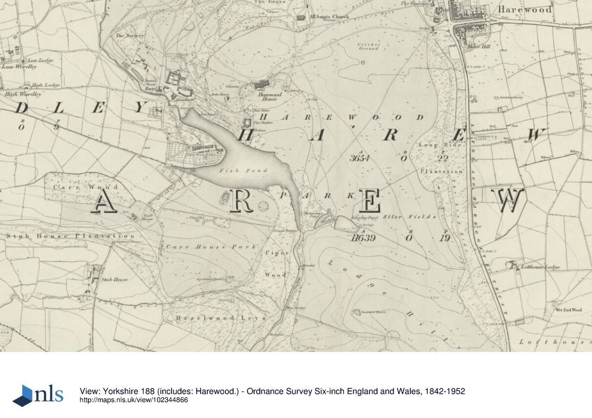
Harewood House lies immediately west of the village of Harewood in a rural and agricultural area. The c 350ha site is on rolling land which slopes down from the north-east to a point near the centre of the site and the lake, and then rises to the south. The north and north-east boundaries are formed by the A659, the north-west boundary is formed by Weardly Lane, and the remaining boundaries by fences dividing the site from agricultural land.
Entrances and Approaches
The principal entrance is from Harewood village where there is a gateway with lodges and linking walls (based on a design by Humphry Repton 1802-4, all listed grade II) from which a drive leads west to the north front of the House. This entrance was constructed following the realignment of the Otley to Tadcaster Turnpike in 1796-1800 when it was re-routed to the north side of Harewood Castle. North of this entrance there is a separate entrance leading to Church Lane which runs westwards to All Saints church. This was the former line of the turnpike and it continues as Sandy Gate, which connects with a system of drives running to the High and Low Lodges, which are on the west side of the site in the adjacent hamlets of High and Low Weardley.
Lofthouse Lodge (gate piers, gates and railings late C18, listed grade II), on the A659 south of the village, leads to a drive which runs west to New Bridge (1837, listed grade II) and turns to run northwards through woodland, crossing Rough Bridge (early C19, listed grade II), giving views of the House and lake before joining the main entrance drive north-east of the House. This approach was under construction in 1774 and was probably laid out by Lancelot Brown (1716-83). Humphry Repton (1752-1818) proposed some areas of new planting alongside it, shown as additions to a map of 1796, c 1800. Alwoodley Lodge (mid-late C18, with a pair of lodges, gates and flanking walls listed grade II together) lies on the south side of the site and a drive runs north from it through High Wood to join with a network of other drives and tracks through the site.
Principal Building
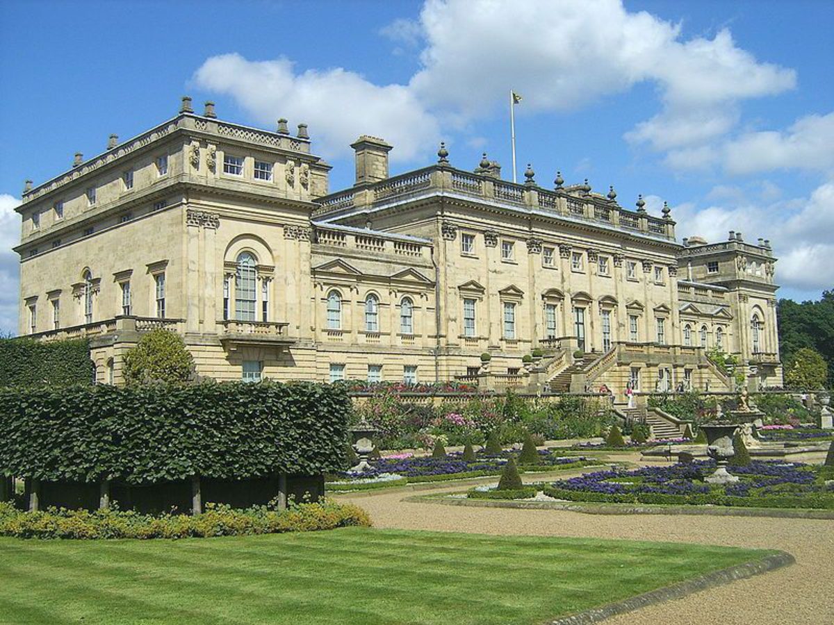
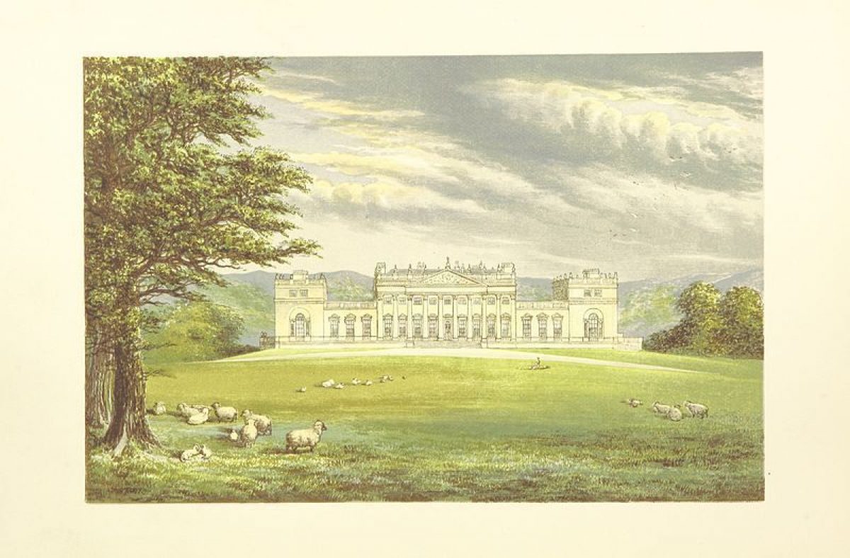
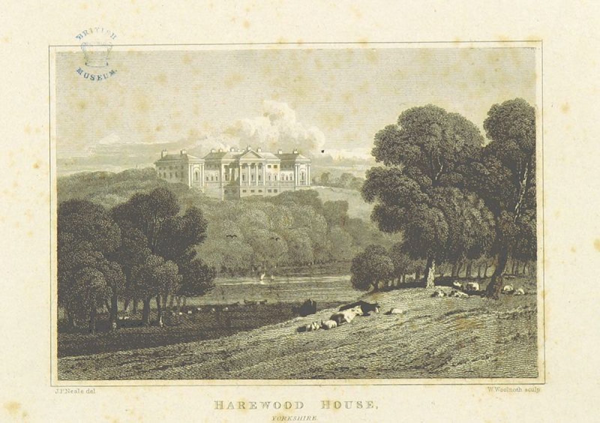
Harewood House (listed grade I) was designed by John Carr (1723-1807) for Edwin Lascelles in 1759. Robert Adam (1728-92) designed much of the interior and the building was altered by Charles Barry (1795-1860) in 1843. The House has some of the finest interiors in the region with work by Joseph Rose, Angelica Kaufmann, Antonio Zucchi and Biagio Rebecca. It stands on a platform overlooking falling land to the south, and slightly rising land to the north, at the far end of a spur of land which extends west from the village. This position was chosen to take advantage of the qualities of aspect and prospect afforded by the elevated site. Some 200m south-west of the House the stable complex (John Carr 1755-8, listed grade I) is in use as a restaurant, shops and related visitor facilities (1998).
The principal house of the estate in the mid C18 was called Gawthorp Hall, which was a medieval manor house altered in the C17 which lay at the bottom of the valley south of the present House and was demolished between 1770 and 1773.
Harewood Castle (listed grade I) lies in the north-east corner of the site c 1.4km north-east of the House. It is of mid C14 date and William Aldburgh received a licence to crenellate in 1366. Despite its semi-ruinous condition it is considered to be the best example of a C14 fortified tower house in Yorkshire. The Castle, with its twin towers rising above the trees which surround it, forms an incident in the landscape and was painted by J M W Turner in 1797.
All Saints church (listed grade I) lies c 400m north-east of the House on the west side of a sub-rectangular churchyard. The building is largely C15 and the west front was altered in 1793. It was restored 1862-3 by Sir G G Scott and is notable for a fine collection of medieval alabaster monuments.
Gardens and Pleasure Grounds
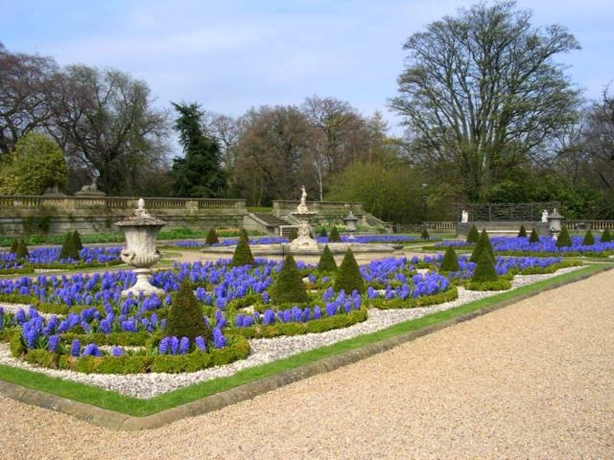
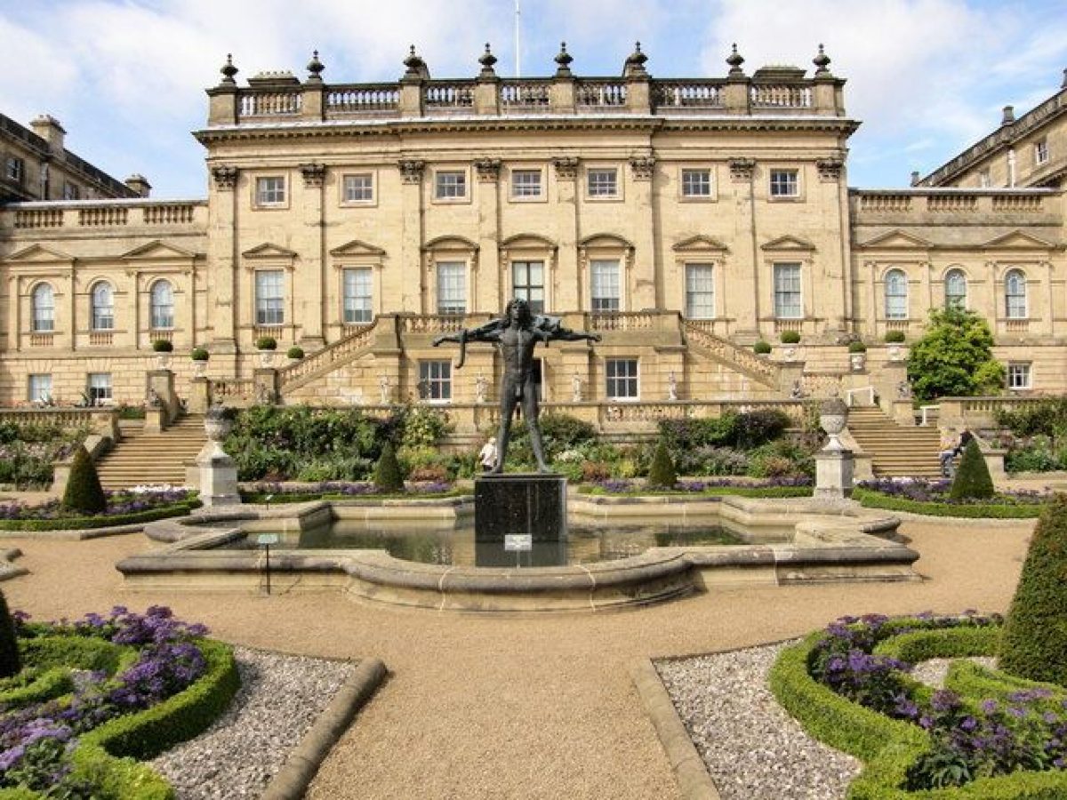
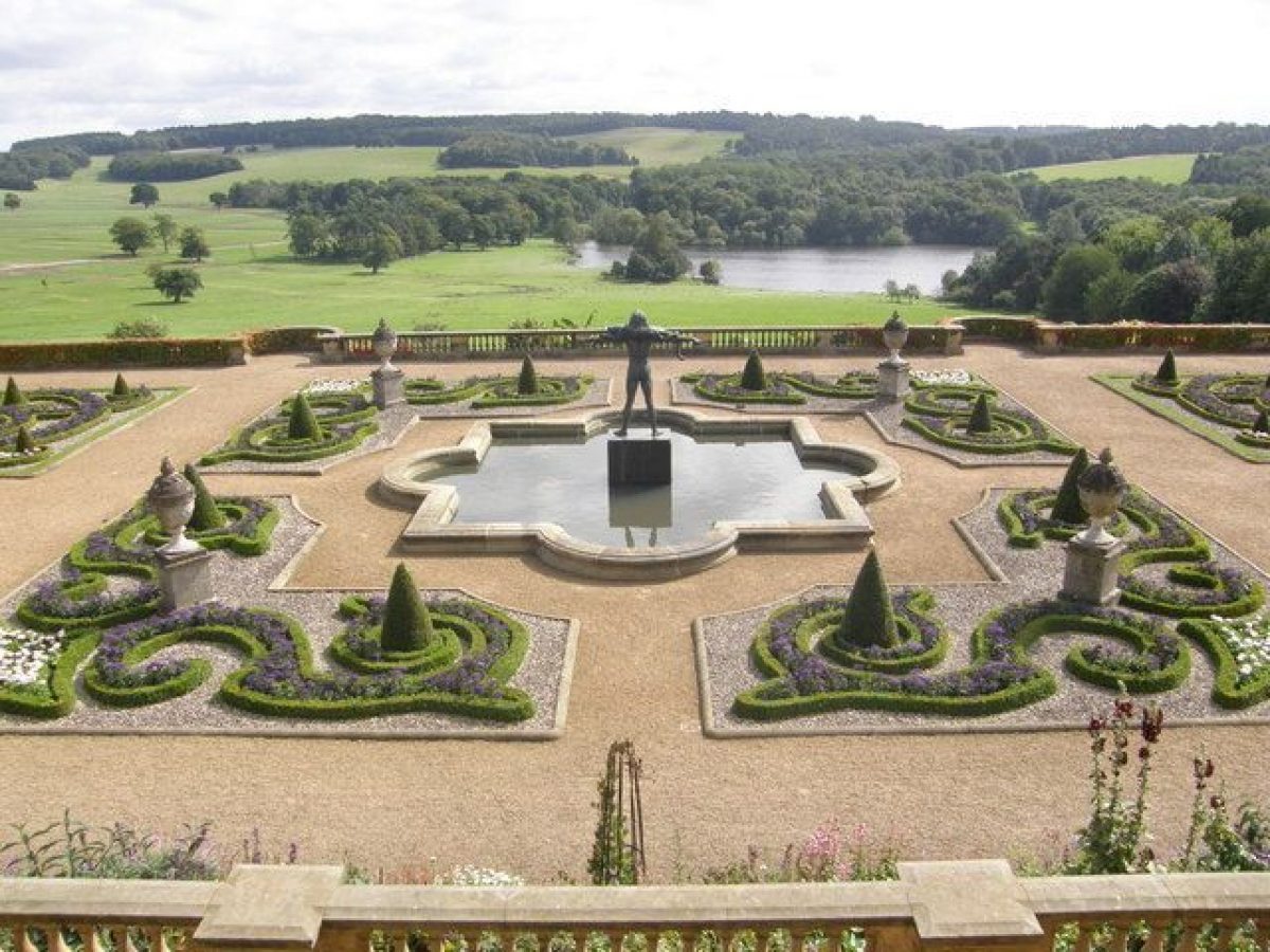
On the south side of the House there is a substantial Italianate terraced garden (listed grade II*) of 1844-51 designed by Charles Barry. A double stone staircase leads down from the House to a terrace with a gravelled walkway and stone retaining walls with a balustraded parapet. The terrace terminates on the east and west sides with stone benches. On each side of the staircase there is a pair of C18 stone sphinxes which Barry moved from the north front. Sets of steps lead down to the lower terrace which is laid out with a central fountain and raised flower beds with curved stone coping. The terrace is supported by a stone retaining wall which is balustraded and has a series of semicircular projections. At each of the east and west ends stone steps descend to a grassed terrace called Archers Walk with a border planted in the late C20 which is divided from the park by a pale. A plan by Barry of 1844/5 shows that his design was carried out with some alterations, principally in the shape of some of the beds and fountains. The flights of steps at each end of the lower terrace are not shown on the plan. Some sources (quoted in Piebenga 1992) attribute the original planting design to W A Nesfield (1793-1881).
The terrace affords impressive long-distance views over the park and lake to the south and it replaced lawns shown on the 1796 map which swept up to the south front of the House.
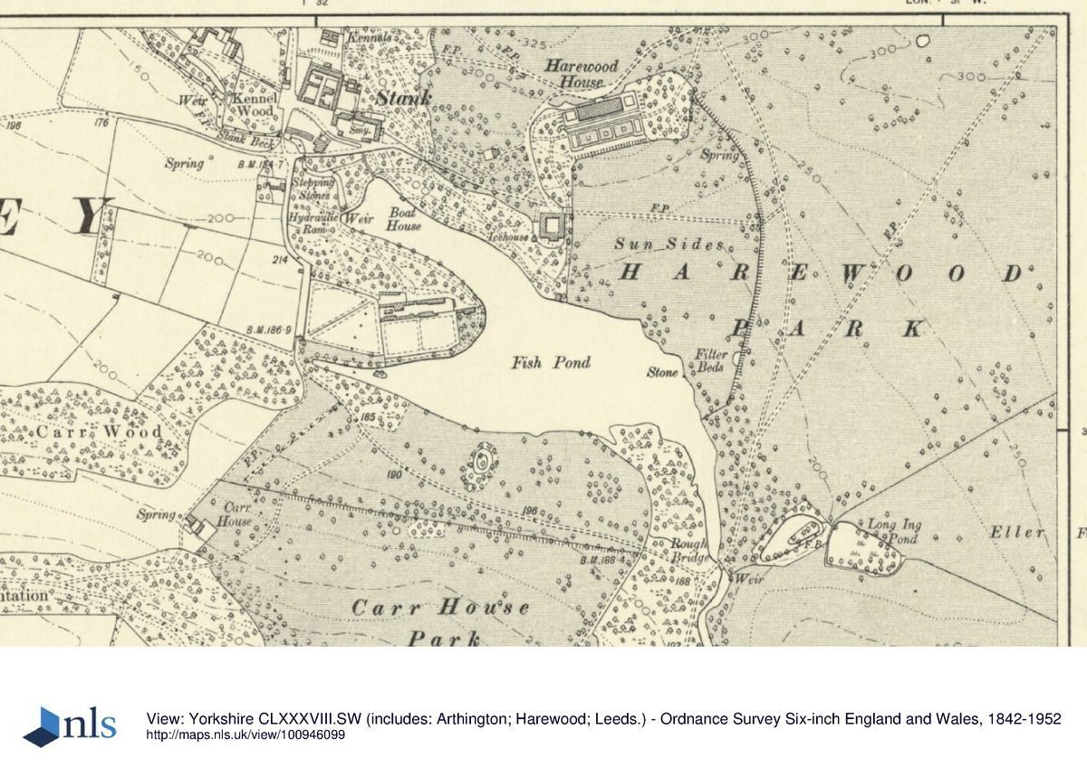
To the south-west of the House the land slopes down to the south and there are pleasure grounds planted with trees and shrubs with paths running through them south-westwards towards the lake. Paths lead along the north side of the lake and c 500m south-west of the House the water runs from the western tip of the lake's northern arm as a cascade, beside which there is an unusual combined icehouse and dovecote (c 1800, listed grade II).
Paths continue around the northern arm of the lake and lead to an area known as the Rose Garden (listed grade II) which is on the east side of the kitchen garden. A rectangular area is enclosed by raised walls and divided into two terraces with low walls. Flagged pavements separate beds planted with roses, and steps lead up to the upper (northern) terrace which has pergolas with miniature Tuscan columns. At the centre of the terrace there is an arbour with a Tuscan porch, within which is a bas relief classical carving. A lean-to is positioned against the north side of the arbour wall.
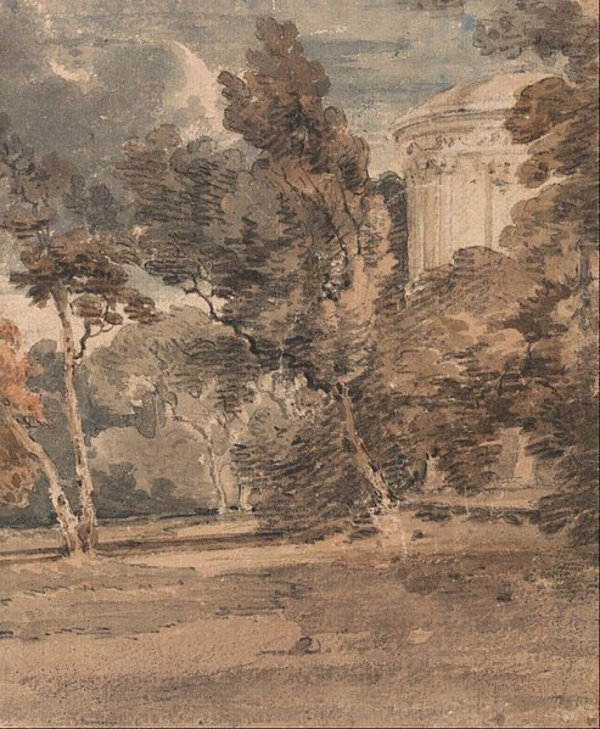
Wooded pleasure grounds lie in the north-east side of the site including an area to the west of All Saints church called The Grove. Some 300m north-west of the church the Rotunda (1785, listed grade II) is a folly from which there are views across Wharfedale and to Harewood Castle, though this is partly obscured by trees. This area was probably first incorporated into the pleasure grounds following the re-routing of the road between the church and village to the north in 1773-4. Paths from the Rotunda lead through the woodland and join with drives running westwards and southwards to the House. Work on the northern pleasure grounds seems to have started under Richard Woods (1716-93) who was paid more than £56 for 'Setting out Grounds' in 1764, the work being supervised by Mr Sparrow (Hay 1993). Thomas White (1736-1811) was engaged soon afterwards and payments of £57 15s in 1766 and £30 9s in 1768 were probably for a continuation of the works started by Woods in the northern pleasure grounds.
A rustic bridge (listed grade II) c 900m north-east of the House leads beneath Church Lane and gives access to paths leading north-east to the Castle ruins. It was constructed following the re-routing of the turnpike, 1796-1800, which allowed the Castle and its immediate environs to be fully incorporated into the pleasure grounds. An account written in 1816 states 'the castle is now taken into the domain, and a widely extended view of Wharfedale may, within the compass of a short walk, be contrasted with the soft and beautiful home scene which opens round the house' (T D Whitaker, quoted in Sheeran 1990).
Park
Parkland extends on each side of the House which lies close to the centre of the site. To the north The Grove and Castle Plantation are divided from open pasture by sunk fences, and there are views of open parkland with woodland beyond it from the north front of the House. The northernmost part of the park is called North Park and was imparked c 1800 following the re-routing of the turnpike road. Wall Side plantation, which shelters the northern part of the eastern boundary, is within an area of former fields which was laid out on the advice of Humphry Repton (1752-1818), c 1800.
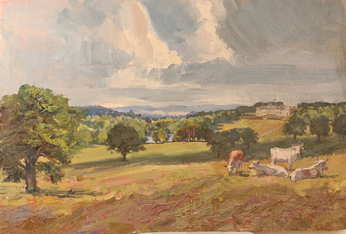
The lake, which is of an irregular Y shape with two arms projecting to the west, lies c 400m south of the House from which it is separated by open pasture called Sun Sides. A lake is shown on a county map of 1771, though this may be based on Brown's proposals rather than what existed at the time, which was probably only a narrow fishpond associated with Gawthorp Hall. The lake was created to Brown's design in a campaign of work which started in 1775 and took three years to complete. J C Loudon later advised upon the outline of the lake, and illustrations of 1806 show that he proposed extensive alteration of the shores to give a broken, rocky outline. Comparison of the 1796 and 1851 maps suggests that any works which took place were restricted to fairly minor irregularities introduced along the north-east shore.
The southern part of the park has extensive areas of woodland around open land called Lodge Hills and Grey Stone Pasture. The Grey Stone (listed grade II), a large gritstone boulder with carvings upon it which are thought to date from c 2000 BC, lies c 1.6km south of the House. Eccup Beck runs across the southern half of the site, through woodland, and continues north to feed the lake.
The park was laid out for Edwin Lascelles during the 1760s and 1770s, and in 1767 a visitor commented on the valley 'surrounded by swamps and marshes, which are designed to be laid under water' (Rev Ismay quoted in Sheeran 1990). Proposals by Lancelot Brown in 1758 seem to have been unexecuted or held in abeyance. In 1772 Brown returned to Harewood. The ground to the north of the House was lowered, the lake constructed and plantations were altered and extended. Brown was at work at Harewood until 1780, and his bill amounted to £6800 (P Goodchild pers comm).
Kitchen Garden
The kitchen garden (walls C18, listed grade II) lies c 400m south-west of the House between the two arms of the lake. There is a series of walled compartments and a range of glasshouses against the north wall of the southernmost enclosure. This has a seating alcove built into the outer southern wall from which there are views across the lake.
Maps
- T Jefferys, County Map, 1771
- J Teal, A Plan of Parts of the Townships of Harewood..., 1796 [copy held by P Goodchild]
- OS 6" to 1 mile: 1st edition published 1851
- OS 25" to 1 mile: 2nd edition published 1908
Archival items
- P Goodchild, Typescript notes on the landscape at Harewood, 1994 [with author]
Description written: November 1998
Register Inspector: CEH
Edited: November 1999
- Visitor Access, Directions & Contacts
Telephone
0113 218 1000Website
https://harewood.org/Access contact details
Harewood House is open between March and November, with weekend only openings in the winter months.
For more detailed visitor information visit the Harewood House website.
Directions
Harewood is off the A659 between Leeds and Harrogate.
For more detailed visitor directions visit the Harewood House website.
Owners
Harewood House Trust Ltd.
Harewood House, LS17 9LG
- History
The following is from the Register of Parks and Gardens of Special Historic Interest. For the most up-to-date Register entry, please visit The National Heritage List for England (NHLE):
11th Century
The estate was owned by Robert de Romelli in the C11, and passed to various families thereafter by marriage.
14th Century
In 1365, it was sold to Sir William Aldburgh, and subsequently passed to the Wentworth family.
18th Century
After several changes of ownership it was bought by Henry Lascelles in 1738.
19th - 21st Century
The estate continued in the Lascelles family, created earls of Harewood in the C18, and remains in private ownership.
Period
18th Century (1701 to 1800)
- Associated People
- Features & Designations
Designations
The National Heritage List for England: Register of Parks and Gardens
- Reference: GD2225
- Grade: I
The National Heritage List for England: Listed Building
- Reference: Gatway, lodges, walls, bridge
- Grade: II
The National Heritage List for England: Listed Building
- Reference: Harewood House, stables, Harewood Castle, All Saint's Church
- Grade: I
Features
- Garden Terrace
- Description: There is a terraced garden of 1844-51 designed by Charles Barry with a planting scheme possibly by William Andrews Nesfield.
- Earliest Date:
- Latest Date:
- Great House (featured building)
- Description: Harewood House (listed grade I) was designed by John Carr (1723-1807) for Edwin Lascelles in 1759. Robert Adam (1728-92) designed much of the interior and the building was altered by Charles Barry (1795-1860) in 1843.
- Earliest Date:
- Latest Date:
- Ornamental Bridge
- Description: New Bridge
- Earliest Date:
- Latest Date:
- Gate Lodge
- Description: Lofthouse Lodge (gate piers, gates and railings dating from the late-18th century, listed grade II).
- Earliest Date:
- Latest Date:
- Ornamental Bridge
- Description: Rough Bridge
- Earliest Date:
- Latest Date:
- Drive
- Description: System of drives running to the High and Low Lodges.
- Gate Lodge
- Description: High and Low Lodges.
- Lake
- Gate Lodge
- Description: Alwoodley Lodge (mid-late 18th century, with a pair of lodges, gates and flanking walls listed grade II together) lies on the south side of the site.
- Earliest Date:
- Latest Date:
- Ruin
- Description: Harewood Castle (listed grade I) lies in the north-east corner of the site around 1.4 km north-east of the house. It is of mid-14th century date and William Aldburgh received a licence to crenellate in 1366. Despite its semi-ruinous condition it is considered to be the best example of a 14th-century fortified tower house in Yorkshire.
- Latest Date:
- Religious, Ritual And Funerary Features
- Description: All Saints church (listed grade I) lies around 400 metres north-east of the house.
- Key Information
Type
Park
Purpose
Ornamental
Principal Building
Heritage Site
Period
18th Century (1701 to 1800)
Survival
Extant
Hectares
611
Open to the public
Yes
Civil Parish
Harewood
- References
References
- Jewell, J., (1819) History and Antiquities of Harewood
- Loudon, J. C., (1806), p16 Country Residences 2
- (25 February 1922), pp 243-8 Country Life, 51
- Jellicoe, G & S., et.al, (1986), p 245 The Oxford Companion to Gardens
- Sheeran, G., (1990), pp 60-5, 105-7 Landscape Gardens in West Yorkshire 1680-1880
- Piebenga, S., (IOAAS, University of York 1992) Harewood House Terrace Garden
- Hay, M., (unpub MA dissertation, IOAAS, University of York 1993) The Northern Pleasure Ground at Harewood
- Related Documents
-
CLS 1/91/366
Part of Garden Conservation Plan - Hard copy
John Sales? - undated
-
CLS 1/91/366