Introduction
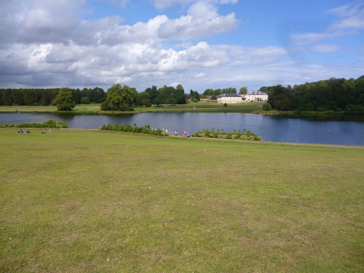
Hardwick Park consists of a landscape garden and parkland occupying about 80 hectares. James Paine designed the garden which remains unaltered, and is in the process of restoration. The design incorporates temples, follies and grottoes set around a lake of about 7 hectares. The site is now run as a Country Park by Durham County Council. The hall is a hotel in separate ownership.
Terrain
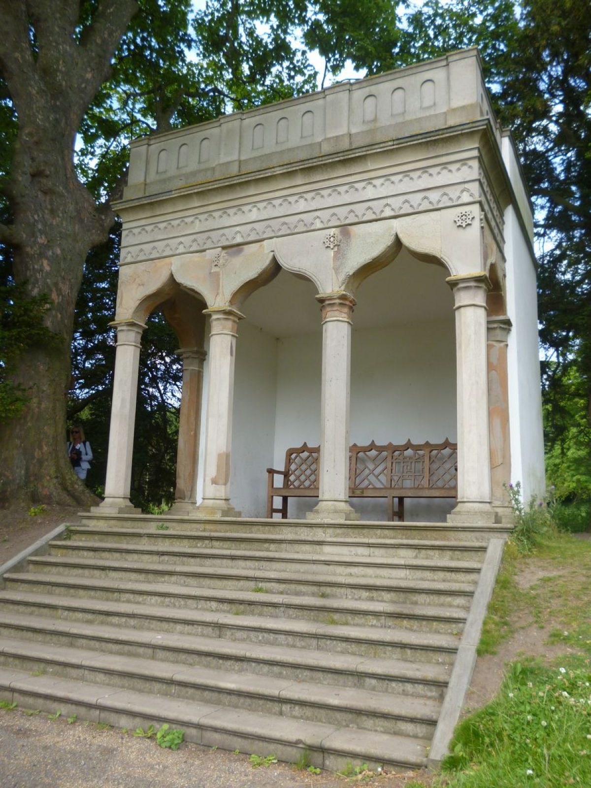
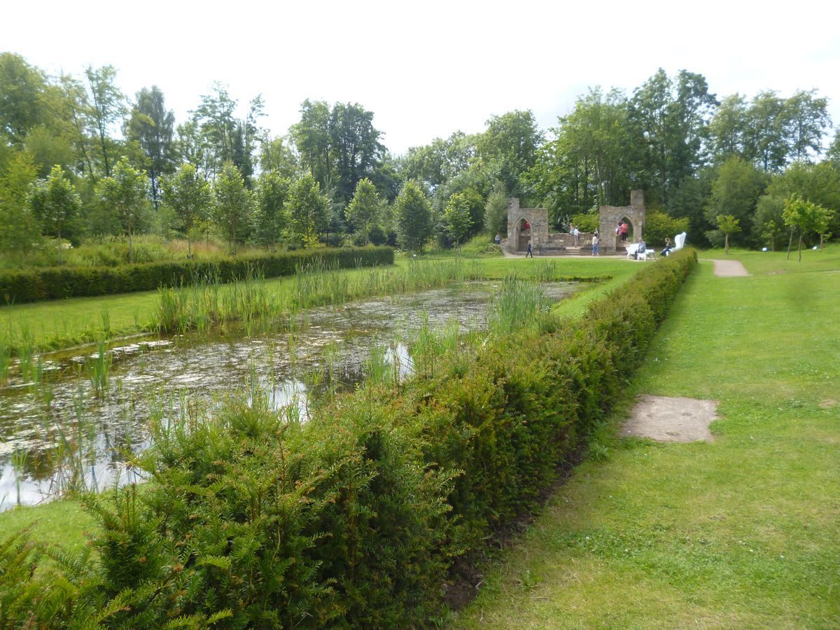
Rolling landscapeJames Paine designed a 7 hectare lake with a circular walk around it. Buildings were arranged around the lake to be viewed in a specific order. They were all of gothic and classical designs but are now mostly derelict or missing. The order of viewing was as follows: the gothic seat, the bath house, the Bono-Retiro and lake cascade, the temple of Minerva, the serpentine bridge, the statue of Neptune, the gothic ruin and finally the banqueting house.
The following is from the Register of Parks and Gardens of Special Historic Interest. For the most up-to-date Register entry, please visit The National Heritage List for England (NHLE):
Pleasure grounds laid out for John Burdon in the period c 1748-60, with a range of garden buildings designed by James Paine mostly now (1998) missing or ruinous. Parkland of C18 or earlier origin.
Location, Area, Boundaries, Landform and Setting
Hardwick Park lies immediately west of Sedgefield in an area which is otherwise rural and agricultural. The A177 to the east of the Hall divides parkland from the pleasure grounds. The c 80ha site is on rolling land bounded by tracks dividing it from agricultural land on the south-west, west and north sides. On the north side the main entrance drive continues westwards behind the Hall from which point it forms the northern boundary. It continues west and north-west to Low Hardwick Farm, and was formerly a road leading to Nunstainton which is shown on a county map of 1768 but not on the 1858 OS map. The gardens of houses backing from Station Road and from a housing estate west of Durham Road are on the eastern boundary, and the remains of a belt of trees, shown on the 1858 OS map, divides parkland from open land between the blocks of housing.
Entrances and Approaches
The main entrance to the site is from the A177, which was built across open countryside and through the park during the C20, from which a drive runs north-west to the Hall. The 1858 OS map shows that this was a secondary entrance into the pleasure grounds, with the main entrance on Durham Road in Sedgefield, c 900m to the east. The western part of this drive survives as a track which has the remains of an avenue, shown on the 1858 map, at its west end.
Principal Building
Hardwick Hall (listed grade II) is a house of 1634 which was remodelled, probably by John Burdon, in the C18. It is a relatively modest L-shaped building with pebble-dashed walls and a hipped roof. The interior was remodelled in the early C20. The Hall lies on the north side of the site overlooking falling land to the south. Immediately north of the Hall there is a stable block, probably of C18 origin, ranged around a courtyard. The Hall is currently (1998) in use as an hotel.
John Burdon commissioned a design for an ambitious new mansion from James Paine (1717-89), and this was to have stood in a commanding position to the west of the present building. It would have had axial relationships with, and views of, the various garden buildings.
Gardens and Pleasure Grounds
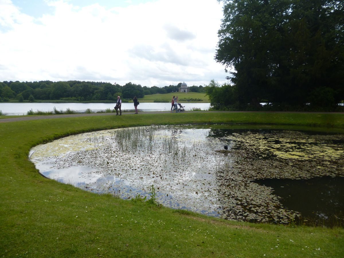
The pleasure grounds occupy a sub-rectangular area south of the Hall. The area immediately to the south and east of the Hall acts as car parking and is tarmacked. There are lawns on all sides but the north. A brick wall is attached to the west wing of the Hall and this extends westwards for a distance of c 110m. At its midpoint there is a pedimented C18 garden pavilion (pavilion and wall listed grade II) overlooking lawns which slope down to the south, and there are views to the south and south-west over rolling land. The lawn immediately in front of the wall was to have been the site of the new mansion. A garden pavilion designed by James Paine in Gothick style stood c 200m south-west of the Hall, overlooking a circular pool. The pool survives, but the pavilion was demolished in the mid to late C20.
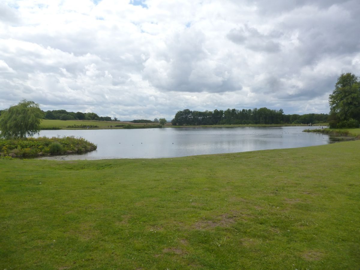
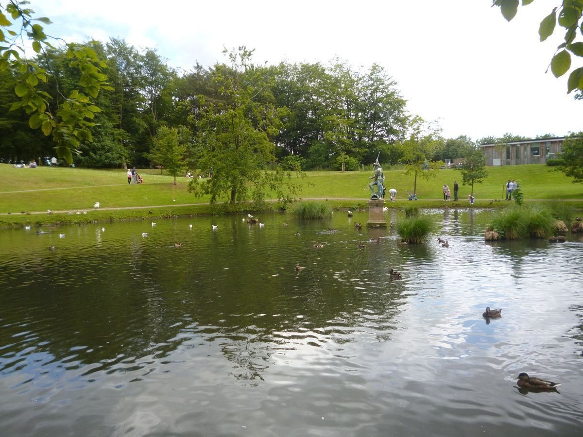
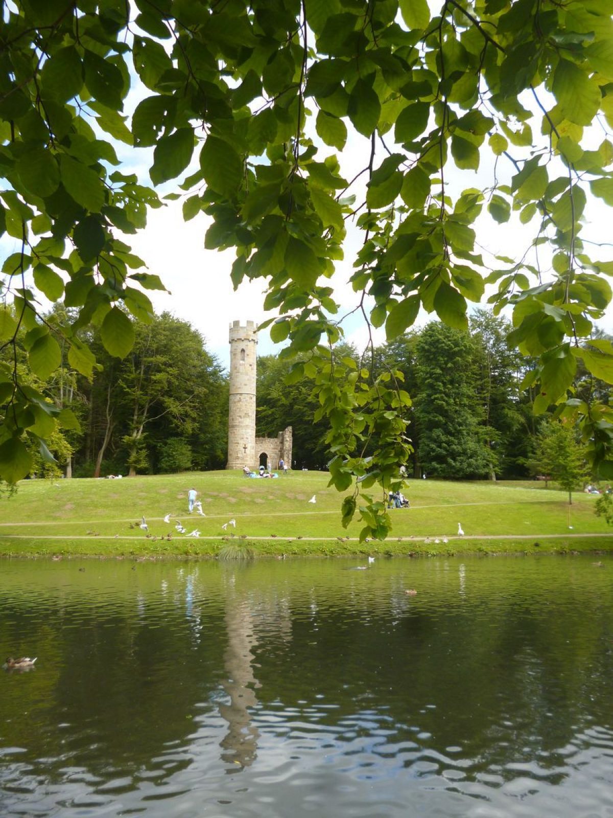
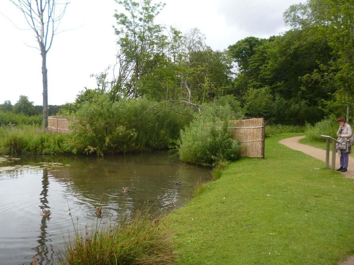
A serpentine lake, c 3km in length, describes an arc from a point c 100m south of the Hall to a point c 600m south-west of it, running through an area of woodland and scrub. There is an island c 500m south of the Hall on which is a plinth which formerly supported a statue of Neptune, removed late C20. The water can be glimpsed from the south front of the Hall, and the 1854-7 OS map shows open lawns with scattered trees between the Hall and Serpentine shore, with a band of woodland running along the eastern edge of the pleasure grounds. Paths lead around the wooded eastern and southern sides of the lake, much as shown on the 1854-7 OS map. On the hillside east of the lake, c 200m south-east of the Hall, a platform marks the site of Paine's Banqueting House which lay overlooking the Serpentine, with views beyond to the west. Some 400m south-east of the Hall, overlooking the Serpentine, is a folly (listed grade II*) in the form of a ruined castle, also designed by Paine, which incorporates medieval masonry from Guisborough Priory.
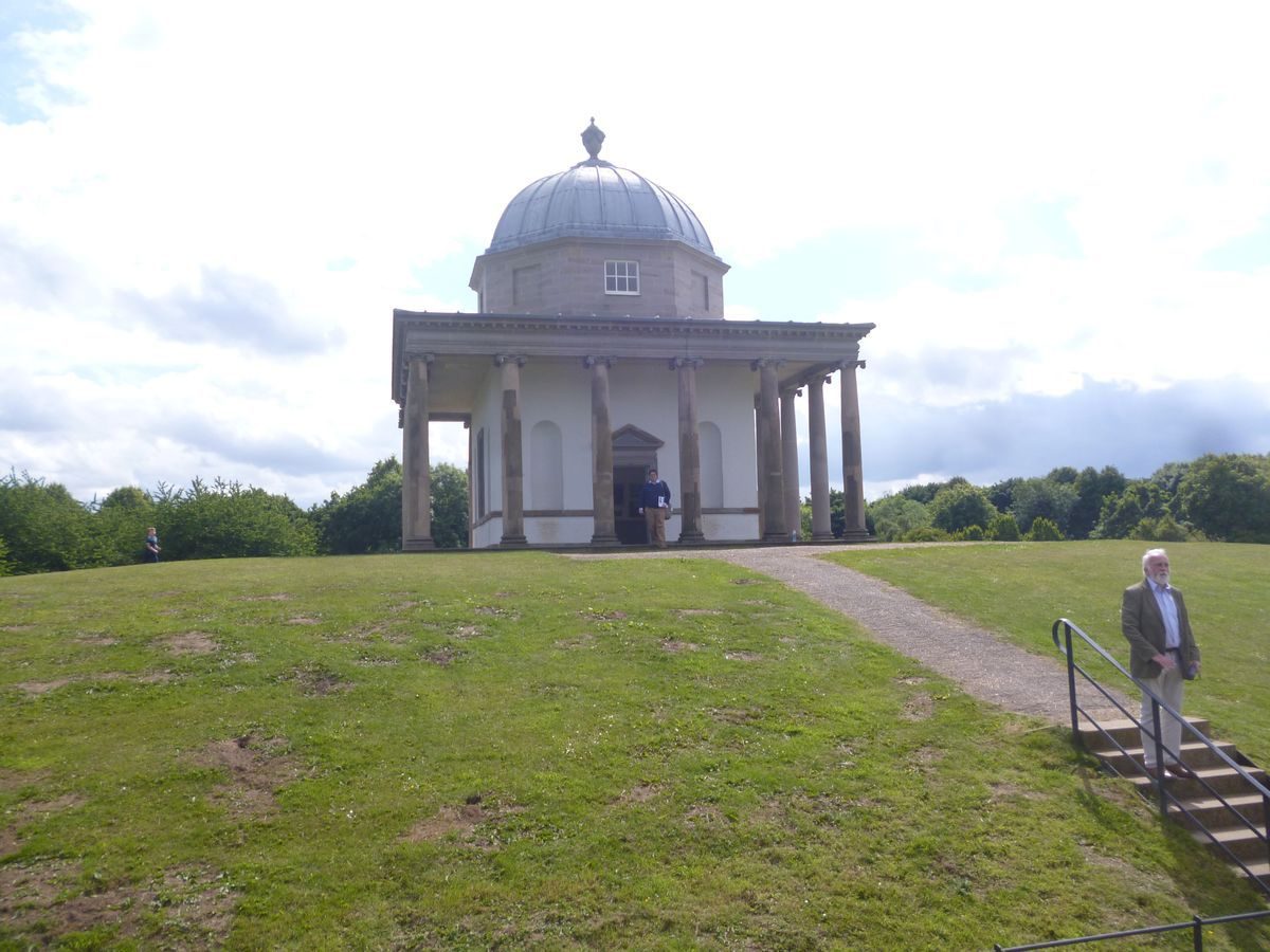
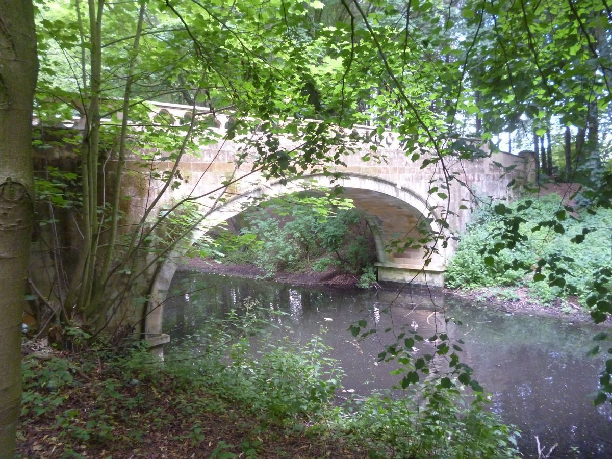
The lakeside path leads to a bridge, called the Serpentine Bridge (Paine, restored 1990s, listed grade II), across the lake, and runs north-west across open grassland to a tree-covered platform c 450m south-west of the Hall. Stone steps lead up onto the platform where there are the ruinous remains of a neoclassical temple designed by Paine and called the Temple of Minerva. This structure was lavishly decorated by the Italian stuccadores Cartesi & Bornesi with paintings by Hayman. There are long-distance views over rolling land on the north and west sides, and across arable and pasture land to the north-east to the proposed site of the new house, and the existing Hall beyond. The views are partially obscured by trees; C19 accounts describe long-distance panoramic views.
The low-lying area between the Temple and Hall was occupied by a large lake shown on a county map of 1768, but is now (1998) under arable cultivation. The platform was probably constructed using spoil from the digging of the lake. The 1854-7 OS map shows the lake, with the Serpentine curving around its east and south sides. It was drained in the late C19, and boggy areas at its south-east corner are all that survive. It was described in 1794 as 'the finest sheet of water in the north of England' (Hutchinson) and covered an area of c 15ha. The lake was the central unifying feature of the landscape, and the structures ranged around it would have been seen in the context of a large expanse of water.
Some 400m south-west of the Hall, on the wooded west side of the former lake, the ruinous remains of Paine's gothick summerhouse, called Bono Retiro, are situated at the head of a rectangular pool which connected with the lake by means of a cascade (demolished late C20). Paine's bath house, demolished C20, was situated north of Bono Retiro, at the north-west tip of the lake, and was aligned with the tower of St Edmund's church in Sedgefield (medieval, listed grade I), which lies c 1.5km to the east and would have been visible as the terminus to a vista along the north side of the lake, across the circular pool, and on through a clearing in the woodland immediately north of the Banqueting House, which is now (1998) overgrown but is shown on the 1854-7 OS map. This was described in 1794 as a 'grand terrace, a gravel walk about 24 feet in width ... at this point of view (looking over a circular bason of water) the bath-house terminates the prospect at one end, and the tower of Sedgefield church at the other' (Hutchinson). The north-west corner of the site is wooded, as shown on the 1854-7 OS map, and the former northern shore of the lake, now obscured by scrub, was open to view.
Park
The park lies on the east side of the site. The remains of a ha-ha are visible for a short distance on the north side of the entrance, and the 1854-7 OS map shows this extending northwards around the kitchen garden. The parkland consists of open grassland with scattered mature trees. Bands of perimeter planting and clumps shown in the southern part of the park on the OS map have largely disappeared. Part of an area on the north-east side of the park which is shown as open parkland on the OS map has been built on.
Kitchen Garden
The kitchen garden lies c 200m north-east of the Hall and consists of a rectangular brick enclosure which is now (1998) used as commercial nurseries. Immediately north of the gardens there is a house which may have been a gardener's house. Garden and house are shown on the 1854-7 OS map, when there was a range of buildings along the north wall and trees within the garden. Garden and house were divided from parkland on the east side by a ha-ha, traces of which remain, this feature continuing around the north and west sides although here little of it survives.
Maps
- T Jefferys, County map, 1768
- OS 6" to 1 mile: 1st edition published 1858
- OS 25" to 1 mile: 1st edition surveyed 1854-7
Description written: May 1998
Register Inspector: CEH
Edited: September 2000, February 2023
- Visitor Access, Directions & Contacts
Telephone
01740 621505Access contact details
The Park is open to the public.
Park gates: 7.30am to 5.00pm
Toilets: 10.00am to 4.30pm
Directions
Hardwick Park is on the west side of Sedgefield in County Durham. Grid Reference NZ 346 288 (Ordnance Survey map Explorer 305).
Owners
Durham County Council
Ramside Estates
- History
The following is from the Register of Parks and Gardens of Special Historic Interest. For the most up-to-date Register entry, please visit The National Heritage List for England (NHLE):
15th to 19th century
A manor house with a domestic chapel is recorded on the site in 1449, and the Hebborne family owned the land at the beginning of the C16. The estate was confiscated from the Hebbornes for their part in the Rising of the North and subsequently awarded to George Frevile. It remained in the Frevile family until 1748 when it was bought by John Burdon. Burdon began laying out the grounds and engaged James Paine c 1754 to design a series of garden buildings which were executed by Durham architect John Bell.
20th Century
The site remained in private ownership until 1923. After various changes in ownership part of the site was acquired by Durham County Council in the 1970s and the Hall and part of the garden by an hotel group. The remaining areas are farmed and are in private ownership (1998).
- Associated People
- Features & Designations
Designations
The National Heritage List for England: Register of Parks and Gardens
- Reference: GD1721
- Grade: II*
Features
- Hall (featured building)
- Description: A brick building with render. The hall is now used as a hotel.
- Gatehouse
- Description: James Paine created the Gothic Gatehouse in around 1764. It is made from sandstone and incorporated medieval masonry from Guisborough Priory. It is currently(2008) in a ruinous form.
- Earliest Date:
- Latest Date:
- Ornamental Bridge
- Description: James Paine and John Bell created the Serpentine Bridge in around 1754. The bridge consists of a single wide elliptical arch and is made from ashlar.
- Earliest Date:
- Latest Date:
- Pedestal
- Description: A lead statue of Neptune on a stone pedestal. It was located on a lake near the Gothic Gatehouse. The statue disappeared at some point after 1945 but the pedestal remains.
- Earliest Date:
- Latest Date:
- Garden Building
- Description: A gothic style building known as the Bono-Retiro. It was enclosed by trees. The building became ruinous by the late-20th century.
- Earliest Date:
- Latest Date:
- Cascade
- Description: A cascade located close to the Bono-Retiro.
- Earliest Date:
- Latest Date:
- Banqueting House
- Description: James Paine designed the banqueting house. It is a palladian style sandstone structure.
- Earliest Date:
- Latest Date:
- Bath House
- Description: The bath house was created in around 1753 and is located at the western end of the terrace. It is a single storey, three-bay palladian structure from sandstone. The building became derelict in the early-20th century.
- Earliest Date:
- Latest Date:
- Ionic Temple
- Description: James Paine created the temple and dedicated it to Minerva. It was erected on a mound and surrounded by a ha-ha. It has a single 5.84 metre (18 feet) cubic room with a leaded dome on an octagon of sandstone. A colonade of 20 ionic columns surrounded the cubic building. The temple survives in a partially dismatled form.
- Earliest Date:
- Latest Date:
- Kitchen Garden
- Description: The kitchen garden lies c 200m north-east of the Hall and consists of a rectangular brick enclosure used (1998) as commercial nurseries.
- Key Information
Type
Park
Purpose
Recreational/sport
Principal Building
Commercial
Survival
Part: standing remains
Hectares
80
Open to the public
Yes
Civil Parish
Sedgefield
- References
References
- {English Heritage Register of Parks and Gardens of Special Historic Interest} (Swindon: English Heritage 2008) [on CD-ROM] Historic England Register of Parks and Gardens of Special Historic Interest
- Pevsner, N and Williamson, E {The Buildings of England: County Durham} (London: Yale University Press, 2002) pp 301-302 The Buildings of England: County Durham
- {Hardwick Park Restoration Plan} (1998) Hardwick Park Restoration Plan
- Hutchinson, W., (1794), pp 65-7 History of Durham
- printed at the office of Elstob W., (1811) A Walk through Hardwicke Gardens
- Surtees, R., (1823), pp 34-5 The History and Antiquities of the County Palatine of Durham
- Fordyce, G., (1855), pp 437-40 History of Durham
- Page W., (1928), p 322 Victoria History of the County of Durham 3
- Jones, B., (1974), p 297 Follies & Grottoes
- Leach, P., (1988), pp 75-7, 115-6, 138-40, 187-8 James Paine