


Introduction
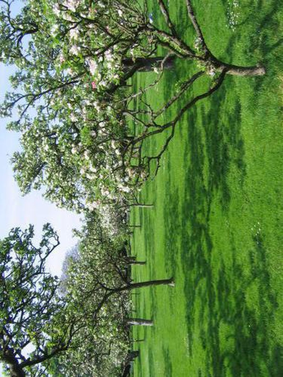
Hardwick Hall has a parkland, orchard, walled gardens, gatehouse and herb garden occupying about 440 hectares.
Terrain
The park is on land which falls to the south and east from a plateau.
The following is from the Register of Parks and Gardens of Special Historic Interest. For the most up-to-date Register entry, please visit the The National Heritage List for England (NHLE):
www.historicengland.org.uk/lis...
Walled gardens with pavilions and a gatehouse probably designed by Robert Smythson during the 1590s and partly remodelled in the late 17th century. The parkland probably has medieval origins and was extended from 1665-6.
DESCRIPTION
LOCATION, AREA, BOUNDARIES, LANDFORM, SETTING
Hardwick Hall lies c 10km north-west of Mansfield. The c 440ha park is on land which falls to the south and east from a plateau. Apart from the M1 motorway, which forms the west boundary, the setting is rural and agricultural. The north and east boundary is formed by fencing dividing the park from agricultural land. The south boundary is formed by Newbound Lane, fencing, and the line of Deep Lane running north-west from the Hardwick Inn.
ENTRANCES AND APPROACHES
There are three main entrances. On the north-west side of the site an entrance called Blingsby Gate leads to an avenue planted with platoons which runs south before curving to the east and to the south again. An entrance with a lodge (c 1825, listed grade II) called Rowthorne Gate on the north-east side of the site leads to a drive which runs south-west and is also planted with platoons. This drive joins with that from Blingsby Gate and continues south-west to a gateway leading to a courtyard on the west side of the Hall. The drives were laid out 1822-4, and the platoons planted c 1825. An entrance on the south side of the site immediately to the north of the Hardwick Inn (listed grade II) has gates from which a drive runs north-east and then curves round to the north and enters the courtyard beside the Hall. Views of Hardwick Old Hall are available from this approach, which is shown on the 1610 map.
PRINCIPAL BUILDING
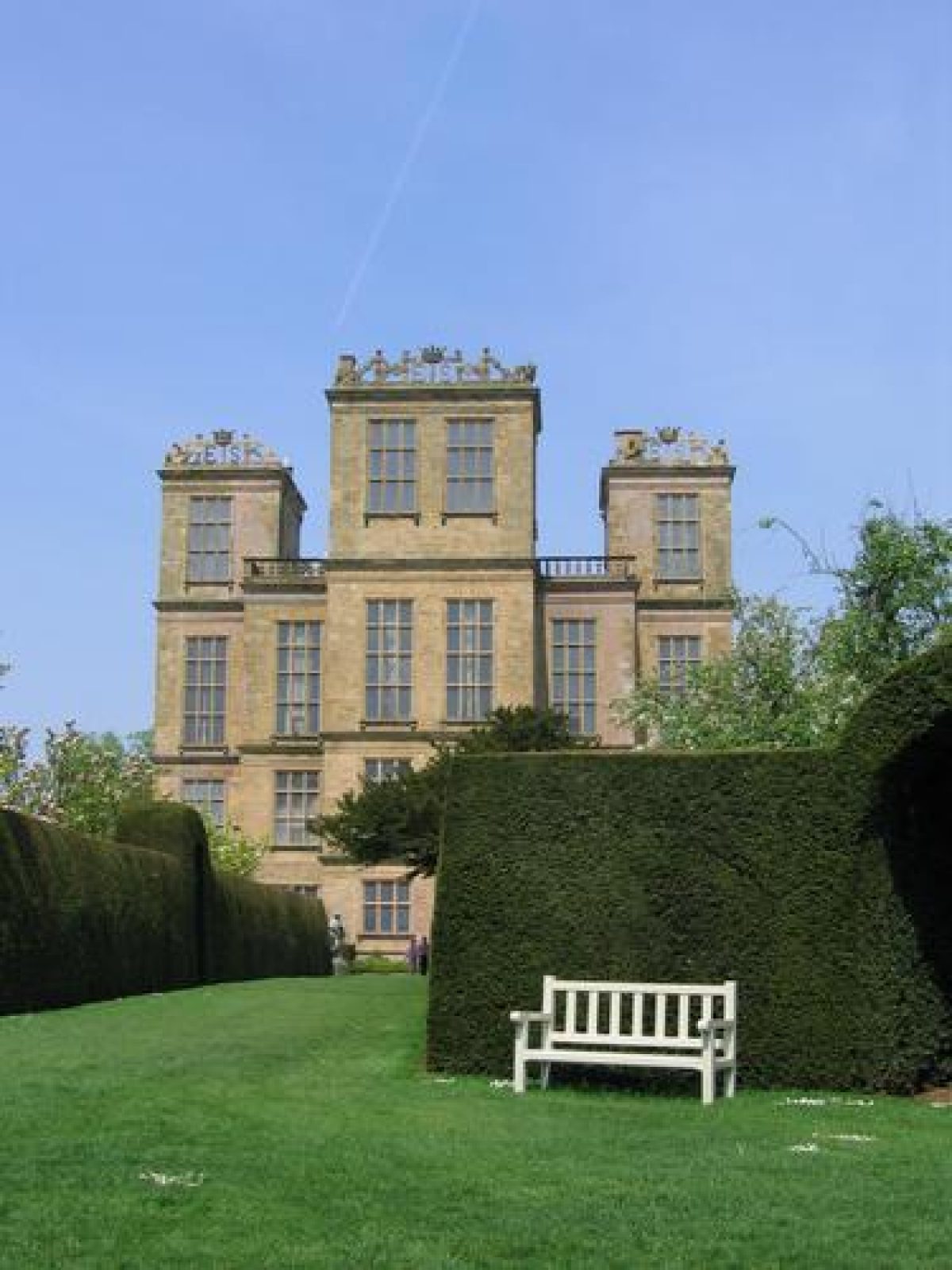
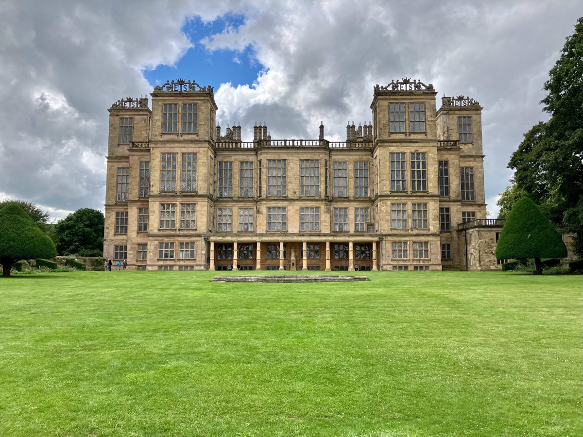
Hardwick Hall (listed grade I) stands on a platform south-west of the centre of the site. The Hall was built 1590-7 to designs attributed to Robert Smythson (c 1555-1614) (Girouard 1983) for Elizabeth, Dowager Countess of Shrewsbury, known as Bess of Hardwick. The Hall is one of the finest and best-preserved houses of its type in the country, and has been described as 'the supreme triumph of Elizabethan architecture' (ibid).
Some 100m south-west of the Hall is Hardwick Old Hall (listed grade I) which stands on the edge of a bluff from which the land falls away precipitously to the west. The north side of the building is set back to the south of a walled courtyard with pavilions at the north-west and north-east corners. The Old Hall has early C16 origins and was substantially remodelled by Bess of Hardwick in the years 1587-90 before the death of her husband, the Earl of Shrewsbury, which gave her the means to begin an entirely new building. The Old Hall was retained for use as ancillary accommodation after the new Hall was completed. It fell into disrepair and was partially demolished in 1740. The decision to retain the north front was possibly prompted by appreciation of its romantic appearance and the ruins were shown in an engraving in the European magazine of 1799. The building is maintained as a controlled ruin by English Heritage (1998).
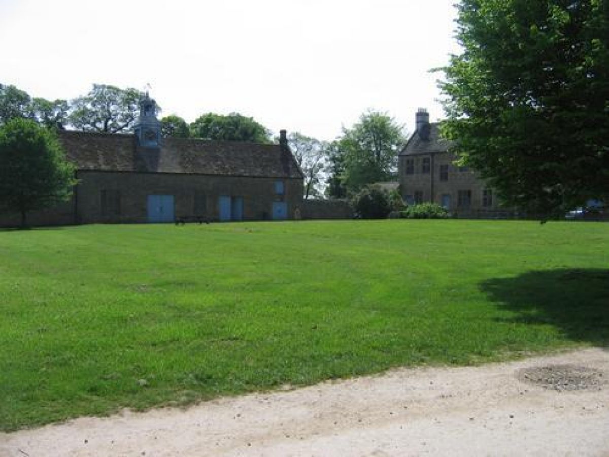
Some 300m south of the new Hall there is a complex of stables (listed grade II*), ancillary buildings and cottages (listed grade II) ranged around a courtyard which is immediately south of the walled South Orchard (see below).
GARDENS AND PLEASURE GROUNDS
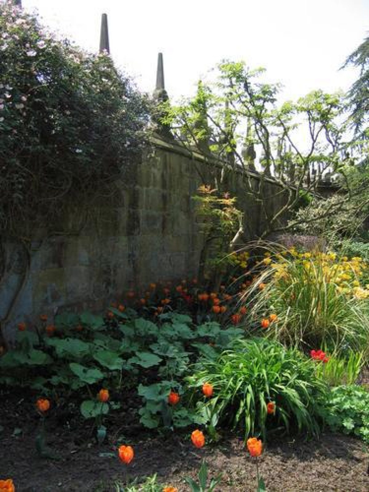
The gardens at Hardwick consist of walled enclosures on each side of the Hall. They are entered from a walled courtyard on the west side of the Hall which has a gateway with obelisks on the north side. The forecourt of the Old Hall forms the south side of the courtyard, and to the south-west an entrance leads into the park alongside a massive retaining wall which rises to a height of c 5m at its southern end, where it is buttressed. There are views over the park from the west side of the courtyard. On the south-east side of the courtyard there is another gateway with obelisks which leads to a drive running to the stables and on to the entrance on the south side of the site. The east side of the courtyard is formed by the wall of the Hall's West Court. A drawing probably of C17 date (guidebook, 13)shows the courtyard with the Old Hall and the adjacent entrance with obelisks.
An area of level grassland to the rear (south) of the Old Hall is divided from the park by a wooded scarp on the west side and enclosed by the west wall of South Orchard (see below) on the east side. A conduit house (C16, listed grade II) lies on the edge of the lawn c 20m south of the Old Hall.
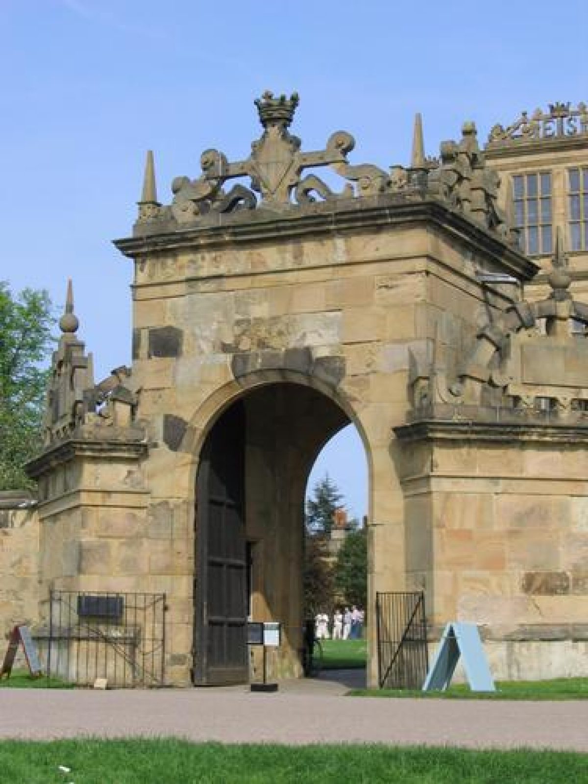
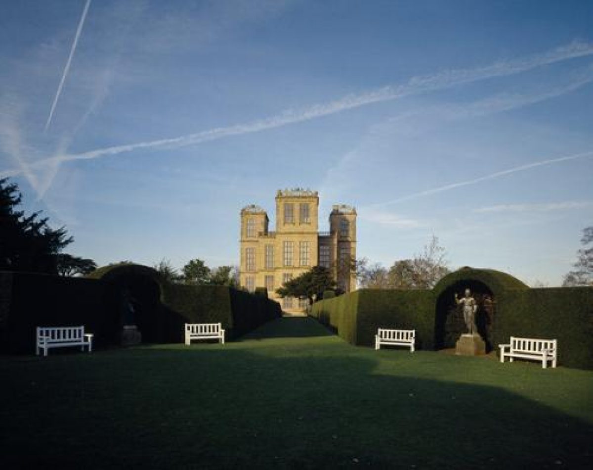
The walled forecourt on the west side of the new Hall is called West Court. A gatehouse is aligned with the west front of the Hall and there are pavilions in the north-west and south-west angles of the forecourt walls, all these structures being crowned with elaborate strapwork cresting. The walls are surmounted by shaped stone crenellations which are not shown on the C17 drawing and may be later additions. The courtyard has a stone-flagged path flanked by lawns between the gatehouse and the entrance to the Hall. A cedar on the side of the path at the west end of the garden was planted c 1837 as one of a pair. An elaborate planting scheme with beds arranged to form the letters 'E S', mirroring the letters on the parapets of the Hall's towers, was laid out in 1833 and is shown in a photograph of 1858. The beds were turfed over c 1921.
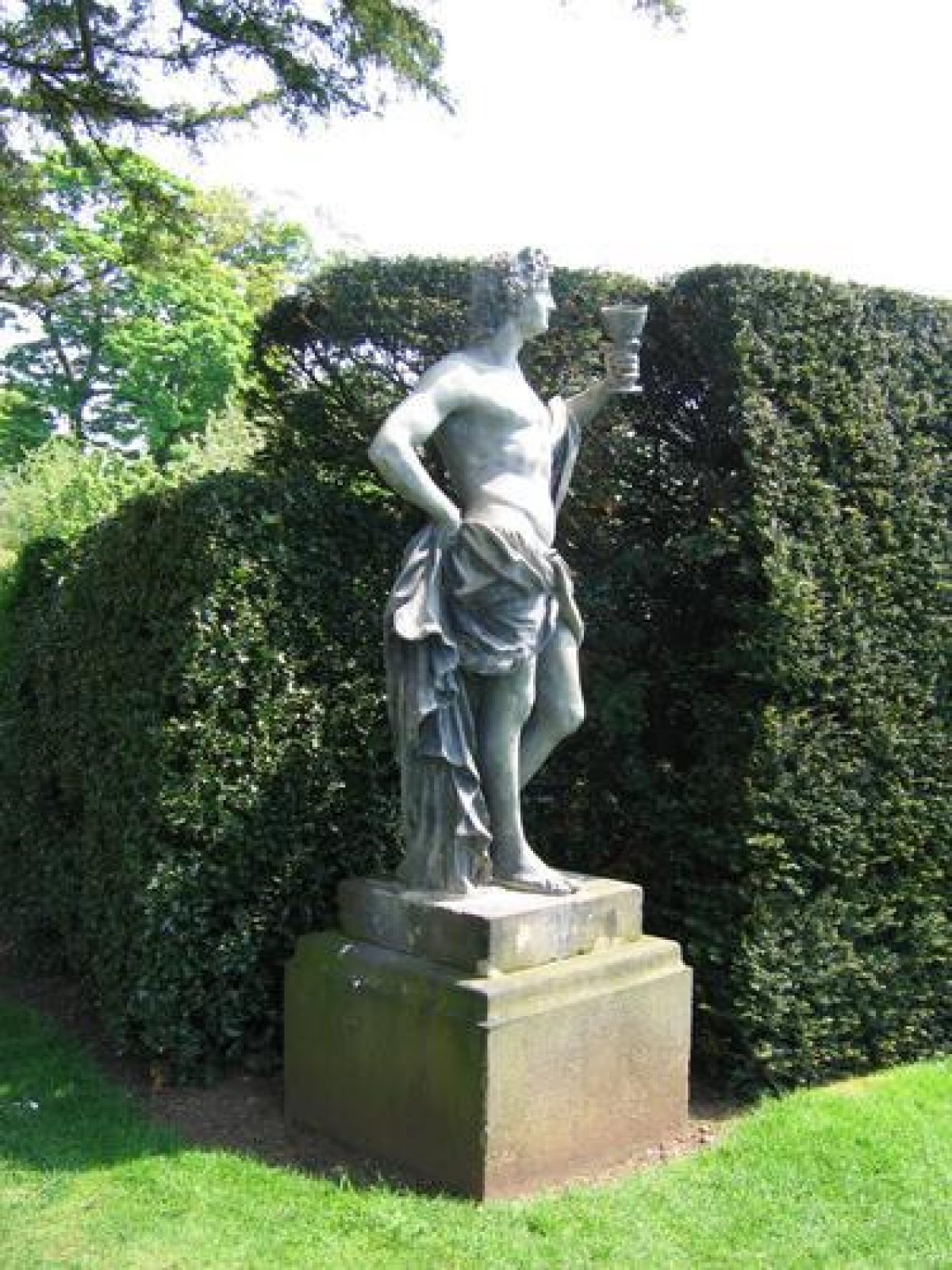
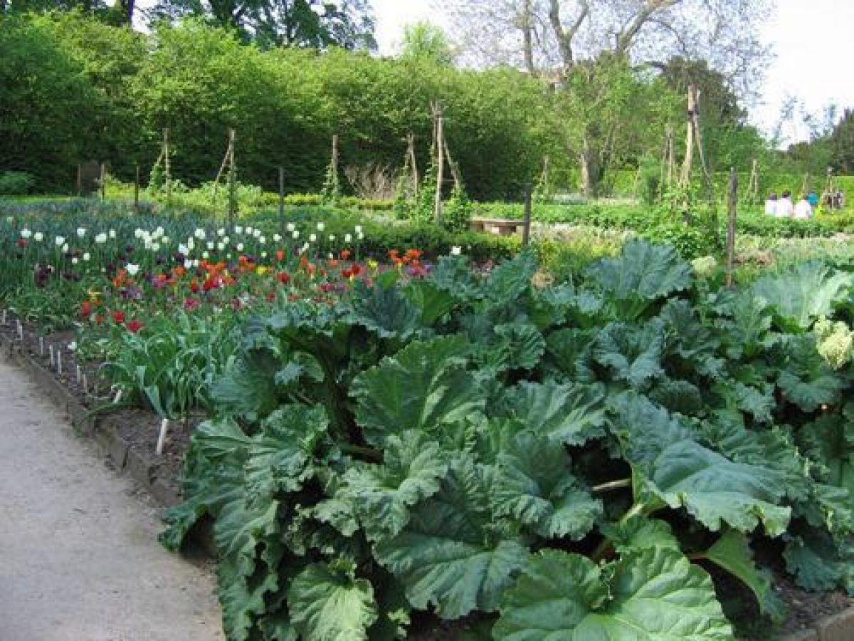
A gateway from the West Court leads into the south garden, called the South Orchard, which is walled and laid out with quartering alleys edged with clipped yew and hornbeam hedges which centre on a rondpoint. Recesses cut into the hedges of the rondpoint at the angles between the alleys form alcoves sheltering C18 statues brought to the site in 1862 when the garden was laid out. The wall at the south-west corner is indented, as shown on the 1610 map, and there is a gateway leading to the stable yard entrance. A second entrance to the stable yard is aligned with the alleys which run north/south across the garden. There is a corner pavilion of similar design to those in the West Court at the south-east corner of the garden. This part of the garden, simply marked 'Gardyn' on the 1610 map, was probably the site of the kitchen garden. It is referred to as an orchard in estate records of 1686 (NT report c 1980), and a painting of 1828 (guidebook) shows it as pasture with grazing animals.
On the east side of the Hall the walled East Court has opposed gateways in the north and south walls which have stone gate piers with bold capitals, probably those described in specifications for garden work dated 1686 (NT report c 1980). The garden is grassed and there is a central basin constructed in 1913 to provide a reservoir of water for firefighting. There is a ha-ha of c 1930 along the east side of the court which has low topiaried yew hedges along the top of it with a central opening affording views to the east and to the avenues in the eastern part of the park. A painting of the east side of the Hall of c 1785 (guidebook) shows a gravel walk aligned with the entrance with a set of stone plinths surmounted by capitals ranged alongside it. Pieces of stonework with carved ox masks in the West Court may be the remains of these features which are possibly the 'pedestalls' which were made in 1686.
The gateway in the north wall leads into a sub-rectangular enclosure marked North Orchard on the 1610 map which is grassed and used as a car park (1998). A pavilion in the east wall c 200m north-east of the Hall balances the pavilion at the south-east corner of the South Orchard.
The gardens, pavilions, outer (west) courtyard and the stable yard are shown in outline on the 1610 map. A number of additional small structures are shown around the perimeter walls, including a building aligned with the east front of the Hall, of which no trace appears to survive. Estate records suggest that there was alteration and embellishment of the gardens in 1686 but this did not alter the basic layout shown in 1610 which survives largely intact (1998).
PARK
The park is largely open pasture land with scattered trees, clumps and patches of woodland. On the east side of the site the land is fairly flat. A double lime avenue, called the wine glass for its shape, is aligned with the east front of the Hall. On the north side the avenue begins c 100m north-east of the Hall and curves to a point c 400m due east of the building. A similar configuration on the south side mirrors this arrangement and the avenues meet, from which point they continue eastwards for a further c 800m to the edge of the park. The avenue was planted in 1925. This part of the park is shown on Senior's 1610 map when it extended to a point c 500m east of the Hall. It is marked 'Launde' and is shown with a few widely spaced clumps of trees. Estate records show that an elm walk was planted in the Launde c 1655. It was cut down in 1730 and its exact position is not known. The north-east boundary is sheltered by Car Plantation, and two ponds, called Car Ponds, lie c 1.2km north-east of the Hall along the inner edge of the plantation. The parkland in this area, to the north and east of the Launde, was common pasture land called Rowthorne Carr until it was enclosed in 1665. The land to the south-east was purchased from the Molyneux family and added to the park in the same year.
A strip of woodland which shelters the south-east boundary of the park c 600m south-east of the Hall is called Lady Spencer's Wood where a walk was cut in the plantation in 1797 for Georgiana, Countess Spencer. The walk was extended to the east in the C19, and part of it planted as a yew walk. The walk was maintained until the first quarter of the C20 and is now (1998) largely overgrown.
The parkland to the west is hilly, dropping steeply to the south and west of the Hall and is well covered with mature trees. Ridge and furrow is visible on some of the level areas west of the Old Hall. A chain of four ponds called Row Ponds is situated c 500m west of the Hall; these are shown on Senior's map and may be identifiable with 'fyshe poules' mentioned in a rental of 1570 (NT report c 1980). These feed into a larger stretch of water called Great Pond c 150m to the west. Miller's Pond, which is the largest of the ponds, lies c 400m to the north-west of Row Ponds. The two larger ponds are not shown on Senior's map, but they were sketched in by a different hand. These were in existence by the 1630s and were created by damming the River Doe Lea which runs from south to north across the west side of the park. Extensive remodelling of the two larger ponds took place during the period 1860(1 and they were repaired and restocked by the National Trust in 1972-6.
In the south-west corner of the park, c 600m from the Hall, there is an elliptical bank planted with trees surrounding a marshy depression. This is the remains of a duck decoy of 1860, which is one of only nine known decoys of this type to be constructed in the country. It was instituted to compensate for the loss of wildfowl habitat occasioned by the remodelling of the ponds. The decoy was constructed on the course of the Doe Lea river and took the form of an elliptical island encircled by water with a bank around it. A cage with hatches operated by pulleys and wires was used to trap wildfowl attracted by plentiful food and decoy birds.
REFERENCES
Journal of Horticulture and Cottage Gardener, (30 December 1875), pp 582-4
Country Life, 64 (8 December 1928), pp 806-14; (15 December 1928), pp 870-8; (22 December 1928), pp 904-11
N Pevsner and E Williamson, The Buildings of England: Derbyshire (2nd edn 1978), pp 229-36
J Anthony, The Gardens of Britain 6, (1979), pp 87-91
Hardwick Hall: Park and Garden Development, (National Trust report c 1980)
M Girouard, Robert Smythson (1983), pp 144-63
Hardwick Hall, guidebook, (National Trust 1989)
Maps (reproduced in guidebook)
William Senior, A Platt of the Mannor of Hardwick..., 1610
Description written: July 1998 Amended: May 1999
Register Inspector: CEH
Edited: November 1999
- Visitor Access, Directions & Contacts
Telephone
441246850430Access contact details
The gardens are open on selected days between February and December.
For more information visit the National Trust website.
The Old Hall is in the care of English Heritage, and is open Wednesdays to Sundays between April and October.
Directions
East of the M1, west of Mansfield.
- History
The following is from the Register of Parks and Gardens of Special Historic Interest. For the most up-to-date Register entry, please visit the The National Heritage List for England (NHLE):
www.historicengland.org.uk/lis...
HISTORIC DEVELOPMENT
Hardwick was part of the manor of Stainsby in the 12th century and was held by tenure probably from the 13th century. By the end of the 13th century Hardwick was considered a manor in its own right and held by the Hardwick family. In 1583 Elizabeth, Countess of Shrewsbury (Bess of Hardwick) bought it from her brother James and moved to the site following a dispute with her husband. An estate map of 1610 by William Senior shows the site as it was left after Bess' death in 1608. The estate passed to the dukes of Devonshire through Bess' second marriage to William Cavendish, and remained in their ownership, though it was not used as the principal residence after the end of the 17th century. It was given to the Treasury in partial settlement of the estate following the death of the tenth Duke of Devonshire in 1950 and transferred to the National Trust in 1959 in whose ownership it remains (1998).
Period
- Post Medieval (1540 to 1901)
- Tudor (1485-1603)
- Associated People
- Features & Designations
Designations
The National Heritage List for England: Register of Parks and Gardens
- Reference: GD1418
- Grade: I
Features
- Hall (featured building)
- Earliest Date:
- Planting
- Description: Herb garden
- Orchard
- Gatehouse
- Parkland
- Walled Garden
- Herb garden
- Key Information
Type
Park
Purpose
Ornamental
Principal Building
Domestic / Residential
Period
Post Medieval (1540 to 1901)
Survival
Extant
Hectares
440
Open to the public
Yes
Civil Parish
Ault Hucknall
- References
References
- {English Heritage Register of Parks and Gardens of Special Historic Interest}, (Swindon: English Heritage, 2008) [on CD-ROM] Historic England Register of Parks and Gardens of Special Historic Interest
- Pevsner, N and Williamson, E {The Buildings of England: Derbyshire} (Harmondsworth: Penguin, 1978) pp. 229-36 The Buildings of England: Derbyshire
- Anthony, J., {The Gardens of Britain 6: The East Midlands} (London: Batsford, 1979), pp. 87-91 The Gardens of Britain 6: The East Midlands
- Raynor, Helen {Survey of the gardens and park at Hardwick} (1987) Survey of the gardens and park at Hardwick
- Askew Nelson {Hardwick Hall Parkland Conservation Plan} (2013) Hardwick Hall Parkland Conservation Plan