Introduction
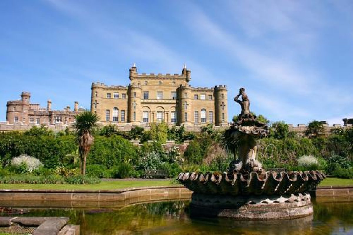
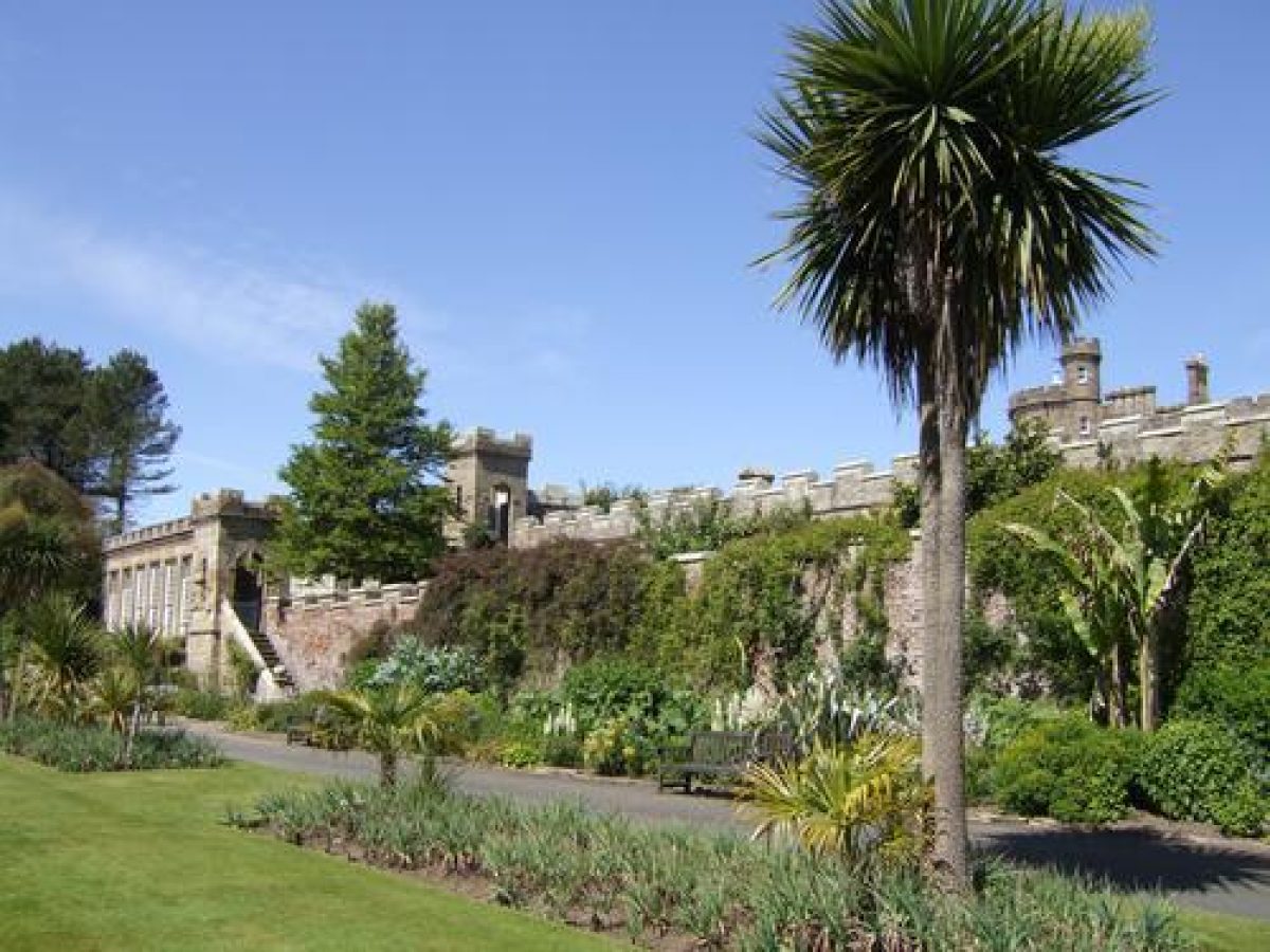
The late-18th-century Culzean Castle perches on a rocky promontory above the sea, surrounded by a park and formal gardens. The formal terraces are planted with perennials and sub-shrubs, many of them tender. There is a deer park created in the mid- to late-19th century and a woodland garden from the same period with a collection of conifers. The policies contain an artificial lake and a mid-18th-century walled garden, approached by an avenue of lime trees. The country park includes walks along the seashore.
The following is from the Historic Environment Scotland Gardens and Designed Landscapes Inventory. For the most up-to-date Inventory entry, please visit the Historic Environment Scotland website:
Location and Setting
Culzean Castle is situated off the A719 coast road, some 12 miles (19km) south west of Ayr and 6 miles (9.5km) west of Maybole. It stands on a rocky bluff some 100' (30m) above the sea overlooking the Firth of Clyde. Under this basaltic cliff, the sea has carved out six caves. The ground to the east of the Castle dips sharply into a natural ravine before rising gently eastward towards Mochrum Hill, some 887' (270m), and to the Carrick Hills beyond. The designed landscape is bordered on three sides by woodland and on the fourth by the sea. The climate is affected by the maritime conditions and by the mildness of the Gulf Stream. The annual rainfall is about 41" and the woodlands protect the gardens from the strong salt-laden winds from the south and west. The soil in the walled garden is a rich loam. Between the coastal strip adjacent to the sea and the poorer upland moorland, the designed landscape is bordered by thick forestry or by open mixed agriculture. There are panoramic views across the Firth of Clyde especially to the Island of Ailsa Craig some 15 miles (24km) to the south-west, the Island of Arran, and the Mull of Kintyre. On clear days, the northern coast of Ulster can be seen. From the A719 there are several glimpses and even longer views into the policies and park through the woodland. The size of the woodland and its scale of canopy contribute greatly to the surrounding scenery.
Culzean Castle lies on the rocky outcrop at the centre of the western edge of the policies. They are bordered on three sides by large woodlands first planted in the late 18th century but almost completely replanted in the last 40 years, probably after World War II. The designed landscape can be seen on the 1st edition OS of 1857 and although there have been one or two minor changes and alterations to the woodland boundaries, particularly on the eastern side of the A719, the extent of the designed landscape of some 845 acres (342ha) has remained the same since the 2nd edition OS of 1894.
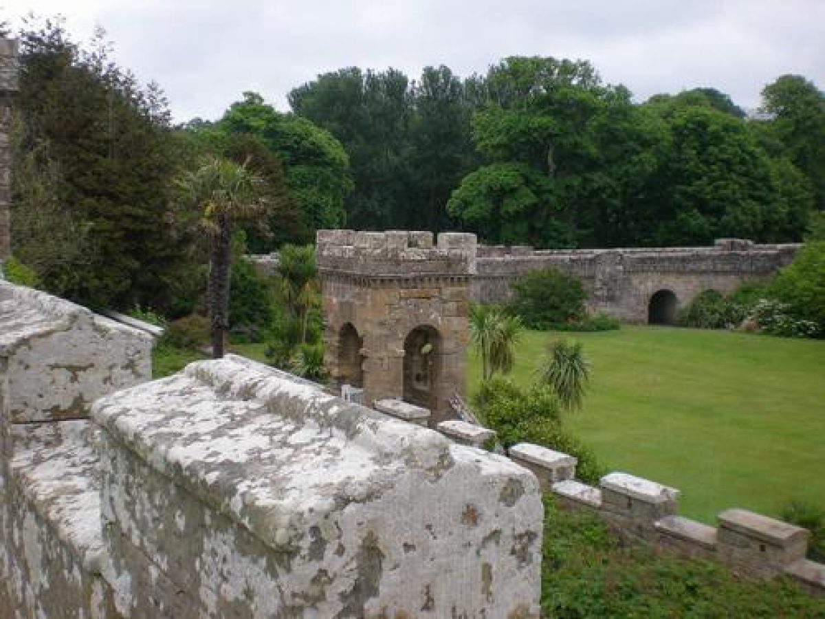
The policies are basically rectangular in shape and run south-west and north- east of the Castle parallel to the coast line. Within the woodland sheltering the Castle there are several buildings, eyecatchers and other features including the walled garden. Each folly was carefully placed to create the impressive design. Swan Pond at the south-western end is a large artifical expanse of fresh water lying very close to the sea.
Landscape Components
Architectural Features
Culzean Castle, listed category A, is recognised as one of Robert Adam's masterpieces. It was built between 1777 and 1792 around a much earlier tower house. Accounts indicate that Hugh Cairncross was the Clerk of Works and he drew up plans for a delightful wooden bridge, gate and fences. Adam's designs for Culzean are thought to have been influenced by Inveraray Castle; the rectangular shape of the central block with its four corner turrets topped by a central tower covered with a glass dome is reminiscent of Inveraray's form. The courtyard and west wing were added by Wardrop & Reid between 1875 and 1878. Since 1945 the NTS has undertaken a restoration and rehabilitation programme which has almost been completed. Shortly after World War II the NTS offered the top floor of the Castle as the National Guest Flat to be run by the Scottish Heritage USA, Inc.
Plans by Robert Adam for the Rustic Arch and Causeway, listed category A, as part of the Castle group, were drawn up in 1780. This mock gothic bridge consisting of five different turrets and six high arches is a folly of remarkable and fanciful design. Nothing is straight, even the road lurches haphazardly past the walls. Sadly many of its unique qualities are hidden, either obscured by sycamore seedlings or spoilt by unsympathetic road surfaces.
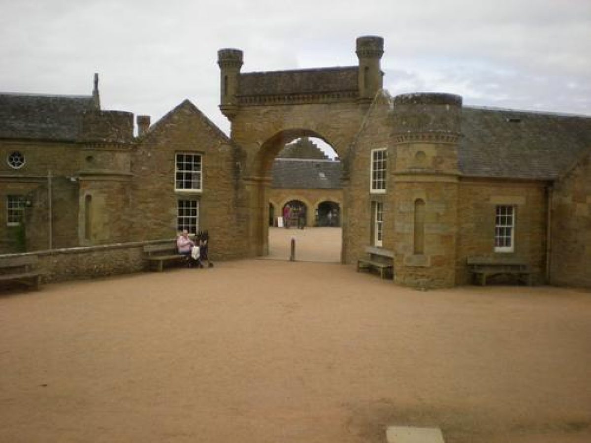
The Home Farm, listed category A, was designed in 1775 by Robert Adam as a model farm. Laid out in the form of a square, each side is made of a T- shaped building. The corners of the buildings are joined to each other by a screen wall with an arched entrance. Between 1971 and 1973 Home Farm was converted into a Visitor Centre by Geoffrey Jarvis of Boys Jarvis Partnership. Between the Castle and Home Farm are a series of buildings one of which is now used as a hostel.
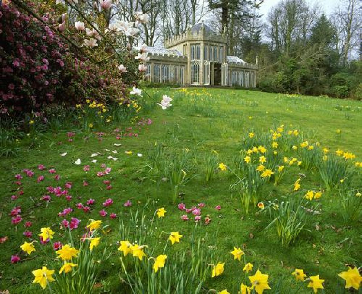
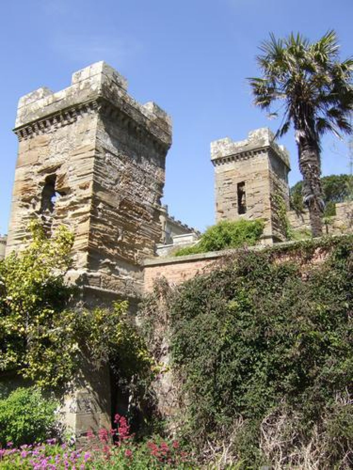
The Camellia House, listed category A, is a gothic conservatory and was probably designed by J. Donaldson in 1818. The Orangery, now undergoing repairs, is also attributed to him. Hoolity Ha' Lodge and Bridge, both listed category A, are gothic fantasies. They have been recorded as Laigh Whiteston Lodge on the OS plans and Penny Glen Lodge on an early 19th century sketch. The Aviaries and Swan Cottages, listed category A, are attributed to Robert Lugar. In sketches, dated 1823 they are called the Pheasantry and on the OS plans they are known as Pond Cottages. The rustic Boathouse lies just to the east of these cottages. The Pagoda, listed category C and now in ruins, is an eyecatcher at the southern end of Swan Pond. The Powder House, listed category B, built in the early 19th century, was also known as the Magazine. Dolphin Cottage and the ruined Bath House, both listed category B, are situated on the seashore next to the cisterns. The Icehouse, listed category C, is sited just to the north of Swan Pond.
The Walled Garden, listed category B, was built in 1752. The date stone on the ornamental gate is marked 1786 and the walls were altered in the late 18th and early 19th centuries. Within the walls the rustic Tea House and Rock Tunnel were built in the mid to late 19th century. On the south drive Swinston Lodge and its arched Gatepiers, listed category A, were built early in the 19th century. The Well-head at the top of Happy Valley is listed category B. Culzean Kennels, listed category B, are early 19th century. Ardlochan Lodge is listed category C. Whiteston Lodge, listed category C, is mid-19th century. Other buildings include Sunnyside Cottage sited near to the disused Curling pond and Pheasantry, Firbank Cottage and the Monument in the Burial Ground.
Parkland
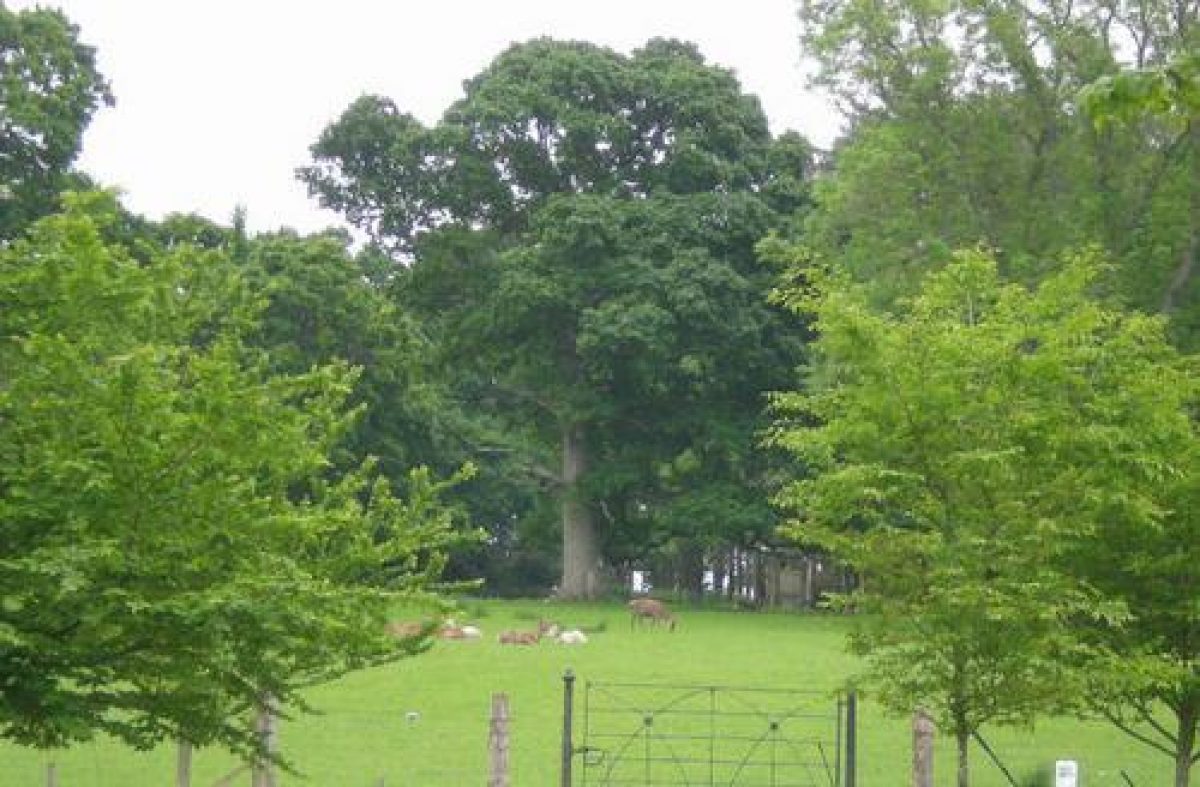
From the mid-18th century, Thomas and David Kennedy, the 9th and 10th Earls, were renowned agricultural improvers. They created the policies out of desolate moorland insisting on removing all the stones, and even resorting to blowing up the larger ones. These pastures, surrounded by woodland shelter strips, became famous for their yields. By the mid-19th century, long picturesque drives ran throughout the policies, and the woodland strips were used to link one area with another. The entrance drive from the north winds through Whiteston Wood, then emerges into the park which was divided by woodland strips. The eccentric Hoolity Ha' Lodge and the arch-backed gothic bridge over Glenside Burn welcomed the visitor. Between the 1857 and 1894 OS plans, the Deer Park was cut out of woodland and many of the fine trees were left as parkland specimens. Today only a few remain. The railway was cut through the northern section between 1894 and about 1909.
Woodland
At the same time as the 9th and 10th Earls were improving the policies they planted large areas of woodland. Using mostly hardwoods mixed with Scots pine and some larch, the Earls planted to improve the land, especially their pastures, by protecting them from the strong salt-laden winds. In the early 19th century, the 1st Marquess continued to plant; it has been estimated that he planted over 5 million trees and it is mostly his tree plantations which can be seen on the 1st edition OS.
Most of the original woodland has been felled but there are still one or two large specimens towering over the younger canopy of conifers. Some of the original trees are still growing in the narrow shelterbelts around the fields. Most of the woods are under 50 years old. Since 1945, the NTS has planted over 180,000 trees using a mixture of conifers and beech aiming for a final crop of beech.
Woodland Garden
Between the Castle and Maidenhead Bay, the 9th and 10th Earls planted a thick woodland which provided shelter for the walled garden and Swan Pond. During the 19th century, the 1st and 3rd Marquesses used the wood to protect their new planting which included many recently introduced conifers and other exotic broadleaved trees. These they planted along a series of garden walks throughout the woodland especially in Happy Valley, around Swan Pond and between the Causeway and the walled garden. They amassed a fine collection of conifers which were commented on as early as 1832 and a little later in the Gardening Magazines. Their value was extolled by Herbert Maxwell in 1908.
Some rhododendrons were planted as understorey; these hybrids are now huge and straggly particularly near the Camellia House. This gothic conservatory, built to house Camellias, is now a ruin. In 1850, an imposing avenue of silver fir (Abies alba), was planted along the drive leading to the Walled Garden. It was removed in about 1980 and replaced with the silver lime trees (Tilia petiolaris}. In amongst a slight tangle, the path through Happy Valley reveals the wealth of planting. Behind the conifers, planted around the 1850s, there are several magnificent 18th century Scots pines. Around a Victorian bog garden there are also many large leaved Rhododendron sinogrande specimens as well as a fine Myrtus apiculata.
Behind these, amongst many others there are tall Douglas firs, upright Lawson cypress trees and a huge Picea sitchensis. The Pine Walk runs parallel to Happy Valley and is planted up as a pinetum. The conifers here include an enormous Pinus ayacahuite and a large Sciadopitys verticillata. In 1970, Alan Mitchell measured over 41 trees including a large Abies alba planted in 1780.
Water Features
There are several ponds and burns throughout the policies; the largest is Swan Pond or Culzean Pond as it is named in the early OS plans. It is thought to have been man-made in either the late 18th or early 19th centuries and water from the Hogston Burn was diverted to fill it. It was used for boating and recently the delightful Swan Lodge or Pond Cottage has been converted into a tearoom for visitors. The Swinston ponds at the southern end of Happy Valley have gradually silted up.
The Gardens
The long picturesque Causeway designed by Robert Adam in 1780 links the Castle's rocky promontory with the policies. The ravine is thought to be partly natural and partly to have been dug out when the Castle was the Kennedy stronghold. This was levelled and made into three terraces in the late 17th century. In 1693 they were described as "very pretty gardens adorned with terrasses" and they were "so well sheltered that the fruits and herbage are more early than in other places". Adam used the terracing to increase the height of his Castle and may well have rebuilt them as they are today. By 1824 John C. Loudon commented that there was "an extensive collection, both of hardy and tender exotics" growing at Culzean.
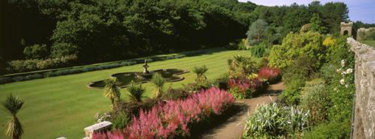
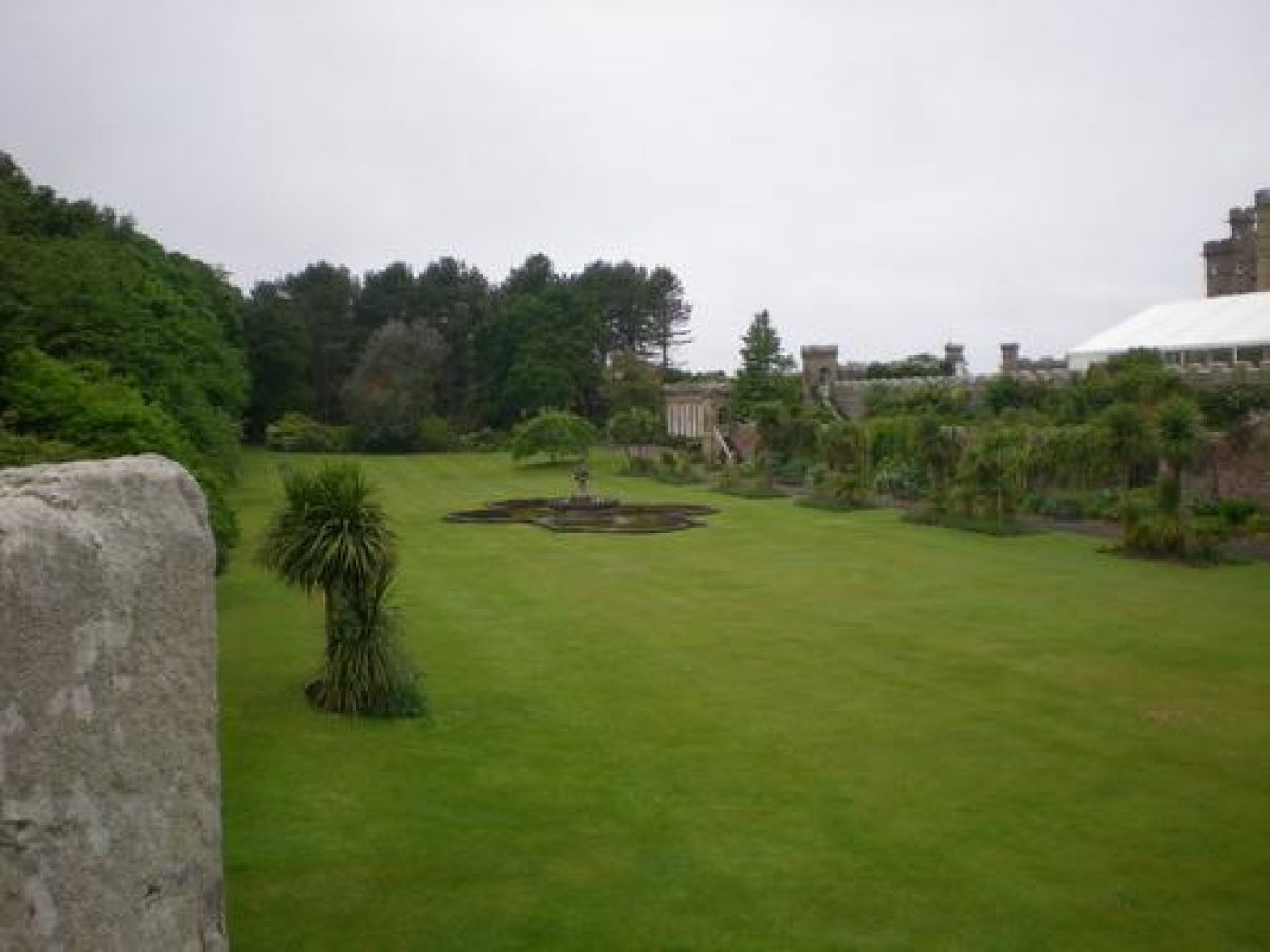
The Castle lies on the top terrace, which extends northwards, and forms a large courtyard. It is used as the entrance for the Castle and for the ornate stables built by Wardrop & Reid in 1875. The second terrace lies below the first and stretches along the length of the whole Castle. It is narrow and contains a small gravel path edged by colourful borders. A range of exotic trees and shrubs grow happily protected by the high retaining wall. Steps at the southern end lead up to a small square tower. The third and final terrace is the wide flat Fountain Court called after the large mid 19th century fountain and basin lying at its centre. The borders along the retaining wall are filled with unusual perennial plants and sub-shrubs, some of which are too tender to grow elsewhere in the area. A row of Cordylines planted in a series of rectangular beds were damaged in the cold winter 1981/82. At the southern end the Orangery, added in 1850, is being restored. On the eastern bank, heathers have been planted as ground cover and some have not established very well.
Walled Garden
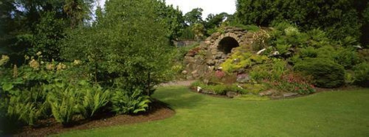
The walls were first built in 1752 and the ornamental gates were added in 1786. Throughout the 19th century, it was mainly a flower garden growing some fruit and the eastern section was decorated with a rustic thatched summerhouse, called the Tea House and a huge rockery mound with a fantastic grotto underneath. Glasshouses covered most of the south facing walls and the fruit growing in them was commented on in gardening articles published in 1882. In 1908, Herbert Maxwell mentioned the largest rhododendron he had ever seen growing in this garden but it was removed in the 1960s.
Flowers and vegetables have always been grown together but, when the NTS first took over the vegetables were extended into both sections. In 1961 this proved to be uneconomic and the gardens now grow both flowers and vegetables. The 19th century peach house has recently been restored but the remainder of the glasshouses have been replaced with modern aluminium ones. A huge cedar still guards the amazing rockery behind which lies the Tea House now used to show a forestry exhibition. Recently a small avenue of the variegated box-elder maple, Acer negundo variegate has been planted between the gate and the rockery. (Since the survey these have been removed). In the south-east corner a rose garden has been planted in the small beds among the tall Cordyline trees which replaced a Victorian parterre. Along the walls there are long herbaceous and tender shrub borders.
- Visitor Access, Directions & Contacts
Telephone
01655 884455Access contact details
The country park is open all year round. Opening hours for the castle and walled garden vary seasonally.
Directions
Culzean Castle can be reached by bus with a one-mile walk to the castle and visitor centre. The Castle is on National Cycle Route 7, and the nearest station is at Maybole 4 miles away.
Owners
The National Trust for Scotland
- History
The following is from the Historic Environment Scotland Gardens and Designed Landscapes Inventory. For the most up-to-date Inventory entry, please visit the Historic Environment Scotland website:
Reason for Inclusion
Outstanding in every way, the attractive layout of parkland, woodland, gardens and architecture at Culzean Castle makes a large impact on the surrounding scenery and provides a rich haven for wildlife. The gardens contain a wide range of interesting trees and shrubs and are noted for their tender exotic plants.
Main Phases of Landscape Development
No information available.
Site History
In the mid 18th century the terraces and walled garden were overlaid on top of the 17th century terraces. Most of the other features including the designed landscape were set out towards the end of the 18th century. There were further additions in the early 19th century and more later in the 19th century. The Castle and grounds were given to the NTS in 1945 and the grounds designated as a Country Park in 1969.
The Kennedy papers are lodged at the Scottish Record Office and have not been consulted but it is known that in 1796 James Thin produced designs for a lodge and gateway. This was followed around 1808, by plans for other lodges by both James Donaldson and Robert Mclachan. In 1812, Robert Buchannan produced drawings for the battery. In 1815, James Gillespie Graham drew up plans for another lodge and designs for further lodges were supplied by Richard Crichton and Alexander Nasmyth. The early design of the avenues and woodland have been attributed to Robert Robinson and, in the early 19th century, Alexander Nasmyth is credited as having influenced the design of the grounds.
Between 1777 and 1792 Culzean Castle was remodelled to designs by Robert Adam. His first modest plan encircled the medieval tower which was part of the Kennedy stronghold. The Kennedy family has been associated with Carrick since the 14th century. The fortified tower house was converted into a more domestic House in the 17th century when the first terraces were probably made by filling in the arm of the isthmus. Sir Thomas Kennedy, the 4th Baronet, inherited Culzean in 1744 and it is probable that he laid out the present terraces. His fortunes improved in 1762, when he became the 9th Earl of Cassillis, inheriting the title and lands from a distant cousin. He prefered to live at Culzean even though Cassillis Castle had been the main family home. Both he and his brother, the 10th Earl of Cassillis were recognised as "foremost improvers" and a local parish minister wrote that the "husbandry of the parish underwent a total and happy revolution". Most of the tree belts were planted by them and they pioneered the planting of strip woodland belts to shelter and thus improve the pasture. David, the 10th Earl, succeeded in 1775 and two years later commissioned Robert Adam to draw up his first design for the new Castle. Adam enlarged his scheme in about 1779 and again in 1785. Both Robert Adam and David, the 10th Earl, died in 1792 just as the alterations were finally finished.
The 11th Earl was a distant relation living in America and returned to enjoy his inheritance for two years before his son, Archibald Kennedy succeeded. The 12th Earl was a great friend of William IV and in 1831 was created 1st Marquess of Ailsa. He engaged, among other designers, Robert Lugar to complete the Lodges: Lugar also designed an ornate pheasantry in 1823. In 1870 the 2nd Marquess died. Again the succession skipped a generation and the property was inherited by his grandson, Archibald, the 3rd Marquess. He lived at Culzean for the next 68 years and he implemented many of the Victorian changes including commissioning Wardrop & Reid to add the west wing. He was a yachting enthusiast and supervised his own boat building in the Boathouse below the Castle.
Three of the 3rd Marquess' sons inherited between 1938 and 1956. In 1945, crippled by death duties, two years after he had succeeded, the 5th Marquess gave Culzean and most of the policies to the National Trust for Scotland. In 1969, with the help of the recently formed Countryside Commission for Scotland, Culzean was declared Scotland's first Country Park.
- Associated People
- Features & Designations
Designations
Historic Environment Scotland An Inventory of Gardens and Designed Landscapes in Scotland
Site of Special Scientific Interest
- Reference: The shoreline at Culzean Castle
Features
- Kennels
- Earliest Date:
- Latest Date:
- Lake
- Description: Swan Pond is a freshwater lake near the sea created by diverting a river to swamp a marshy area. It was originally intended for fishing and boating.
- Earliest Date:
- Latest Date:
- Well Head
- Camellia House
- Description: A gothic conservatory probably designed by James Donaldson and restored in 1995.
- Earliest Date:
- Latest Date:
- Pagoda
- Description: The pagoda was restored in 1998.
- Orangery
- Description: Now restored, the orangery is attributed to James Donaldson.
- Boat House
- Icehouse
- Description: Icehouse near Swan Pond
- Earliest Date:
- Latest Date:
- Ornamental Fountain
- Description: A fountain on the lowest castle terrace.
- Earliest Date:
- Latest Date:
- House (featured building)
- Description: The house was created by Robert Adam around a much earlier tower house based on a medieval tower.
- Earliest Date:
- Latest Date:
- Garden Terrace
- Avenue
- Description: An avenue of lime trees.
- Key Information
Type
Estate
Purpose
Ornamental
Principal Building
Domestic / Residential
Survival
Extant
Hectares
306
Open to the public
Yes
Electoral Ward
North Carrick and Maybole West
- References
References
-
Historic Scotland, 'Culzean Castle', {Gardens and Designed Landscapes},
- Peter McGowan Associates with Christopher Dingwall, 'Culzean Castle', in {Ayrshire Garden and Designed Landscape Survey} (Prestwick: South Ayrshire Council, 2007) [on CD-ROM] Ayrshire Garden and Designed Landscape Survey
- Millar, A. H., {The Castles and Mansions of Ayrshire with Historical and Descriptive Accounts} (Glasgow: Grimsay Press, 2004), pp. 64-5 The Castles and Mansions of Ayrshire with Historical and Descriptive Accounts
- Close, R. (ed), {Ayrshire and Arran: An Illustrated Architectural Guide} (Edinburgh: The Rutland Press, 1992), pp. 169-72 Ayrshire and Arran: An Illustrated Architectural Guide
- Sinclair, J. (ed), {[Old] Statistical Account of Scotland} ([n.p.]: [n.pub.], 1971-9), Vol. 10, pp. 474-500 [Old] Statistical Account of Scotland 1791-1799
- Mitchell, Sir A. (ed), {Geographical Collections Relating to Scotland made by Walter Macfarlane} (Edinburgh: [n.pub.], 1907), Vol. 2, p. 9 Geographical Collections relating to Scotland made by Walter Macfarlane
- Loudon, J. C., 'General Results of a Gardening Tour made in 1831', {The Gardener's Magazine}, 1833, pp. 8-9 The Gardener's Magazine
- {Ordnance Survey County Series Six Inch} (Southampton, 1854) Ordnance Survey County Series Six Inch
- Captain M. J. Armstrong and Son {A New Map of Ayrshire} (1775) A New Map of Ayrshire
- William Roy {Military Survey of Scotland} (1750) Military Survey of Scotland
- Joan Blaeu {Atlas Novus - South Carrick/North Carrick/Kyle/Cunninghame} (Amsterdam, 1654) Atlas Novus - South Carrick/North Carrick/Kyle/Cunninghame
- Coventry, M., {The Castles of Scotland} (Edinburgh: Goblinshead, 1997), pp. 138-9 The Castles of Scotland
- Land Use Consultants, {An Inventory of Gardens and Designed Landscapes in Scotland} ([n.p.]: The Countryside Commission of Scotland, 1987), Vol. 2, pp. 218-25 and p. 388 An inventory of gardens and designed landscapes in Scotland
- Chittenden, F. J., (ed), {Conifers in Cultivation: Report of the Royal Horticultural Society Conifer Conference 1931} ([n.p.]: The Royal Horticultural Society, 1931), p. 466 Conifers in Cultivation
- Love, D., {Lost Ayrshire: Ayrshire's Lost Architectural Heritage} (Edinburgh: Birlinn, 2005), pp. 8-10 Lost Ayrshire: Ayrshire's Lost Architectural Heritage
- Peter McGowan Associates and others {Culzean Estate Conservation Management Plan} (2012) Culzean Estate Conservation Management Plan
Contributors
Historic Scotland
-
Historic Scotland, 'Culzean Castle', {Gardens and Designed Landscapes},
- Related Documents
-
CLS 1/918
Conservation Management Plan - Digital copy
Jura Consutants with Peter McGowan Associates and LDN Architets - 2013
-
CLS 1/918