Introduction
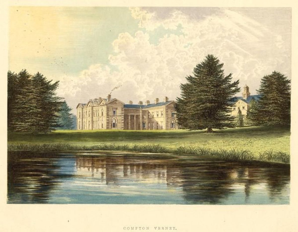
The site at Compton Verney has medieval origins. The present house was developed by Robert Adam in the 1760s from an early-18th-century house, and at the same time the park was landscaped by Lancelot Brown. After decades of neglect, it is in the process of being restored following its purchase by the Peter Moores Foundation in the 1990s.
Terrain
The ground rises westwards from the lakes to the Fosse Way which follows a ridge of high ground, while to the east the land rises to ridges of higher ground to the north-east and south-east.
The following is from the Register of Parks and Gardens of Special Historic Interest. For the most up-to-date Register entry, please visit The National Heritage List for England (NHLE):
A mid C18 landscape park laid out by Lancelot Brown with associated structures designed by Robert Adam and Brown.
LOCATION, AREA, BOUNDARIES, LANDFORM, SETTING
Compton Verney is situated c 2.5km south-east of Wellesbourne and c 2km north-west of Kineton, to the north-east and south-west of the B4086 road which runs from north-west to south-east through the site. The c 210ha site comprises some 15ha of informal pleasure grounds and kitchen garden, and c 195ha of parkland, associated woodland and lakes. The site is bounded to the west by the B4455 road, the Roman Fosse Way, while to the south-west the boundary is formed by a minor road leading to the village of Combrook. To the south the site is bounded by domestic properties in Combrook, and to the east and north it adjoins agricultural land. The boundary of the park to the north is formed by a deep ditch or sunk fence which may relate to the pale of a C17 or early C18 park north-east of the house which is indicated on Beighton's Map of Kington Hundred (1730). A stream, a tributary of the River Dene, which flows through the site in a shallow valley from north-east to south-west is dammed to form two lakes. The ground rises westwards from the lakes to the Fosse Way which follows a ridge of high ground, while to the east the land rises to ridges of higher ground to the north-east and south-east. There are complex internal vistas within the site which alternately reveal and conceal the house and lakes from points of high ground around the park. There are views to the north beyond the site, and south across the village of Combrook and its environs.
ENTRANCES AND APPROACHES
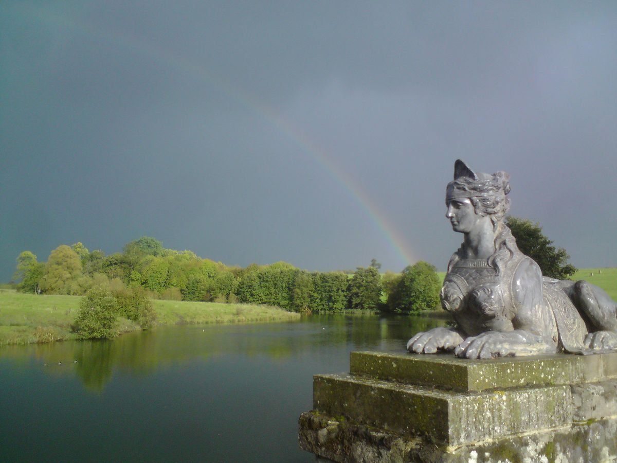
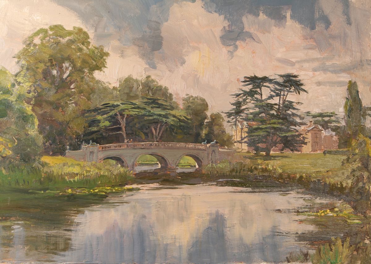
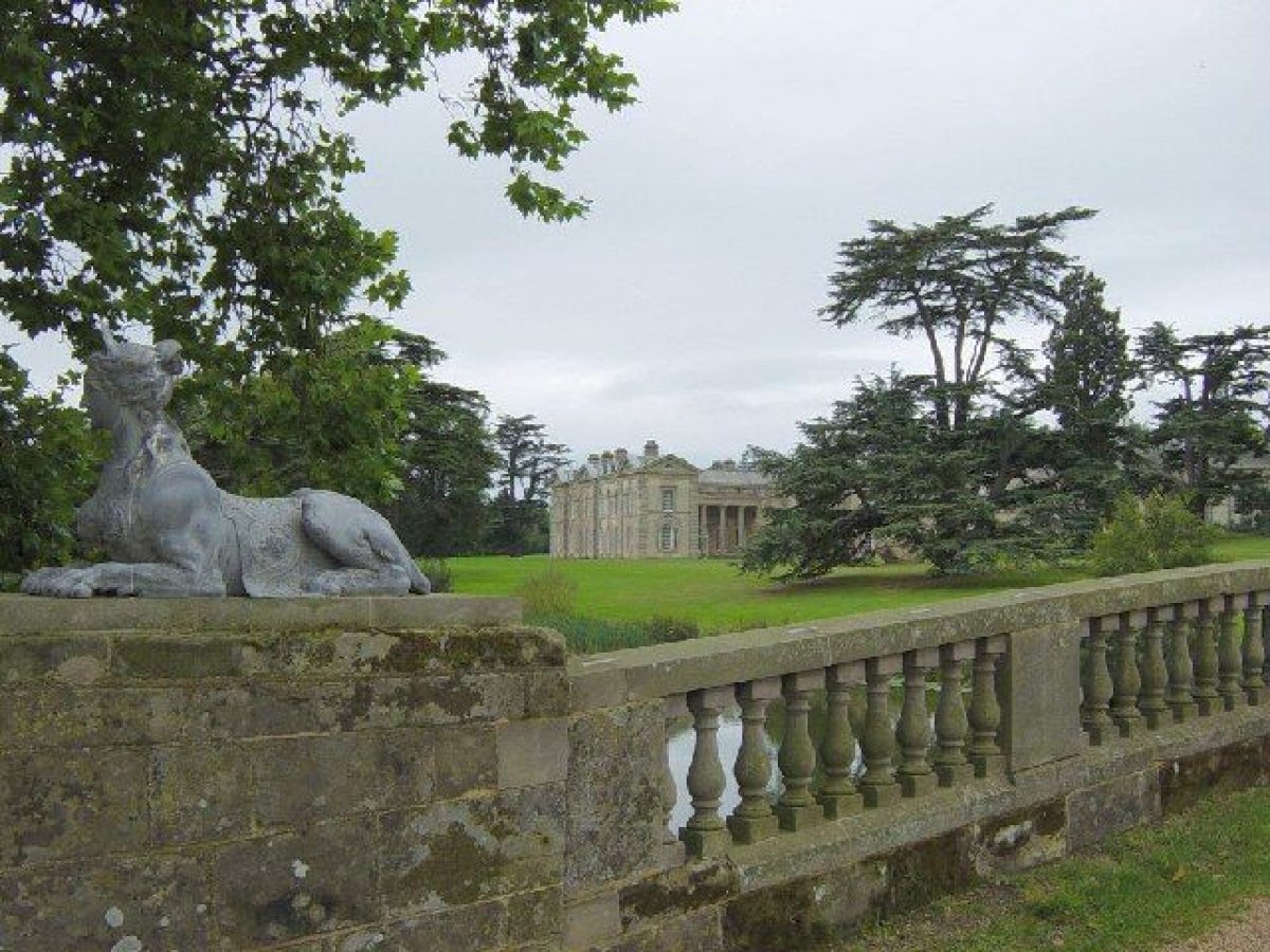
Compton Verney is approached from the B4086 Wellesbourne to Kineton road. Some 400m south-east of the house a late C20 entrance on the north side of the road leads to a tarmac drive with late C20 gravelled car-parking areas to the north-east. Immediately to the west of the present entrance, tall, C18, square-section stone piers surmounted by stone pineapple finials support elaborate wrought-iron gates and an overthrow, and are flanked by later low walls (all listed grade II*). From the gates the drive passes north for c 270m through areas of lawn, with evergreen shrubbery and mixed ornamental trees to the west screening the lake from view. Sweeping north-west for c 130m, views across the north-east park are revealed, while to the south-west a mid C18 brick icehouse (listed grade II) is surrounded by a grove of mature yews. The drive continues on a north-west course, dropping gently and revealing views north to the north-west park, and south-west across the lake to the house and pleasure grounds. It crosses the lake on a triple-arched bridge, known as the 'Adam Bridge', built to the designs of Robert Adam or Lancelot Brown in 1770 (listed grade II*). The piers flanking the east and west ends of the bridge formerly supported lead figures of sphinxes (removed mid C20). From the bridge the drive sweeps west-north-west for c 100m to reach a junction with a service drive which leads c 80m north-west to the north-east facade of the early C18, two-storey stone stable block (listed grade II*) immediately north-east of the house. The stable block, converted in the late C20 to domestic use, is constructed around a central paved courtyard with a pedimented south facade lit by tall sash windows. It was built to designs by James Gibbs in 1736-43 (Tyack 1994). A further late C20 service drive ascends north-east from the stables to a late C20 residents' car-parking area which is screened by ornamental trees and shrubs. At its junction with the drive leading to the stables, the principal drive turns sharply south-west for c 130m to approach the gravelled forecourt below the east facade of the house. The forecourt is enclosed to north and south by the north and south wings of the house, which were remodelled by Adam in the mid C18.
A further drive approaches the site from the B4086 road c 480m west-north-west of the house. A mid C18 lodge by John Gibson stands to the north-west of the entrance, which is flanked by low stone quadrant walls which support ornamental mid C19 wrought-iron railings. The drive, today (2000) an agricultural track, leads c 480m north-east across the north park to join a further drive which approaches the site from the Fosse Way to the north-west. This latter drive passes for c 500m south-east through a double avenue of late C20 limes (replacing elm), before turning south for c 200m to reach the stables.
The south drive was created as part of Brown's improvements for the fourteenth Lord Willoughby in the mid C18 by re-forming an early C18 formal walk or avenue which is shown on Fish's plan of 1736 along more curvilinear lines. The location of the Adam Bridge corresponds to the site of a dam which in the early C18 divided the Middle Pool from the Upper Long Pool. In the mid C19 an alternative entrance from the Kineton road was made c 160m east of the principal entrance, leading to a drive which followed the boundary of the north-east park for c 300m before joining the south drive c 50m south-east of the icehouse. Today (2000), this drive is a grassy ride bordered by an avenue of mature Wellingtonias. Some 40m north-west of the site of the south-east entrance, the drive crosses a small stream on a low, mid C19, stone, single-arched bridge, probably designed by John Gibson. The mid C18 south drive replaced an early C18 formal approach from the east, which led from a road from Warwick to Kineton which was diverted in the mid C18.
PRINCIPAL BUILDING
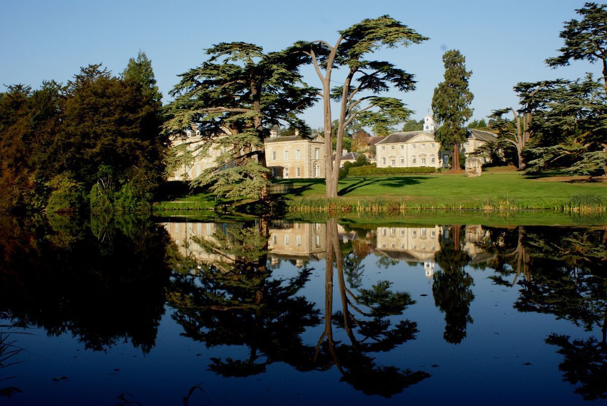
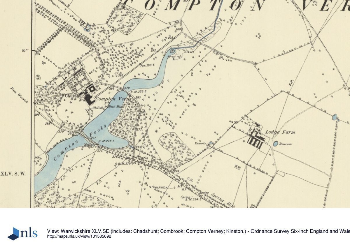
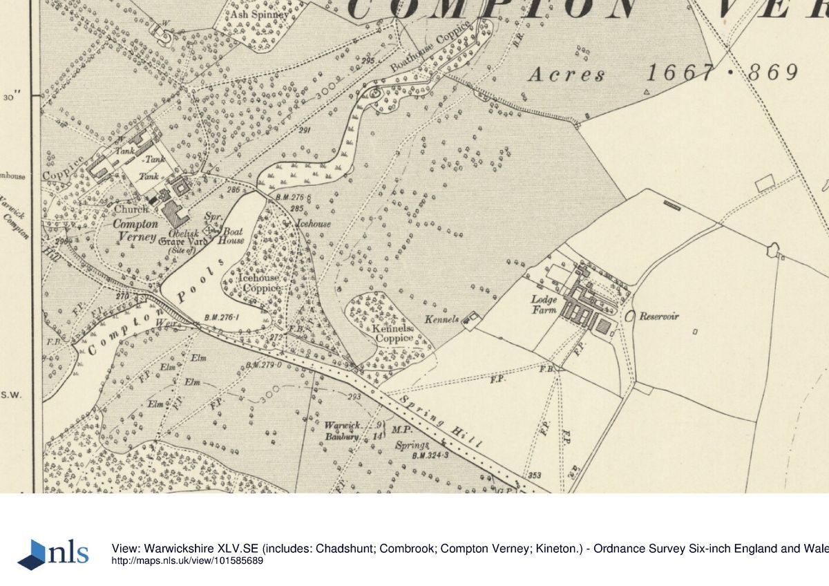
Compton Verney (listed grade I) stands on a level terrace towards the centre of the site, to the north-west of the upper lake. Approximately U-shaped on plan with an open forecourt to the north-east, the house is constructed in stone and comprises two storeys with an attic. The north-east or entrance facade lies behind a full-height Corinthian colonnade surmounted by a frieze and balustrade; the north-east facades of the flanking north-west and south-east wings each have a ground-floor Venetian window set in an arch, rusticated quoins and shallow pediments. The south-east or garden facade is symmetrical, with end bays breaking forward below pediments. A similar centrepiece is surmounted by a pediment, while attic dormers are also pedimented. The south-west or garden facade has a projecting central section articulated by monumental Doric pilasters and a balustraded parapet, and is lit by arch-headed windows surmounted by bold key-blocks. The central doorcase is rusticated, and there is further rustication on the quoins. The C19 service wing to the north-west of the mansion was demolished in the mid C20 and has been replaced by a late C20 two-storey building accommodating art galleries and associated facilities. The present mansion stands on the site of a mid C15 house built by Sir Richard Verney and extended in the late C16 by another Sir Richard Verney. The south-west range of this house was rebuilt in the early C18, possibly to a design by John Vanbrugh, or William Townsend of Oxford (Bearman 2000). The south-east wing was rebuilt by 1736 and is shown in an elevation incorporated on an estate plan by James Fish (1736). This range was extended to the north-east in the mid C18 by Robert Adam, who also remodelled the north-east facade: plans were produced in 1760 and work commenced in 1762 under William Hiorn of Warwick (Tyack 1994). Minor alterations were made to the house by Henry Hakewill in the early C19, with further alterations being made by John Gibson in the mid C19. The house fell into decline in the mid C20 and is currently (2000) the subject of a major programme of restoration and consolidation.
GARDENS AND PLEASURE GROUNDS
The informal pleasure grounds lie to the east, south and west of the house, with a further area of pleasure ground to the south-east of the lake. The pleasure grounds to the east of the house comprise a wide, approximately level area of lawn, bounded to the north by C19 metal estate fencing which separates the lawn from the park, and to the east by the lake. To the north-west a grass slope planted with scattered mature C19 conifers extends up to the south facade of the early C18 stable block. There are further scattered mature C18 and C19 cedars on the lawn to the east and south-east of the house; those c 30m south-east mark the site of the medieval parish church of Compton Verney which was demolished in 1772 as part of the improvements planned by Lancelot Brown. A short obelisk (listed grade II), erected in 1848 and constructed from Cornish granite sent by J T Treffry of Place, Fowey is modelled on the Lateran obelisk, Rome (SBTRO) and marks the location of the church. A ledger stone marks the entrance to the Verney family vault, while a further eight headstones (now, 2000, laid horizontal) dating from the C17 to late C20 survive from the burial ground. Some 80m east of the house a rectangular, brick-lined tank is situated adjacent to the lake, while immediately to the north-west stone steps descend into a stone-lined spring chamber partly enclosed by C19 metal spiked railings.
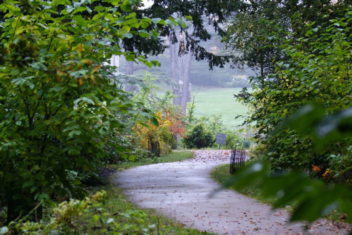
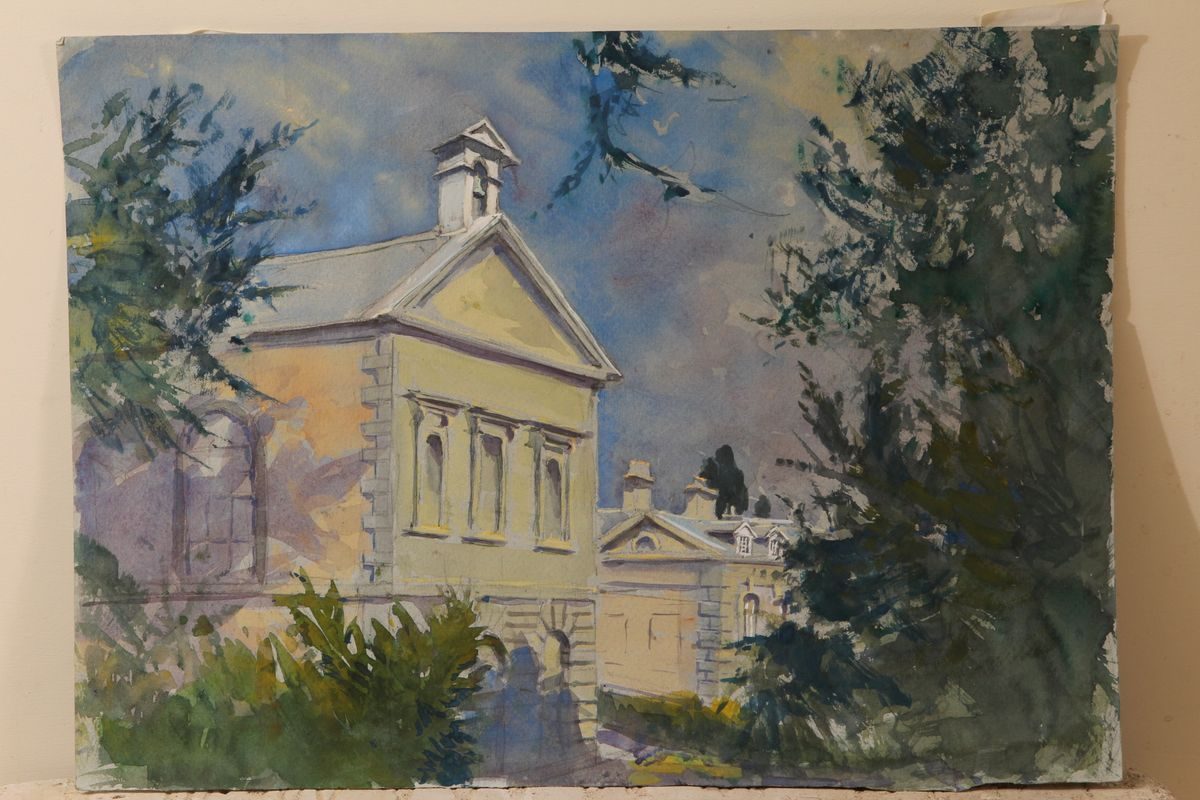
The pleasure grounds to the south of the house comprise further generally level areas of lawn with a simple gravelled walk immediately below the facade of the house. At the south corner of the house a group of lime trees are planted to enclose a small rectangular area of grass with an opening to the north, a feature shown on Padley's plan of 1818 (SBTRO). Evergreen shrubs to the south-west and south-east frame a vista across the lake from the house and pleasure grounds. The gravel walk below the south facade returns to continue below the west facade, ascending c 30m beyond the house to reach the late C18 chapel (listed grade I) which was built to designs by Brown from 1776 to replace the demolished church. The pleasure grounds west of the house comprise a level lawn extending c 200m from the house to an C18 stone-walled ha-ha, now (2000) partly obscured by scrub and young trees. This forms the boundary between the pleasure grounds and the B4086 road and would formerly have allowed views from the lawn across the road to the lower lake. The west lawn is planted with C18 and C19 specimen trees and cedars. To the north the ground rises to a late C20 drive which serves domestic properties in the walled garden. Beyond the drive the upper slope is planted with evergreen shrubbery and mature trees, among which two late C20 houses have been built c 260m west of the house. Some 130m west-north-west of the house is the site of the late C18 orangery which was constructed to a design by Robert Adam or Lancelot Brown in 1769-70. The east facade was ornamented with Doric pilasters (CL 1913), while the interior had ornamental plasterwork by Robert Moore (Tyack 1994). This structure, which is known from early C20 photographs, was demolished c 1930. There are significant views south and south-east across the pleasure grounds and lake from the site of the orangery. A further area of mature evergreen shrubbery and specimen trees, Greenhouse Coppice, extends c 160m west from the site of the orangery to the B4086 road to the south of the north-west lodge. The late C19 OS map shows walks passing through this shrubbery, with views north across the north park and west across the public road to the south park.
The western lawns and pleasure grounds were developed in their existing form by Brown in 1769-72, replacing formal gardens comprising a canal aligned on the west facade of the house which terminated to the west in a rounded octagonal basin, with parterres on the slope to the north-west and between the canal and lake to the south. This early C18 formal layout is recorded on Fish's plan of 1736.
Some 130m south of the house, a group of mature yews adjacent to the site of the mill which survived until the mid C18 (Hollar c 1656; Fish, 1736) screens the north-west end of the mid C18 dam which retains the lake. The dam supports a late C18 stone bridge (listed grade II) designed by Adam or Brown, comprising five elliptical-headed arches through which the water flows to feed the lower, southern lake. A grass walk leads from the western pleasure grounds for c 100m, through the remains of a C19 cast-iron gate and on to the bridge, revealing significant views across the lake, north to the Adam Bridge and north-west to the house, and thence after c 100m re-entering an area of pleasure grounds south-east of the lake through the remains of a similar C19 gate. Curvilinear mown grass walks lead through an area of mature evergreen shrubbery and specimen trees on the south-east and east banks of the lake, while to the east areas of lawn border the south drive. A walk follows the edge of the lake to join the south drive immediately east of the Adam Bridge, thus forming a circuit walk. The south-east pleasure grounds assumed their present informal appearance as part of Brown's late C18 alterations to the early C18 formal landscape. Fish's plan (1738) indicates that in the early C18 this area formed a formal plantation or wilderness with a principal walk running from north-east to south-west crossed by a walk running from north-west to south-east; boundary walks were linked by diagonal cross walks. The present path pattern does not appear to correspond to the early C18 walks.
PARK
The park surrounds the house and pleasure grounds on all sides and is crossed from north-west to south-east by the B4086 road.
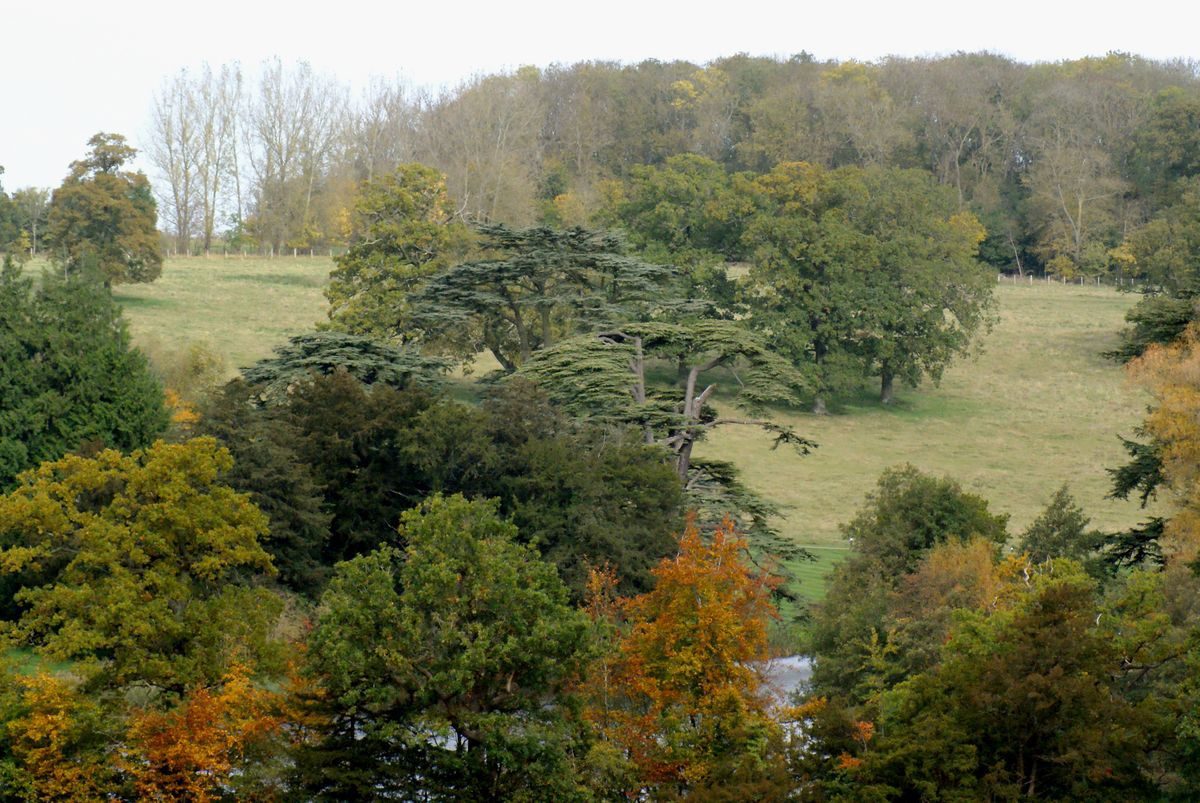
The park to the north and north-west of the house remains (2000) predominantly pasture with scattered trees, and is crossed by the north-west drive and associated avenues. Some 430m north of the house the park is bounded by Ash Spinney, an area of deciduous woodland, while the east-facing slope of the shallow valley extending to the north-east of the house retains scattered deciduous trees from a denser planting recorded on the late C19 OS. This timbered area survived from a formal plantation or wilderness recorded by Fish in 1738. The north park is separated from the north-east park by the lake which extends c 400m north-east from the Adam Bridge to Boathouse Coppice, an area of mainly late C20 poplars planted on marshy ground. A late C18 or early C19 brick and stone bridge (collapsed, 2000) c 700m north-east of the house carries a carriage drive through Boathouse Coppice, linking the north and north-east parks. The north-east park is today in arable cultivation and lacks any surviving trees. In scrubby woodland on the eastern boundary of the park, c 700m east-south-east of the house, the ruins of C19 brick kennels survive. Kennels Coppice, a mixed plantation (replanted late C20), forms the south-east boundary of the park. The northern areas of park were formed in the early C18 as part of the improvements made to the estate by the Hon John Verney. A plan by James Fish dated 1736 indicates this area as part of the land 'proposed to be made into a New Park' (SBTRO); it was modified, broadly to assume its present form, in 1769-72 by Brown.
The park to the south and south-west of the B4086 road remains predominantly pasture, with an area in arable cultivation to the east. The south park comprises the east- and west-facing slopes of a valley which extends c 1km south from the house to the village of Combrook, together with an area of level high ground to the north-east of the village, and the north-facing slope which descends to the B4086 road south-east of the house. An extensive naturalistic lake extends through the valley and is retained to the south by a high earth dam. This lake assumed its present form in 1814-15 under the supervision of the Birmingham canal engineer, William Whitmore, who extended the existing early C18 'New Poole' (Fish, 1736, 1738). The New Pool is not indicated on Hollar's mid C17 drawing; its southern limit corresponds to the island in the early C19 lake. The east-facing slope above the lake is laid out with an area of deciduous woodland, Fosse Rides, through which a carriage drive or ride extends c 800m south-west from the pleasure grounds south-west of the house along the crest of the slope. Below the woodland, scattered deciduous trees within the park soften the eastern edge of the plantation. Further mixed plantations, Round Clump and Knightley Coppice, lie below Fosse Rides to the south-east. The west bank of the lake is lightly wooded with deciduous trees and specimen pines which are underplanted with evergreen shrubs. Park Farm, a mid C20 house and associated farm buildings occupies the site of the C19 boathouse c 650m south-west of Compton Verney. There are extensive easterly views across the lake from the park, and north along the lake from a walk which crosses the dam. The park on the west side of the lower, southern lake was developed in three phases from a small deer park which existed in the mid C17 (Hollar), and which extended south-west from the public road to the boundary of the parish of Combrook. James Fish's plan (1738) shows an avenue aligned on the south-west facade of the house extending across the park parallel with the New Pool, while a paddock to the north-north-west corresponds to the present meadow which lies north of Fosse Rides and south-east of the Fosse Way. This park was altered in the late C18 by Brown, and was then further extended in the early C19 to assume its present form. The early C19 development of the park is recorded on a plan of 1818 by Paul Padley (SBTRO).
The west-facing slope above the east bank of the south lake is today (2000) covered by mixed woodland, The Rides, with areas of deciduous trees underplanted with evergreen shrubbery concentrated adjacent to the lake. Areas on the upper slopes and level ground above have been extensively replanted in the late C20 as commercial mixed woodland. The northern boundary of The Rides, marked by the remains of C19 metal estate fencing and late C20 timber fences, adjoins arable land on a north-facing slope which descends from the woodland to the B4086 road. Some 500m south-south-east of the house, immediately inside the northern boundary of the woodland, the remains of a late C18 or early C19 brick and stone classical temple overlook the upper lake and north park. The date of the construction of the temple is unknown, but its remains indicate that its open north facade was supported by Doric columns similar to those used by Brown or Adam on the orangery; it is shown on Padley's plan (1818). The park to the east and north-east of the southern lake was developed in the late C18 or early C19 from agricultural land which was crossed by three avenues aligned on Compton Verney house (Fish, 1736, 1738). The Rides corresponds in part to the area identified as Windmill Ground on Fish's plan of 1736 and is shown as unwooded on Yates' Map of Warwickshire (1793). Vestiges of the formal avenue aligned on the house and leading south-east across the park to Red House are indicated on the late C19 OS map (1886), but these trees do not survive today and this field (outside the site here registered) is now in arable cultivation.
KITCHEN GARDEN
Lying c 50m north of the house and enclosed by brick walls c 3m high to the north, east and west, and c 2.5m high to the south, the kitchen garden is today (2000) developed with four late C20 detached dwellings and associated gardens. A late C18 stone gardener's cottage (listed grade II) stands c 20m north-west of the kitchen garden with stables and farm buildings to the west. A steep slope descends south-east from the kitchen garden to service buildings north-west of the house. These comprise the early C19 stone Butler's House (listed grade II), and the early C19 brick and stone coach house (listed grade II). The site of the kitchen garden is shown by Fish (1736, 1738) as a series of three parterres with diagonal walks radiating from central circular motifs, laid out within a walled enclosure which extended c 140m south-west of the present south-west wall of the kitchen garden. The garden appears to have been developed in its present form as part of Brown's late C18 improvements. The extensive early C18 orchards laid out in Naggs Close to the north-west, south-west and north-east of the kitchen garden had been removed by the late C19 (Fish, 1736; OS 1886).
REFERENCES
W Dugdale, The Antiquities of Warwickshire (2nd edn 1730), p 565
G Lipscombe, Journey into South Wales (1802)
J P Neale, Views of the Seats ...IV, (1821)
Jones's Views (1829)
F O Morris, A Series of Picturesque Views III, (1866-80), p 3
Country Life, 34 (18 October 1913), pp 528-35; 126 (3 September 1959), pp 172-3
G Jekyll, Garden Ornament (1918), p 88
R G Verney, The Passing Years (1924)
Victoria History of the County of Warwickshire V, (1959), pp 58-60
N Pevsner and A Wedgewood, The Buildings of England: Warwickshire (1966), pp 239-41
Warwickshire History I, no 1 (1970), pp 18-24; III, no 1 (1975), pp 2-14
D Stroud, Capability Brown (1975), pp 141-2, 221
S Markham (ed), John Loveday of Caversham, the travel journals of John Loveday, (1984), pp 190, 332, 496-7
G Tyack, Warwickshire Country Houses (1994), pp 64-70
R Bearman (ed), Compton Verney A History of the House and its Owners (2000)
Maps
H Beighton, A Mapp of Warwickshire, 1" to 1 mile, surveyed 1722-5, published 1729
H Beighton, A Map of Kington Hundred, surveyed 1725, published 1730
J Fish, The survey of part of the Manour of Compton in the County of warwick viz the House Courts Gardens and Pooles and those adjoyning Grounds proposed to be made into a new Park ..., 1736 (DR98/1820), (Shakespeare Birthplace Trust Record Office (SBTRO)
J Fish, The Survey of the Manor of Compton in ye County of Warwick ..., 1738 (DR98/1819), (SBTRO)
W Yates and Sons, Map of Warwickshire, surveyed 1787-9, published 1793
P Padley, Plan of Estates in Compton Verney and Combrook in the County of Warwickshire ..., 1818 (DR98/1832), (SBTRO)
OS Old Series 1" to 1 mile, published 1834
OS 6" to 1 mile:
1st edition published 1886
2nd edition published 1904-6
OS 25" to 1 mile:
1st edition published 1886
2nd edition published 1905
Illustrations
W Hollar, The Prospect of Compton House from the grounds, on the South-East side thereof, c 1656 [published in Dugdale 1730]
Elevation of south facade of house and stables, on J Fish's survey of 1738
Robert Adam drawings for Compton Verney, (Victoria and Albert Museum; Sir John Soane Museum)
Watercolour, west facade of Compton Verney, c 1800 (Aylesford Collection, Birmingham Reference Library Archive)
Archival items
Willoughby de Broke family papers (DR98), (SBTRO)
Plans for bridge at Compton Verney attributed to L Brown, 1769 (DR98/1747/1, 2, 3), (SBTRO)
W Whitmore, plans for damhead at Combrook, 1818 (DR98/1747/4(7), (SBTRO)
Garden accounts, 1725(8 (DR98/1798), (SBTRO)
Aerial photographs, 1954 (OU89(91), (Cambridge University Collection)
Description written: May 2000
Amended: July 2000, September 2000
Register Inspector: JML
Edited: December 2000
- Visitor Access, Directions & Contacts
Telephone
01926 645 500Access contact details
Open mid-March to mid-December
Tuesday – Sun – 10am-5pm
Monday – Closed, except bank holidays.
Galleries are open from 10.30am-5pmFor more detailed visitor information visit the Compton Verney website.
Directions
7 miles east of Stratford-on-Avon on the B4086, 6 miles from M40 junction 12.
For more detailed directions visit the Compton Verney website.
Owners
The Peter Moores Foundation
- History
The following is from the Register of Parks and Gardens of Special Historic Interest. For the most up-to-date Register entry, please visit the The National Heritage List for England (NHLE):
www.historicengland.org.uk/listing/the-list
HISTORIC DEVELOPMENT
Compton Verney, often also known until the C19 as Compton Mardak, belonged to the Mardak family from the C12 to the C14. In the 1430s the estate was granted by Henry VI to John Verney, Dean of Lichfield, who in turn conveyed it to his relation, Sir Richard Verney. Sir Richard built a substantial courtyard house in 1442-3 adjacent to the parish church and to the west of a village which was depopulated and cleared in the C16 (Dugdale 1730; Tyack 1994). A mill powered by a chain of pools formed by damming a stream stood to the south of the house. In the late C16 another Sir Richard Verney married the sister of Sir Fulke Greville, Lord Brooke, of Warwick Castle (qv), from whom Sir Richard inherited substantial estates and a claim to the dormant barony of Willoughby de Broke. Sir Richard Verney made additions to the C15 house which are shown in a mid C17 engraving by Wenceslas Holler (Dugdale 1730); he was succeeded by his son, Sir Greville Verney. Sir Greville's son, Richard, successfully petitioned for the revival of the Willoughby de Broke barony in 1695, when he became the eleventh Baron. Lord Willoughby de Broke died in 1711 and was succeeded by his son, the Dean of Windsor, who c 1714 began an ambitious remodelling of the house (CL 1913; Tyack 1994). At the same time an extensive formal landscape was created, recorded on a plan of 1736 by James Fish (SBTRO). John Loveday considered the gardens 'well contrived for Use and Convenience' and praised the views from the house to the chain of pools (Markham 1984). Work on the house and grounds was continued by the Hon John Verney, Master of the Rolls from 1738, who occupied Compton Verney after the death of the twelfth Lord Willoughby de Broke in 1728. The fourteenth Lord Willoughby, who succeeded in 1752, was created Lord of the Bedchamber, and in 1761 married the sister of Lord North of Wroxton Abbey, Oxfordshire (qv). At the same period he commissioned plans from Robert Adam (1728-92) for the extension of the early C18 house, while in 1768 Lancelot Brown (1716-83) prepared plans for the surrounding landscape (Stroud 1975). Compton Verney was praised by Richard Jago in his poem Edge Hill (1767), while a visitor in 1799 noted that 'the pleasure grounds are varied with great elegance, and the water and plantations are delightful' (Lipscombe 1802). Further improvements were made for the fourteenth Lord Willoughby in 1814-15; these changes are recorded on an estate plan of 1818 by Paul Padley (SBTRO). In the mid C19 the architect John Gibson was called in by the sixteenth Lord Willoughby to make changes to the interior of the house and build lodges on the estate; Gibson had earlier worked for Lord Willoughby's sister-in-law, Mary Elizabeth Lucy, at Charlecote, Warwickshire (qv).
Compton Verney continued to be owned by successive lords Willoughby de Broke until 1921, when the nineteenth Lord was forced to sell the house and surrounding land to Joseph Watson, a soap manufacturer and racehorse owner. Watson was raised to the peerage as Lord Manton in 1922, but the estate was sold by his son in 1929. From 1939 the house remained unoccupied, being sold in 1958 to an industrialist, Harry Ellard, and again in 1984 to Christopher Buxton, who converted the stables into apartments. In 1993 the house and immediate grounds were purchased by the Peter Moores Foundation for use as an art gallery; the remainder of the site is today (2000) in divided ownership.
Compton Verney is one of a group of sites in Warwickshire at which Lancelot Brown advised in the mid and late C18. These include Newnham Paddox (qv), Packington Hall (qv), Combe Abbey (qv), Charlecote Park (qv), Ragley Hall (qv) and Warwick Castle (qv).
- Associated People
- Features & Designations
Designations
The National Heritage List for England: Register of Parks and Gardens
- Reference: GD1320
- Grade: II*
Style
English Landscape Garden
Features
- Lawn
- Specimen Tree
- Ornamental Bridge
- Sphinx
- House (featured building)
- Description: The house was originally built in 1442-3, with substantial later re-modelling, mainly around 1714 and in the 1760s.
- Earliest Date:
- Stream
- Lake
- Description: Two lakes
- Key Information
Type
Park
Purpose
Ornamental
Principal Building
Domestic / Residential
Survival
Extant
Hectares
210
Open to the public
Yes
Civil Parish
Compton Verney
- References
References
- Jekyll, G., {Garden Ornament} (London: Country Life, 1918), p. 88 Garden Ornament
- {English Heritage Register of Parks and Gardens of Special Historic Interest}, (Swindon: English Heritage, 2008) [on CD-ROM] Historic England Register of Parks and Gardens of Special Historic Interest
- Stroud, D., {Capability Brown} (London: Faber, 1975), pp. 141-2, 221 Capability Brown
- Pevsner, N. and A. Wedgwood, {The Buildings of England: Warwickshire} (Harmondsworth: Penguin Books, 1966), pp. 239-41 The Buildings of England: Warwickshire
- Tyack, G., {Warwickshire Country Houses} (Chichester: Phillimore, 1994), pp. 64-70 Warwickshire Country Houses
- {Victoria History of the County of Warwickshire Volume 5} ([n.p.]: [n.pub], 1959), pp. 58-60 Victoria County History: Warwick, Volume 5
- Related Documents
-
CLS 1/291/1
Park and Pleasure Ground Conservation Plan - Digital copy
Colvin and Moggridge - 2001
-
CLS 1/859
Park and Pleasure Ground Conservation Plan - Hard Copy.
Colvin and Moggridge - 2001
-
CLS 1/291/1