Introduction
Bramham features geometrically laid out pleasure grounds and water gardens which extend into the park and woods. Features include the Broadwalk, Obelisk Pond and cascades.
Terrain
The site is on rolling land which slopes gently down to the north-west and is bisected by a small valley with a stream which runs north-west/south-east.www.historicengland.org.uk/listing/the-list
Pleasure grounds and park laid out during the period around 1700-13, with additions by John Wood the Elder of around 1725-8 for Robert Benson, first Lord Bingley, adorned with temples and statuary for the second Lord Bingley from about 1732 to 1760.
DESCRIPTION
LOCATION, AREA, BOUNDARIES, LANDFORM, SETTING
Bramham Park lies c 1.5km south-west of the village of Bramham. The c 250ha site is in a rural and agricultural setting on rolling land which slopes gently down to the north-west and is bisected by a small valley with a stream which runs north-west/south-east. The northern boundary is formed by Thorner Road, where there is a wall. A mixture of fencing and walls runs along much of the western boundary, the southern part of which is defined by Mangrill Lane. The edge of Whittle Carr, excluding Jenny Sober Plantation, forms the south-west boundary, while Black Fen, excluding Open Rake and Rakes Wood on the east side, defines the south-east corner of the site. A line running parallel to the north drive excludes Biggin Park to the north-east. The boundaries largely reflect those shown on John Wood's c 1725-8 plan with the addition of an area of parkland with perimeter planting on the north-west side of the site.
ENTRANCES AND APPROACHES
There is an entrance with a lodge called North Lodge on Thorner Road from which a drive leads south and then turns south-west into a lime avenue, shown on Wood's map, aligned with the east front of the house. An entrance on the west side of the site has a gateway at the end of a drive from Thorner Road leading to a drive which runs along the north-east side of the house with an entrance to the courtyard leading from it. The drive continues south-east with an entrance to the stable courtyard, and then continues south-east through an area of woodland called Black Fen. There are a variety of other secondary entrances around the site.
PRINCIPAL BUILDING
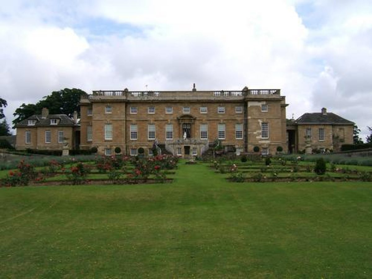
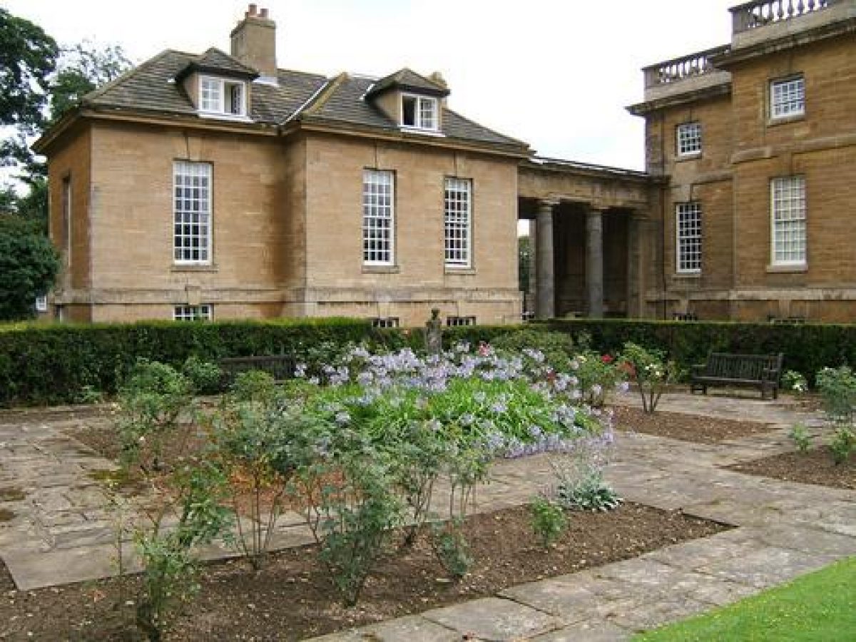
Bramham Park (listed grade I) was designed c 1700-10, probably by Robert Benson with assistance from Thomas Archer who received payments from Benson in 1699 and 1700, though Archer's involvement may have been minimal. It was damaged by fire in 1828 and after lying empty was restored 1906-14 by Detmar Blow for George Lane Fox. The house is orientated north-west/south-east, but for the sake of clarity the orientation is described in the text as north/south. The building is flanked by colonnades which link it to pavilions. Attached to the south side, and forming the south side of a courtyard on the east front, is an early C18 stable block (listed grade I) with additions attributed to James Paine. A secondary courtyard to the south has around it a range of ancillary buildings including a further early or mid C18 stable block (listed grade II). The house is in use as a private residence (1998).
GARDENS AND PLEASURE GROUNDS
The gardens and pleasure grounds consist of the area immediately around the house, and two blocks of woodland which are linked by axial views, one to the west of the house, and the other, called Black Fen, c 1km south of the house.
On the east side of the house there is a courtyard entered via a gateway with stone pedestals surmounted by sphinxes, linked by low walls to a pair of clustered piers with bands of vermiculation which are surmounted by stone bears supporting the Benson arms. These are attached on each side to ha-ha walls with low parapets which enclose the north-east side of the courtyard (all these structures early C18, listed grade I). A drive leads around a rectangular lawn which has stone obelisks at the corners (all listed grade II).
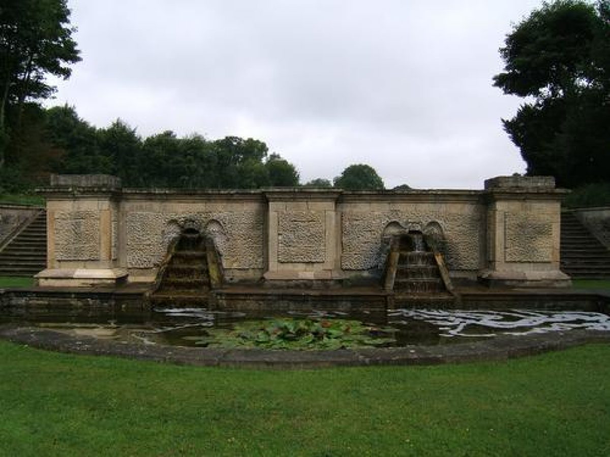
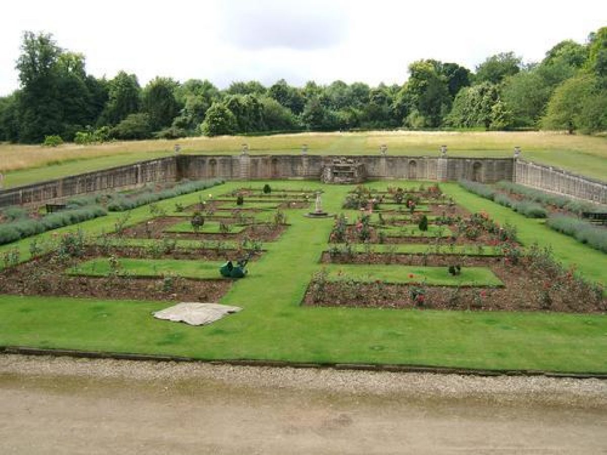
On the west side of the house and aligned with the garden entrance there is a parterre, laid out as a formal rose garden, sunk into ground which rises to the west with retaining walls on three sides. Set into the west wall, which is surmounted by urns, are the remains of a rustic cascade (walls, urns and cascade listed grade I) with a beast's head which was the termination of a water feature leading down the slope from a tank, shown on Wood's plan. This was described in 1725 by Lord Oxford and has been attributed to Thomas Archer (Hussey 1967). There are lawns on each side of the parterre and beyond these, on ground which rises gently to the west, are the areas of woodland.
The garden is bounded on the north side by North Terrace running along the edge of a ha-ha (listed grade II). This is linked with the ha-ha on the east front of the house, and is described on Wood's plan as 'Terraces that surround the house'. At the west end of the North Terrace the boundary continues southwards as a wall which becomes a ha-ha again as it turns south-east and east to South Terrace (listed grade I). This last has a central bastion from which views can be obtained southwards and south-east to Black Fen. The bastion is shown as a rectangular platform on Wood's plan. The ha-ha then dies away into the natural slope of the valley from which point a fence runs through woodland to the fenced drive running south-east from the house to Black Fen.
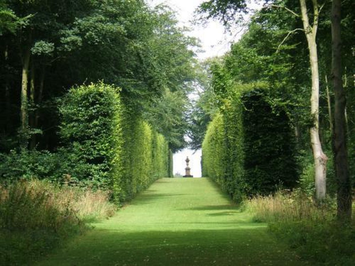
The gardens consist of alleys running through woodland between high beech hedges, in places replanted, which describe a geometrical circuit with complex internal and long-distance views. The layout conforms closely with that shown on Wood's map except that a system of serpentine paths which he shows in the north-east side of the grounds is not now evident. An earlier plan, dated c 1710(13 shows that the garden and Black Fen had acquired their basic form by this time, and must represent the 'curious gardens' mentioned by Colen Campbell in 1710 (Vitruvius Britannicus, quoted in Hussey 1967).
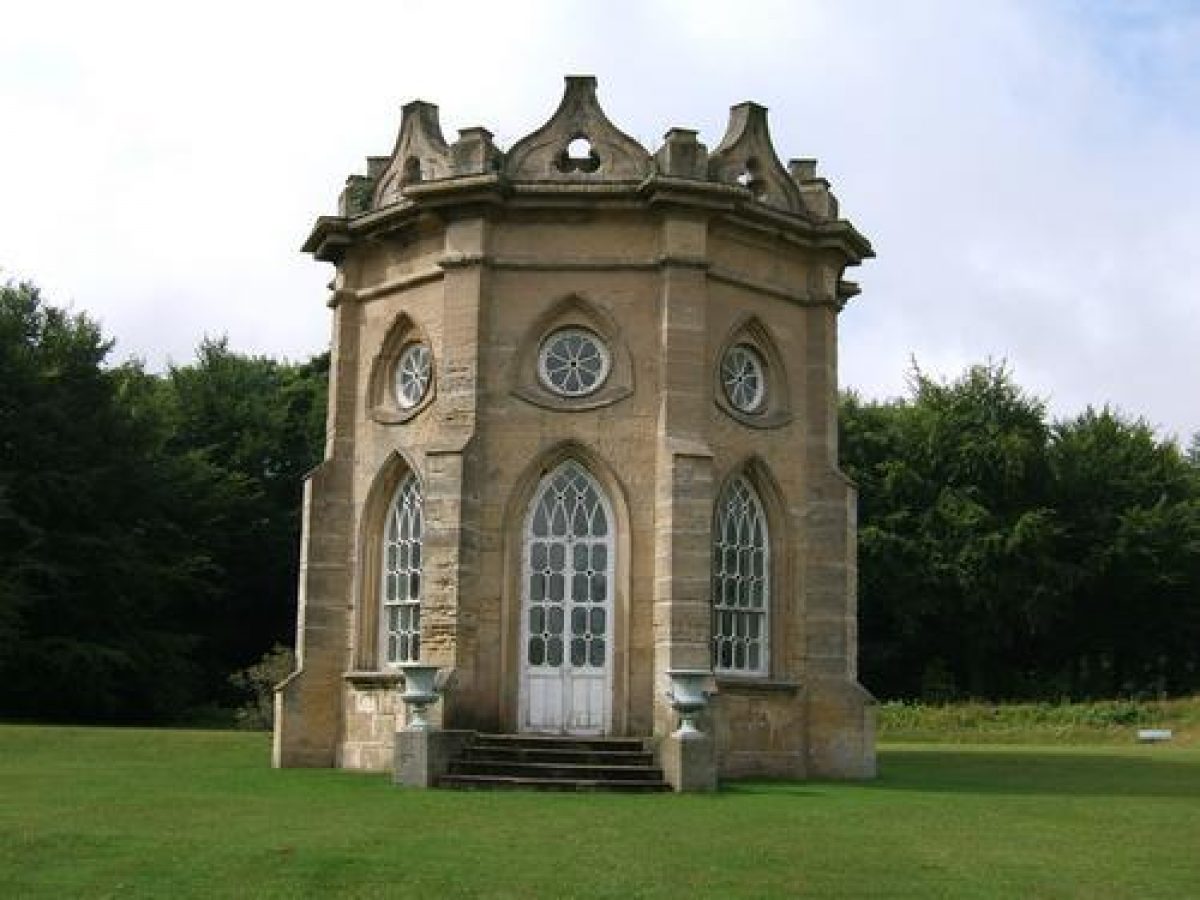
A path running along the front of the house has at its northern end a temple (listed grade I) by James Paine called the Chapel (for which use it was converted in 1912) ending the vista, and at the other (southern) end, views over Obelisk Pond to the Round House and obelisk in Black Fen in the far distance (see below). Established in the period c 1710-13, this is the principal axis of the site, which was embellished with the various structures during the period c 1732-60.
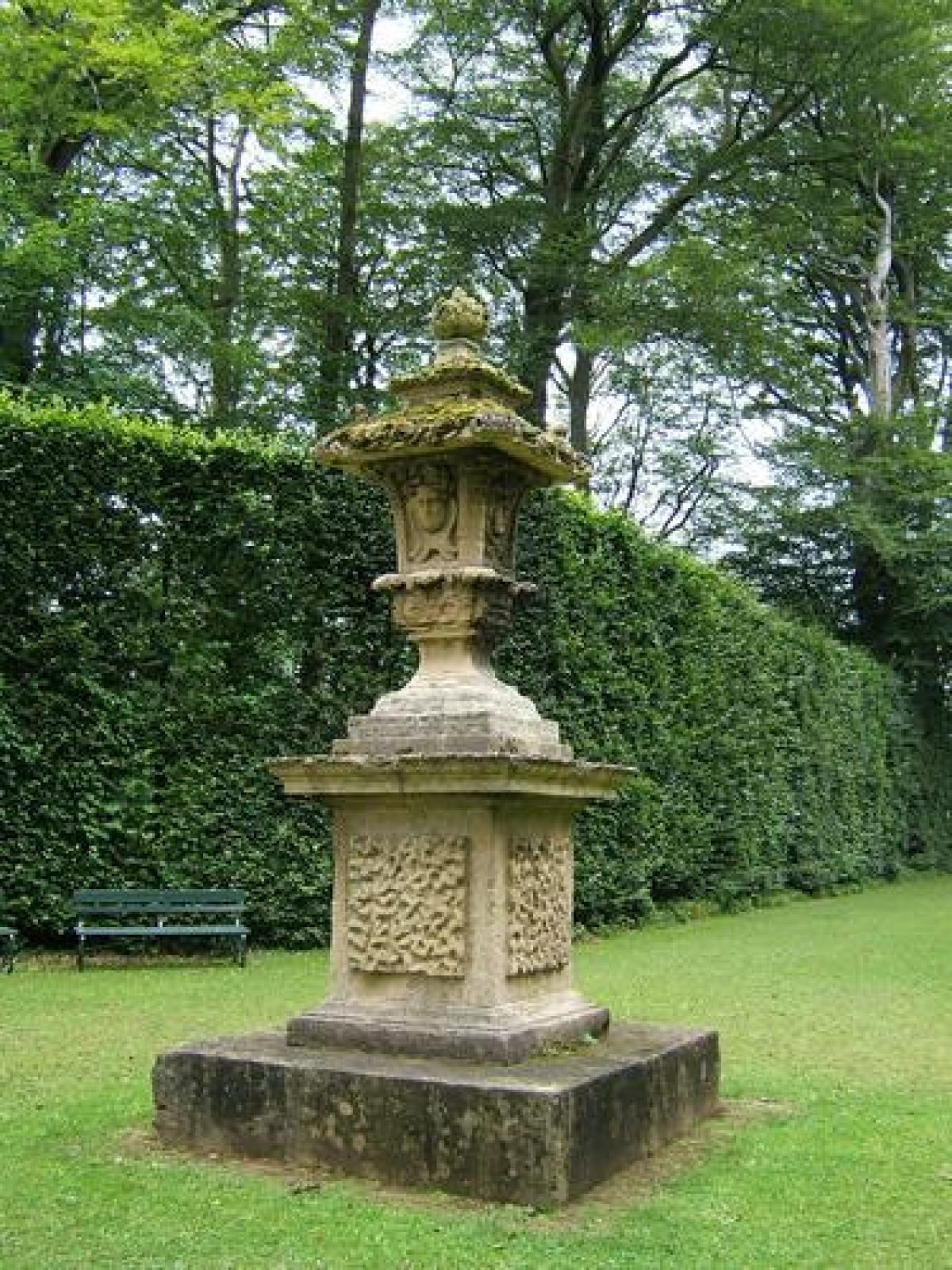
From the Chapel the path turns westwards between high beech hedges to a diamond-shaped enclosure which has a pedestal supporting a statue of a nymph (C18, listed grade II). Alleys lead off northwards to North Terrace and the main route continues, turning south-westwards to a meeting of five alleys which has at its centre a pedestal supporting a carved stone vase called the Four Faces (C18, listed grade II). From this point the first alley leads south-east with a long view to the white gate on the South Approach at the east side of the pleasure grounds. The second alley (clockwise) leads south across the head of the stretch of water called the T canal to a distant view of the Lead Lads temple at the west side of the pleasure grounds in Black Fen (see below). The third alley, between beech hedges, has had views extended during the late C20 by a ride cut in woodland called Whittle Carr to the south-west, beyond a valley (and close to the feeder pond for the T canal).
A path leads along the ha-ha to the South Terrace but before that another track from an access gate to the north leads southwards to the Open Temple (probably early C18, listed grade I), from which the Quarter Mile Walk goes eastwards to cross the Broad Walk c 100m south of the house, where a yew hedge masks the way into the walled garden.
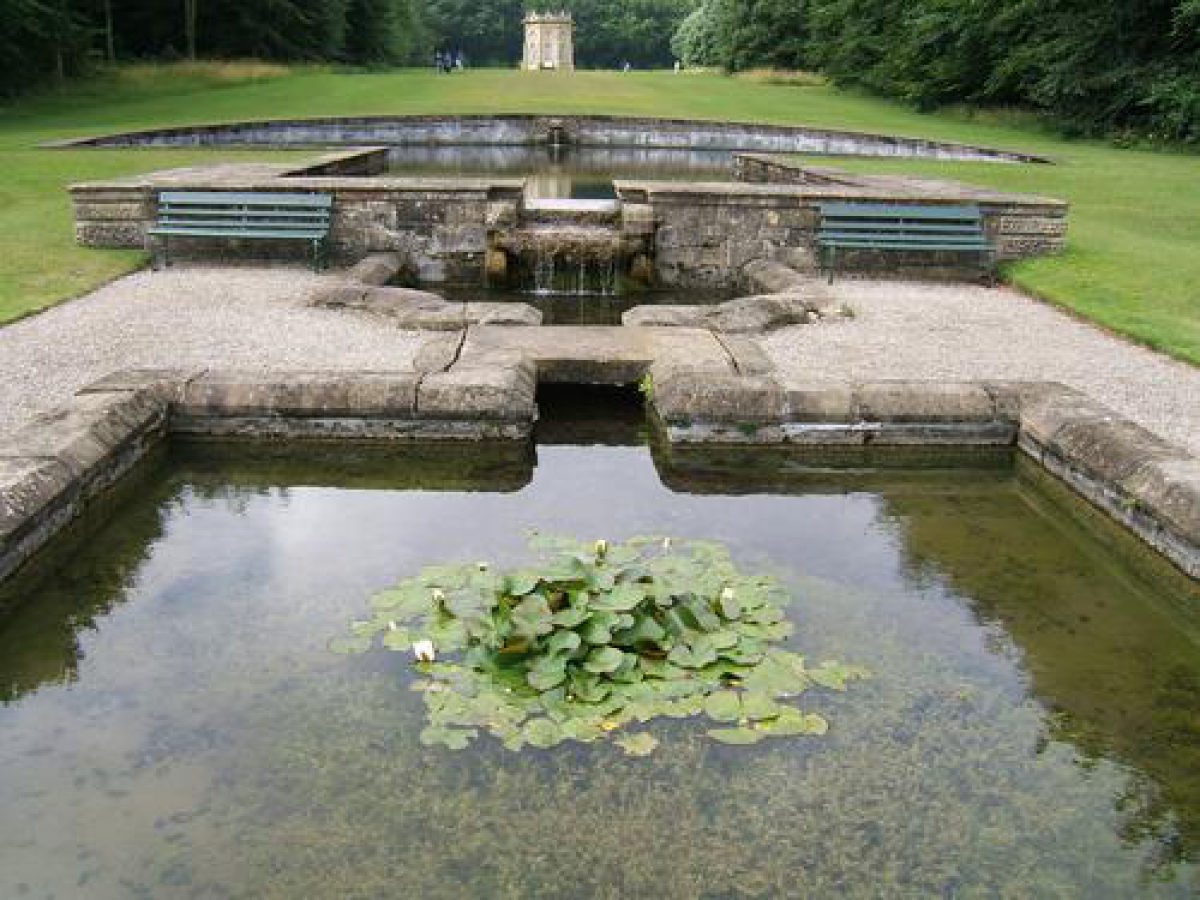
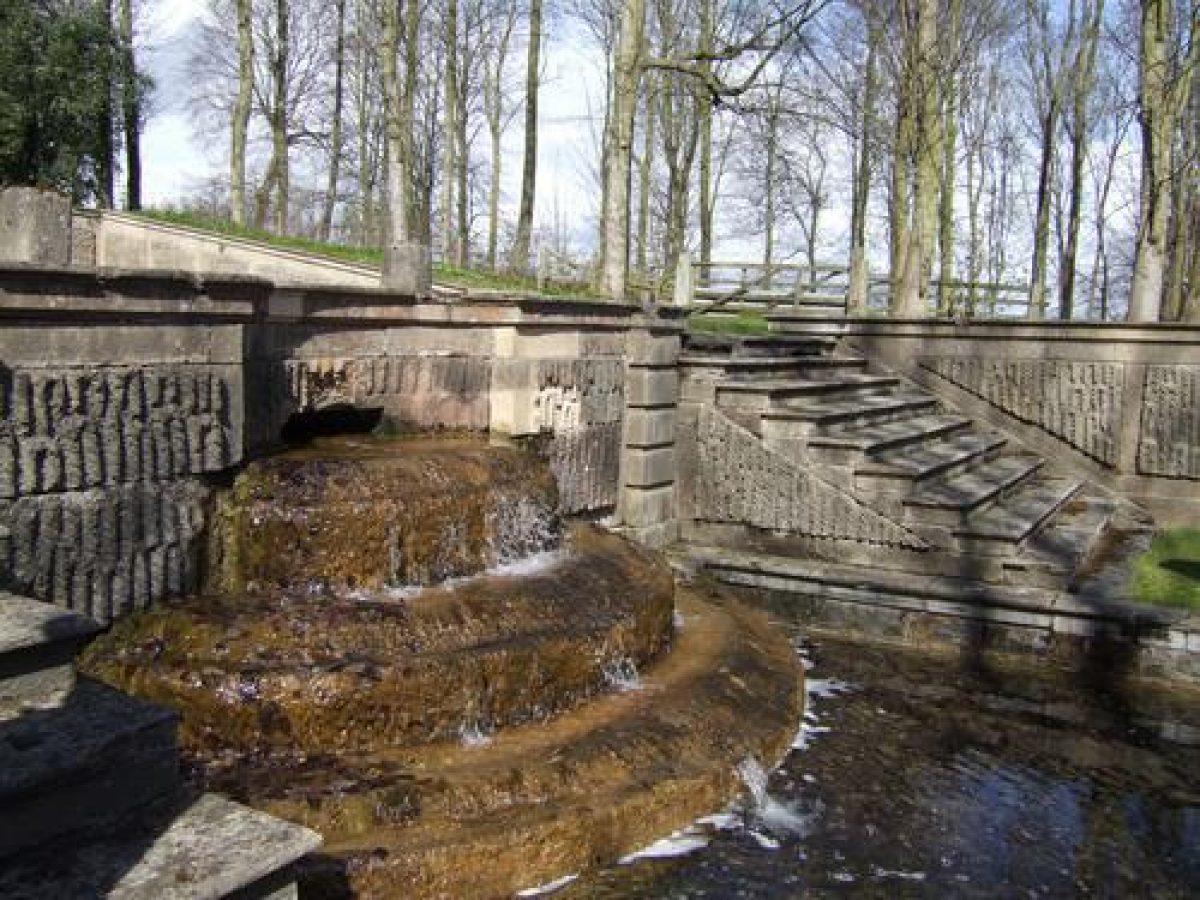
At an angle to the bastion on South Terrace there is a stretch of water called the T canal (listed grade I). The long arm of the T runs north-eastwards and intersects with one of the main vistas from the Four Faces, where a stretch of water at an angle forms the short arm of the T. Possibly designed by John Wood, it was constructed in 1728 when Lord Bingley mentions it in a letter to his head gardener, Robert Fleming. There are views eastwards to the house from the head of the T, though the canal is not visible from it. At the south end of the alley connecting the Four Faces with the short arm of the T there is a winding path which leads north-east to a clearing, formerly the site of a bowling green, where, c 400m south-west of the house, the Gothic Temple (to a design by Batty Langley published in 1742, listed grade I) is sited. The land falls to the east, with views to parkland over Obelisk Pond which is the centrepiece of a system of pools and cascades, with urns, dragon heads and rusticated and vermiculated masonry detailing, possibly designed by Wood and shown on his plan. Obelisk Pond is fed from a semicircular pool (the Half Moon Pool) and cascade on the west side, where the ground is terraced down the slope. The water empties into three smaller pools on the south side. To the south of the southernmost pool the land slopes steeply into the small valley, where there are the remains of a continuation of the cascade down the slope. This is shown on Wood's map, which also shows a series of rectangular pools at the bottom of the valley. On the south side of the valley the Broad Walk continues across the park to Black Fen and the Round House, which is visible from the house.
Some 180m south-west of the house there is a hedged enclosure with tennis courts, with a gothic summerhouse (listed grade II) at the south end. The summerhouse is not shown on the 1847 OS map, but it appears in a clearing on that of 1892.
The avenue leading to Black Fen, which is mainly composed of a mixture of young and very mature beech trees, leads to a ha-ha with opposed sets of stone steps leading up to a platform on which is the Round House (listed grade I), a large circular temple within a rondpoint. This is mentioned in an account of 1750 and it is scaled to act as a focus in distant views. A series of routes lead through woodland from the Round House, linking with another rondpoint c 180m to the south-east within which is a large obelisk (listed grade II*), designed by John Carr for the second Lord Bingley in memory of his son Robert, who died in 1768. Terminating the vista c 200m south-west of the obelisk there is a temple called the Lead Lads (listed grade II*) which is visible from the Four Faces and has views across the park to the pleasure grounds near the house. The system of rondpoints and radiating rides in Black Fen conforms with what is shown on the c 1710-13 plan (Hussey 1967).
PARK
The parkland is a mixture of arable and pasture land. To the east of the house there are scattered trees within the parkland, and on the south side there are some clumps and a block of woodland shown as an avenue on the 1847 OS map with a ride through it called Lord Bingley's Walk. Woodland called Whittle Carr at the south-west corner of the park has rides leading through it. Wood's map was made before the re-routing of the watercourses was completed in 1728, so his map is inaccurate in this one respect.
KITCHEN GARDEN
The kitchen garden lies immediately south of the stable yard and consists of an irregular walled enclosure subdivided by a wall now used (1998) as paddocks. The garden is shown on Wood's plan. The 1847 OS map shows the northern compartment as an orchard.
REFERENCES Used by English Heritage
Country Life, 16 (24 September 1904), pp 450-8; 50 (1 October 1921), pp 416-23; (8 October 1921), pp 448-55; 123 (20 February 1958), pp 350-3; 123 (12 June 1958), pp 1294-7; (19 June 1958), pp 1384-5; 124 (24 July 1959), p 190; no 39 (28 September 1989), pp 120-5
H Colvin, A Biographical Dictionary of English Architects (1954), pp 689-91
C Hussey, English Gardens and Landscapes (1967), pp 70-7
N Pevsner, The Buildings of England: Yorkshire The West Riding (1967), pp 142-3
K Lemmon, The Gardens of Britain 5, (1978), pp 156-9
G & S Jellicoe et al, The Oxford Companion to Gardens (1986), p 70
Bramham Park, guidebook, (around 1986)
Maps
J Wood, The Plan of Bramham Park..., around 1725-8
T Jefferys, County Map, 1771
OS 6" to 1 mile: 1st edition surveyed 1847
OS 25" to 1 mile: 1st edition published 1892
Description written: April 1998
Amended: March 1999
Edited: November 1999
- Visitor Access, Directions & Contacts
Telephone
441937846000Website
https://bramhampark.co.ukAccess contact details
The gardens are open by appointment only, during the week: http://www.bramhampark.co.uk/VISITING/OPENING%20AND%20PRICES/
Directions
http://www.bramhampark.co.uk/CONTACT/DIRECTIONS%20AND%20MAPS/
- History
The following is from the Register of Parks and Gardens of Special Historic Interest. For the most up-to-date Register entry, please visit the The National Heritage List for England (NHLE):
www.historicengland.org.uk/listing/the-list
HISTORIC DEVELOPMENT
The site was enclosed by Robert Benson senior in the mid-17th century. His son Robert inherited in 1677. After a grand tour in France and Italy he laid out the grounds at Bramham during the period 1698-1731. John Wood the Elder (1704-54) was employed during the period around 1725-8 to map the layout and probably to help with the water features. Politician, courtier to Queen Anne and ambassador to Spain, Benson was created Lord Bingley in 1713 and died in 1731. His daughter Harriet married George Fox (later Fox Lane after inheriting Irish land in 1751), who became the second Lord Bingley in 1762. They employed James Paine in about 1753 to embellish the stable block and to design the principal garden building (probably the Orangery, now the Chapel). Other garden buildings and statuary were introduced during the period 1732-73. Bramham was inherited by a nephew, James Fox (later Lane Fox), but garden ornaments were removed and an oak wood felled before he moved there in 1791. The layout of pleasure grounds and parkland was maintained, with minor alterations after that time. A storm in 1962 toppled 400 mature trees in the garden woodland alone, severely damaging the beech hedges, but subsequent replanting has restored the original layout. The estate remains in private ownership (1999).
- Associated People
- Features & Designations
Designations
The National Heritage List for England: Register of Parks and Gardens
- Reference: GD1531
- Grade: I
Style
Geometric
Features
- Walk
- Description: Broadwalk.
- Ornamental Pond
- Description: The Obelisk Pond. So called because of the view of the Obelisk from it.
- Earliest Date:
- Latest Date:
- Folly
- Description: The Gothic Temple.
- Obelisk
- Temple
- Cascade
- Earliest Date:
- Latest Date:
- Key Information
Type
Garden
Purpose
Ornamental
Survival
Extant
Hectares
250
Open to the public
Yes
Civil Parish
Bramham cum
- References
References
- Hussey, C., {English gardens and landscapes 1700-1750} (London: Country Life, 1967), pp. 70-7 English gardens and landscapes 1700-1750
- {English Heritage Register of Parks and Gardens of Special Historic Interest}, (Swindon: English Heritage, 2008) [on CD-ROM] Historic England Register of Parks and Gardens of Special Historic Interest
- Jellicoe, Sir G. et al (eds), {The Oxford Companion to Gardens} (Oxford: Oxford University Press, 1986), p. 70 The Oxford Companion to Gardens
- Pevsner, N., {The Buildings of England: Yorkshire The West Riding} (Harmondsworth: Penguin Books, 2nd edition 1967), pp. 142-3 The Buildings of England: Yorkshire The West Riding
- Land Use Consultants {Bramham Park Conservation Management Plan} (2013) Bramham Park Conservation Management Plan
- The Landscape Agency {Bramham Park Landscape Management and Conservation Plan} (2000) Bramham Park Landscape Management and Conservation Plan
- Related Documents
-
CLS 1/78/331
Landscape Management and Conservation Plan - Hard copy
The Landscape Agency - 2001
-
CLS 1/535
Conservation Management Plan - Digital copy
Land Use Consultants - 2012
-
CLS 1/537
Landscape Management and Conservation Plan - Digital copy
The Landscape Agency - 2000
-
CLS 1/78/331