Introduction
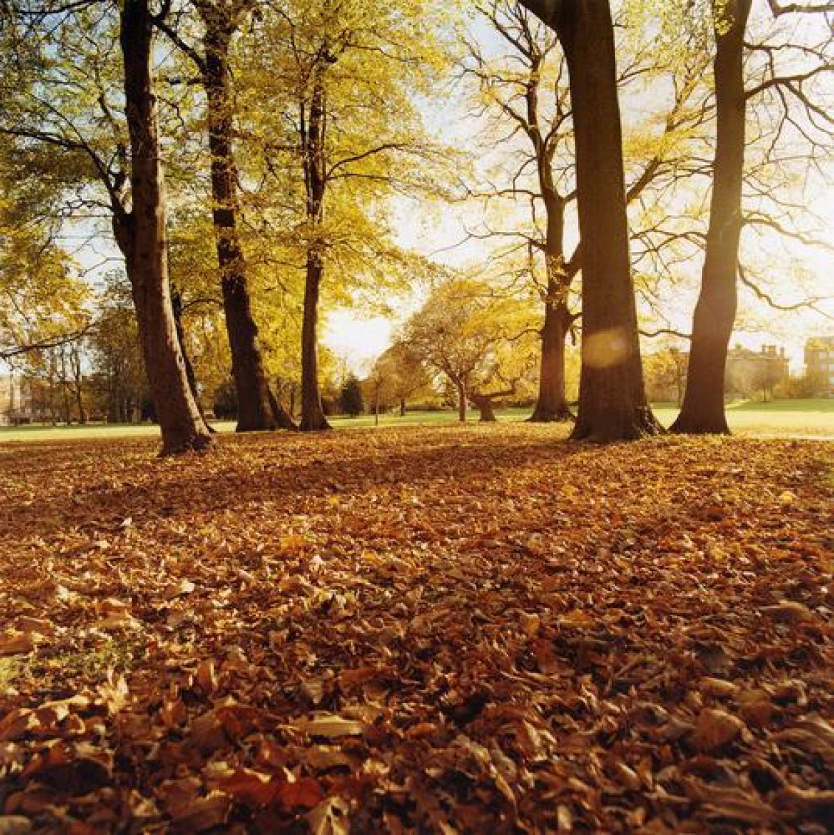
Birkenhead Park is a mid-19th-century public park occupying 90 hectares. It features parkland, woodland and meadows as well as two lakes and sports facilities.
It is reputed to be the oldest public park in England, and elements of its design occur in Central Park, New York.
Terrain
The site is situated on undulating land in a residential area.
The following is from the Register of Parks and Gardens of Special Historic Interest. For the most up-to-date Register entry, please visit The National Heritage List for England (NHLE):
Birkenhead Park, opened in 1847, was the first public park to be established at public expense in the United Kingdom. It was designed by Joseph Paxton and incorporated a number of innovative features. It was influential on the design of public parks both nationally and internationally. It is considered an outstanding example of Paxton's work and a landmark in the history of public parks.
LOCATION, AREA, BOUNDARIES, LANDFORM, SETTING
Birkenhead Park is situated c 1.5km from Birkenhead town centre. The c 90ha site is situated on undulating land in a residential area. The park was laid out within an area bounded by Park Road North, Park Road East, Park Road South and Park Road West. A belt of land around the park between these roads and a curving perimeter carriage drive called Park Drive was designated for private houses and villas and divided into plots, as shown on Paxton's plan of 1844 and in a revised form on a sale plan of 1850. Where these were built and survive they form an integral part of the park's setting and the private gardens backing on to the park form the park boundary along Park Drive. Most of the plots on the south and west sides of the site were built on, not all of them however in accordance with the sale plan. In those areas which were not built on, on the north and east sides of the site, the park boundary is formed by Park Road North and Park Road East. Most of the original railings have been removed, but sections remain on the north side of Ashville Road, on those parts of Park Road North fronting the Birkenhead Park Rugby Union Football ground and Park High Lower School, fronting 76 Park Road West, the playing fields on Park Road East and Park High School on Park Road South.
ENTRANCES AND APPROACHES
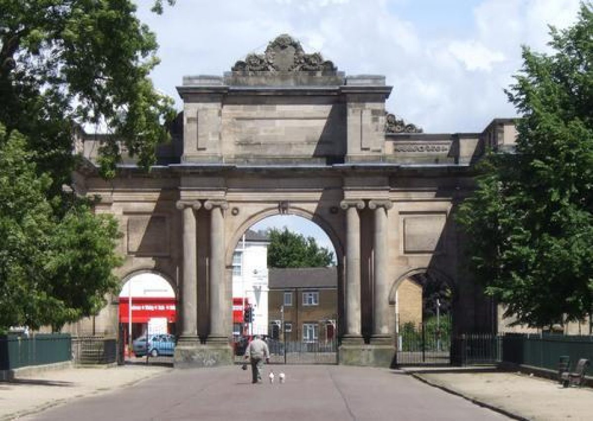
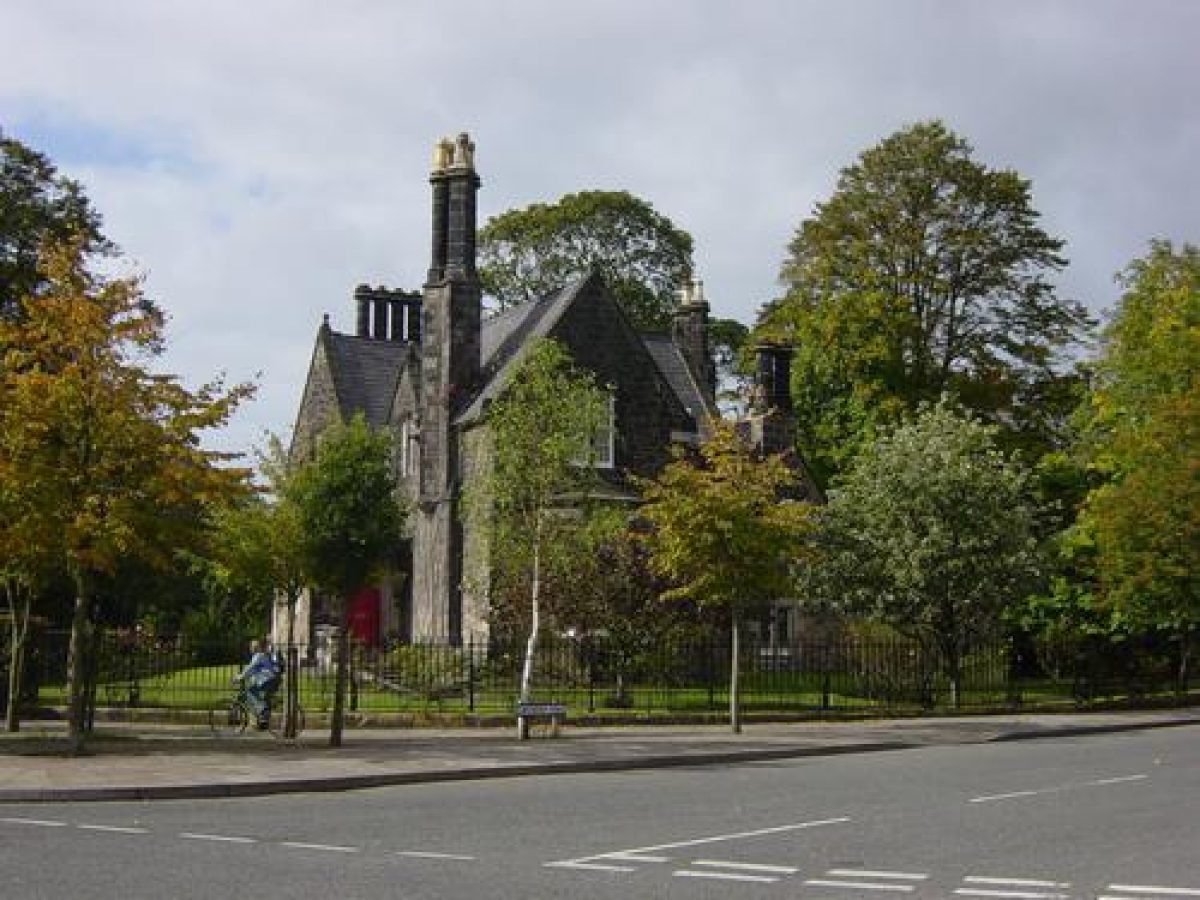
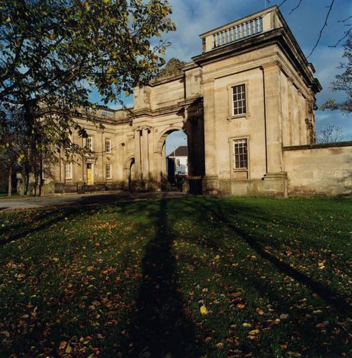
There are five entrances with lodges.The largest of these, known as the Grand Entrance Gateway, is a triple-arched screen flanked by lodges and designed by Lewis Hornblower (listed grade II*). It is situated at the junction of Park Road North and Park Road East. Other lodges were designed by John Robertson, perhaps in collaboration with Hornblower (Pevsner 1971). On the corner of Park Road East and Park Road South is the Gothic Lodge with a pair of stone gate piers (listed grade II), on Park Road South is the Italian Lodge (listed grade II), and on Park Road West is the Castellated Lodge (listed grade II). Paired lodges on Park Road North (both listed grade II) are known as Norman Lodge East and Norman Lodge West respectively, though the architectural style is Greek Revival. Another Italianate-style lodge situated on Ashville Road is known as Central Lodge. The lodges generally have iron gates and decorative stone gate piers which are of the same design as those belonging to many of the surrounding houses and villas, as well as the two sets of four gate piers on each side of Ashville Road to the north-east and south-west of its junction with Cavendish Road. In addition to the principal entrances there are a number of informal pedestrian entrances.
The park is divided by Ashville Road, which was designed as a route for through traffic and is connected to the perimeter carriage drive, Park Drive. The park is known as Upper Park on the north-west side of Ashville Road and Lower Park on the south-east side.
GARDENS AND PLEASURE GROUNDS
One of the innovatory features of Birkenhead Park was the system of circulation and traffic segregation, which also serves to divide the park into areas of different character. The outer carriage drive, Park Drive, was designated for pleasure traffic only; it describes a sinuous route around the perimeter and has on its outer edge a pedestrian walkway. Tree planting is concentrated along Park Drive where clumps and belts of trees accord well with Paxton's design as shown on the 1844 plan of the park. Certain sections of footpath have been lost, particularly those which formed links across the lakes, and some new footpaths have been created, but the network of paths which survives can be closely related to Paxton?s design.
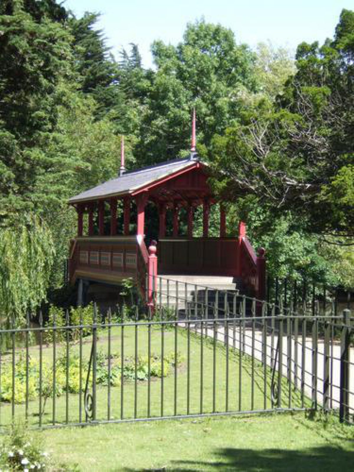
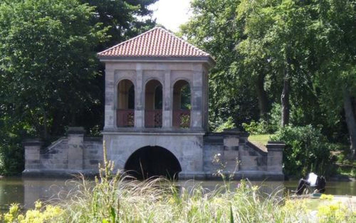
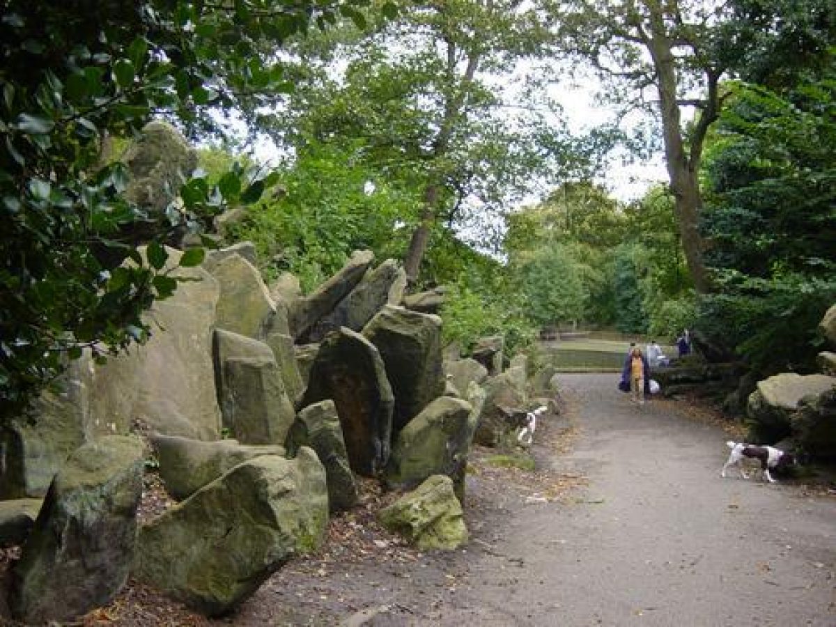
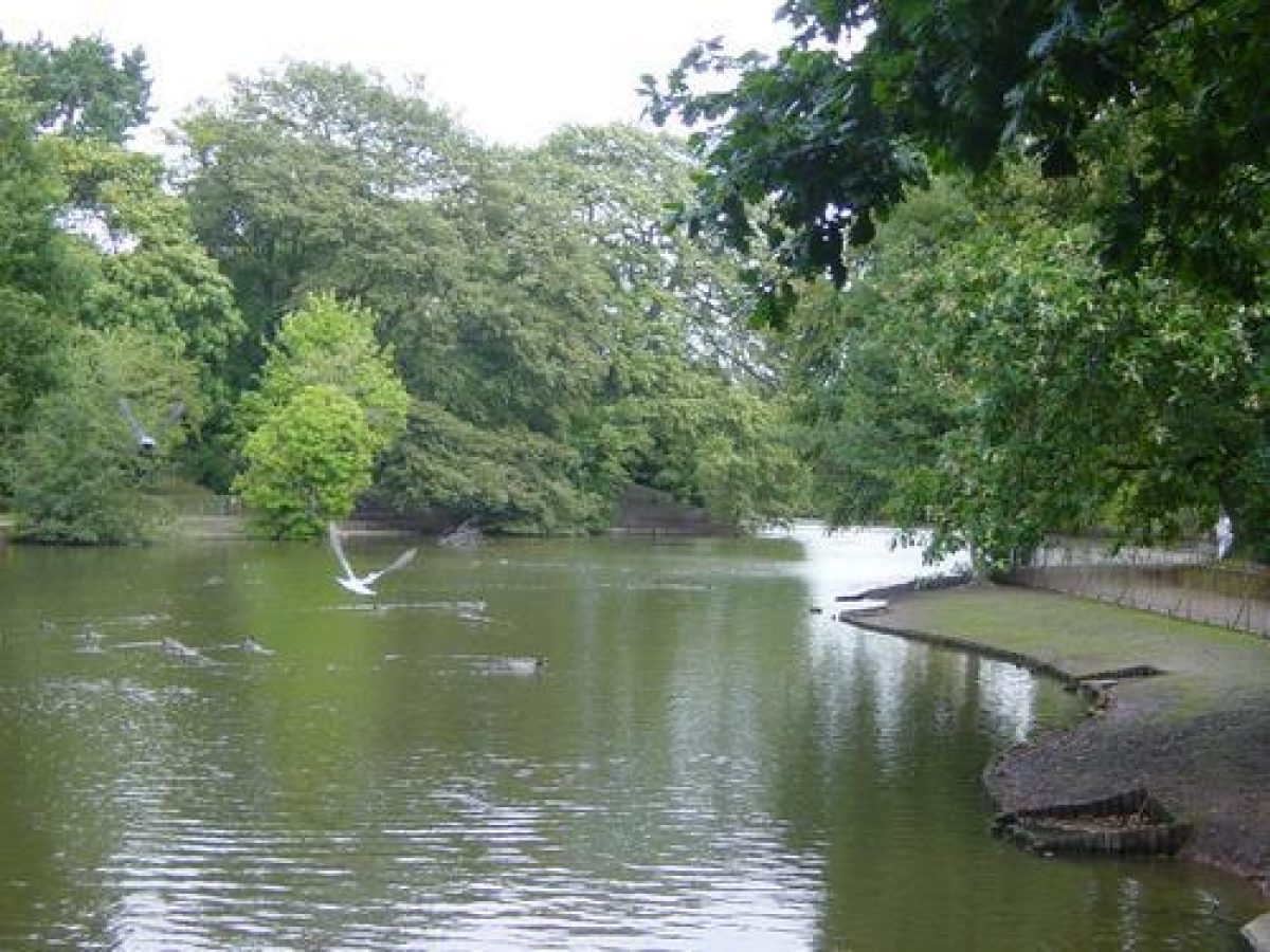
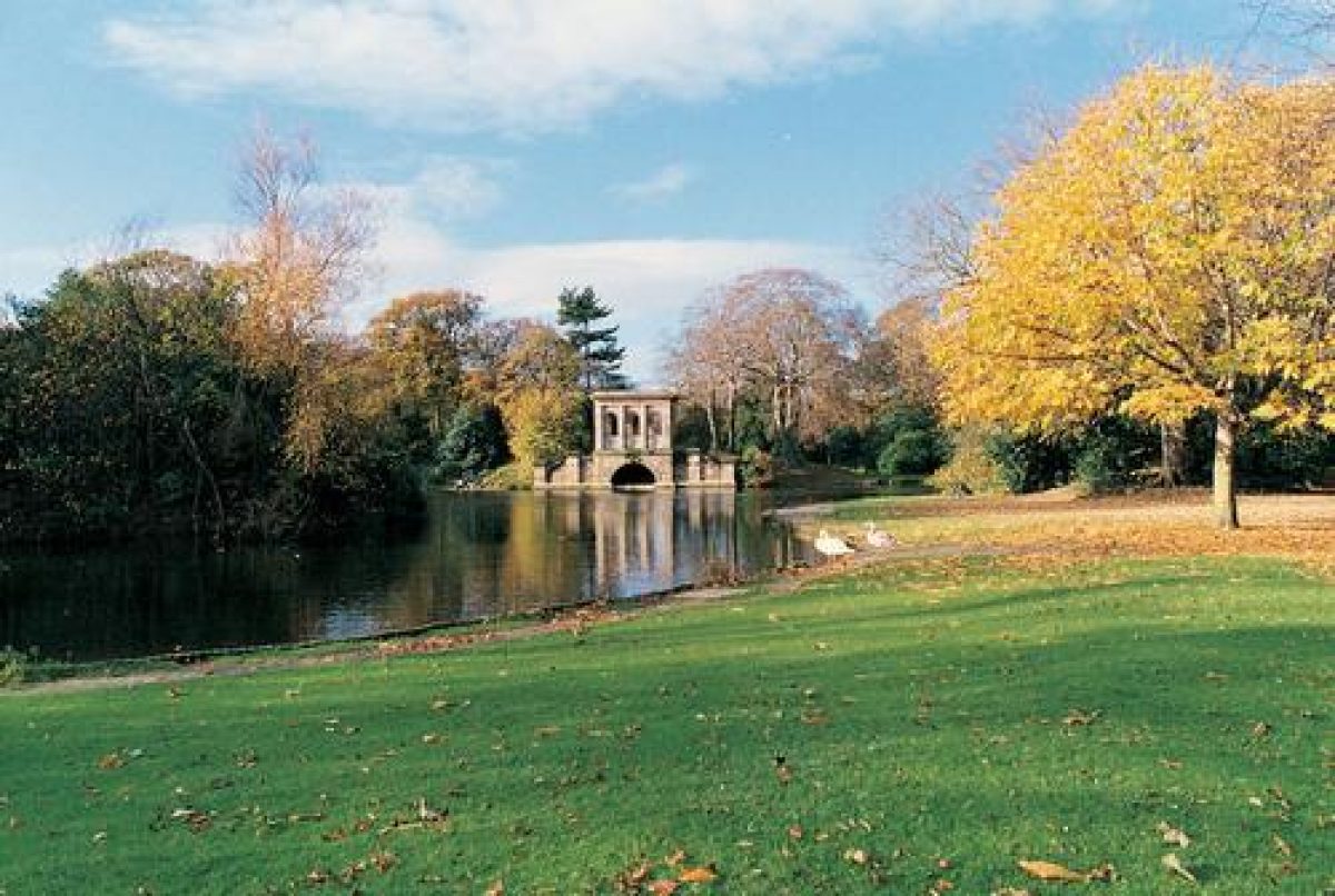
In Lower Park the lake is situated on the north-east side of the site. It is surrounded by banks and mounds planted with trees and has an irregular outline, with fingers of water stretching out to create a varied landscape allowing different views to unfold as the path around the lake is followed. There is an irregularly shaped island in the centre of the lake which is planted with trees. A boathouse with a pavilion superstructure designed to be used as a bandstand is situated on the western shore (listed grade II). On the island is a decorative covered bridge, called the Swiss Bridge (listed grade II). Other bridges connecting the island to the shore were demolished in the 1970s. On the north and east sides of the lake is a rockery with a path winding through it. North of the lake, between Park Drive and Park Road North, is an area of bowling greens and to the east, between Park Drive and Park Road East, are playing fields. Both these areas were designated as plots for villas on the 1850 sale plan. Some 200m south-west of the lake is an area of boggy ground which was formerly a small lake. The lake is shown on the OS map of 1875 but not on Paxton's plan of 1844. West of this are a cricket pavilion (listed grade II) and a cricket pitch, and the central and western areas are open grassland which contrast with the thickly planted and enclosed character of the lake and its immediate surroundings.
Upper Park occupies a somewhat smaller area than Lower Park. A lake is situated on the north-east side of the site and, like its counterpart in Lower Park, is surrounded by banks and mounds planted with trees with a footpath leading around its perimeter. There is an irregularly shaped island planted with trees south of the centre of the lake. Areas of open grassland are situated to the south and west forming a contrast, as in Lower Park, with the lake area. In the south-east corner of Upper Park, between the lake and Ashville Road, is an area used for works and maintenance with various late C20 buildings on the former site of nurseries and glasshouses. North-west of the lake, between Park Drive and Park Road North, is a fenced area with a rugby ground and stand on an area designated for villas in the sale plan of 1850. North-east of the lake, between Park Drive and Cavendish Road, are a number of villas laid out as suggested on the 1850 sale plan. On the other side of these, between Cavendish Road and Park Road North to the north and Ashville Road to the south-east, is an area of open grassland with tennis courts on land which was also originally designated as plots for villas.
The south side of Ashville Road, north of its junction with Cavendish Road, is occupied by houses on plots between the road and Park Drive, partly as suggested on the 1850 sale plan.
REFERENCES Used by English Heritage
G F Chadwick, The Park and the Town (1966), pp 68-9
N Pevsner and E Hubbard, The Buildings of England: Cheshire (1971), pp 91-3
Landscape Design, (November 1989), pp 24-7
Landscape Design, (March 1990), pp 16-17
H Conway, People's Parks (1991), pp 88-90
Birkenhead Park, (Colson Stone Partnership 1992)
Maps
J Paxton, Plan of Birkenhead New Park with the Surrounding Building Lots as intended to be sold, 1844
Sale Plan of land surrounding Birkenhead Park, 2 July 1850
OS 10' to 1 mile: Cheshire sheet XIII 3.17, 3.23, 3.28, published 1875
Description written: March 1997
Edited: March 1999
- Visitor Access, Directions & Contacts
Telephone
0151 652 5197Website
https://birkenhead-park.org.uk/Access contact details
Open daily all year, dawn to dusk.
0151 652 5197.
Directions
In central Birkenhead, south of the A553 and close to Park Station.
- History
Birkenhead Park was created between 1843 and 1847. It was the first park in the world to be created by a municipality. The land was acquired through Act of Parliament and the project was financed from the profit of the houses which surrounded the park.
Joseph Paxton designed the park with the help of Edward Kemp who came to supervise the construction in 1843. In 1845 Kemp was awarded the position of Park Superintendent following recommendation from Paxton. Kemp had a salary of £150 a year and lived onsite in the Italian Lodge. He was given a budget of £1,000 per year and it was Kemp who was largely responsible for the planting and general development of Birkenhead.
Frederick Law Olmsted visited the park on a tour of Europe in 1850. He was an American who later went on to incorporate many of the features at Birkenhead in his design at Central Park, New York.
The following is from the Register of Parks and Gardens of Special Historic Interest. For the most up-to-date Register entry, please visit the The National Heritage List for England (NHLE):
www.historicengland.org.uk/listing/the-list
HISTORIC DEVELOPMENT
Birkenhead Park was laid out by Joseph Paxton (1803-65) following the Third Improvement Act (Birkenhead) 1843. Paxton was appointed by Sir William Jackson, and Edward Kemp, who had worked with Paxton at Chatsworth, Derbyshire, was recruited to supervise the construction of the park. Another contact from Chatsworth, John Robertson, designed the lodges around the park with Liverpool architect Lewis Hornblower. Belts of housing around the park boundaries were intended to subsidise the expense of the park.
In 1845 Paxton was asked by the Commissioners to alter the plans of unsold building plots. Following this he withdrew from further involvement leaving Edward Kemp in charge of completion. Kemp remained in charge until 1891, serving forty-six years as Park Superintendent.
The park was opened in 1847. In 1850 Frederick Law Olmsted (1822-1903) visited the site and the design influenced his own designs for Central Park in New York, which opened in 1858.
Period
- Post Medieval (1540 to 1901)
- Victorian (1837-1901)
- Associated People
- Features & Designations
Designations
Conservation Area
The National Heritage List for England: Register of Parks and Gardens
- Reference: GD1992
- Grade: I
Features
- Boat House
- Ornamental Bridge
- Description: The Swiss Bridge.
- Ornamental Lake
- Ornamental Lake
- Bowling Green
- Gate Lodge
- Description: The Italian Lodge.
- Gate
- Cricket Pavilion
- Carpet Bed
- Specimen Tree
- Key Information
Type
Park
Purpose
Recreational/sport
Principal Building
Parks, Gardens And Urban Spaces
Period
Post Medieval (1540 to 1901)
Survival
Extant
Hectares
90
Open to the public
Yes
Electoral Ward
Birkenhead and Tranmere
- References
References
- {English Heritage Register of Parks and Gardens of Special Historic Interest}, (Swindon: English Heritage, 2008) [on CD-ROM] Historic England Register of Parks and Gardens of Special Historic Interest
- Conway, H., {People's Parks: The Design and Development of Victorian Parks} (Cambridge: Cambridge University Press, 1991), pp. 88-90 People's Parks: The Design and Development of Victorian Parks in Britain
- Pevsner, N. and E. Hubbard, {The Buildings of England: Cheshire} (Harmondsworth: Penguin, 1971), pp. 91-3 The Buildings of England: Cheshire
- {Birkenhead Park Historic Landscape Survey} (1998) Birkenhead Park Historic Landscape Survey
- Donald Insall {Birkenhead Park Conservation Area Appraisal and Management Plan} (2009) Birkenhead Park Conservation Area Appraisal and Management Plan
- Related Documents
-
CLS 1/161/1
Birkenhead Park Management Plan - Hard copy
Dept of Leisure Services - 1991
-
CLS 1/975/1
Restoration Plan, Vol.1 - Hard Copy
Hilary Taylor Landscape Associates Ltd - 2001
-
CLS 1/975/2
Restoration Plan, Vol.2 - Hard Copy
Hilary Taylor Landscape Associates Ltd - 2001
-
CLS 1/975/3
Restoration Plan, Vol.3, Appendices - Hard Copy
Hilary Taylor Landscape Associates Ltd - 2003
-
CLS 1/973/1
Restoration and Management Plan, vol.1 Survey and Analysis - Hard Copy
Hilary Taylor Landscape Associates Ltd - 1999
-
CLS 1/973/2
Restoration and Management Plan, vol.2 Recommendations - Hard Copy
Hilary Taylor Landscape Associates Ltd - 1999
-
CLS 1/973/3
Restoration and Management Plan, vol.3 Appendices 1-3 - Hard Copy
Hilary Taylor Landscape Associates Ltd - 1999
-
CLS 1/161/1