Introduction
Albert Park is a public park which has recently undergone a programme of restoration. Features include a boating lake, bowling green and bandstand. The site occupies about 29 hectares.
Terrain
The park is on level land which falls away to the east at the extreme eastern end of the site.
The following is from the Register of Parks and Gardens of Special Historic Interest. For the most up-to-date Register entry, please visit The National Heritage List for England (NHLE):
A public park designed by William Barratt of Wakefield and opened in 1868, with war memorial entrance screen walls and a cenotaph of 1922.
Location, Area, Boundaries, Landform and Setting
Albert Park is situated c 1.5 km south of the centre of Middlesbrough on the east side of Linthorpe Road, in an area which is predominantly residential. The c 29 ha park is on level land which falls away to the east at the extreme eastern end of the site. The park is enclosed by railings, probably of mid C20 date, on all but the east side where there is a stone wall. It is bounded by roads called Park Road North, Park Vale Road, and Park Road South.
Entrances and Approaches
The principal entrance is from Linthorpe Road to the west, where there is a forecourt flanked by lawns and a central war memorial in the form of a cenotaph which is aligned with the main gates. The entrance is flanked by walls of Portland stone surmounted by urns with inset bronze plaques bearing the names of the dead (Brierly & Rutherford 1922, walls and cenotaph listed together grade II). The entrance with screen walls replaced walls and ornamental ironwork gates which were the gift of Bolckow. The gates erected in 1922 were found to be unsafe in 1978 and were removed, finally being replaced in 1982.
Principal Building(s)
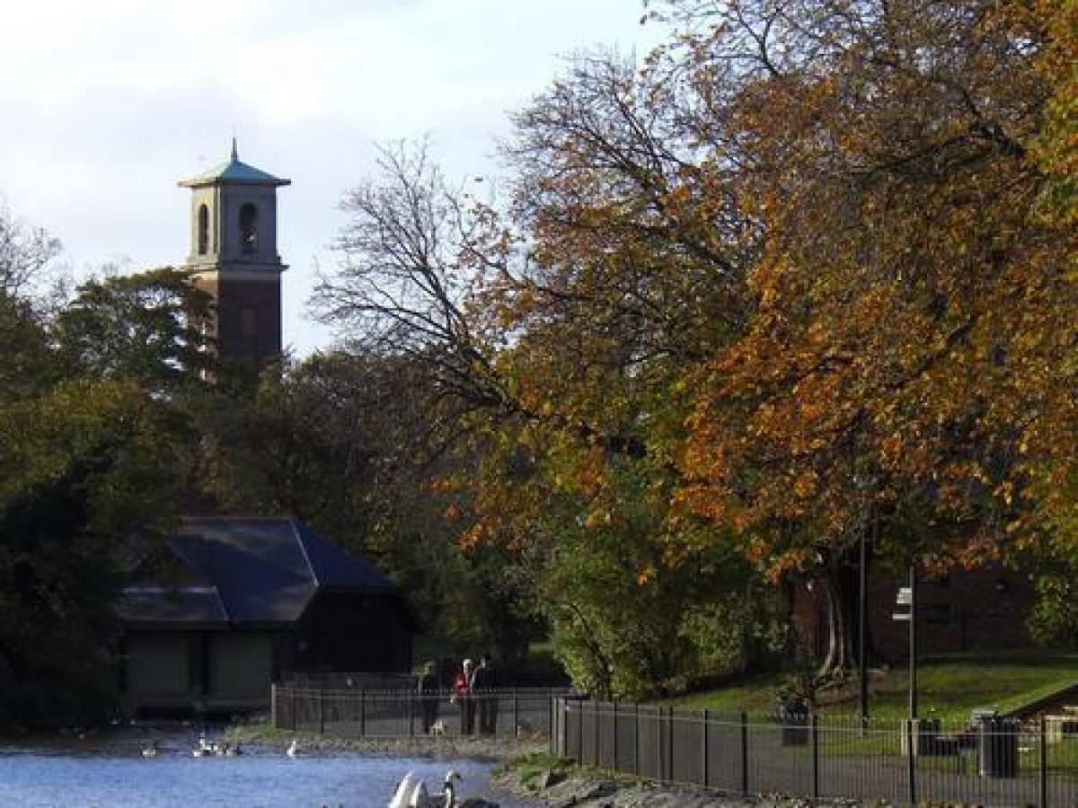
The Dorman Museum (1901-4, listed grade II) lies on the south side of the forecourt. It was set up as a natural history museum and memorial to the men of the 3rd Battalion Yorkshire Regiment, and the grounds around it were laid out (and subsequently maintained) by the Park Committee in 1904.
West Lodge (C J Adams 1866, listed grade II) is situated within the park immediately to the south of the main entrance. Attached to the west side is a wall with a plaque commemorating the opening of the park and a niche for a bust of Bolckow which has been removed. A second entrance at the north-east tip of the park has a lodge called East Lodge which was built in 1871; this is set close to the shore of Lower Lake c 50m south-west of the entrance. There are entrances at each end of the north/south axial path; that to the north has stone gate piers, and the southern one has brick gate piers of C20 date. There are a number of other informal entrances to the park.
Gardens and Pleasure Grounds
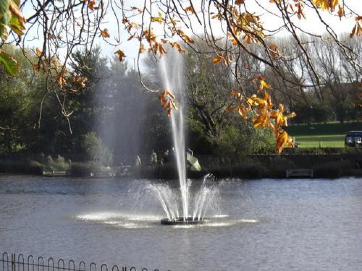
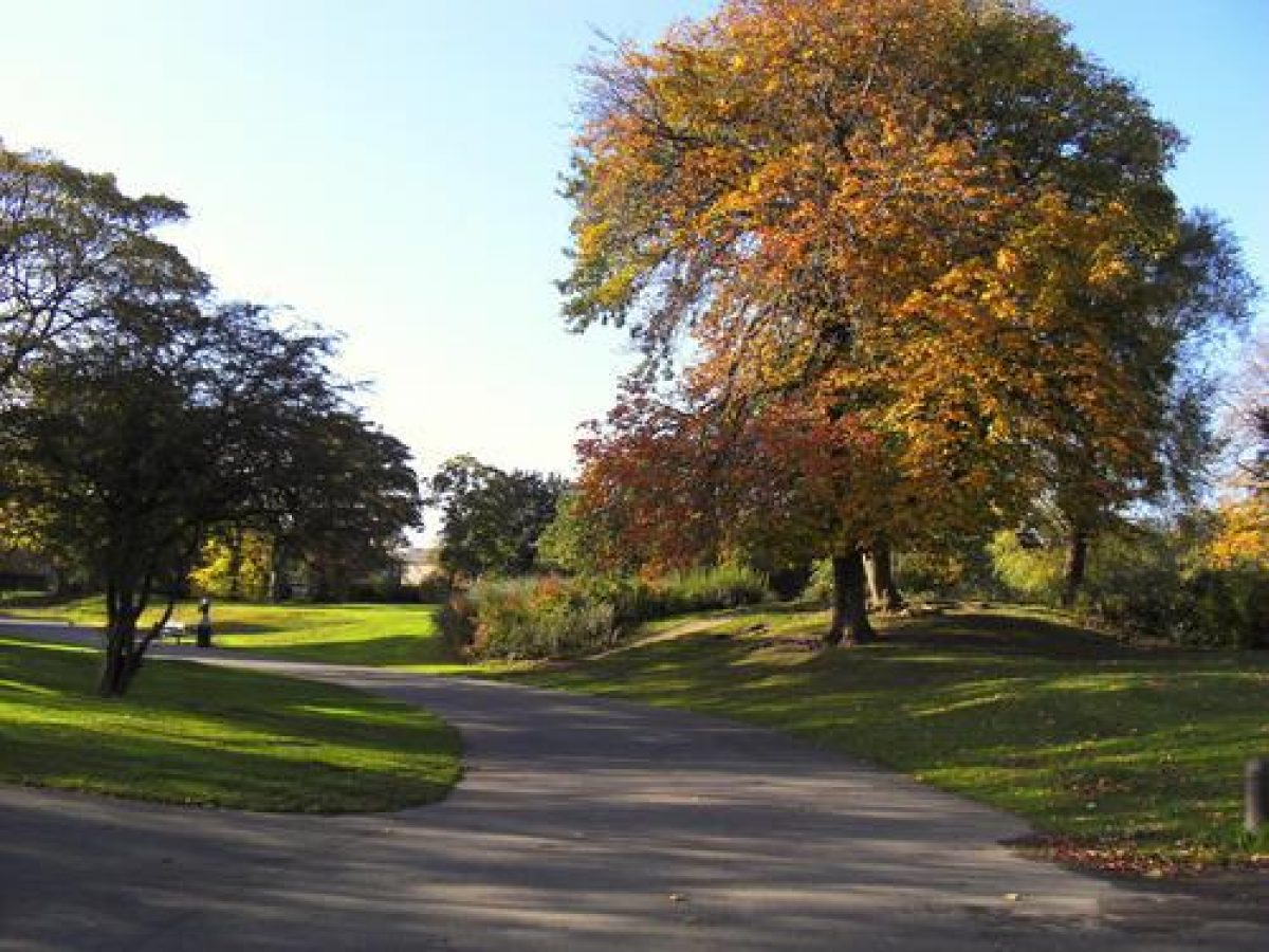
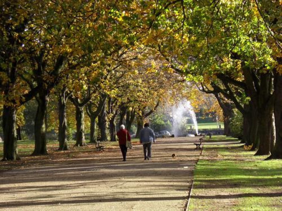
Albert Park is roughly rectangular in shape and it is divided into quadrants by axial paths. A large lake, called Lower Lake, lies along the extreme eastern side of the park. The main entrance leads to the West Walk, which was originally lined with Wellingtonias planted by Bolckow and other dignitaries at ceremonial tree plantings at the park's inception. These have been replaced by horse chestnut trees, many of which have plaques beneath them recording ceremonial plantings to commemorate national and local events during the 1930s. A cast-iron clock of c 1900 (listed grade II) is situated c 30m east of the entrance alongside the Walk, and c 20 m east of this is a stone sundial (1876, listed grade II). A South African War Memorial (1904, listed grade II) in the form of an obelisk on a pedestal lies alongside the Walk c 120 m east of the entrance. At the point at which the axial paths cross there is a circular area with a fountain, erected in 1869 and altered and repaired in the late C19 and C20. This area was designated by Barrett for the display of sculptures, though none was erected.
The Walk continues eastwards as East Walk, which is also lined with horse chestnuts, as it was in 1881 (Moorsom 1997). At the eastern end of the Walk steps lead down to the shore of Lower Lake. There are views of the lake with the largest of its islands along most of the length of East Walk. South Walk is planted with a C20 avenue of ornamental cherry trees and North Walk is flanked by planting which includes some cherries. The North and South Walks were called the Italian Gardens in the C19 and were planted with floral bedding backed by a screen of shrubs and trees. An intricate pattern of beds is shown on the 1868 plan alongside the Walks. A sinuous perimeter path links the axial paths, much as shown on the 1868 plan, apart from the section along the north-east quadrant which follows a fairly straight route, as shown on the 1875 plan. The area between this path and the park wall is shown thickly planted on the C19 plans and OS maps. The planting is now represented by scattered trees at various stages of maturity, and some areas of thicker planting, including a row of Turkey oaks along the perimeter path in the north-east quadrant.
The north-west quadrant of the park is largely occupied by sports facilities, with tennis courts to the west and bowling greens to the east. A tennis court which lies c 50m north-east of the main entrance is on the site of a bowling green shown on the 1875 plan, and two more tennis courts to the north of this were constructed in the mid and late C20. A large pavilion of late C20 date lies on the east side of the northernmost court. A bowling green on the south-east side was constructed in 1913, and another to the north in 1948, on the site of a croquet ground and a maze. These features are shown on the 1868 plan c 250m and 300m north-east of the main entrance respectively.
The north-east quadrant has informal playing fields on the north-west side in an area where the small North Lake, shown on the 1875 plan, was situated. This was constructed in 1869, extended in 1878, and finally filled in in 1951. Immediately east of the lake was an archery ground, also shown on the 1875 map, which had been taken over for use as a football pitch by 1876, with Middlesbrough Football Club playing its first match there in 1877 (Moorsom 1997). To the south of this there is an area of planted mounds which would have commanded views of the lake and were probably formed from spoil generated by the excavation of the lakes. The largest of these is called Bell Hill because it was once the site of the bell rung to signal park closing time. A path known as the Swiss Walk led through this area and is faintly discernible as a track. There is a late C20 fenced children's playground between the mounds and the East Walk, and a miniature golf course, opened in 1950, on the north-east side of the quadrant which is bounded by a hedge and railings.
Lower Lake runs along most of the eastern side of the park. It is stone lined with an irregular elongated shoreline which is followed by paths. Three islands are shown on the 1894 OS map, but only the two to the north appear on the 1875 plan. At the southern tip of the lake is a fenced area of tarmac which was formerly a playground. The lake originally extended along the west side of this area but this part of it was filled in during the late C20. A pavilion of 1955 overlooks the lake from the south end of the western banks and a late C20 boathouse, also on the western shore, lies immediately south of the precincts of East Lodge. The lake was formed by damming the Marton West Beck which runs as an overflow along a diverted course between the eastern lakeside walk and the boundary wall.
The south-east quadrant consists mainly of grassland with clumps of trees and shrubs encircling an area of open grassland formerly used as a cricket pitch which is shown on the 1868 maps and subsequent maps through to 1915. In the north-east corner, immediately behind the lakeside pavilion, there is a roller-skating rink of 1947, fenced and screened by hedges and surrounded by low terraced seating areas.
The south-west quadrant also consists mainly of lawns with a network of curving paths running through them. In the south-east corner there is a maintenance yard surrounded by a fence and screened by planting. This was occupied by nurseries shown on the 1894 OS map. Immediately north of this area was a lake, called Upper Lake or Cannon Lake, which is shown on the 1868 plan. The lake was ornamented by a number of rustic stone arches, including the remains of a Norman archway, and a cannon captured during the Crimean War stood on its north shore. The lake was filled in and its associated structures removed in 1947. In the north-west corner of the quadrant there is a lake crossed by bridges and overlooked by rockeries; this feature was created during the 1980s.
Maps
(reproduced in Moorsom 1997)
- Conveyance plan, 1867
- Plan of Albert Park, 1868
- Plan of Albert Park, 1875
- OS 25" to 1 mile:
- 1st edition published 1894
- 2nd edition published 1915
- 1929 edition
Description written: March 1998
Register Inspector: CH
Edited: November 2004
- Visitor Access, Directions & Contacts
Website
https://www.middlesbrough.gov.uk/leisure-culture-and-parks/parks-and-green-spaces/albert-park/Access contact details
Directions
1.5 kilometres south of the centre of Middlesbrough. Please see:
Owners
Middlesbrough Borough Council
PO Box 99, Town Hall, Middlesbrough, TS1 2QQ
- History
The following is from the Register of Parks and Gardens of Special Historic Interest. For the most up-to-date Register entry, please visit The National Heritage List for England (NHLE):
19th Century
The idea of creating a public park in Middlesbrough was raised in the Borough Council in 1859, but no immediate action was taken. In 1864, a local industrialist, Henry Bolckow, bought land off Linthorpe Road and presented it to the Council for use as a public park. An agreement drawn up between Bolckow and the Council in 1865 specified that the park should be called Albert Park and that £3000 should be spent on laying it out. Work commenced in 1865 to a design by William Barratt, using trees and shrubs from his nursery in Wakefield. A plan of the park design of 1868 shows the proposals and a plan of 1875 probably reflects the executed layout.
- Associated People
- Features & Designations
Designations
The National Heritage List for England: Register of Parks and Gardens
- Reference: GD1637
- Grade: II
Features
- Boating Lake
- Bowling Green
- Fountain
- Bandstand
- Gate Lodge
- Key Information
Type
Park
Purpose
Recreational/sport
Principal Building
Parks, Gardens And Urban Spaces
Survival
Extant
Hectares
29
Open to the public
Yes
- References
References
- {English Heritage Register of Parks and Gardens of Special Historic Interest} (Swindon: English Heritage 2008) [on CD-ROM] Historic England Register of Parks and Gardens of Special Historic Interest
- LDA Design {Albert Park, Middlesborough Borough Council, Document Two, Heritage Report} (1998) Albert Park, Middlesborough Borough Council, Document Two, Heritage Report
- Chadwick, G., The Park and the Town (1966), p 109 Park and the Town
- Conway, H., People's Parks (1991), pp 102-03 People's Parks
- Moorsom, N., (report for Middlesbrough Borough Council 1997) Albert Park, Middlesbrough, (report for Middlesbrough Borough Council 1997)