Introduction
Wavertree Park and Botanic Garden is a mid-19th-century public park, incorporating an earlier walled botanic garden covering 4.5 hectares. A mid-19th-century formal layout of planting beds survives in the area of the former botanic garden.
Terrain
The park is sited on ground rising gently to the north and, in the eastern section of the park, to the east.The following is from the Register of Parks and Gardens of Special Historic Interest. For the most up-to-date Register entry, please visit The National Heritage List for England (NHLE):
A private, walled botanic garden opened in 1836, taken into the charge of the local authority in 1846 and with the early 19th-century layout and mid-Victorian geometric beds extant. The Botanic Garden is surrounded by a public park opened in 1856 and extended in the late 19th century and forms one of the earliest of an inner ring of public parks developed in Liverpool in the mid-Victorian period.
Location, Area, Boundaries, Landform and Setting
Wavertree Park lies c 2.5km east of Liverpool city centre. The whole area of the park is c 14.6ha, of which c 4.5ha are occupied by the Botanic Garden. The park is bounded to the north by Edge Lane and to the west by Botanic Road. These boundaries are marked by low stone walls with railings, the whole c 1.8m high, and along the Botanic Garden boundary to Edge Lane additionally by evergreen hedging. The area of the park was slightly reduced between 1908 and 1927 when the Edge Lane boundary was moved c 10.5m to the south in order to accommodate a tramway. The south-west corner of the park has a short boundary with Wavertree Road marked by a low stone wall and railings. East of the south-west corner the boundary has been slightly realigned in the C20 to incorporate Leigh Road, a short length of carriageway off Wavertree Road on the line of the former drive to Wavertree Hall. To the south-east the park merges with C20 landscaping to Wavertree Boulevard. To the east of the park is a service road and the former Littlewoods Pools building. The boundary with the service road has C20 railings c 1.4m high set on a low embankment.
The park is sited on ground rising gently to the north and, in the eastern section of the park, to the east. A mound rises from the south-west corner of the park, parallel with the south-east boundary, partially following the line of the 'Exhibition Road' shown on a plan of the 1886 RHS Exhibition (ibid) and the 1894 OS map. The mound may be late C20 landscaping, possibly carried out in conjunction with the formation of Wavertree Boulevard. In the east corner of the park there is a steep-sided knoll. This feature is indicated on the 1894 OS map when the area was still within the curtilage of Edge Hall.
The park is set in an area of mixed commercial, industrial, and residential use. On Botanic Road, to the west, late C19 three-storey terraced housing faces onto the park with a Territorial Army Centre at the junction to the north with Edge Lane. Opposite the park, on the dual carriageway of Edge Lane there is a church, late C19 terraced housing, and an hotel. The main Liverpool to Manchester railway runs to the south of the park.
Entrances and Approaches
From surrounding roads there are three principal entrances into Wavetree Park and one into the Botanic Garden. The mid C19 section of the park has principal entrances at the junction of Botanic Road with both Edge Lane at the north-west corner and Wavertree Road at the south-west corner. Both have single carriage entrances flanked by stone gate piers with gates and C20 bollards flanked by boundary stone walls and railings; the north-west entrance is set back in a shallow semicircle. The eastern section of the park has an entrance from Edge Lane, at the centre of the boundary east of the Botanic Garden, with stone gate piers marking a central carriage drive and two side pedestrian entrances all with iron gates.
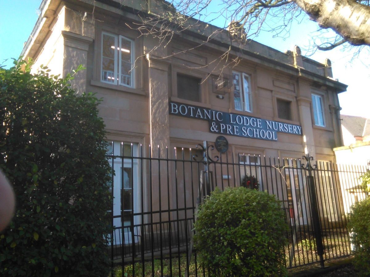
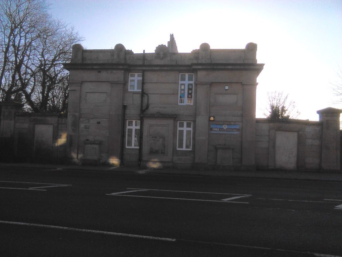
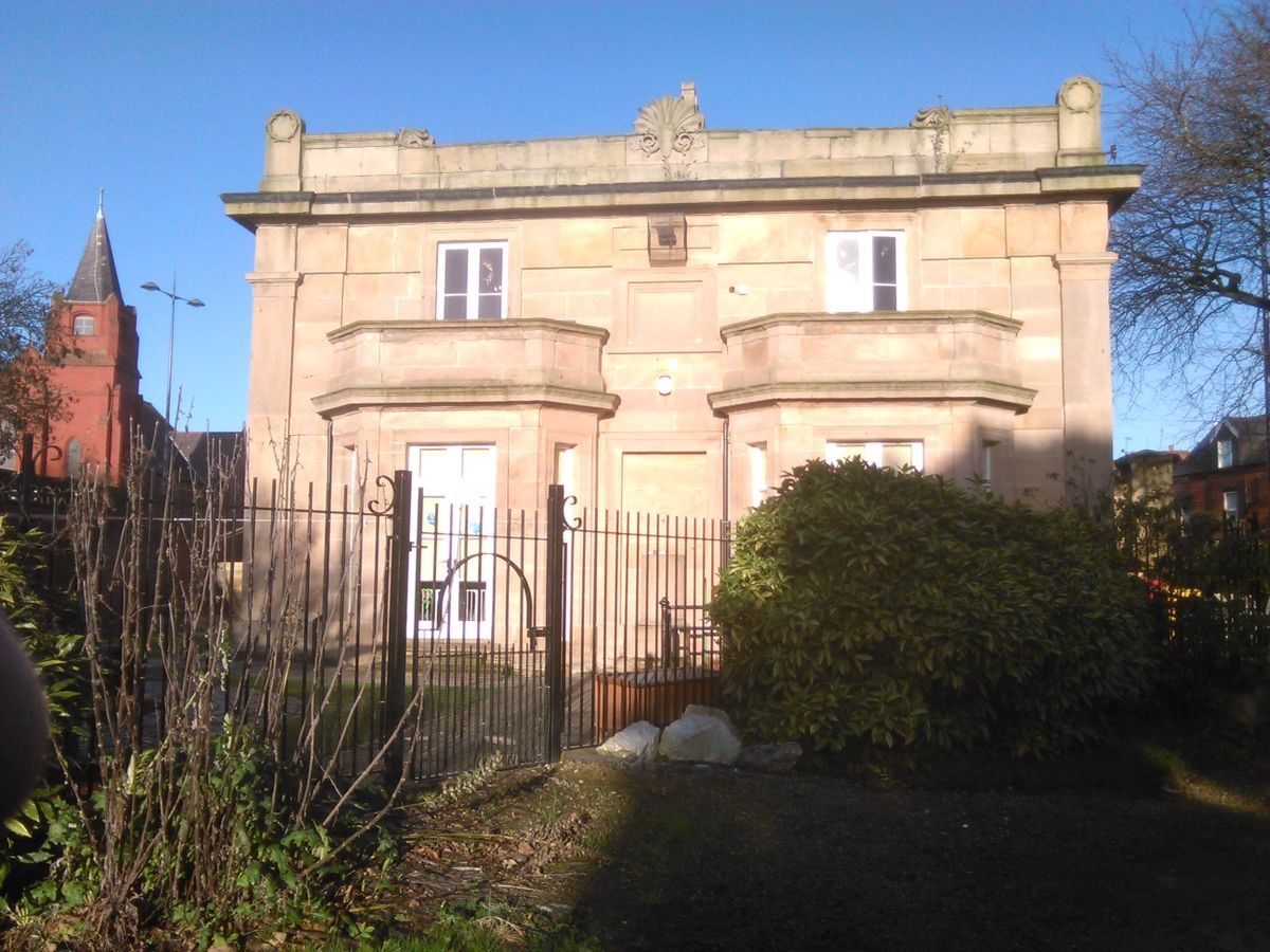
From Edge Lane there is a principal entrance directly into the Botanic Garden at its north-east corner. This entrance is marked by stone gate piers and iron gates. The Improvement Plan of c 1840 indicates that there was a single entrance into the Botanic Garden at the centre of the north boundary to Edge Lane. An entrance remained in this location but this lies on the early C20 adjusted boundary line between flanking curves in the boundary wall. It is immediately opposite the iron-gated entrance into a now disused brick-walled yard area to the south and has the character of a service entrance. A further entrance is marked by a doorway set in the flanking screen wall to the east side of the lodge, but prior to 2001 it is no longer in use. The two-storey Curator's lodge (1836-7, listed Grade II) is set into the north-west corner of the Botanic Garden, fronting onto Edge Lane. Built of ashlar stone in Neoclassical style, prior to 2001 it became vacant but is now (2013) to be used as a nursery.
There is a secondary pedestrian entrance into the mid C19 western area of the park, at the centre of the west boundary with Botanic Road. It is marked by steps down from pavement level into the park and has stone gate piers with iron gates set in the boundary wall. A C20 vehicle entrance from Botanic Road is located 60m south of the junction with Edge Lane and is formed by a break in the boundary wall and railings. On the east boundary there is a secondary pedestrian entrance, 210m south-south-east of Edge Lane, marked by steps up within the park and a C20 metal gate.
Gardens and Pleasure Grounds
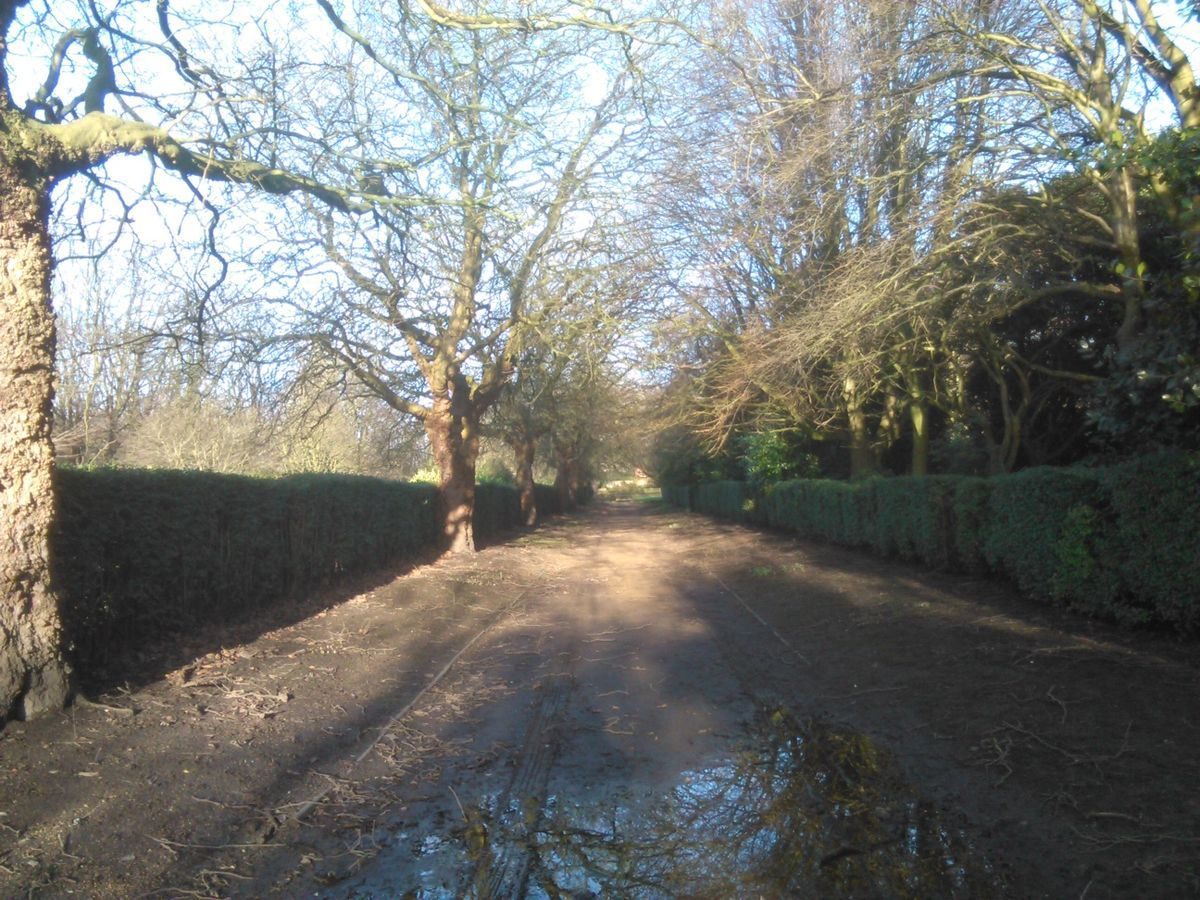
The Botanic Garden is set within the northern half of Wavertree Park, enclosed by c 3m high brick walls which separate it from the park to the west, south, and east. There are four entrances from the park into the Botanic Garden, two being in the western wall, 30m and 105m south of the lodge. Both of these openings have late C19 iron gates although the opening closest to the lodge appears to be late C20. The other two entrances from the park are in the southern boundary, 225m south of the lodge, and in the eastern boundary at the south-east corner of the Garden, 280m south-east of the lodge, the latter with an iron gate.
Within the boundary of the Garden there is a perimeter path, winding adjacent to the west and south boundaries and running parallel to the boundaries on the other two sides. The layout of this path is as shown on the c 1840 Improvement Plan except where it has been straightened adjacent to the north boundary subsequent to the early C20 realignment of this boundary with Edge Lane. In the north of the Garden there is a rectangular brick-walled compound 98m by 24m, the long side set 12m south of, and running parallel to, the Edge Lane boundary. The c 1840 Improvement Plan indicates the compound, fronted by a conservatory along its south side. OS plans of 1908 and 1927 show a replacement conservatory of 1870 (ibid) in the same location and the compound largely filled with further glasshouses, all, prior to 2001, gone.
South of the conservatory site, running from west to east between the perimeter paths is a 7m wide terrace. At the east end of the terrace, 150m east of the lodge, there is an area of raised geometric beds set in grass. The south side of the terrace has a low stone retaining wall with returns down on either side of a central 10m wide set of steps. The steps are now in concrete which replaced the stone steps in 1988 (ibid). The steps are set at the north end of a central axial path which terminates at an oval bed adjacent to the south Garden boundary wall. Below the terrace the 12m wide path runs between open lawned areas inset with annual planting beds. Some 8m south of the steps there is a circular planting bed at the centre of the path, formerly a pond with fountain (Improvement Plan, 1840; OS 1927). The axial path is flanked, 25m south of the steps, by a pair of stone statues, each of a seated figure; in 2001 these were only partially intact and now (2013) completely removed. The statues were of characters from Burns' poems (Gallagher 1994).
A path running parallel to, and 33m to the south of the terrace, also links the perimeter routes. To the south of this the Garden is divided into three distinct compartments. The central compartment is formed of four rectangular lawns, arranged symmetrically on either side of the main axial path and divided centrally from west to east by a further path. The axial path between the beds is bounded by dense evergreen shrub planting. The lawns are slightly sunken and laid out with beds in a geometric design with interlocking 'scroll' beds. The layout of the beds appears little altered to that shown in an engraving of 1886 (Bradshaw 1989).
To the west and east of the lawns, two allées run parallel to the main axial path. The boundaries between the allées and lawns are marked by clipped hedges. Flanking the central compartment are two further compartments to west and east. These are laid out as informal lawns with curving paths and grouped shrub planting on raised mounds. In the western compartment, 95m south of the lodge, the outline of sunken, intersecting circular planting beds, now grassed over, is clearly visible.
Adjacent to the centre of the southern boundary the perimeter path divides around an oval planting bed, on line with the central axial path. This bed was formerly a pond with a central fountain (Tithe map, 1838; OS 1908). Against the southern boundary wall are seven raised beds c 0.9m high and edged in randomly coursed stone. OS plans of 1908 and 1927 indicate that formerly there was more extensive and informal rockwork to the southern boundary. The western and eastern boundary walls are largely hidden by shrub planting.
The Botanic Garden paths are generally laid with rolled gravel with some C19 stone edgings and today (2013) the main layout remains as indicated on Bennison's plan of 1835. The geometric beds are considered to be a significant and original example of mid-Victorian (1850-70) geometric planting (Bradshaw 1989).
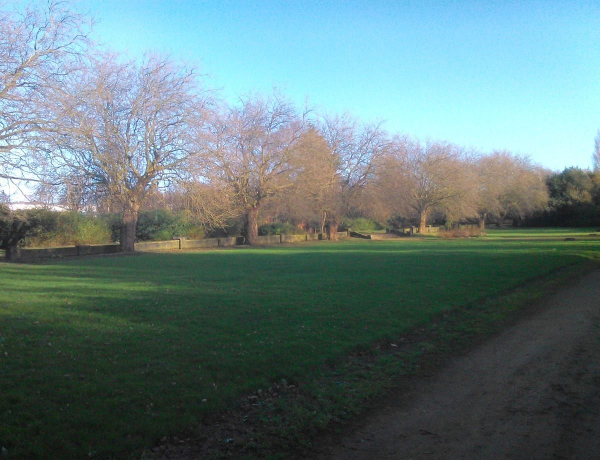
Park
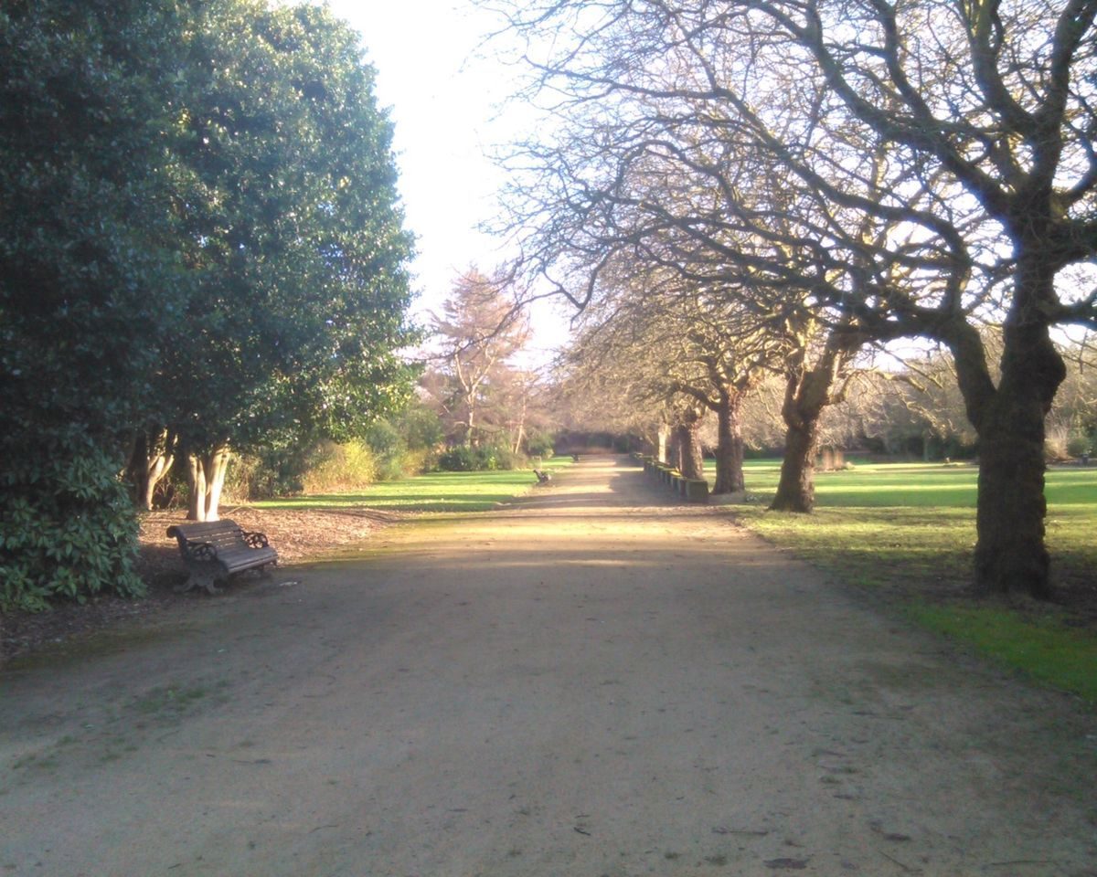
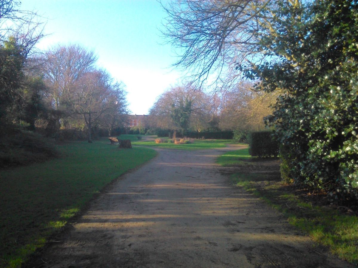
The park to the west, south, and east of the Botanic Garden is very largely laid to grass, with the southern areas used as playing fields. From the south-west entrance at the junction of Botanic Road and Wavertree Road a 6m wide path leads north-east. Immediately to the east of the entrance there is a C20 children's play area, extended 2010-11. Some 185m north-east of the south-west entrance the path divides around the remains of a late C19 cast-iron drinking fountain with shell basins (listed Grade II). North-east of the fountain a late C20 avenue of trees lines the path. Adjacent to the south-east corner of the Botanic Garden the path divides around a circular planting bed at the junction with a path leading to the south-east entrance into the Botanic Garden.
A third path leads west from this junction, along the outside of the southern boundary of the Botanic Garden, to the entrance at the centre of the western park boundary with Botanic Road. In the eastern section of the park the main tree-lined path winds northwards to the entrance from Edge Lane, 250m east of the lodge, with a secondary tree-lined path leading east to the entrance in the east boundary. The eastern area of the park is laid to grass with a few informal small groups of trees and occasional individual trees along the outer boundaries of the park and adjacent to the eastern boundary wall of the Botanic Garden. A new sports changing pavilion was built in the Wavertree Road end of the part in the early C21.
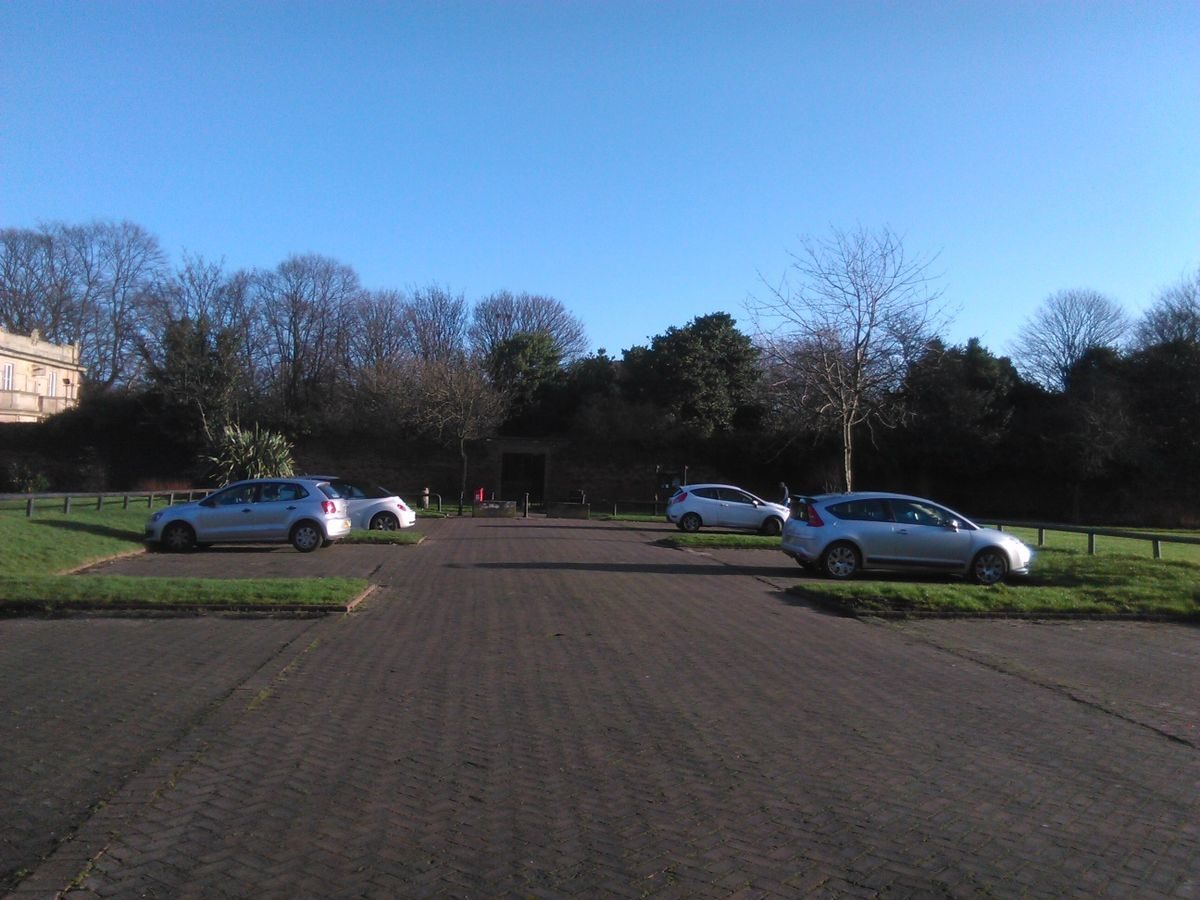
The area to the west of the Botanic Garden is predominantly laid to grass with a perimeter path, joined by a central path running from west to east and shrub planting adjacent to the western boundary wall of the Botanic Garden. In the north-west of the park there is a C20 parking area, with access from Botanic Road. A sporadic line of trees marks the inner sides of the park boundary to Botanic Road and Edge Lane with a few mature specimens to the latter. In the south-west of the park there is screen tree and shrub planting.
Maps
- A Map of the Environs of Liverpool - Date: 1768
- A Map of the Environs of Liverpool - Date: 1816
- A Map of the Town and Port of Liverpool with their Environs - Date: 1835
- Tithe Map for West Derby parish - Date: 1836 - Source: Liverpool Record Office
- Improvements Plan - Date: c 1840 - Source: Liverpool Record Office
Archival items
- Postcards, c 1900 (Liverpool City Council)
Reasons for Designation
- Wavertree Botanic Garden and Park, Liverpool, the former opened in 1836 and the park in 1856, is designated at Grade II* for the following principal reasons:
- Date: the park is an especially early example of a municipal botanic garden and park;
- Design: although enhanced, the landscape design is essentially unchanged from its original mid C19 layout;
- Designer: the formal 1836 botanic garden design was by its curator, John Shepherd;
- Historic interest: an important component of Liverpool's ambitious mid C19 sequence of public parks;
- Structures and features: the garden and park retain structures and planting from the Mid C19 including the Grade II-listed Curator's lodge of 1836-7.
Date first registered: June 2001
Updated: February 2022
- Visitor Access, Directions & Contacts
Access contact details
This is a municipal site, open daily for general public use. The walled garden is open from 10 am
Directions
Access to the park is via Botanic Road off Edge Lane with a small car park on site.
Owners
Liverpool City Council
Municipal Buildings, Dale Street, Liverpool, L2 2DH
- History
The following is from the Register of Parks and Gardens of Special Historic Interest. For the most up-to-date Register entry, please visit The National Heritage List for England (NHLE):
19th Century
In 1802 a group of Liverpool botanists, including William Roscoe, opened a private botanic garden near Mount Pleasant in Liverpool. The Liverpool Botanic Garden was the first in the world to be developed by public subscription to a private society and was emulated by other large provincial towns (Bradshaw 1989). In 1831 it was decided to move the Garden to a larger site at Edge Lane. The new c 4.5ha site was laid out in a formal design, bounded by walls and railings, by the curator John Shepherd and was opened in 1836.
In 1840 Liverpool Corporation paid a debt of £3800 incurred by the Garden's proprietors in return for a public right of access on two days a week. The Corporation took full charge of the Garden in 1846 with the result that public access to the Garden was allowed seven days a week and on one day a month to the conservatory (The Builder 1846).
In 1843 Liverpool Corporation purchased the site of Wavertree Hall, also known as Plumbe's Hall, to the south of the Botanic Garden, for the purpose of a gaol. The land was left unused until, in 1856, it was laid out as Wavertree Park. By 1894 (OS) the park adjoined the Botanic Garden to the west and south and by 1908 (OS) a section of park had been laid out east of the Botanic Garden. This section was, together with the west section of the park, formerly in the same ownership as Edge Hall to the north (Bennison, 1835).
In 1850 the Liverpool Improvement Committee advertised for plans to be submitted for the improvement of the borough and the laying out of unoccupied lands. The plan selected, by H P Horner, bore the motto Rus in Urbe. A part of Horner's proposals was for a 'belt of garden or parkland', including nine public parks, to be formed between the town, as it then existed, and any further urban development (The Builder 1846); the plan was not adopted due to lack of funds. The creation of Wavertree Park however, followed by the opening of Sheil Park in 1862, Newsham Park (qv) in 1868, Stanley Park (qv) in 1870, and Sefton Park (qv) in 1871 did create a ring of parks around the town, almost equidistant from the pier head on the River Mersey to the west.
Between 1849 and 1864 the layout of the Botanic Garden was altered, with beds in geometric patterns being introduced in the central area (Bradshaw 1989). In the early 1870s the original conservatory was replaced with one designed by the Borough Architect, Mr Robson with the Curator of the Botanic Garden, Mr Tyerman. The conservatory was destroyed by bomb damage in the Second World War.
In 1886 the International Shipperies Exhibition, visited by Queen Victoria, was held on a site immediately to the east of the park. To coincide with this the Royal Horticultural Society accepted Liverpool Corporation's offer of Wavertree Botanic Garden and Park as the site for their Annual Exhibition. In the late C19 the Botanic Garden became the central production site for municipal bedding and plant displays while also supplying plant specimens to Liverpool University as late as 1913 (ibid).
Wavertree Botanic Garden and Park remains (2022) open to the public and is in the ownership of Liverpool City Council.
Period
- Post Medieval (1540 to 1901)
- Victorian (1837-1901)
- Associated People
- Features & Designations
Designations
The National Heritage List for England: Register of Parks and Gardens
- Reference: GD4922
- Grade: II*
The National Heritage List for England: Listed Building
- Reference: Curator's Lodge
- Grade: II
Features
- Flower Bed
- Description: A layout of geometric planting beds created in the former botanic garden area.
- Earliest Date:
- Latest Date:
- Boundary Wall
- Description: Some boundaries are marked by low stone walls with railings, the whole roughly 1.8 metres high.
- Key Information
Type
Park
Purpose
Recreational/sport
Principal Building
Parks, Gardens And Urban Spaces
Period
Post Medieval (1540 to 1901)
Survival
Extant
Hectares
14.6
Open to the public
Yes
Electoral Ward
Kensington and Fairfield
- References
References
- {English Heritage Register of Parks and Gardens of Special Historic Interest}, (Swindon: English Heritage, 2008) [on CD-ROM] Historic England Register of Parks and Gardens of Special Historic Interest
- Conway, H., {People's Parks: The Design and Development of Victorian Parks} (Cambridge: Cambridge University Press, 1991), pp. 58-9, 229 People's Parks: The Design and Development of Victorian Parks in Britain
- Bradshaw, A, D., (1989) Wavertree Botanic Gardens Feasibility Study
- Gallagher, C., (1994) English Heritage Register Review: Merseyside
- (4 December 1846) - p 593 (9 November 1850) - p 532 The Builder