Introduction
Tring Park is an 18th-century landscape park and woodland, which at its most extensive covered about 150 hectares. It was bisected by the Tring bypass in the mid-20th century and is now in divided use and ownership. There are the remains of late-19th-century gardens of about 4 hectares beside the house (now a school). The park south of the bypass is a public park which covers about 120 hectares, and is leased to The Woodland Trust. It contains woodland and sensitively-managed grassland, and is an Site of Special Scientific Interest within the Chilterns Area of Outstanding Natural Beauty.
Terrain
The house stands on a plateau in the north-west corner of the park, the land sloping sharply down to the east into a valley and rising again to a plateau extending to London Lodge.www.historicengland.org.uk/listing/the-list
A late 17th-century country house by Sir Christopher Wren, with gardens, surrounded by park and woodland laid out late 17th/early 18th century with work by Charles Bridgeman and James Gibbs, landscaped late 18th century. Parts of the early formal layout remain, together with earthwork remains of a large, possibly late 17th-century, formal garden layout. The house and garden were altered by the Rothschilds in the later 19th century.
DESCRIPTIONLOCATION, AREA, BOUNDARIES, LANDFORM, SETTING
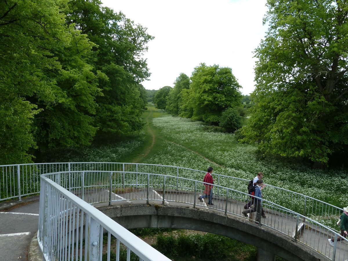
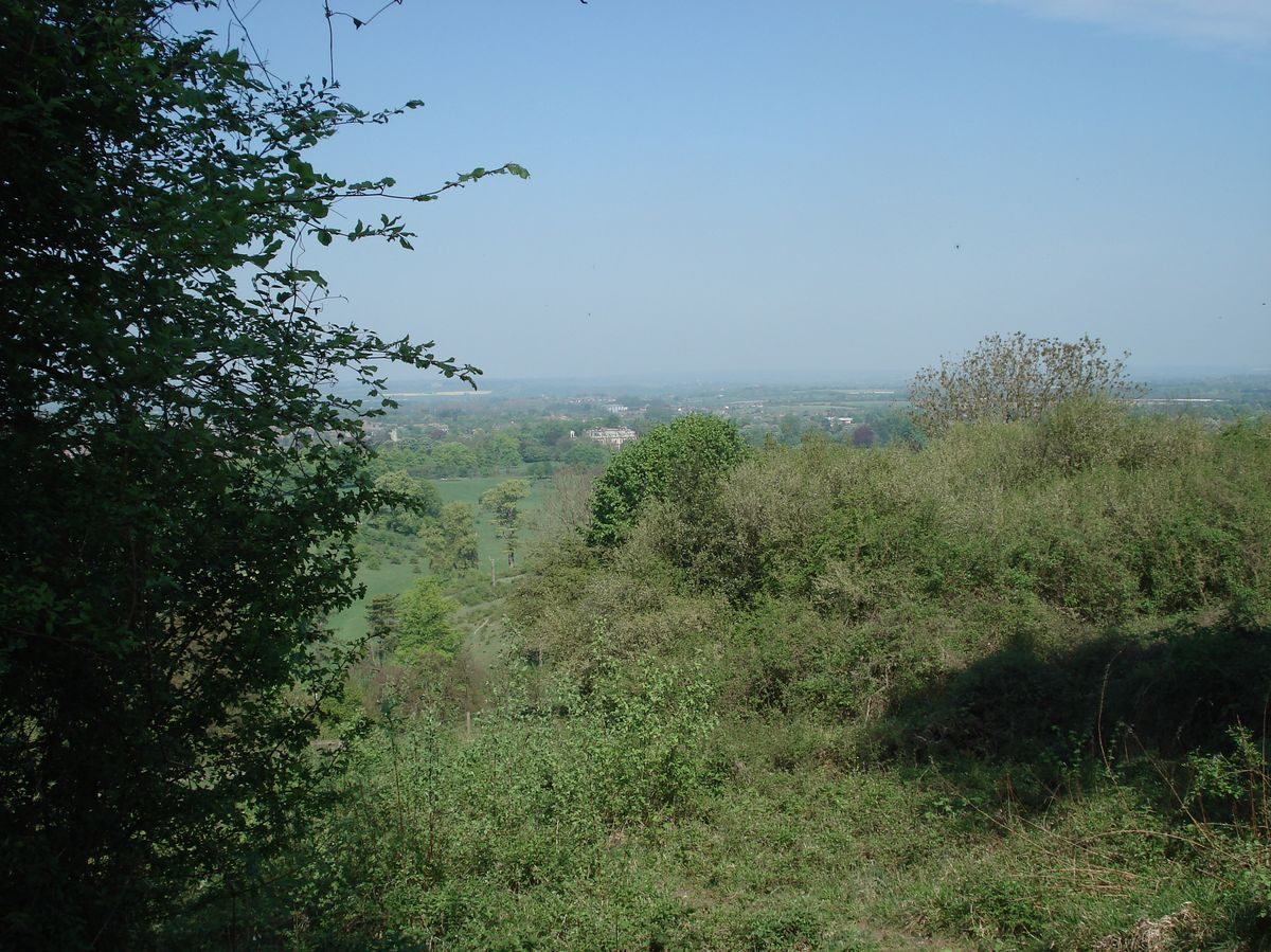
Tring Park straddles the north-west-facing Chiltern scarp slope at the south-east corner of the town of Tring. The c 120ha site is bounded to the north-east by London Road (diverted off the line of the Roman Akeman Street which runs through the park), marked at the southern end by a brick and flint boundary wall, to the north-west by Tring, and on the other sides by agricultural land and woodland. The house stands on a plateau in the north-west corner of the park, the land sloping sharply down to the east into a valley and rising again to a plateau extending to London Lodge. South of the bypass the park is cut by a series of valleys between low hillocks, overlooked to the east and south by the woodland plantation on the scarp, from which long views extend north and north-west over the Vale of Aylesbury. The setting is largely rural, with the expanded market town of Tring adjacent to the north and west, and the village of Wigginton close by to the south-east. Views extend north from the house, down the hillside, across the High Street to Pond Close, an open green space enclosed by housing, lying on a hillside 500m to the north. This remnant of an early C18 feature known as Upper Pond Close was linked to the High Street via a further paddock known as Pond Close, now covered by a car park. The two Pond Closes were linked to form part of the grand vista from the house by an extension northwards of the double avenue flanking the drive, as a single avenue, extending into farmland beyond Upper Pond Close as a walk (Colbeck, 1719).
Within the wider setting, Tring Park is one of seven Rothschild country estates within a 10km radius of Aylesbury bought and embellished during the second half of the C19, including Waddesdon Manor (qv), Eythrope House (qv), Ascott House (qv), Mentmore Towers (qv) and Halton House (qv).
ENTRANCES AND APPROACHES
The main approach enters off Tring High Street c 300m north-west of the house, between two late C19 timber-framed buildings, passing an ornamental lamp post (later C19 for Rothschild Estate, listed grade II). The drive extends south-east, flanked mainly by late C20 houses, turning east 100m from the house, the approach being flanked by mature yews, other evergreen shrubs and trees. The drive opens out into a rectangular gravel carriage sweep on the north front of the house, into which a porte-cochère projects over steps up to the front door. A further C19 ornamental lamp post (listed grade II) stands at the west corner of the carriage sweep. A spur 100m from the house leads from the main drive south past the stables to the west, to a curved, brick-walled passage giving access to the enclosed, sunken service court on the west front.
In the C18 the house was approached directly off the High Street via a straight drive aligned with the north front, encircling an ornamental basin c 125m north of the house (Colbeck, 1719; Campbell 1739). The drive was removed, probably in the late C18, but the lawn through which this drive extended runs south from a red-brick wall (early C18, probably c 1711 for William Gore, listed grade II) bounding the High Street. The wall seems to have been built when the main road on Akeman Street was diverted from crossing the park south of the house. The ground is banked up behind (south of) the wall to conceal traffic where it crosses the grand vista from the house. From the bank the level lawn extends southwards, rising c 125m from the road up a graded hillside to the carriage sweep on the north front. The lawn is flanked by the remains of a mature double lime avenue.
A further former approach entered at London Lodge, 600m east of the house, standing close to the junction where the London Road was diverted north-east away from the course of Akeman Street which ran through the park until the early C18. The large, highly ornate, timber-framed and white-painted lodge (late C19, probably William Huckvale, listed grade II) is flanked by two widely spaced flint and stone-dressed gate piers. From here the course of the former drive extends west across the park, flanked by a lime avenue, following the former course of Akeman Street. The drive, having crossed level ground for c 300m, descends into a dry valley, being carried across the bottom by a raised causeway. It then curves north up the west side of this valley, alongside the east boundary of the garden, to arrive at an iron gate giving access to the east side of the adjacent carriage sweep.
On the south side of Park Road, the approach from Aylesbury, 600m south-west of the house (outside the area here registered), lies West Lodge, a timber-framed and white-painted, single-storey late C19 lodge. Park Road gives way to Park Street, passing Tring Zoological Museum (William Huckvale 1889, 1908, 1972, listed grade II) standing 200m west of the house. This largely red-brick and half-timbered, purpose-built building was erected by the first Baron Rothschild for his son Lionel Walter Rothschild to house his natural history collection created in the late C19 and early C20. It was opened to the public in 1892. At the east end of Park Street, on the south side, stands a group of timber-framed, late C19 buildings, with a lodge at the east end. From here, 150m south-west of the house (the westerly point at which Akeman Street emerges from the estate, and at the western entrance to the area here registered), a raised former service drive (now disused) extends for c 50m north to the south-west corner of the former stable yard. It is flanked by yew trees, and beyond to the east by a high brick wall (C18). The drive formerly entered the stable yard (partially rebuilt as school premises, late C20).
PRINCIPAL BUILDING
Tring Park house (Sir Christopher Wren c 1682/3, remodelled after 1872, listed grade II*) lies close to the west boundary, towards the north corner of the site. The three-storey house is brick-built with stone dressings and a mansard roof. It retains much of the Wren structure, which was overlaid by late C19 detailing. A door towards the east end of the south, garden front opens onto the garden.
The two-storey east wing of the former stable yard, known as the Clock House (dated 1709, possibly by James Gibbs, now school accommodation, listed grade II*) stands c 50m west of the house, built of red brick. Its main entrance lies on the east front overlooking the service drive off the main north drive. The former stable yard to the west is now (1999) enclosed on the other three sides by late C20 school buildings replacing earlier stable buildings.
GARDENS AND PLEASURE GROUNDS
The gardens lie to the west of the stables and south of the house. The area to the south is largely laid to informal lawn, reached from two doors in the south, garden front of the house. The main garden door, towards the east end, opens onto a small, raised, stone-paved terrace surrounded by a low stone parapet. From here steps lead south down to a gravel path running parallel to the south front; the path is also reached by the second garden door, at the west end of the main facade. The south front overlooks an informal level lawn, terminated c 75m from the house at a brick ha-ha. Beyond this lies an area of scrub leading to the park. The east side of the lawn is laid to hard tennis courts, screened from the lawn to the west by a tall hedge. The east boundary is marked by a tall golden yew hedge. On the west side of the main lawn the grass falls away slightly, leading to the C18 brick wall which forms the west boundary of this area, beyond which runs the remains of the service drive extending north from Park Street. Towards the north end of this west section stands a late C20 covered swimming pool, the north boundary of the area being formed by the south wing of the stables, now (1999) rebuilt as school buildings. In the early to mid C18 the area adjacent to the main south front of the house was laid to lawn, flanked by avenues, with a bosquet to the west of this with a small garden pavilion on its west edge. To the west of this, where the ground now falls away slightly, lay a kitchen garden.
At the west boundary of the south lawn, 50m from the house, a curved path flanked by flint walls leads down to a souterrain leading beneath the remains of the raised service drive, giving access to the western section of the garden, lying west of the stables. The tunnel emerges flanked by further flint retaining walls west of the course of the drive, covered by a round-arched iron frame over which climbers formerly made a green tunnel. Immediately west of this a lawn leads to a flight of stone steps (late C19) leading down to Lord Rothschild's tennis court, now enclosed by an overgrown (1999) yew hedge. North of this lies a long rectangular lawn flanked by earth banks planted with yews and other evergreens. This lawn is bisected by a late C20 school building, the northern half of the area containing various specimen ornamental trees. In the late C19 (OS 1899) this lawn was encircled by a mixed planting of trees enclosing an informal perimeter path (now, 1999, not visible).
Some 200m north of the house, adjacent to the High Street, lies the Memorial Garden, now a public garden, formerly one of the late C19 formal garden areas. It is dominated by an informally shaped pond lying at the east end, and is planted with many yews, Wellingtonias and other ornamental trees amongst informal lawns. The garden was opened to the public in the mid C20.
PARK
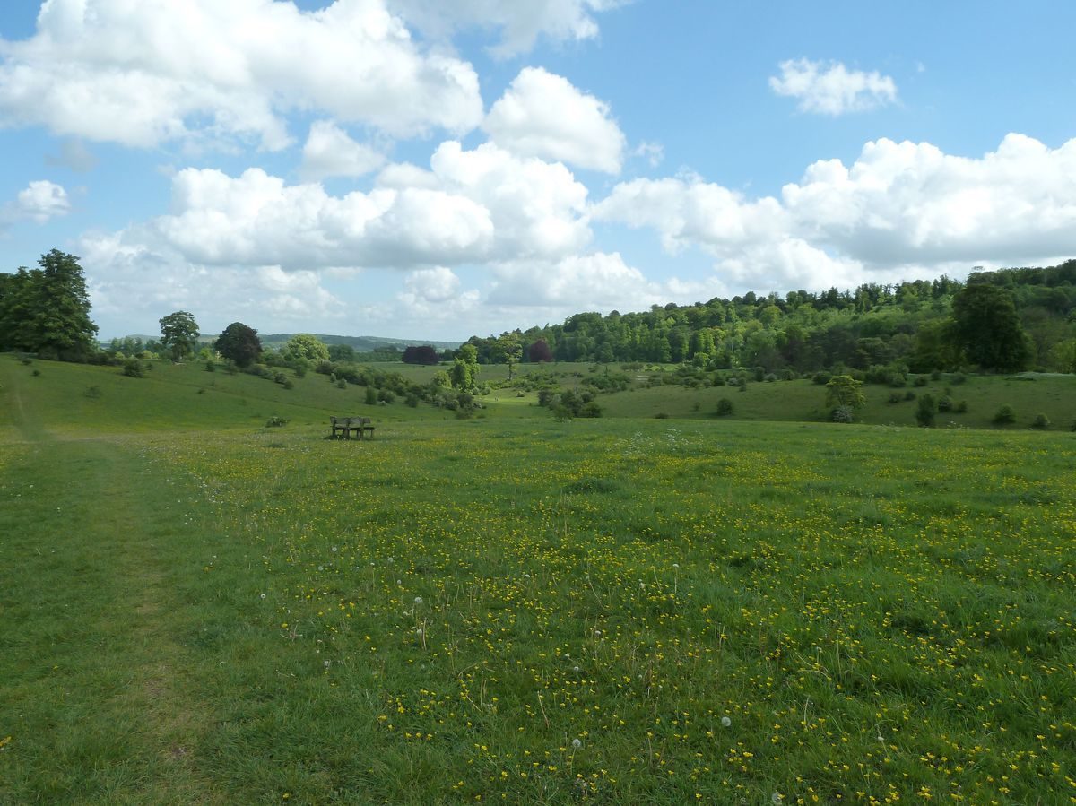
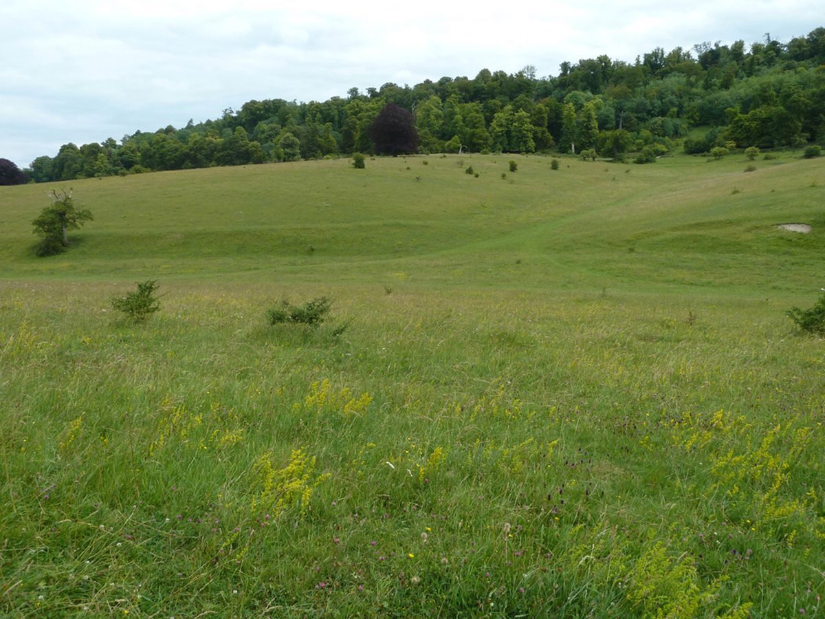
The park, landscaped in the late C18 by the owner Drummond Smith, lies east and south of the house and is largely laid to pasture. Planted with single trees and clumps, it is bisected from west to east 250m south of the house by the A41(M) dual carriageway. The park is bounded to the north and east as far south as Oddy Hill, c 700m south-east of the house, by a belt of mature trees planted with many mature yews. An ornamental drive once extended north and west from London Lodge through the narrow northern boundary belt, overlooking the park to the south. Passing the kitchen gardens to the north, through what is now the Memorial Garden, it emerged c 200m north of the house on the grand north vista lawn, continuing south through ornamental woodland west of the vista before joining the present north drive 100m north-west of the house (OS).
The park north of the bypass is bisected from north to south by a valley lying east of the south garden terrace. Formerly (Colbeck, 1719; Campbell 1739) a walled formal garden extended 300m east from the house and south lawn terrace, overlooked by the east front. The valley bottom contained a formal canal, headed by an eleven-bay orangery (James Gibbs). The earthwork on which it stood appears to remain. The sloping valley sides were ornamented by two large, intricately designed parterres (not terraced, surprisingly), the easternmost one leading up to a large bowling green on the level plateau above to the east, with a west-facing pavilion at the north end. To the east of this lay a wilderness with bosquets and an alcove set into the east boundary wall. The style of the parterres shown in early to mid C18 sources (Colbeck, 1719; Campbell 1739) indicates that the formal garden probably predates Bridgeman's work, possibly being late C17 or very early C18.
South of the house lies a plateau, bounded to the east by the valley. Bridgeman's canal should have crossed this area, on an axis with the south front, the site now entirely landscaped apart from two slight terraces to west and east, which may have been the site of the avenues which flanked the canal. At the southern end of the canal a series of terraces are thought to have stepped up from the water to a stone pyramid (James Gibbs), flanked by rows of trees (Campbell 1739). This formal landscape was swept away in the late C18 by Drummond Smith, although many of the early C18 formal avenues were merely thinned to obtain a less formal effect.
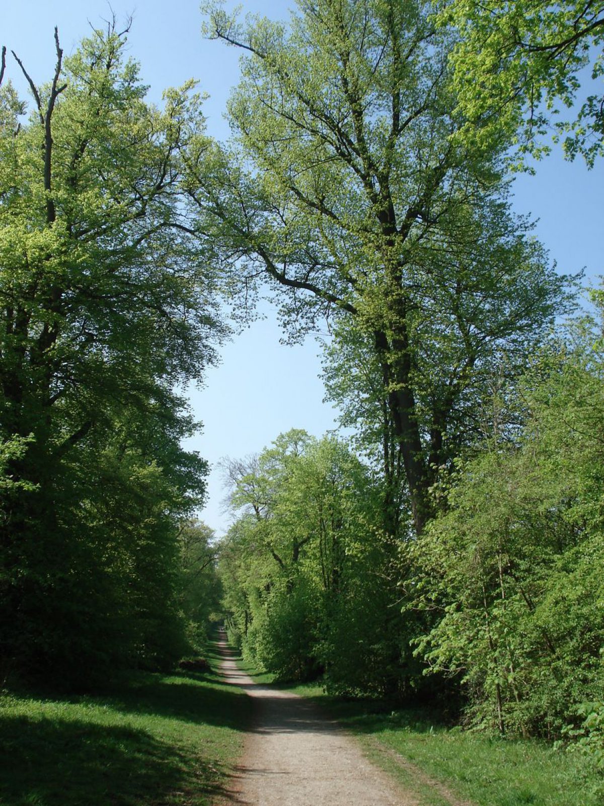
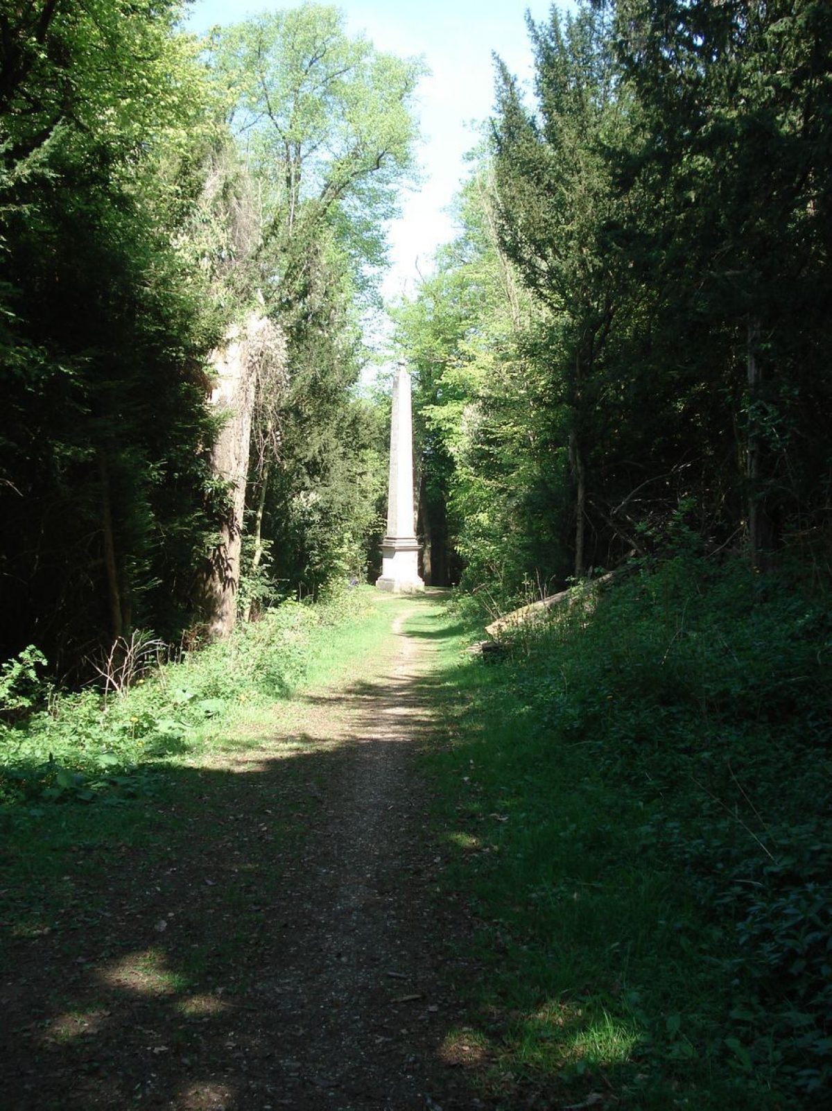
South of the London Lodge the perimeter belt merges into Park (or Bull's) Wood, occupying the scarp above the open parkland to the west. The Wood is traversed by a network of early C18 straight rides cut across the hillside, some flanked by yew avenues, largely focused on Nell Gwynn's Monument (early C18, probably James Gibbs, listed grade II). This 15m high stone obelisk, lying 700m south-east of the house, is set at a rond point on a circular terrace at the centre of four rides, and is visible within the woodland from the house. From the obelisk a ride extends 200m north-east up to the Temple or Summer House (early C18, probably James Gibbs, listed grade II), a stuccoed, white-painted portico standing adjacent to the floor of the Summer House (upper portion gone) which it originally fronted, aligned on the ride down to the obelisk. From the Summer House, the Charles II ride extends 200m south just below the top of the scarp, to a further intersection of rides (possibly the site of a lost building or structure). From here the Charles II ride continues south-westwards as a 10m wide terrace flanked by an avenue of trees. At a point c 700m south-west of the Summer House the ride again changes direction, this facilitated by a circular terrace standing on a substantial embankment on the north (downslope) side of the feature. From here the ride and avenue continue 750m south-west close to the top of the scarp, terminating at a further circular terrace. Spectacular views extend north and north-west from the Charles II ride, although somewhat grown over (1999) by mature trees. From the southern circular terrace a serpentine walk (called in the early C18 an 'artinatural' path and planted with flowering shrubs, Colson Stone 1995) descends the scarp, opening out into the south-west corner of the open parkland (Colbeck, 1719; Campbell 1739).
Within the southern parkland a lime avenue aligned on the house extends south-west along the west boundary. The occasional, possibly early C18 specimen tree appears to survive in the open park, but most appear to be from later plantings. Some earthworks survive in the open park.
KITCHEN GARDEN
The former kitchen garden lies on the north boundary, adjacent to the London Road, c 300m north-east of the house and outside the registered area. It is divided into several sections by C18 brick walls, in similar style to that running along the service drive up to the stable yard from Park Street. The western section is filled with houses, the eastern half contains a supermarket. Garden House (C18, listed grade II) lies in a small open area between the two former main enclosures, overlooking the course of the ornamental drive through the northern belt.
REFERENCES
Salmon, History of Hertfordshire (1728), p 130
C Campbell, Vitruvius Britannicus (1739)
Country Life, 2 (5 June 1897), pp 604-6; 14 (21 November 1903), pp 674-8; 153 (1 February 1973), pp 268-70
C Holme, Gardens of the Southern and Eastern Counties (1907), plates 123, 124, 125, 126
B Cherry and N Pevsner, The Buildings of England: Hertfordshire (1977), pp 369-70
P Willis, Charles Bridgeman (1977), pp 60, 183-4
Tring Park, Landscape Survey and Management Plan, (Colson Stone Partnership 1995)
J Harris, The Artist and the Country House (exhibition catalogue 1996), plate 85
M Rothschild, The Rothschild Gardens (1996), pp 142-51
Maps
John Oliver, The Actual Survey of the County of Hertford, 1695
Joseph Colbeck, An Exact Map of Tring ... Surveyed for Sir William Gore, 1719 (private collection) [copy in Rothschild 1996]
Dury and Andrews, A topographical Map of Hartford-shire, 1766
Enclosure map for Tring parish, 1799 (Hertfordshire Record Office)
OS 6" to 1 mile: 1st edition 1884; 2nd edition 1900; 3rd edition 1925
OS 25" to 1 mile: 2nd edition 1899
Description written: February 1999
- Visitor Access, Directions & Contacts
Telephone
0845 600 3078Access contact details
The site is open all year. Parking.
Directions
Accessible from Tring and Wigginton.
Owners
Dacorum Borough Council
Hemel Hempstead Civic Centre, Marlowes, Hemel Hempstead, Hertfordshire, HP1 1HH
- History
The following is from the Register of Parks and Gardens of Special Historic Interest. For the most up-to-date Register entry, please visit the The National Heritage List for England (NHLE):
www.historicengland.org.uk/listing/the-list
HISTORIC DEVELOPMENT
In 1682 (Colson Stone 1995) Henry Guy employed Sir Christopher Wren to build Tring Manor house, lying immediately north of Akeman Street, the grounds flanked close by to north, west and east by village streets (Oliver, 1695). Guy adorned his house 'with gardens of unusual form and beauty' (Salmon 1728), which may well be those shown extending eastwards in early to mid-18th-century sources (Colbeck, 1719; Campbell 1739). In 1705 the estate was sold to Sir William Gore (died 1708), the estate being inherited by his son, William (died 1739), who added a park and developed a formal landscape to the south. In 1710 the length of Akeman Street which had passed south of the house was closed, unifying the park and house. The formal elements of park and woodland were laid out by Charles Bridgeman (died 1738) in the 1720s, with buildings designed by James Gibbs, including a summerhouse and obelisk in the woodland. The intended principal feature of Bridgeman's layout was a 1100ft by 100ft (about 330 x 30 metres) canal centred on the south front of the house (Colbeck, 1719; Campbell 1739), although it is now (1999) extremely difficult to see how the canal fitted the undulating nature of the ground. By the 1760s (Dury and Andrews, 1766) the principal features of the formal landscape remained, although the canal was in much reduced form (if it had ever been built to the full projected size). In 1786, having been in the possession of the Gore family for five generations, Tring Park was sold to Drummond Smith who landscaped the park, removing the extensive formal gardens east of the house. The formal woodland rides, avenues and structures, however, remained. In the early 1830s the estate was leased to Nathan Mayer Rothschild who continued to plant and improve the estate, which was sold in 1872 to Baron Lionel de Rothschild. In 1974 the A41(M) was constructed, dividing the park into two sections, and the southern part of the park was sold into separate ownership. The house is now (1999) a boarding school, the southern part of the parkland being owned by Dacorum Borough Council and having open access.
- Associated People
- Features & Designations
Designations
Area of Outstanding Natural Beauty
- Reference: Chilterns
The National Heritage List for England: Register of Parks and Gardens
- Reference: GD1126
- Grade: II
Site of Special Scientific Interest
Features
- Avenue
- Description: The double avenue flanking the drive.
- Earthwork
- Description: Earthwork remains of a large, possibly late 17th-century, formal garden layout.
- Earliest Date:
- Latest Date:
- Manor House (featured building)
- Now School
- Earliest Date:
- Latest Date:
- Parkland
- Woodland
- Key Information
Type
Park
Purpose
Conservation
Principal Building
Education
Survival
Part: ground/below ground level remains
Hectares
120
Open to the public
Yes
Civil Parish
Tring
- References
References
- {English Heritage Register of Parks and Gardens of Special Historic Interest}, (Swindon: English Heritage, 2008) [on CD-ROM] Historic England Register of Parks and Gardens of Special Historic Interest
- Willis, P., {Charles Bridgeman and the English Landscape Garden} (London: Zwemmer, 1977), pp. 60, 183-4 Charles Bridgeman and the English Landscape Garden
- Pevsner, N. and B. Cherry, {The Buildings of England: Hertfordshire} (Harmondsworth: Penguin, 1977), pp. 369-70 The Buildings of England: Hertfordshire