
Introduction
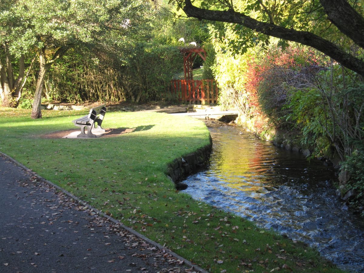
The Den, Kirriemuir is a public park close to the centre of the town. It was opened in 1867 and extended later in the 19th century. It is situated in a small valley with a good stream running through. It has a bandstand, children's play area and a public toilet.
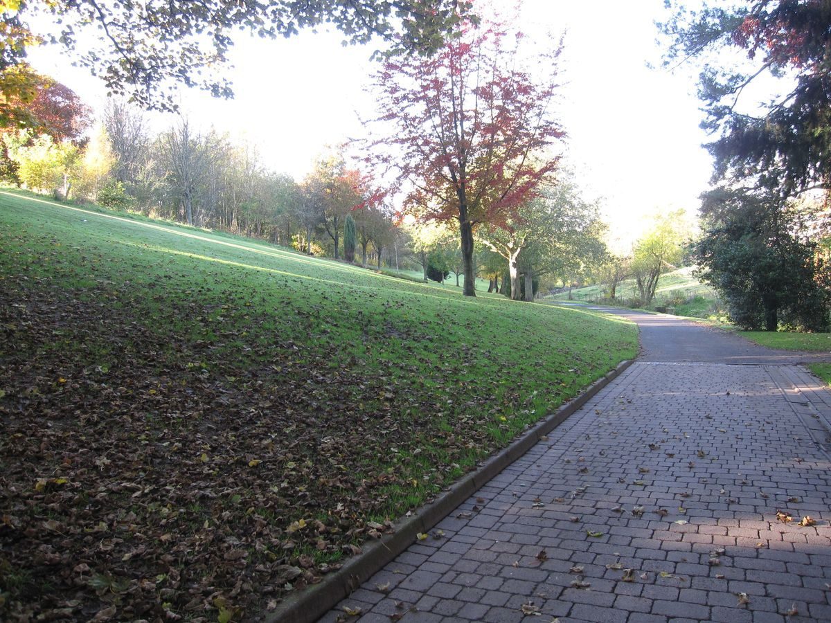
The view into The Den can be seen from the higher surrounding areas. In particular, adjacent properties look directly over it. As the Den is elongated, the view along the main drive shows much of the park with the view changing along the length of the park.
The main boundaries around the park are wooden posts with wooden rails. Boundaries along the Gairie Burn vary according to the adjacent properties on the north of the burn. These can be eclectic.
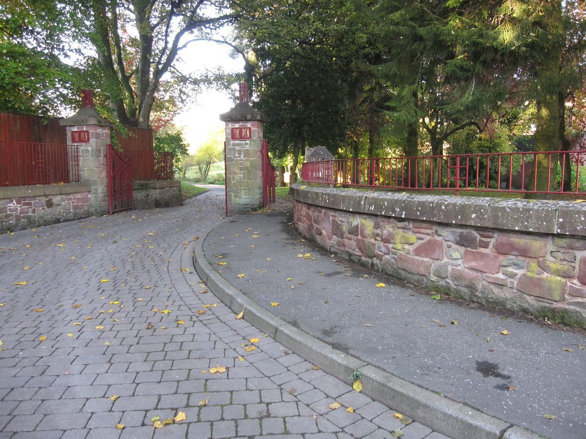
The main entrance gate is on Tannage Brae at the south-west of the park with double wrought iron gates and a matching pedestrian gate. Next to the road bridge mentioned above, there is a pedestrian underpass leading into the park. A single pedestrian entrance is on Cortachy Road at the north-east end of the park. There are additional pedestrian entrances at the town and Southmuir boundaries. The entrance by Lochmill has a turnstile. The park is always open.
The Den House, 94 Glengate, DD8 4JG, previously the park-keeper's cottage sits in The Den beside the Gairie Burn. It is a two storey red sandstone building with gable ends; slated roof with chimneys at both ends.
The Bandstand is a wooden structure on a stone base with hipped roof in corrugated iron. There is a front veranda with steps. This is not the original bandstand nor sited in the original place.
There is a children's play area behind Den Cottage.
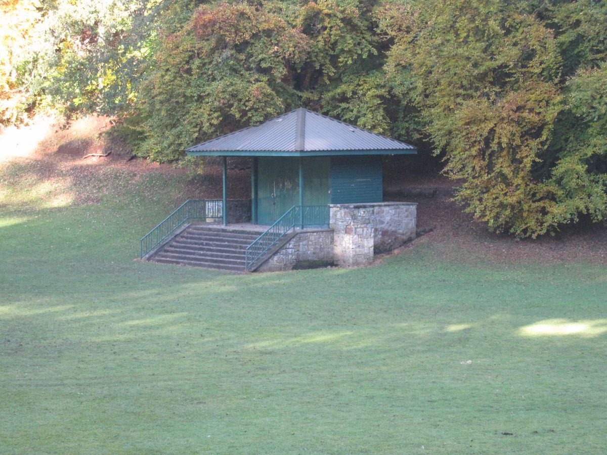
There are public toilets in the centre of the park near to the children's play area. This is a concrete structure.
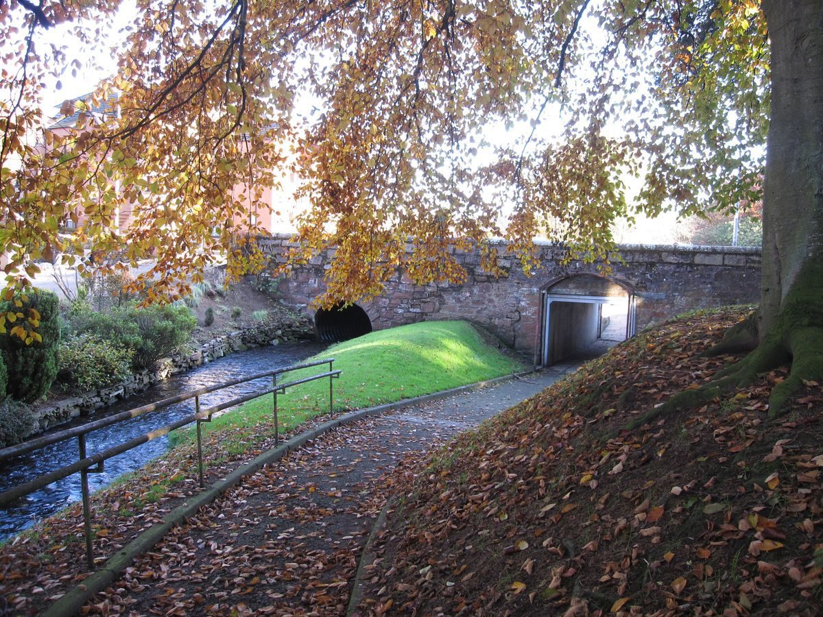
The road bridge at the north-west is strictly outside of the Den but brings the Gairie Burn from Kinnordy Loch via the Muckle Drain and into the Den.
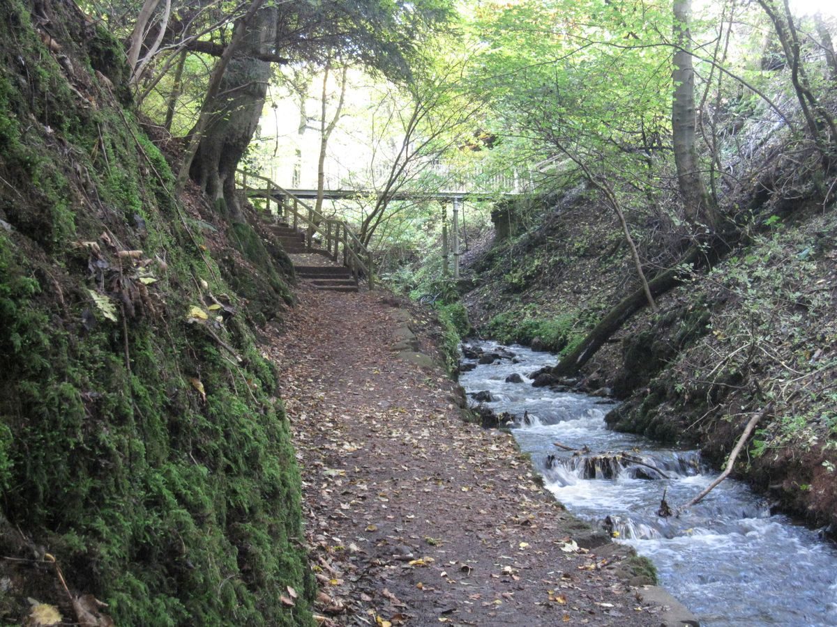
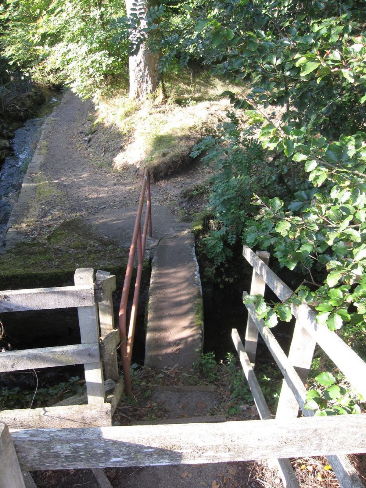
Other bridges are the Coffin Bridge at the north-west, the High Bridge near Lochmill and the Bridge by Den Cottage, which has vehicle access. Several small bridges cross the Gairie Burn along its length in the Den. Various small bridges across the Gairie Burn give access to the park from adjoining properties that stand on the heights above The Den.
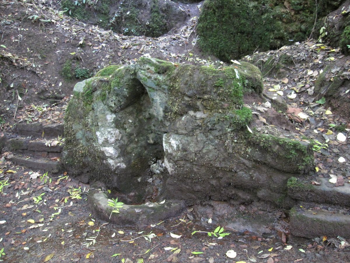
The Cuttle Well is a natural spring; there is a rock-built surround with concrete additions. It sits near to the High Bridge close by the waterfall.
The main drive runs through the park from the main gate on the south-east. This runs alongside the Gairie Burn and exits the park by the Coffin Bridge on the north-west. At the south-east end, it is wide enough to admit a vehicle but reduces to pedestrian width towards the centre of the park. At this point there are cast-iron bollards.
Several lanes and footpaths run from the town into the park on the north. The principal of these is the vehicle access to Den Cottage from the Glengate. Similarly, from the south side there are footpaths into the Den. At the north end, a waterfall on the Gairie Burn runs underneath the High Bridge.
Part of the park may be flooded to allow skating or curling although this has not happened for a number of years.
MAPPED SOURCES:
All maps referenced are from the on-line collection of the National Library of Scotland Map Collection and may be viewed on-line at http://maps.nls.uk.
1862 OS 1st edition 25" to mile sheet XXXI.16 surveyed 1862 published 1865. (Before The Den was established.)
1901 OS 2nd edition 25" to mile sheet 031.16 revised 1901 published 1902.
1922 OS 2nd edition 25" to mile sheet 031.16 revised 1922 published 1924
PRIMARY AND DOCUMENTARY SOURCES:
1867 Plan of The Den at the scale of 100 feet to one inch; copied and enlarged from the 1st edition OS map; annotated with the names of the original trustees. (Part of Angus Archives reference TD/43 Title Deeds).
HISTORICAL ILLUSTRATIONS:
Angus Archives hold a variety of early photographs of The Den.
- Visitor Access, Directions & Contacts
Access contact details
The Den is open at all times.
Directions
From the A90 heading north, take the A926 to Kirriemuir. On entering the town of Kirriemuir, continue into the one way system and take the first left, Tannage Brae. The Den is down the hill on the right.
Owners
Angus Council
Angus House, Forfar, DD8 1AX
- History
1867 The community of Kirriemuir acquired that part of The Den on the south side of the Gairie Burn from Sydney Wilkie, an Australian from Kirriemuir.
1867 & 1883 They also acquired properties extending from the road leading to Meikle Mill to the Burn of Gairie.
1870 Death of Sydney Wilkie who was part benefactor of The Den ie south side.
1882 Agreement made with Kinnordy Estate regarding the north side (implemented 1909).
1884 Fundraising for The Den.
1908 The above properties transferred to the Provost, Magistrate and Councillors of the Burgh of Kirriemuir on behalf of the community.
1909 The Den on the north side of the Burn of Gairie was acquired in feu from Kinnordy Estate.
1936 The bridge by the park keeper's house was replaced by a concrete bridge. Further remedial work carried out.
2012 The Den House for sale.
2012 Plan to rebuild the walls of the Gairie Burn within The Den.
- Features & Designations
Style
Informal
Features
- Bandstand
- Description: Wooden structure on a stone base with hipped roof in corrugated iron. There is a front veranda with steps.
- Cottage (featured building)
- Description: Previously the park-keeper’s cottage. Two storey red sandstone with gable ends; slated roof; chimneys at both ends. As at October 2012, the house is for sale by Angus Council.
- Earliest Date:
- Water Feature
- Description: The Cuttle Well is a natural spring; there is a rock-built surround with concrete additions.
- Key Information
Type
Park
Purpose
Recreational/sport
Principal Building
Parks, Gardens And Urban Spaces
Survival
Extant
Hectares
6
Open to the public
Yes
Electoral Ward
Kirriemuir East
- References
References
- Reid, A. {The Regality of Kirriemuir} (Edinburgh: John Grant, 1909) 321-324 The Regality of Kirriemuir
Contributors
Garden History Society in Scotland