
Introduction
Temple Newsam comprises a landscape park and pleasure grounds set in a larger estate. The estate was largely created during the 18th century by William Etty and Lancelot 'Capability' Brown. Features include an 18th-century walled garden, a formal garden, lakes and rhododendron walks.
Terrain
The site is on rolling land which slopes down to the south and also to the east to a stream from which the land rises in the extreme eastern part of the park.www.historicengland.org.uk/listing/the-list
Summary of Garden
Parkland with late-C17 elements and an early-C18 approach with a bridge and ponds by William Etty, remodelled during the 1760s to a partially executed scheme by Lancelot 'Capability' Brown.
Details
Parkland with late-C17 elements and an early-C18 approach with a bridge and ponds by William Etty, remodelled during the 1760s to a partially executed scheme by Lancelot 'Capability' Brown.
LOCATION, AREA, BOUNDARIES, LANDFORM, SETTING
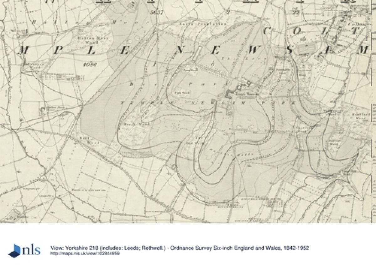
Temple Newsam is situated c5km SE of Leeds city centre, S of the suburb of Whitkirk. The c370ha site is on rolling land which slopes down to the S towards the A1-M1 link road and also to the E to a stream from which the land rises in the extreme E part of the park. The land is built-up on the N side and the rest of the site is set in rural surroundings, with areas to the S and SW that have been reclaimed following mid-C20 opencast mining. The boundaries are formed by a mixture of walling and fences, and part of the N boundary is an C18 brick wall (Grade II) attached to brick gate lodges (see below) at the N entrance to the park. The A1-M1 link road, constructed in the late C20, and the A63 now form the S boundary of the estate.
ENTRANCES AND APPROACHES
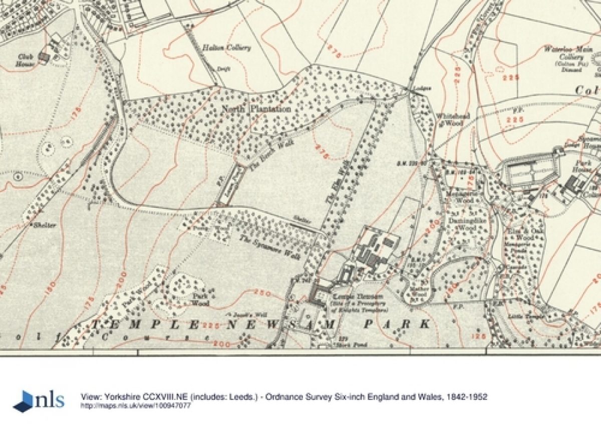
There are three main entrances to the site, and a number of secondary informal entrances. To the N the principal entrance has a pair of brick lodges designed by Sir Andrew Fountaine (1742, Grade II) and brick gate piers. A drive leads S and divides, with one branch continuing S to the house as an avenue called Elm Walk, and the other running SE to parking areas and the home farm and which is marked on a plan of 1762 by Lancelot Brown (1716-83) as an 'intended road'. On the NW side a drive leads from Halton and runs S and then E to the house. The third entrance is on the E side of the estate where there is a gated entrance from Bullerthorpe Lane. A pair of castellated Gothick gate lodges linked by an arch c90m W of this entrance, probably designed by John Carr (1723-1807), were demolished in 1946. The drive leads W as a track cut as a ride through woodland designed by Etty c1710 and called The Avenue. This gives views of the house framed by trees, then the ground drops and the house is lost from view as the track crosses a strip of water called Avenue Ponds that is aligned SW-NE. The ponds are divided by a causeway with bowed stone edges on the N side and crossed by a stone bridge (Grade II). The bridge and ponds were designed by William Etty (1675-1734) and constructed during the period 1710-15. As the ground rises on the W side of the ponds the house comes into view again and can be seen set within parkland as the highest point of this part of the approach is reached. It has been suggested (Sheeran 1990) that Brown adapted Etty's scheme by creating the clearing in the woodland at this point and diverting the drive to the N so that it took an oblique approach to the house, thereby allowing the house to be seen in its parkland setting. A county map surveyed 1765-70 shows The Avenue extending down to a stream at the bottom of the hill. Until the late C20 the disposition of woodland and clearing approximated with Brown's plan, which shows Avenue Ponds and the line of the avenue planted with platoons along each side. However, the woodland has since enlarged through both planting and natural seeding, and formerly clear areas are now covered by trees, although The Avenue itself remains clearly visible.
PRINCIPAL BUILDING AND SUBSIDIARY BUILDINGS
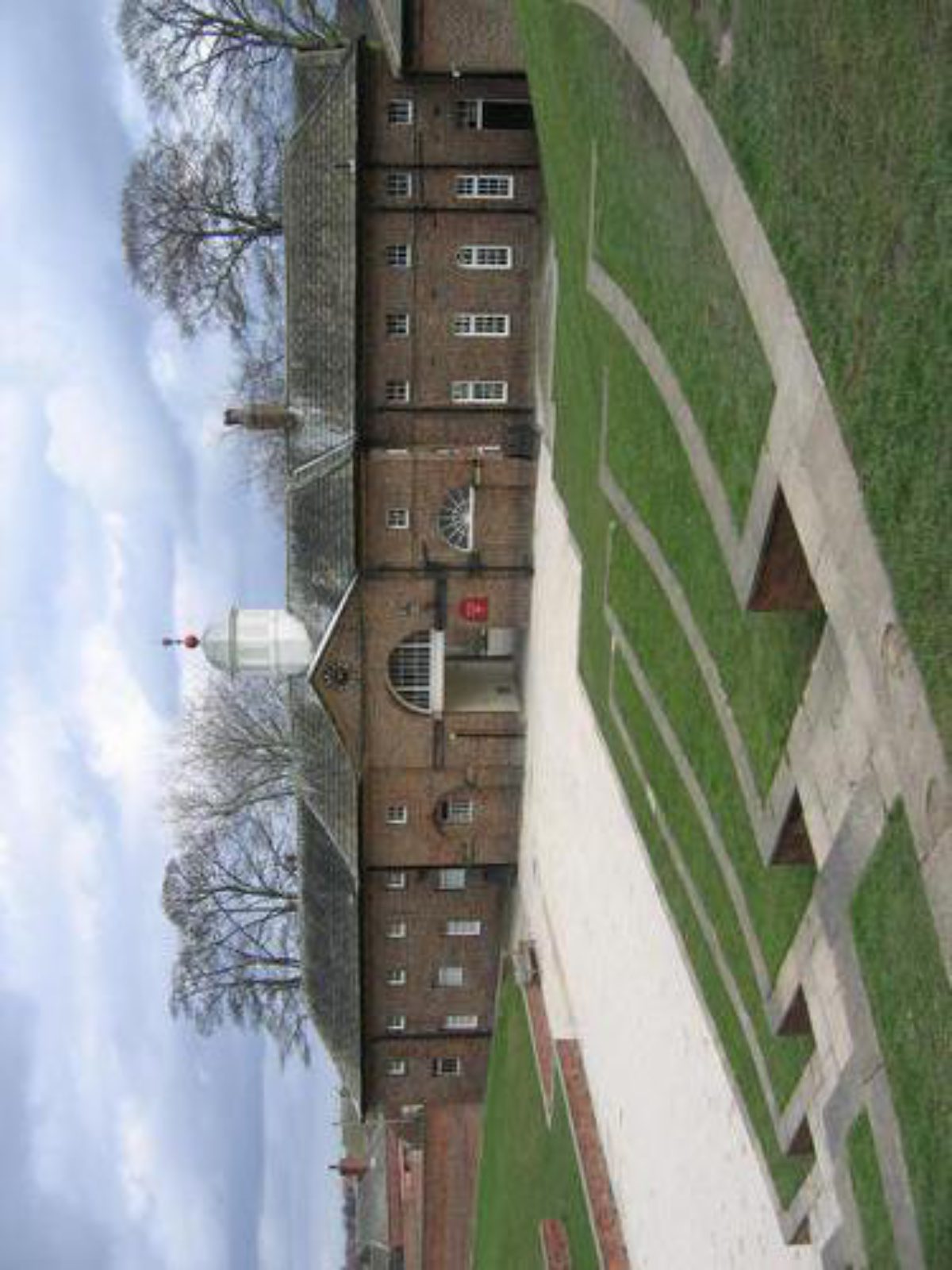
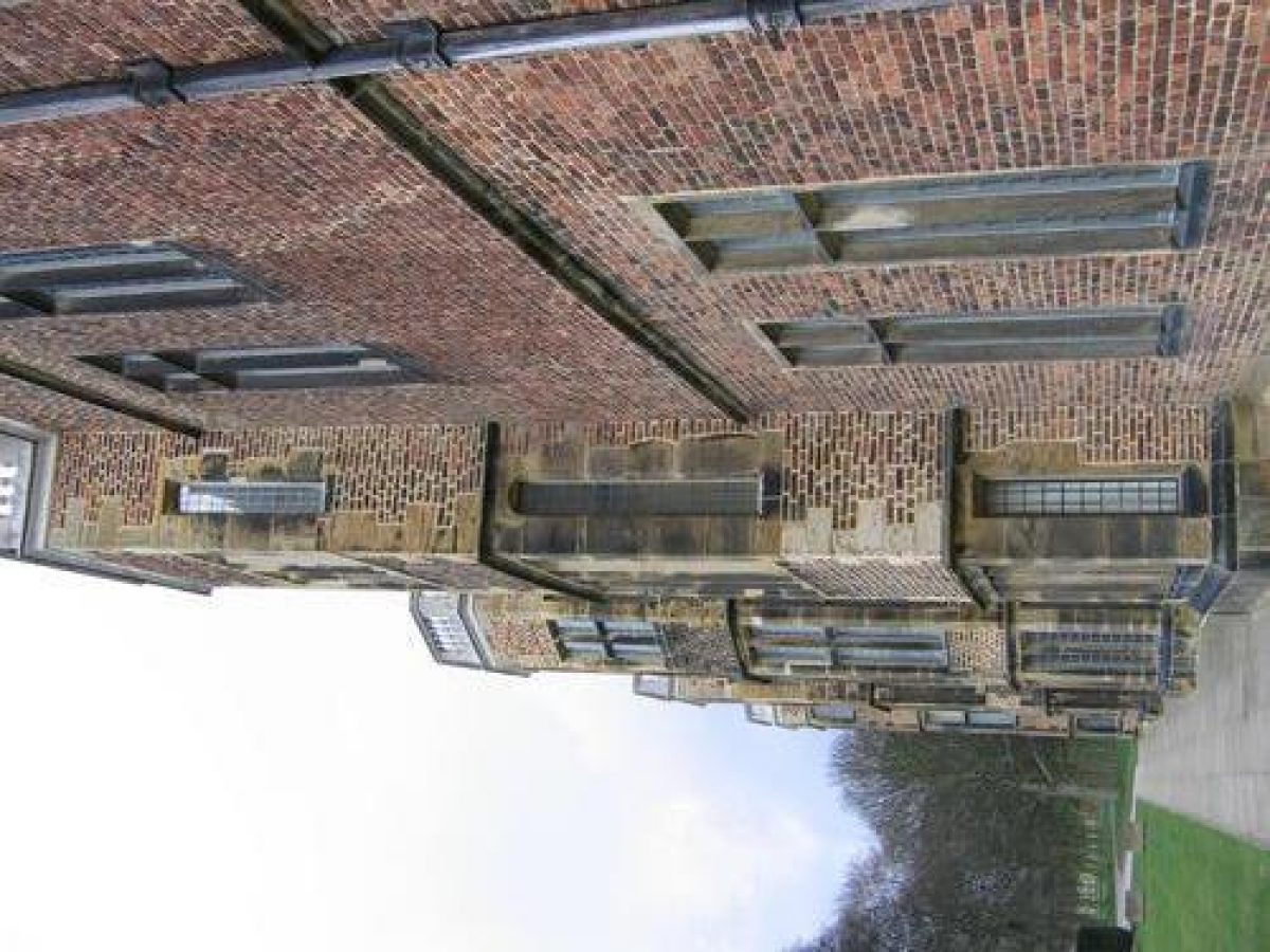
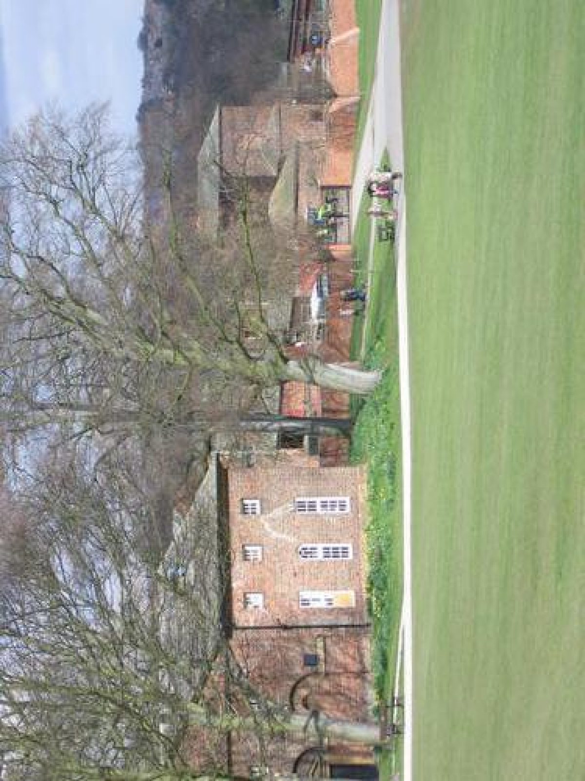
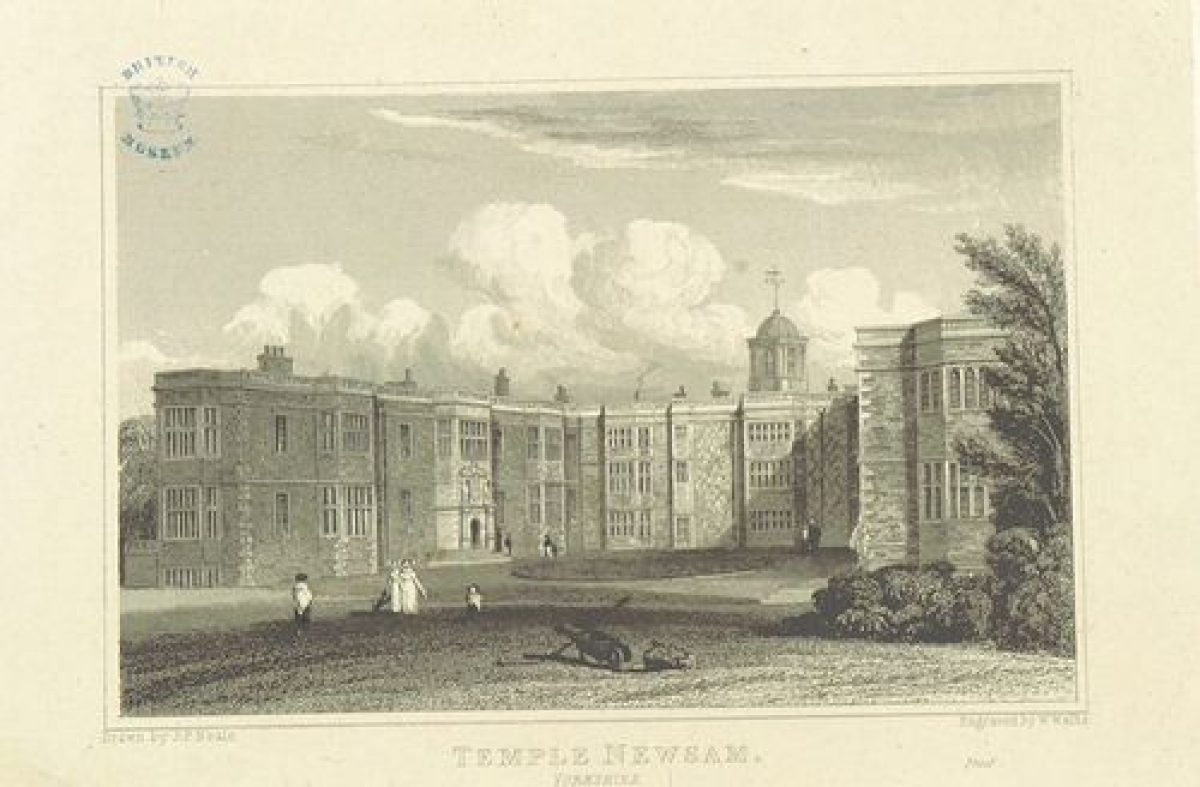
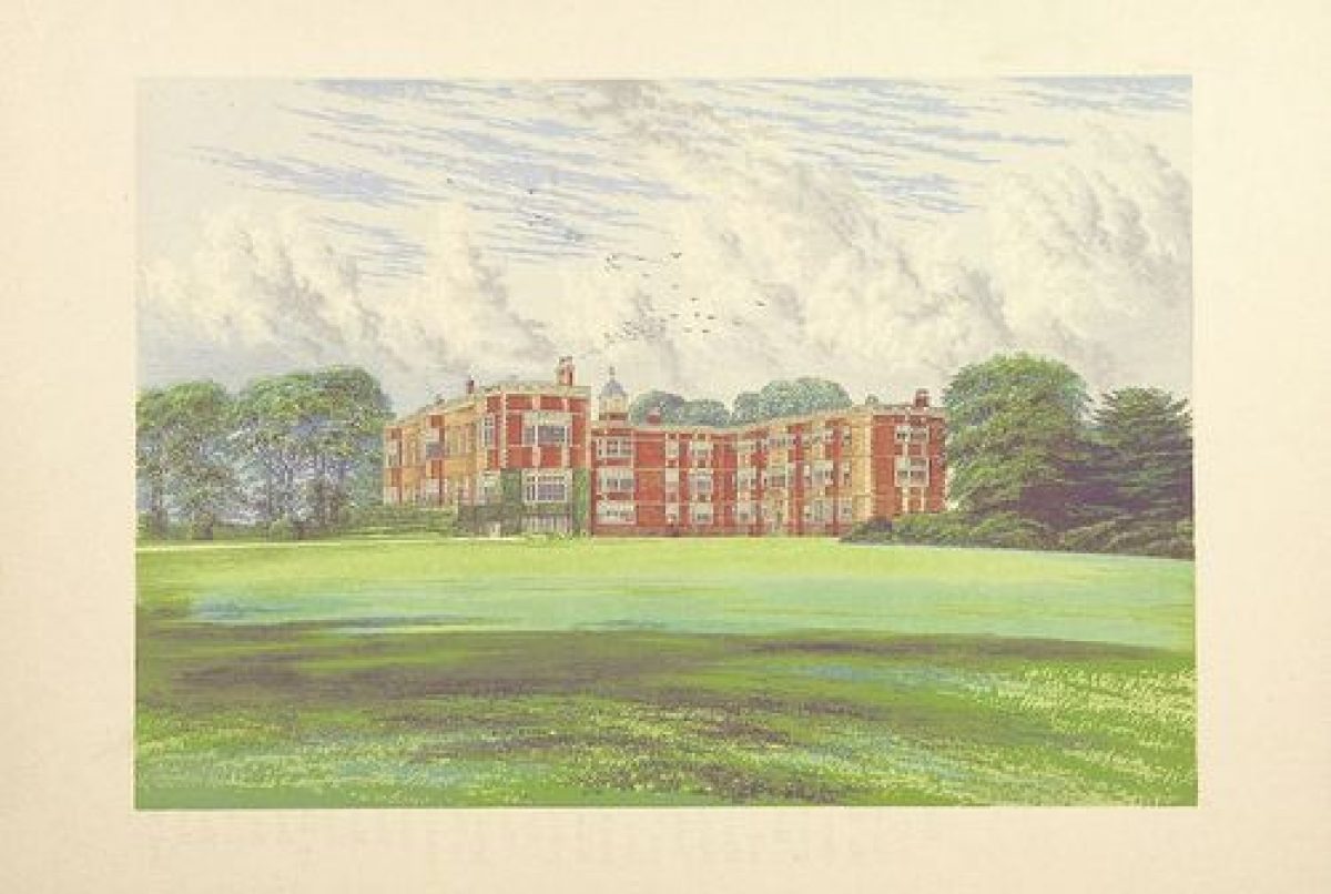
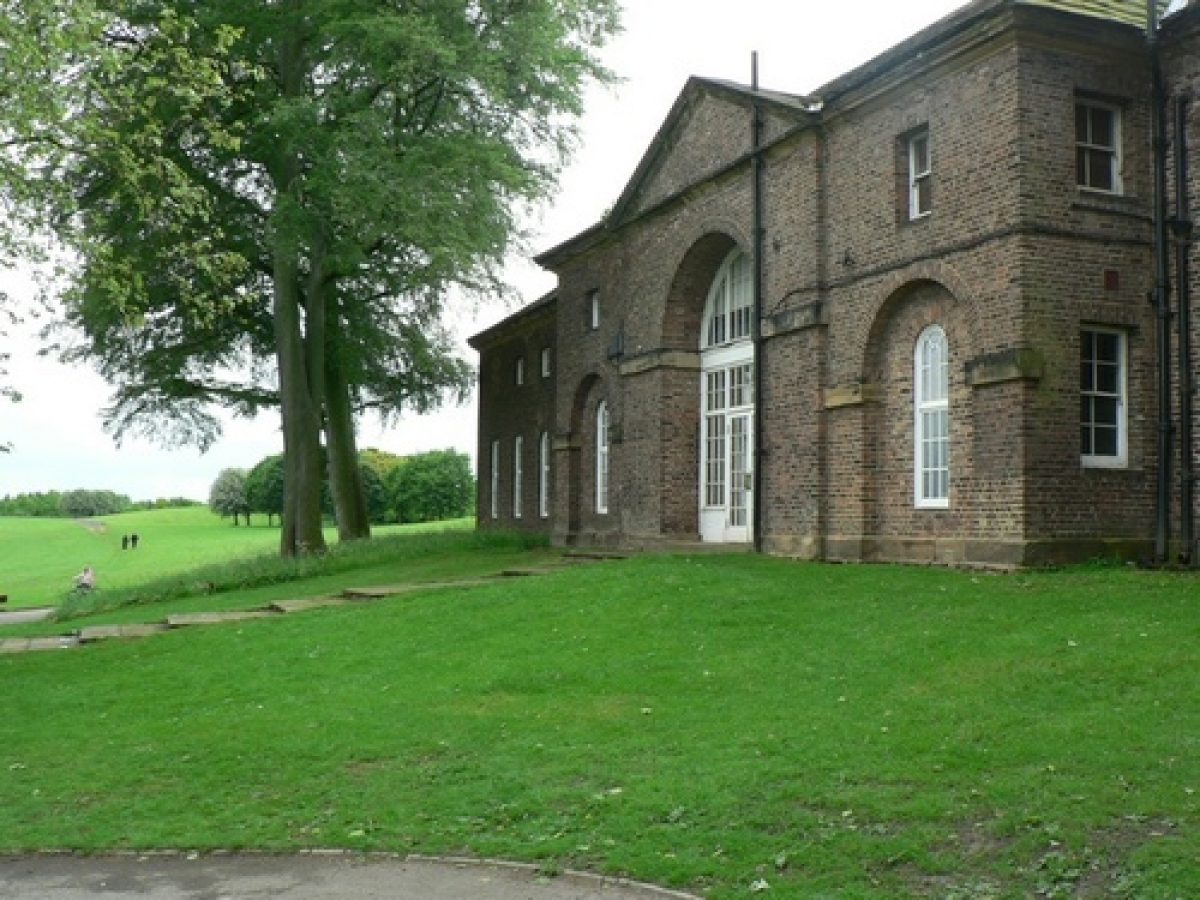
Temple Newsam (Grade I) stands at the head of a spur close to the centre of the site, commanding long-distance views in all directions apart from to the W. The original courtyard-plan house was built in 1518 by Thomas, Lord Darcy. When Sir Arthur Ingram acquired the property in the early C17 he rebuilt the N and S wings. The E wing was demolished after a fire in 1636. Interior alteration in the early C18 was followed by the remodelling of the S wing at the end of the century by Frances Gibson, widow of Charles Ingram, the 9th Viscount. Views of the tower of the medieval Grade I listed St Mary's Church at neighbouring Whitkirk are available from the N side of the house where there is a paved forecourt used for car parking. On the E side of the house there is a courtyard which was levelled and paved during the 1970s; it is now a gravelled area with a small square section of lawn to the centre.
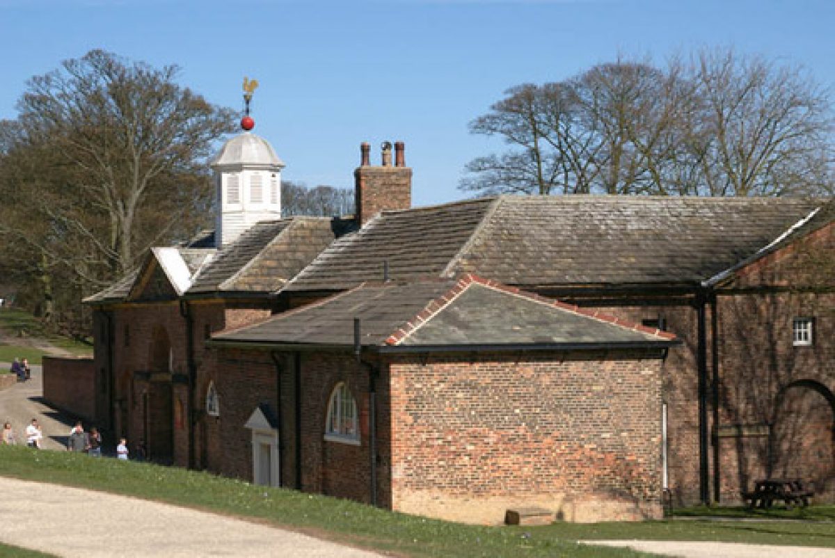
Some 60m NE of the house there is a neo-classical stable block (Grade II*) probably designed by Daniel Garrett, and later extended by Lancelot Brown in the 1760s. A painting of c1745 by James Chapman (at Temple Newsam) shows a riding school (now demolished) situated to the SE of the house, forming a balanced composition with the stables.
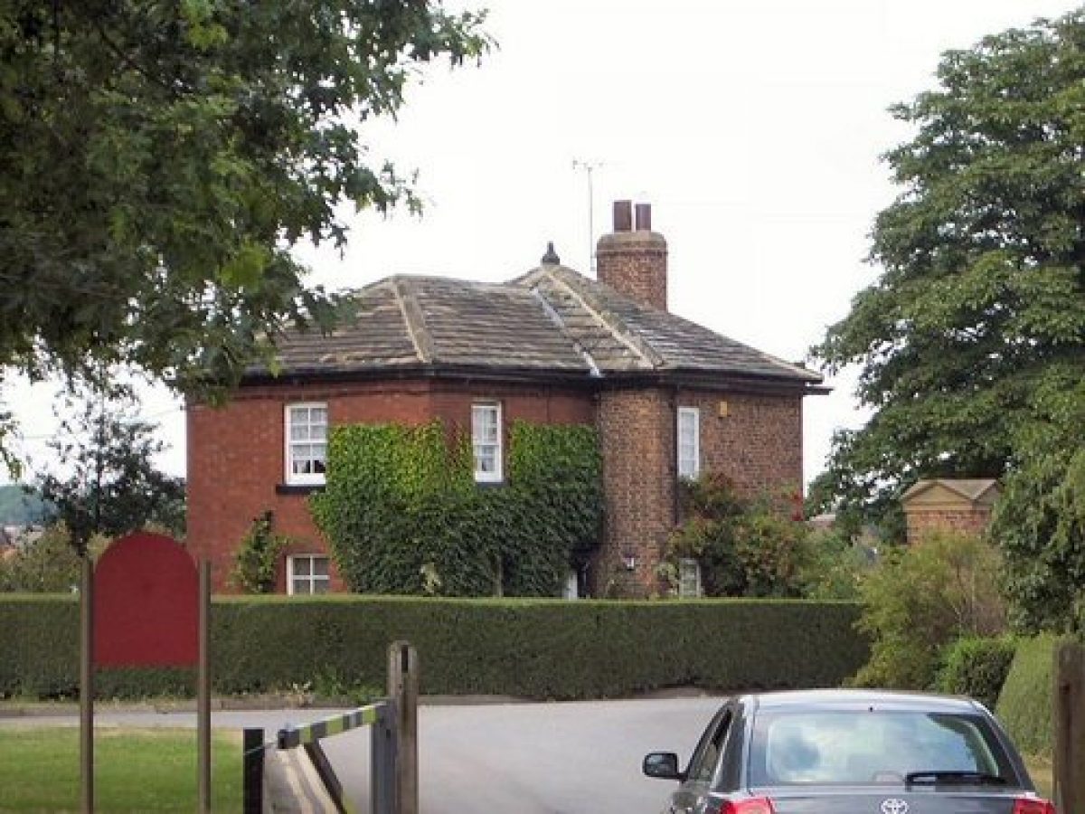
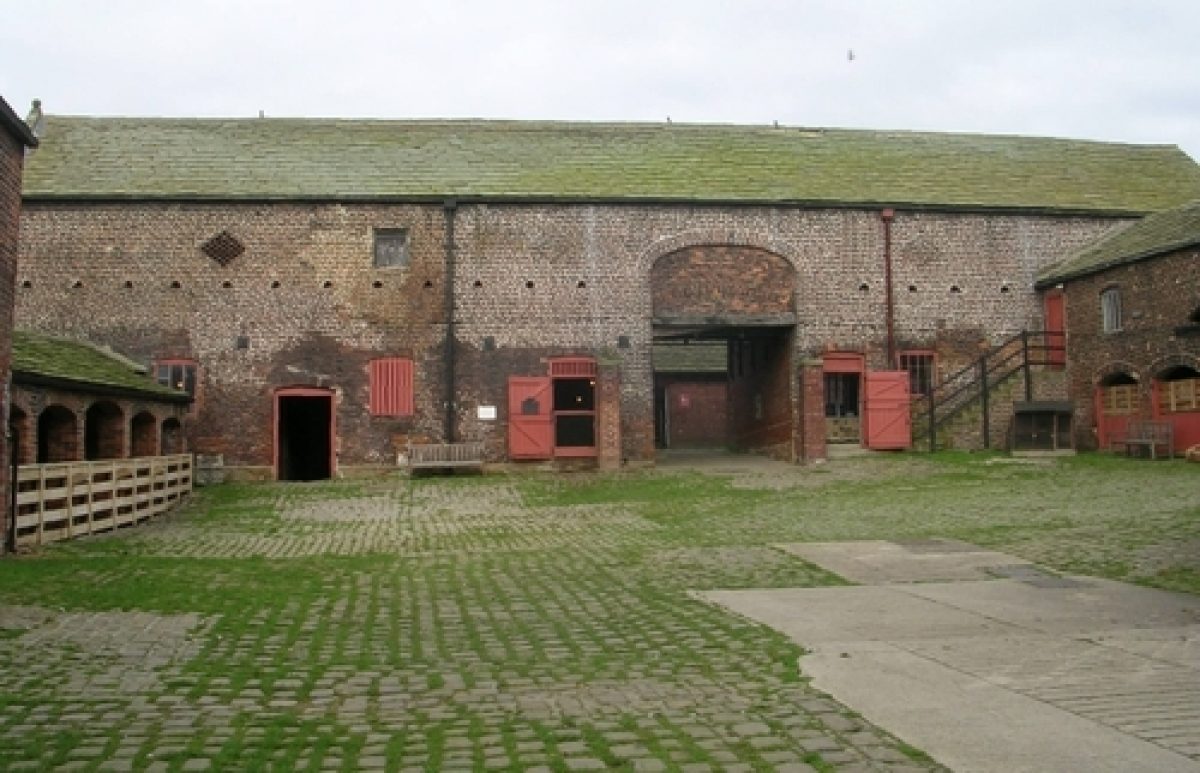
Immediately N of the stables there is a home farm, largely of mid-C18 date, which includes a farmhouse and cottage (both Grade II), a barn dated 1694 (Grade II) and other agricultural buildings some of which are listed at Grade II. The farm is in use as a centre for rare livestock breeds.
GARDENS AND PLEASURE GROUNDS
SW of the house is the Mount, which is the only survivor of the Tudor park and gardens.
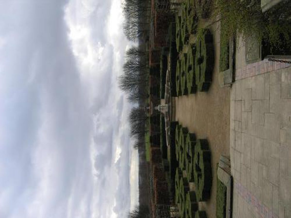
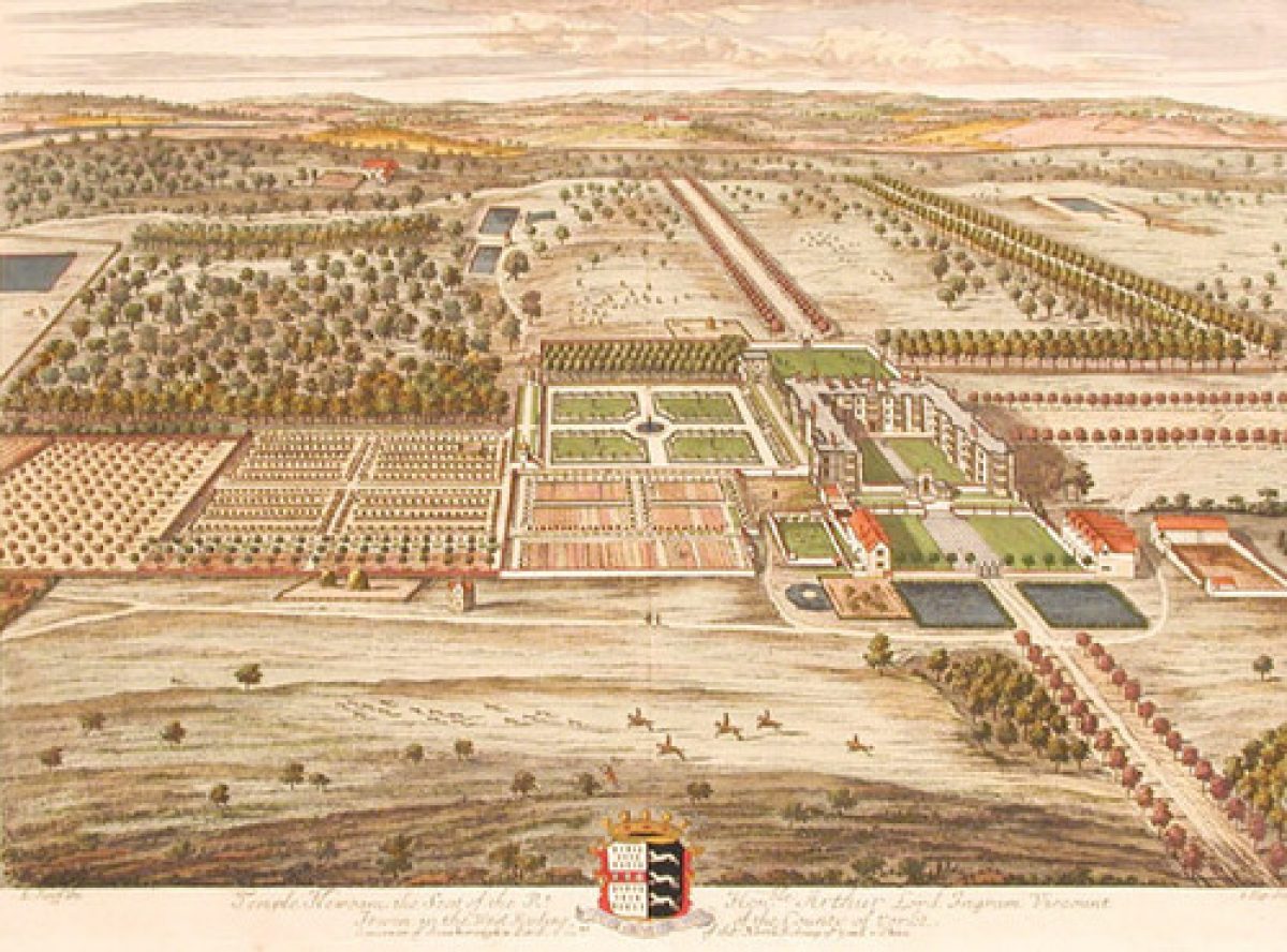
On the W side of the house is a former bowling green with a ha-ha beyond that was introduced after 1904. Formal gardens laid out during the 1970s are situated on the S side of the house. The S garden incorporates a cast-iron fountain of c1875 (Grade II) by Andrew Handyside & Co of Derby, which was previously the centrepiece of an Italianate garden laid out by Emily Meynell Ingram. The S and W gardens occupy part of the site of extensive formal gardens shown on the Knyff and Kip engraving of 1699, which were laid out for Sir Arthur Ingram by Peter Monjoye. A balustraded terrace runs below the S front and is possibly a surviving section of Monjoye's S terrace, although it has also been suggested that it might be a late-C18 replacement carried out as part of Frances Gibson's works to the house and gardens. A terrace appears in this location on the Knyff and Kip engraving of 1699, and also on a drawing of 1815 (at Temple Newsam) where it is depicted with cast-iron railings. Knyff and Kip show the terrace as being longer and extending W as a walk terminating with a banqueting house, which is mentioned in accounts of 1635-6 and an inventory of 1666 (LAC 1987); excavations carried out in 1973 found little surviving evidence for the structure. Lawns with clumps of shrubs are shown on the S and W sides of the house on the 1815 drawing.
Pleasure grounds lie immediately E of the home farm. A ha-ha, included in Brown's plan of 1762, extends from a point c250m E of the house and curves N and then E to a point c500m NE of the house. This encloses an area with lawns, scattered specimen trees, informal flower beds and shrubs with areas of woodland on the N side, called Damingdyke Wood and Menagerie Wood, which have winding paths leading through them. The E extent of the area is defined by two small elongated lakes (the first and second of three such ponds) called Menagerie Ponds, which are crossed by a bridge leading to paths running NE to the kitchen garden. The remains of ornamental rockwork between the upper (N) and middle lake survive, and there is a stepped cascade at the S end of the middle lake. A third lake, S of the middle lake, lies within the parkland. The lakes are located slightly to the N of a large lake shown on the Brown plan, and are much smaller. An C18 painting by Rooker (private collection) shows Temple Newsam from the E with a lake in a similar position to Menagerie Ponds, but of a much larger size, and it has been suggested that the scene was intended to show the effect of Brown's proposals (effectively an C18 visual mock-up) and was painted before they were carried out (Sheeran 1990). Brown's plan also incorporates a similarly sized lake proposed for the W half of the estate, but this was also not implemented. A path that marks the S edge of the pleasure grounds and which lies alongside the parkland, running W towards the house and E to the Menagerie Ponds, is marked on Brown's plan of 1762.
The N boundary of the pleasure grounds is formed by a brick wall in which is set, c250m NE of the house, a pair of stone gate piers surmounted by sphinxes by Lancelot Brown (Grade II) to a design by Lord Burlington published in 1738. Known as the Sphinx Gates, the iron gates and piers were moved to this position from the principal N entrance.
PARK
Parkland exists to all sides of the house. The areas to the S and SW of the estate were excavated for opencast coal mining during the mid-C20; the land has since been reclaimed and the SW section is in use as a golf course.
The N part of the park is sheltered by woodland called North Plantation, shown in a similar form on Lancelot Brown's plan. Set to the S of this, c300m NW of the house, is a late-C20 sports arena.
Some 100m NW of the house a path runs parallel to the E end of the NW (Halton) drive and cuts through a block of mainly sycamore woodland as a ride known as Sycamore Walk, with a dog-leg return at the E end that heads S to the house. This is located in the position of a tree-lined avenue/ride shown on the 1699 Knyff and Kip engraving, and is also shown on Brown's 1762 plan. Another avenue, which no longer exists, is also shown on the Knyff and Kip engraving and was aligned with the W side of the house.
Open parkland to the N and E of the house has scattered trees and clumps. The Knyff and Kip engraving depicts another avenue immediately in front of the E front of the house, on the line of the ride from the E entrance (The Avenue) and passing between now-demolished service buildings. Two paintings of mid-C18 date, one by Philip Mercier and another by James Chapman (at Temple Newsam), show that the avenue had been removed by this time and an oval lake created in front of the E side of the house, between the stable and riding-school blocks.
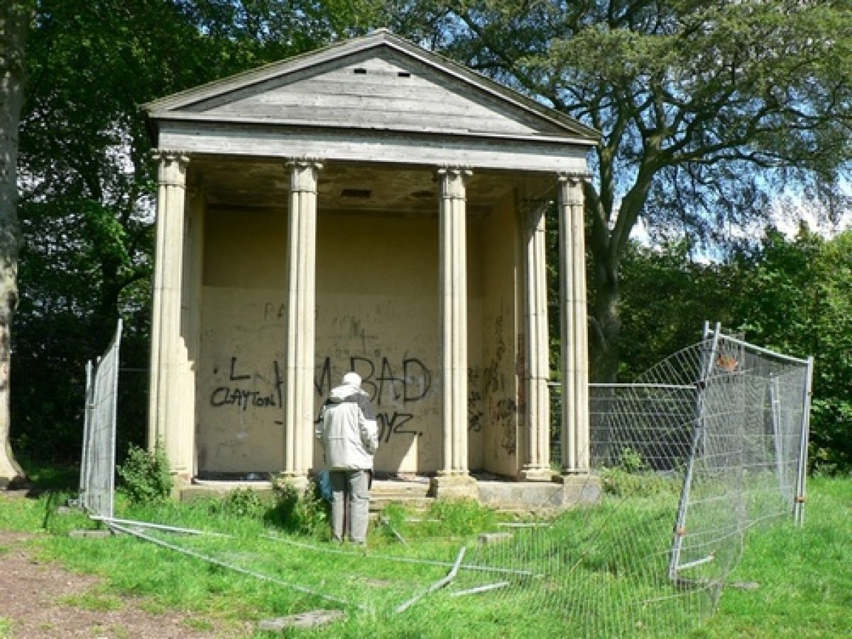
In the E parkland the land rises on the E side of a stream that runs as an outflow from the three Menagerie Ponds. Atop the hill is a small clearing c700m E of the house where an eyecatcher temple called the Little Temple (Grade II*) is sited. The temple is in the position of a rotunda shown on Brown's plan, which can be seen against a backdrop of woodland in views from the house. The temple is believed to have been designed by Brown and was constructed instead of the rotunda. Originally the clearing was larger and the temple was clearly visible from the main house and E terrace, but vegetation has grown up since the late C20 and now largely obscures views from and to the temple.
Temple Newsam was the first of Brown's commissions in West Yorkshire to be executed. The work was supervised by Thomas White and William Stones, and Brown was paid £2,800 over the period leading up to 1771. As there are no known plans of the site prior to Brown's remodelling it is not possible to tell exactly how his proposals related to the work by Etty and the landscape shown on the Knyff and Kip engraving. There is some evidence, however, that the E approach and avenues called Elm Walk and Sycamore Walk are part of an earlier landscape incorporated into Brown's executed scheme.
KITCHEN GARDEN
The kitchen garden consists of a sub-rectangular walled garden (Grade II) with a C20 glasshouse along the inner face of the N wall. The garden is to the E of one shown on the Brown plan of 1762 suggesting that this part of his plan was modified. The kitchen garden and its precincts are planted as flower gardens, which include the national collection of delphiniums, asters and other flowering plants.Reasons for Designation
The historic park and garden at Temple Newsam is registered at Grade II for the following principal reasons:
* Historic interest: it reflects changing tastes and fashions in garden design during the C18, blending formal and informal, and redesigning and remodelling earlier gardens;
* Type: it is a good example of an C18 landscape park and pleasure grounds, a landscape type that was hugely influential across Europe and North America and is considered to be one of England's most significant contributions to art and design;
* Designers: it is largely the work of William Etty, a notable architect and designer, and Lancelot 'Capability' Brown, England's most influential designer of informal landscapes, who both worked on the landscape in separate phases during the C18;
* Design interest: its informal parkland landscaping retains key signatures of Brown's work and highlights the influence of Claude Lorrain's C17 paintings of ideal landscapes on his designs, whilst Elm Walk, Sycamore Walk and Etty's The Avenue remain as important survivors of the estate's earlier more formal schemes;
* Group value: it has strong group value with the main house of Temple Newsam (Grade I), as well as the neo-classical stable block (Grade II*), numerous Grade II buildings at Home Farm, north lodges (Grade II), and listed garden structures, including the Little Temple (Grade II*),the Sphinx Gates (Grade II), walled garden (Grade II), cast-iron fountain (Grade II), and stone bridge (Grade II).
Selected Sources
Books and journals
Colvin, H, A Biographical Dictionary of English Architects 1530-1830, (1995), 355
Jellicoe, G, Jellicoe et al, S, The Oxford Companion to Gardens, (1986), 76
Leach, P, Pevsner, N, The Buildings of England. Yorkshire West Riding: Leeds, Bradford and the North, (2009), 25, 27, 41, 42, 68, 112, 404, 543-8, pl.34
Sheeran, G, Landscape Gardens in West Yorkshire 1680-1880, (1990), 45-50
Stroud, D, Capability Brown, (1950), 125-6
Lynch, K, Eyres (Editor), P, 'Yorkshire Capabilities. The Yorkshire Landscapes of Capability Brown' in New Arcadian Journal, , Vol. No.75/76, (), 64-69
Websites
Copy of Domesday Book entry for Neuhusu (what is now Temple Newsam), accessed 22 July 2016 from http://opendomesday.org/place/SE3630/temple-newsam/
'Houses of Knights Templar' in A History of the County of York: Volume 3, accessed 20 July 2016 from www.british-history.ac.uk/vch/yorks/vol3/pp256-260
Other
Engraving by Knyff and Kip, Britannia illustrata, 1707. Reproduction held at Temple Newsam
Lancelot Brown, Plan of Improvements etc, 1762. Reproduction held at Temple Newsam
Leeds Arts Calendar 2, no.8 (1949), pp 15-19; no.61 (1968), pp 22-24; no.76 (1975), pp 28-32; no.90 (1982), pp 26-32; no.60 (1987), pp4-7
T Jefferys, County Map, surveyed 1765-70, published 1771
Temple Newsam Estate Cultural Management Plan. 2000. Available at Temple Newsam
Various archival information, including paintings, photographs and newspaper articles held by Temple Newsam Art Gallery
- Visitor Access, Directions & Contacts
Telephone
44 113 336 7461Access contact details
The park is open throughout the year. The house and farm are open Tuesday to Sunday from 10.30 am.
Directions
The site can be reached from junction 46 of the M1.
Owners
Leeds City Council
Civic Hall, Calverley Street, Leeds, LS1 1UROther Websites
- http://www.leeds.gov.uk/museumsandgalleries/Pages/Temple-Newsam.aspx
- http://www.archaeology.wyjs.org.uk/documents/archaeology/newsletters/News26pag8.pdf
- http://list.historicengland.org.uk/resultsingle.aspx?uid=1001356
- https://www.parksandgardens.org/projects/capability-brown/885-an-extraordinary-order-the-little-temple-at-temple-newsam?showall=&start=7
- https://parksandgardensuk.wordpress.com/2016/04/30/temple-newsam/
- History
The following is from the Register of Parks and Gardens of Special Historic Interest. For the most up-to-date Register entry, please visit the The National Heritage List for England (NHLE):
www.historicengland.org.uk/listing/the-list
History
In the C11 the estate was owned by Ilbert de Lacy and is recorded as 'Neuhusu' ('at the new houses') in the Domesday Book. In the C12 it was owned by William de Villiers who sold the land to the Knights Templar who built Temple Newsam Preceptory on the site. Following the suppression of the Knights Templar in 1308 the estate was seized by the Crown and eventually passed to the Countess of Pembroke in 1337/8, and subsequently to the Darcy family. In 1518 members of the Darcy family settled on the site and built Temple Newsam House.
In 1537, following his involvement in the Pilgrimage of Grace, Thomas Darcy, Lord Darcy of Darcy was executed for treason and his estates, including Temple Newsam, were seized by the Crown. In 1544 Henry VIII gave the estate to his niece Margaret, Countess of Lennox and her husband Matthew Stuart, Earl of Lennox, whose son Henry, Lord Darnley was born in the house. After Darnley's marriage to Mary Queen of Scots in 1565 the estate was again seized by the Crown.
In 1622 the estate was sold to Sir Arthur Ingram and the Ingram family, who were later created Viscounts Irwin. Ingram rebuilt the N and S wings over the following 20 years, and incorporated part of the original building into the W wing. In 1636 a fire destroyed the E wing and it was subsequently demolished. The grounds were re-designed in 1710-15 by William Etty of York who had worked with Nicholas Hawksmoor at Castle Howard. The house was remodelled further between 1736-46, and in 1762 Charles, 9th Viscount employed Lancelot 'Capability' Brown to re-design the landscape at Temple Newsam, although Brown's design was never fully implemented. William Stones was Brown's full-time foreman for the works, which ran until 1771.
Following the death of the 9th Viscount the estate passed through several female lines and was eventually inherited by the Hon Edward Wood (later 1st Earl of Halifax) in 1904. In 1909 610 acres at the SW corner of the estate were compulsorily purchased by Leeds Corporation to construct a sewage plant and open-cast coal mining also commenced at the estate boundary. In 1922 Wood sold the house and remaining estate to the City of Leeds with covenants ensuring their protection.
Temple Newsam park is open to the public and the house is used as a museum and art gallery run by Leeds City Council. Home Farm is also open to the public and is one of the largest working rare breeds farms in Europe.
Period
- 18th Century (1701 to 1800)
- Late 18th Century (1767 to 1800)
- Associated People
- Features & Designations
Designations
The National Heritage List for England: Register of Parks and Gardens
- Reference: GD3011
- Grade: II
NCCPG National Plant Collection
- Reference: Aster, Phlox, Delphinium, Solenostemon and Chrysanthemum.
Features
- Mansion House (featured building)
- Description: The mansion was built in the early-17th century by Sir Arthur Ingram, remodelling an earlier Tudor house.
- Earliest Date:
- Lake
- Fountain
- Description: A Victorian cast-iron fountain.
- Garden Terrace
- Description: The south terrace, created in the late-18th or early-19th century.
- Temple
- Amphitheatre
- Description: A turf and stone amphitheatre.
- Stable Block
- Ferme Ornee
- Boundary Wall
- Description: Part of the north boundary is an 18th-century brick wall.
- Earliest Date:
- Latest Date:
- Gate Lodge
- Description: Brick gate lodges at the north entrance to the park.
- Key Information
Type
Estate
Purpose
Recreational/sport
Principal Building
Domestic / Residential
Period
18th Century (1701 to 1800)
Survival
Extant
Hectares
370
Open to the public
Yes
- References
References
- Stroud, D. {Capability Brown} (London: Country Life, 1950), pp. 125-6 Capability Brown (Country Life article)
- {English Heritage Register of Parks and Gardens of Special Historic Interest}, (Swindon: English Heritage, 2008) [on CD-ROM] Historic England Register of Parks and Gardens of Special Historic Interest
- Jellicoe, Sir G. et al (eds), {The Oxford Companion to Gardens} (Oxford: Oxford University Press, 1986), p. 76 The Oxford Companion to Gardens
- Sheeran, G. {Landscape Gardens of West Yorkshire 1680-1880} (Wakefield: Wakefield Historical Publications, 1990), pp. 45-50 Landscape Gardens in West Yorkshire 1680-1880
- Pevsner, N., {The Buildings of England: Yorkshire The West Riding} (Harmondsworth: Penguin Books, 2nd edition 1967), pp. 348-50 The Buildings of England: Yorkshire The West Riding
Contributors
Jenifer White
- Related Documents