Introduction
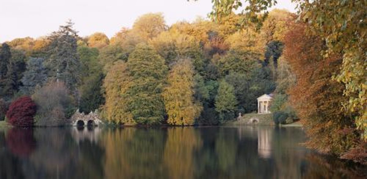
Stourhead is an 18th-century landscape garden, with a lake and woodland of 16 hectares, set within a larger estate of park, wood and farmland. The lake is surrounded by a series of classical temples and follies.
Terrain
The ground at Stourhead is generally undulating and in parts hilly.
The following is from the Register of Parks and Gardens of Special Historic Interest. For the most up-to-date Register entry, please visit the The National Heritage List for England (NHLE):
www.historicengland.org.uk/lis...
NOTE
This entry is a summary. Because of the complexity of this site, the standard Register entry format would convey neither an adequate description nor a satisfactory account of the development of the landscape. The user is advised to consult the references given below for more detailed accounts. Many Listed Buildings exist within the site, not all of which have been here referred to. Descriptions of these are to be found in the List of Buildings of Special Architectural or Historic Interest produced by the Department of Culture, Media and Sport.
Stourhead contains an extensive and complex landscape garden and park. Its main phases of development date from the 18th, 19th, and 20th centuries. This includes mid- to late 18th-century works by Henry Hoare II, Henry Flitcroft, and William Privet of Chilmark, late 18th- and early 19th-century works by Richard Colt Hoare, and 20th-century conservation and restoration work by the National Trust.
SUMMARY DESCRIPTION
Stourhead, a site of c 331ha, lies north of the A303 between Wincanton and Mere in a rural area. The ground at Stourhead is generally undulating and in parts hilly. The small village of Stourton lies immediately to its south-east, with farmland beyond it. Further to the south lies the village of Bonham and to the south-west the village of Gasper. Immediately to the south-west lies Top Lane Farm with its surrounding land enclosed by Castle Wood. To the north-west the site is bounded by mature woodland called The Convent. The northern boundary is formed by the road between the villages of Hardway and Kilmington. To the north-east and south-east the site is enclosed by farmland, while the eastern boundary is formed by the B3092.
There are fine views down to the landscape garden to the north-east from the public footpaths through Top Lane and Top Wood to the south-west of the site.
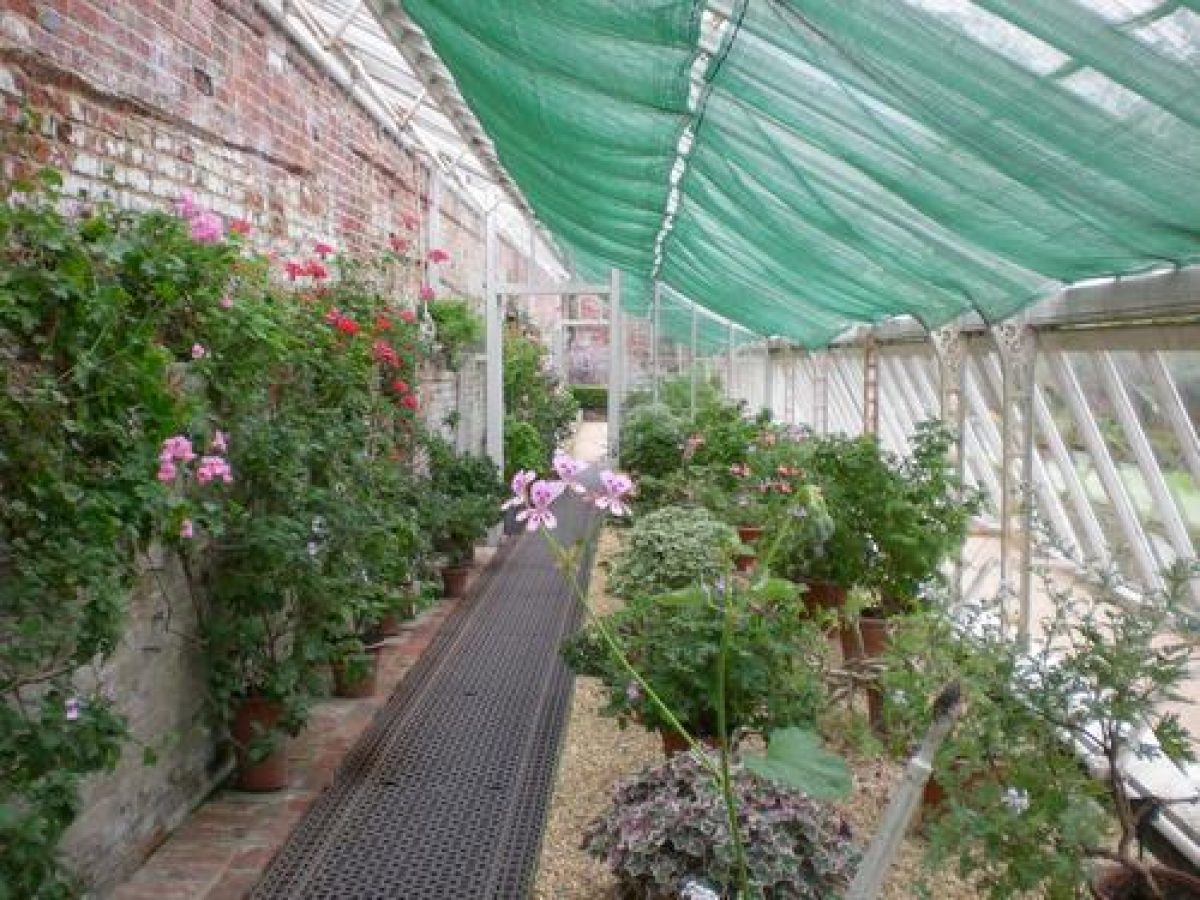
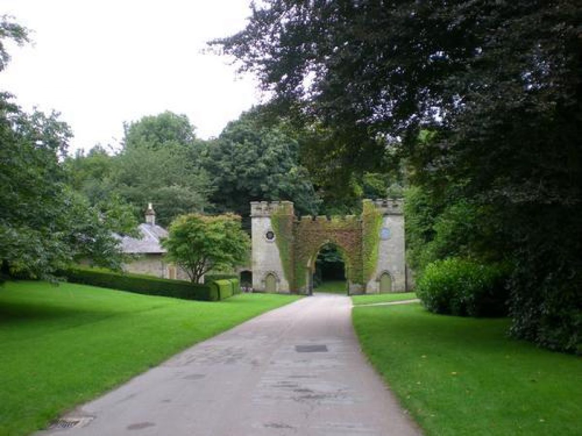
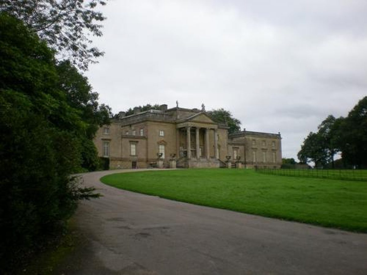
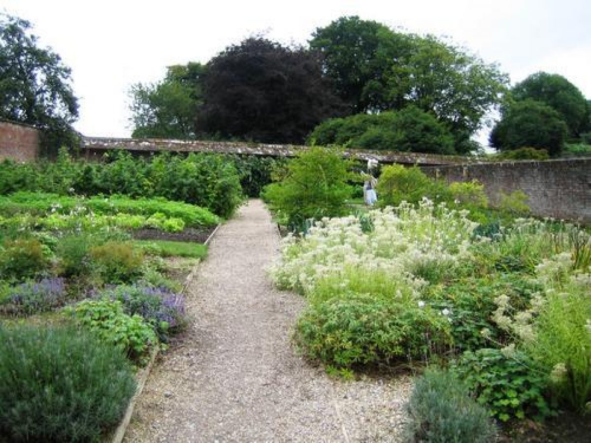
The existing approaches to Stourhead House were introduced by Richard Colt Hoare in the late C18. The main approach is from the south-west along Stourton High Street, where c 250m south-east of the House stands the Clock Tower Gateway and Clock Tower Lodge (both listed grade II). The House can also be approached from the north-west via Terrace Lodge (now known as Terrace Cottage, listed grade II), and formerly also via Drove Lodge (listed grade II) 400m to the east-north-east. Stourhead House (listed grade I) stands in the centre of the park which occupies the eastern part of the site. A mid to late C18 stable yard (including various buildings listed at grade II) is situated c 150m to the south-east, with a rectangular walled kitchen garden built of brick attached to the south. This is laid out on a slope and contains three terraces separated by internal walls.
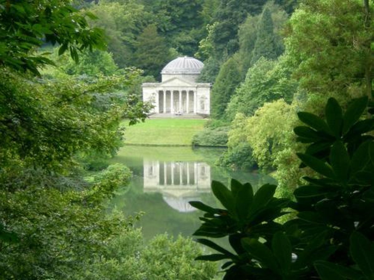
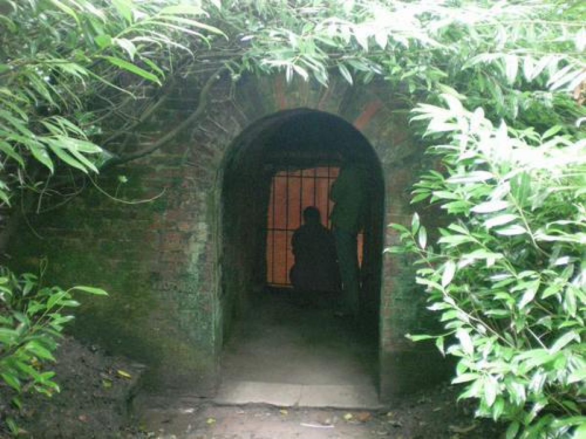
The landscape garden lies to the south and west of the House, its central feature being the series of informal lakes and ponds. It is laid out around a main circuit walk that leads from the lawn south of the House into the garden around the main triangular lake situated in the valley below. The walk, called The Shades, meanders along the eastern slope of the lake, where it passes the site of the Turkish Tent. The path continues down to the lakeside and then turns in a north-westerly direction on the eastern shore of the lake, running parallel to the formal Fir Walk situated above it to its east, with at its far north-west end The Obelisk (listed grade I). At the northern tip of the lake, at Six Wells Bottom, the path turns to continue along the west side of the lake. Here it passes the Grotto (listed grade I) introduced in the mid C18 to a design by William Privet of Chilmark. Further along the walk stands the C18 Gothic Cottage (listed grade I) from where there is a fine view of the late C18 Palladian Bridge (listed grade I) crossing the far eastern tip of the lake. The path continues southwards from the Gothic Cottage and passes the Pantheon (listed grade I) designed by Henry Flitcroft in the mid C18. Beyond the Pantheon the path continues over the Iron Bridge (listed grade II) of 1860, which replaces an earlier bridge of c 1840, crossing the south-west tip of the lake. The path then runs along the south side of the lake, passing the smaller Turner's Paddock Lane to its south-west. Further east, the late C18 rustic Rockwork Bridge (listed grade I), which crosses Stourton High Street, carries the path up the southern slope above the lake towards the late C18 Temple of Apollo (Henry Flitcroft, listed grade I). East of the Temple the path continues down the slope again to a late C18 tunnel under Stourton High Street, called the Grotto Underpass (listed grade II). The path then leads to the far eastern tip of the lake where the medieval Bristol High Cross (listed grade I), introduced into the garden in the late C18, stands. Beyond this lies the village and church of Stourton, which were seen as important features within the designed landscape from the 1760s (Batey and Lambert 1990). The main circuit walk ends on the south-east side of the lake at the mid C18 Temple of Flora (Henry Flitcroft, listed grade I), with c 70m to its north a late C18 boathouse (listed grade II) on the lakeside. There are very fine surprise views between the key garden buildings, including the village and church. The garden with its various features also contains a complex programme of historical and political iconography and symbolism, reflecting the Hoare family¿s place and role in C18 society.
The main park at Stourhead dates from the late C18 and surrounds the House to the north, east, and west. It is edged by a thin belt of mature trees to the north and east, with a thicker plantation called Sand Walk to the south-west. The park contains a scattering of mature single trees and small clumps. To the north-west the park is linked to a ride called The Terrace, which runs along the north-east boundary, and is screened to its south-west by Sunny Hanging, a mature belt of trees with Six Wells Bottom beyond it. The Terrace ride runs for c 1.4km in a north-westerly direction, before turning south-westwards where it runs along the northern boundary for 1.5km to Alfred's Tower (listed grade I). This triangular tower, introduced in the late C18 and designed by Henry Flitcroft, stands at the far north-west tip of the site, on Kingsettle Hill. It was built on the spot where King Alfred raised his standard after emerging from hiding on the Isle of Athelney, and it commemorates the accession of George III in 1760 and the end of the Seven Years War in 1763. From the tower are spectacular views of the park and the surrounding countryside.
The south-west and north-west parts of the site are covered in dense mature woodland, including Shady Hanging, Park Hill, and Tucking Mill Hanging to the south-west, and Little Combe, Great Combe, and Convent Bottom to the north-west. The latter woodland is named after The Convent (listed grade I), situated c 1.2km to the south-east of Alfred's Tower. This is a rustic folly in Gothic style introduced in 1765 by Henry Hoare II to adorn one of the various rides he created in the woodland. During the C20 it was significantly altered and converted to a cottage and has since been in use as a private dwelling.
REFERENCES
Note: there is a wealth of published material about this site. The key references are listed below.
Country Life, 9 (6 April 1901), pp 432-9; 57 (18 April 1925), pp 592-4; 83 (11 June 1938), pp 608-14; no 24 (8 June 2000), pp 200-02
K Woodbridge, Landscape and Antiquity: Aspects of English Culture at Stourhead 1718 to 1838 (1970)
K Woodbridge, The Stourhead Landscape (NT guidebook 1971, revised 1982)
B Cherry and N Pevsner, The Buildings of England: Wiltshire (2nd edn 1975), pp 494-500
The conservation of the garden at Stourhead and parts of the park relating to it, (National Trust 1978)
J Warburg and Courtauld Institutes XLVI, (1983), pp 133-43
J Garden History IX, no 2 (1989), pp 71-7
M Batey and D Lambert, English Garden Tour (1990), pp 190-4
I Mayes, Restoration Plan for the Stourhead Grade I Listed Landscape, (report for National Trust 1997)
Stourhead Landscape Garden, guidebook, (National Trust 2000)
C Thacker, Building Towers, Forming Gardens (2002)
Maps
Andrews and Drury, Map of Wiltshire, 1773 (Wiltshire and Swindon Record Office)
Plan of the Manor of Stourton for Richard Colt Hoare, 1785 (Wiltshire and Swindon Record Office)
C Greenwood, Map of Wiltshire, 1820 (Wiltshire and Swindon Record Office)
Tithe map for Stourton parish, 1839 (Wiltshire and Swindon Record Office)
OS 6" to 1 mile: 1st edition published 1889; 1926 edition
Illustrations
C W Bamfylde, drawings of Stourhead landscape, c 1770 (see Woodbridge 1971)
- Visitor Access, Directions & Contacts
Telephone
01747 841152Access contact details
Directions
The site is 8 miles south of Frome on the A361.
Owners
The National Trust
Heelis, Kemble Drive, Swindon, SN2 2NA
- History
The following is from the Register of Parks and Gardens of Special Historic Interest. For the most up-to-date Register entry, please visit the The National Heritage List for England (NHLE):
www.historicengland.org.uk/lis...
NOTE
This entry is a summary. Because of the complexity of this site, the standard Register entry format would convey neither an adequate description nor a satisfactory account of the development of the landscape. The user is advised to consult the references given below for more detailed accounts. Many Listed Buildings exist within the site, not all of which have been here referred to. Descriptions of these are to be found in the List of Buildings of Special Architectural or Historic Interest produced by the Department of Culture, Media and Sport.
HISTORIC DEVELOPMENT
There was a park at Stourton during the 15th and 16th centuries, which was created by the Stourton family who owned the estate from before the Norman Conquest. In 1717 the Stourton family sold their estate to Henry Hoare I (1677-1725), a wealthy banker from London. Henry Hoare replaced the Stourton home with a Palladian-style country house designed by Colen Campbell in about 1721-4. To the east of the new house was a railed forecourt with an oval lawn, and walled gardens were laid out to its south.
In 1725, Henry's son, Henry Hoare II (1705-85) inherited Stourhead. In about 1733 he began to extend his father's gardens with a formal terrace walk of Scotch firs to the west of the house. After his return from Italy in 1741, he started to lay out an extensive landscape garden influenced by what he had seen during his travels. He created a lake from two existing ponds situated in a valley to the west of the house, which formed the foreground to the new gardens looked down upon from the hillside near the house. A single-span wooden bridge crossed the north-west arm of the new lake, and a circuit walk led through the pleasure ground, passing several garden buildings mostly designed by his friend the architect Henry Flitcroft.
The various buildings and features included the Temple of Flora, the Pantheon, the Grotto, the Temple of Apollo, the Hermitage, the Bristol High Cross, and the Obelisk. After 1765 other features were added, amongst which were the Palladian Bridge, the Gothick Greenhouse, and the Turkish Tent. Henry Hoare II also undertook an extensive planting scheme, the main purpose of which was to create pictorial effects and contrasts between dark and light. In the late 1770s he completed Alfred's Tower, the focal point for a formal ride around the park and surrounding woods, which had already been conceived in 1762.
Coplestone Warre Bampfylde recorded the landscape gardens created by Henry Hoare II in a series of detailed drawings of around 1770 (reproduced in Woodbridge 1971).
Not long before his death, Henry Hoare handed Stourhead over to his grandson, Richard Colt Hoare (1758-1838). Between 1791 and 1815, Richard added two wings to the existing house, remade the boundaries and the ha-ha between the garden and surrounding meadow, moved the main approach drive and castellated gateway to its current position, and extended the park and built new lodges.
In the garden around the lake he removed various garden buildings or their remains, including the Gothick Greenhouse, the Turkish Tent, and the bridge over the lake. New features were added including the gothick porch and seat to Watch Cottage, and Terrace Lodge. He also laid gravel paths, including new ones to the north-west corner of the lake, removed some of his grandfather's planting, and introduced new varieties of ornamental trees and shrubs, including Rhododendron ponticum and laurel, planted around the lake during the early 19th century.
Richard Colt Hoare was succeeded by his half-brother Henry Hugh Hoare, and subsequently by the latter's son Hugh Richard Hoare. Eventually, in 1857, Stourhead passed to the latter's nephew, Henry Ainslie Hoare. In the early 1860s he added a portico to the house in accordance with Colen Campbell's original design, rebuilt the obelisk, erected an iron bridge across the south-west arm of the lake, and introduced new ornamental planting.
After Henry Ainslie Hoare's death in 1894, his cousin Henry Hoare succeeded him. The latter increased the variety of ornamental trees and shrubs around the lake, created a pinetum to the north-west of the lake, and after a fire in 1902, extended and altered the west front of the house.
In 1946, Henry Hoare gave the house and most of the grounds to the National Trust, who initially mainly tidied up the grounds and cleared overgrown areas. During this period the Temple of Apollo was re-roofed. In the mid 1950s and 1960s the emphasis of the management of the garden was on the plant collection which was rearranged and further developed. Some historic vistas were opened up, and the dams near the lake and various garden buildings were repaired. In 1973 the National Trust appointed a committee to prepare a policy and restoration plan aimed at the long-term preservation of the 18th-century landscape at Stourhead, taking into account subsequent developments (National Trust 1978).
Most of the site remains (2003) in the ownership of the National Trust, with one area in private ownership.
- Associated People
- Features & Designations
Designations
The National Heritage List for England: Register of Parks and Gardens
- Reference: GD1440
- Grade: I
Style
Classical Landscape
Features
- Temple
- Description: Temple of Flora
- Earliest Date:
- Latest Date:
- Temple
- Description: Temple of Apollo
- Earliest Date:
- Latest Date:
- Lake
- Folly
- Description: King Alfred's Tower
- Earthwork
- Description: There are two Iron Age hill forts
- Lawn
- Obelisk
- Description: This replaced the original 1746 structure.
- Earliest Date:
- Latest Date:
- Walk
- Description: Fir walk
- Dam
- Grotto
- Ornamental Bridge
- Description: The Palladian bridge
- Earliest Date:
- Latest Date:
- Cascade
- Garden Building
- Description: The Pantheon
- Earliest Date:
- Latest Date:
- Mansion House (featured building)
- Description: Palladian-style country house.
- Earliest Date:
- Latest Date:
- Woodland
- w
- Parkland
- Farm
- l
- Key Information
Type
Garden
Purpose
Ornamental
Principal Building
Domestic / Residential
Survival
Extant
Hectares
331
Open to the public
Yes
Civil Parish
Stourton with
- References
References
- {English Heritage Register of Parks and Gardens of Special Historic Interest}, (Swindon: English Heritage, 2008) [on CD-ROM] Historic England Register of Parks and Gardens of Special Historic Interest
- Pevsner, N. and B. Cherry, {The Buildings of England: Wiltshire} (Harmondsworth: Penguin, 1975), pp. 494-500 The Buildings of England: Wiltshire
- Batey, M. and D. Lambert, {The English Garden Tour: a view into the past} (London: Murray, 1990), pp. 190-4 The English Garden Tour: a view into the past
- Woodbridge, K., {Landscape and Antiquity: Aspects of English Culture at Stourhead, 1718-1838} (Oxford: Clarendon Press, 1970) Landscape and Antiquity: Aspects of English Culture at Stourhead, 1718-1838
- Sales, John {The Conservation of the garden at Stourhead} (1976) The Conservation of the garden at Stourhead
- Related Documents
-
CLS 1/76/328
The Conservation of the Garden at Stourhead: Report and Recommendations - Hard copy
Committee appointed by National Trust - 1978
-
CLS 1/76/328