Introduction
Prestwold Hall has 18th-century parkland with mid-19th-century additions. The garden also contains mid-19th-century formal areas which were further developed in the 20th century. The house is currently (2008) a venue for corporate and other events.
Terrain
The site is on the western extremity of the Leicestershire wolds, on gently rising land.www.historicengland.org.uk/listing/the-list
Formal gardens, largely of around 1842 by William Burn, and a landscape park of around 1770 associated with a country house remodelled by Burn.
DESCRIPTION
LOCATION, AREA, BOUNDARIES, LANDFORM, SETTING
Prestwold Hall and church stand within Prestwold Park 5km east of Loughborough on the western extremity of the Leicestershire wolds. In fact here the wolds are so low as to be almost imperceptible, and from the Hall the only views are south, across the gently rising parkland. To west and south the park is bounded by roads (Prestwold Lane and Loughborough Road respectively). To the east the outer boundary of Old Wood adjoins fields east of Burton on the Wolds, while to the north there is a track running along the edge of Wymeswold, a disused Second World War airfield. The area here registered is c 80ha.
ENTRANCES AND APPROACHES
As since c 1900 the Hall is approached from the west, along a straight drive through Park Plantation which bifurcates north of the church, one arm continuing to the service court (and now large car park) behind the Hall and another to a gravelled area adjoining the porte cochere on its west side. At the west end of the drive are curved flanking walls, wrought iron-gates and a pair of neat, cube-like, neo-classic, single-storey lodges of 1821 with four-columned arcades facing across the drive (all listed grade II). The lodges are set at a slight skew, in order to increase the perspective down the drive.
A back drive from the Hall, along the north side of Park Plantation, emerges on Prestwold Lane 150m north of the main gates. On the north side of the entrance is North Lodge (listed grade II), a one-and-a-half storey brick estate cottage of 1850.
PRINCIPAL BUILDING
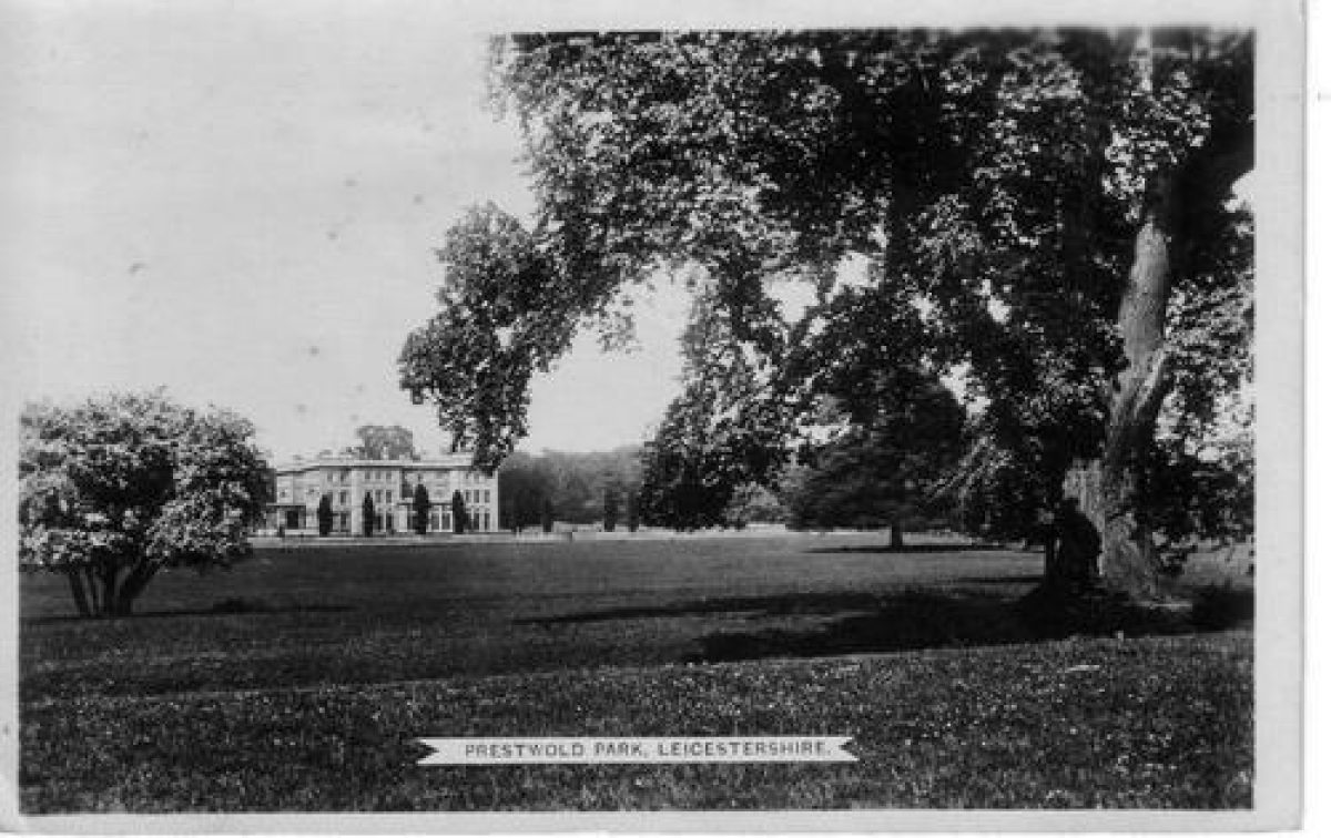
Prestwold Hall (listed grade I) represents a remodelling in 1842-4 by William Burn for C W Packe of an earlier, H-plan, building. It is of Ancaster stone, and is of three storeys with a balustraded parapet. The main, garden front is to the south, and is of eleven bays. It has two projecting three-bay wings, set between which and projecting still further is a columned conservatory of 1842-4. This has contemporary stone-edged raised beds and a stone-flagged floor, and is well planted. The entrance front is to the west, and again it has projecting three-bay wings by Burn who here added a porte cochere between them. Burn's work incorporated a dining room added in 1805 by William Wilkins the elder (d 1815). To the north is a stables and service range, partly C18 and remodelled c 1840 (listed grade II).
GARDENS AND PLEASURE GROUNDS
Running between the Hall and Prestwold Lane is Park Plantation, an ornamental wood with large numbers of mature specimen trees and an understorey of laurel and rhododendron. It was already present in the early C19 and may be part of the planting around Prestwold by C J Packe in the late C18 which was so commended by Nichols (1800, 355).
Prestwold's gardens lie principally to the south of the Hall, and represent the scheme devised in 1842 by Burn. Running along the south side of the Hall is the South Terrace, with a broad gravel walk which continues eastward, along the bottom of the East Lawn. South of the South Terrace are lawns and beds, all contained within a stone-balustraded parapet (it and associated features listed grade II). On the main axial line south from the conservatory the parapet has a bowed projection, while at the east and west ends of the path along the bottom (south) of the main lawn are stone bench seats. The beds themselves, arranged symmetrically about the central axis, are scalloped and arranged around central basins. Planted at points around the edges of the beds are cypress trees, some planted c 1880 and others c 1930.
The stone-balustraded parapet continues east to define the south and east boundaries of the East Lawn which extends for 100m east of the Hall. Running east from the Hall along a grass terrace which comprises the northern part of the East Lawn is a line of cedars, already in 1780 said to be of 'notable' size (CL 1959, 828). Behind (north) and parallel with them is a yew hedge. This was planted c 1910 to create a herbaceous border along the outer, south side of the walled kitchen garden. It is now a private family garden. To the west of the formal beds the stone-balustraded parapet continues almost to the churchyard. This area of the garden, between the churchyard and the west edge of the main lawn, is a lawn planted with shrubs and specimen trees, mostly coniferous and mature.
A path from the east side of the garden between the east wall of the walled garden and Icehouse Plantation leads to a woodland garden, the Wild Garden. This was developed, probably in the later C19, in the northern half of that plantation, and comprises flagged paths and steps winding though ornamental woodland and shrubs. Although still kept up as a woodland garden in 1959 it had long ceased to be so managed in the later 1990s. At the north-east corner of the garden is a ruinous icehouse.
Before Burn's reworking of the gardens c 1842 the Hall was set on an informal lawn with shrubberies and trees to north, east and west, and with the main entrance and gravel sweep to the south. This arrangement, probably established when the park was laid out c 1770, replaced that shown on an estate map of 1735. At that time there was a north/south alley-like walk between the south front of the Hall and the start of the south-east avenue. West of the walk was a square garden divided into quarters.
PARK
The Hall lies close to the centre of a roughly circular park 1km in diameter. The southern half of the park, overlooked from the Hall and the gardens to its south, is mainly open farmland. From the edge of the gardens the ground falls slightly for c 250m, to an open drain which curves from east to west across the park. About 100m south-west of the church is Church Pond, a square fishpond. North of the drain the ground rises, to Rookery Plantation and Old Wood which lie on the south and south-east edge of the park. New planting south of Rookery Plantation is intended to link it with Park Plantation, to complete the plantation belt around the southern half of the park. North of the Hall there are closes (eg Tomlins) with permanent pasture (some underlain with ridge and furrow) and some parkland trees (beech, horse chestnuts), some in clumps. In a declivity 300m north of the Hall are brick cowhouses of c 1900. About 150m north of the Hall is Laundry Cottage (listed grade II), a late C16 timber-framed building. This is the sole survivor of Prestwold village.
The park was probably laid out around the Hall about the time it was rebuilt, c 1760-70. The map of 1735 shows that at that date church and Hall lay south-east of a crossroads, with another road to Burton running from west to east c 400m south of the Hall. North of the Hall and around the village crossroads was the hamlet of Prestwold, then about a half-dozen farms. Earlier Prestwold was larger, and in 1595 comprised a dozen houses and cottages. The medieval village may have been larger still. Around the village were enclosed fields, the northern boundary of which corresponds fairly closely to the later park boundary. Beyond this to the north was Hoton Common and extensive open field land. Running across the farmland from the Hall were two straight avenues. One ran west for 2km to Cotes (named after the family's house near Huntingdon), another of the Packe's houses. The other ran south-east. These seem to have been removed when the park was created, along with the village and the surrounding closes. At the same time the old roads to Prestwold and from it to Burton were closed (although the road west from the crossroads was probably retained as the back drive) and the modern diversion (Prestwold Lane, Loughborough Road) created around the edge of the new park. Although no record has been found of imparkment it is this phase of improvement, dated by him to c 1770 onwards, which Nichols (1800, 355) alludes to when he speaks of how the then owner C J Packe had engaged in extensive planting to leave the Hall boosomed in calm serenity.
KITCHEN GARDEN
A rectangular brick-walled kitchen garden, 80m east/west by 50m north/south, lies 100m north-east of the Hall. In 1998 no glass survived and the interior was overgrown. A good range of brick sheds, perhaps mid C19, stands along the outside the north wall. Some 100m north-east of the garden is a brick gardeners cottage of the later C19.
The kitchen garden's perimeter walls were probably constructed when Prestwold was imparked, c 1770.
REFERENCES
J Throsby, Select Views of Leicestershire 1, (1789)
J Nichols, History and Antiquities of Leicester 3, part i (1800), pp 354-5 (4 volumes, in 8 parts, 1795-1811, reprinted 1971)
Gardener's Magazine 7, (1831), pp 426-7
Country Life, 125 (16 April 1959), pp 828-31; (30 April 1959), pp 948-51
M Girouard, The Victorian Country House (1975), pp 138-42
Maps
Survey of the Manor of Prestwold, 1735 (private collection), (copy in Leicestershire Record Office: PP276)
Prestwold, no date (early 19th century), (Ma/256/2), (Leicestershire Record Office)
OS 6" to 1 mile: Leicestershire sheet 18 NW, 1st edition 1887; 2nd edition 1905; 3rd edition 1922
OS 6" to 1 mile: Leicestershire sheet 11 SW, 2nd edition 1901; 3rd edition 1922
OS 25" to 1 mile: Leicestershire sheet 18.2, 1st edition 1885
Description written: July 1998
Edited: July 1999
- Visitor Access, Directions & Contacts
- History
The following is from the Register of Parks and Gardens of Special Historic Interest. For the most up-to-date Register entry, please visit the The National Heritage List for England (NHLE):
www.historicengland.org.uk/listing/the-list
HISTORIC DEVELOPMENT
The manor of Prestwold was purchased from the Skipwiths around 1653 by Christopher Packe, a London draper and partisan of Cromwell who in 1654 became Lord Mayor and was knighted. In 1656 he was summoned to the Upper House as Lord Packe. After his death in 1682 son followed father at Prestwold, successively being held by Christopher, Clifton, Charles and Charles James Packe (died 1816), who around 1760 rebuilt the Hall and soon after created the park around it. When C W Packe inherited Prestwold in 1837 he had an income of £11,807 from the 2,523 hectare estate. Five years later he called in the Scottish architect William Burn (died 1870) to remodel the Hall and lay out new gardens to its south. Packe (died 1867) and his wife had no children and the estate was entailed on his brother, Lt Col G H Packe. In 1998 the estate remained in private hands, with the Hall and grounds being used for corporate entertainment.
Rising above the shrubbery about 100 metres to the west of the Hall is the tower of St Andrew's church (listed grade II*), a medieval building largely rebuilt by Sir Arthur Blomfield (died 1899) in 1890.
Period
18th Century (1701 to 1800)
- Associated People
- Features & Designations
Designations
The National Heritage List for England: Register of Parks and Gardens
- Reference: GD1962
- Grade: II
Features
- Hall (featured building)
- Description: Charles James Packe (died 1816) rebuilt the Hall around 1760. The hall was re-modelled in the 1840s.
- Earliest Date:
- Latest Date:
- Parkland
- Key Information
Type
Park
Purpose
Recreational/sport
Principal Building
Domestic / Residential
Period
18th Century (1701 to 1800)
Survival
Extant
Hectares
110
Open to the public
Yes
Civil Parish
Prestwold
- References
References
- {English Heritage Register of Parks and Gardens of Special Historic Interest}, (Swindon: English Heritage, 2008) [on CD-ROM] Historic England Register of Parks and Gardens of Special Historic Interest