Introduction
Grimsthorpe Castle has a landscape park developed from a forest that was first recorded in the Domesday book in 1086. The forest was transformed into a landscape park in the 17th and 18th centuries. The Castle is set on a ridge running from north-west to south-east through the site, giving views to east and west.
Terrain
The Castle is set on a ridge running from north-west to south-east through the site, giving views to east and west.The following is from the Register of Parks and Gardens of Special Historic Interest. For the most up-to-date Register entry, please visit The National Heritage List for England (NHLE):
An early C16 park, with alterations by Lancelot Brown in 1771, forms the setting for a castle rebuilt in the mid C16 as a country house, surrounded by mid C19 and C20 gardens which contain traces of an early C18 layout by Stephen Switzer.
Location, Area, Boundaries, Landform and Setting
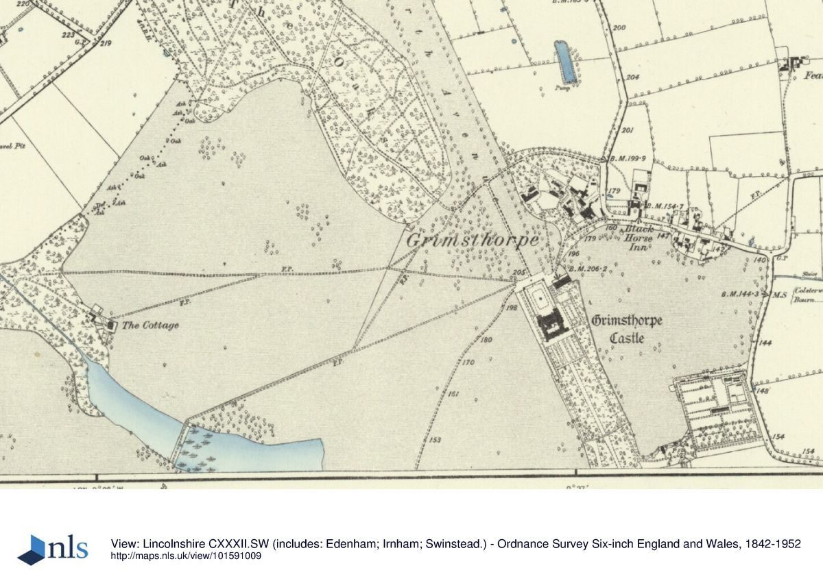
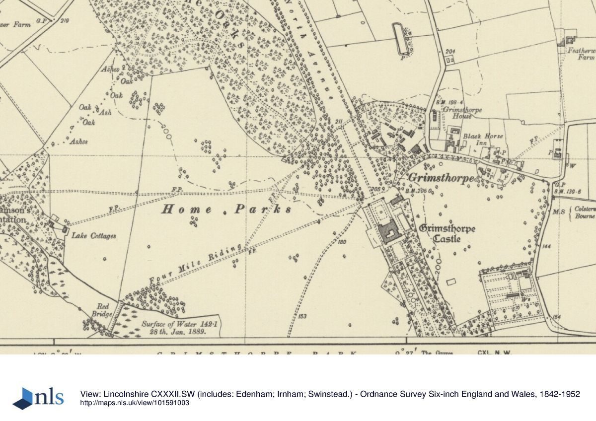
Grimsthorpe Castle occupies a rural setting c 18km south-east of Grantham, immediately to the west of the village of Grimsthorpe. The c 1000ha site is some 5.2km long and 1.8km wide. Its northern boundary is formed by the A151 while to the west, south, and east the site is bounded by farmland. The Castle is set on a ridge running from north-west to south-east through the site, giving views to east and west.
Entrances and Approaches
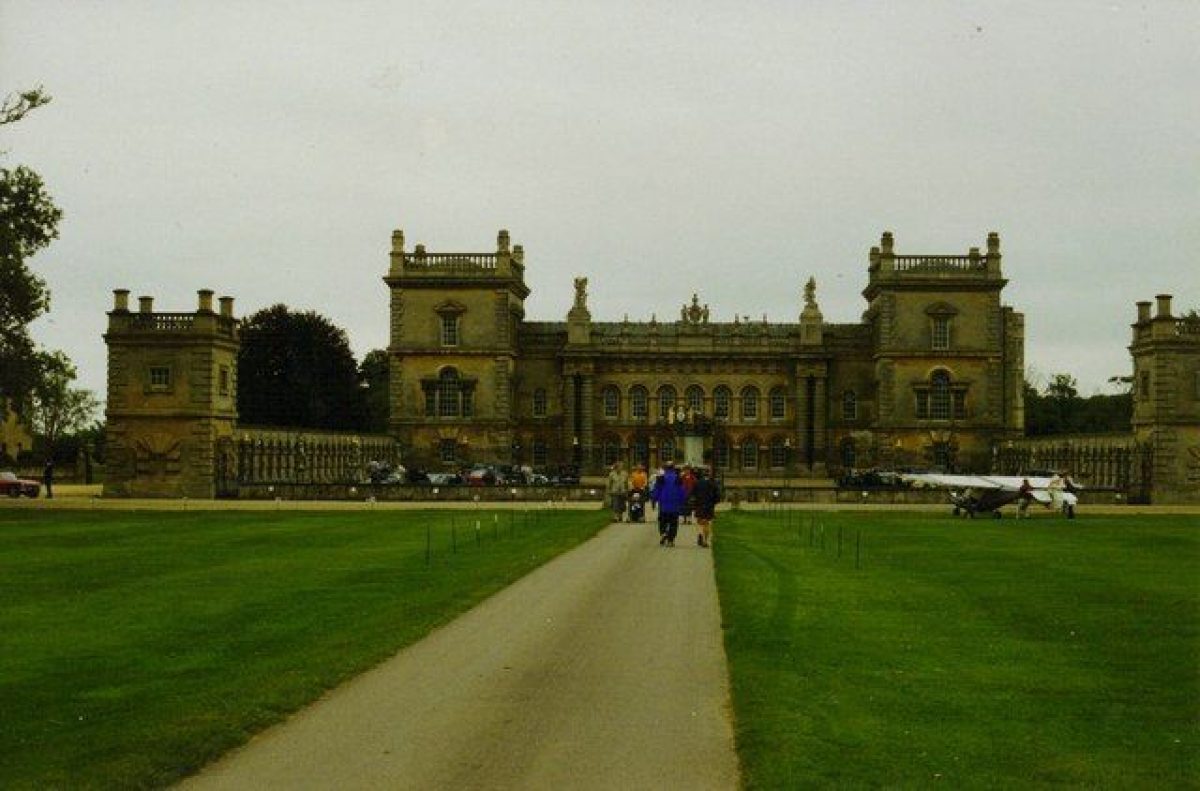
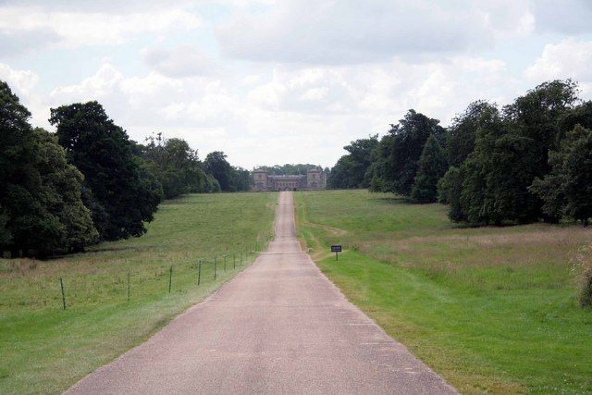
The present (2000) approach to the Castle is from the A151 to the north along the North Avenue. This replaces the entrance from the village of Grimsthorpe north-east of the Castle, which is marked by the limestone rubble and Collyweston slate Lodge Cottage (listed grade II). The drive, which runs south-east to the north-west front, was created to mark Queen Victoria's Jubilee in 1897. On the Kip and Knyff engraving of 1715 this approach is shown as a wide single avenue leading from an ornate gate at the north end. By 1745 it had become a double avenue of oak (Tycho Wing map).
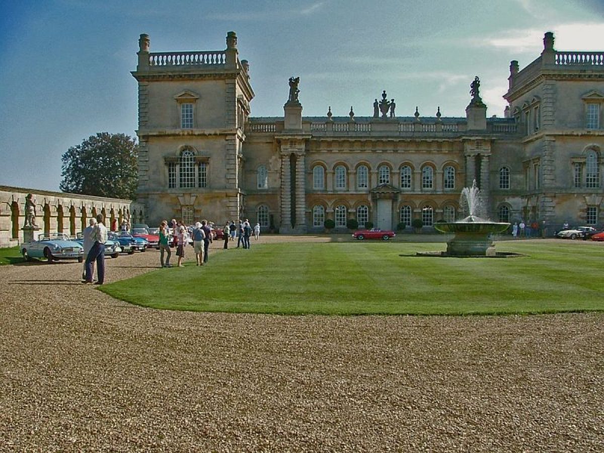
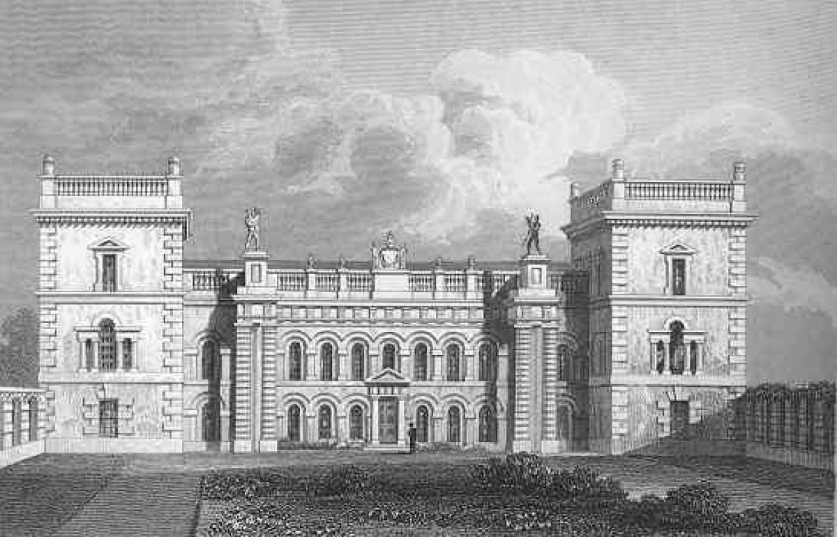
The main approach from the south (no longer in use) leads north past the site of a lodge, originally located c 4.5km south-west of the Castle but now (2000) gone. The drive runs north through parkland along Chestnut Avenue, around the southern end of the lake and across the park to the forecourt. Running parallel to Chestnut Avenue and slightly to the west is the Four Mile Riding, a C17 riding which crosses the northern end of the lake over Red Bridge to arrive at the forecourt below the north-west front. Chestnut Avenue was made the principal carriage drive in the 1830s by the twenty-first Baron Willoughby. The forecourt below the north-west front, designed by Vanbrugh, is enclosed by walls to the east and west and by ornamental gates flanked by railings to the north. Within the court a gravel path surrounds a grass plat with central fountain basin (C18, listed grade II). The rectangular court was the result of a reworking after 1799 of an earlier court laid out as part of Vanbrugh's alterations in the 1720s (Pardo 1991).
Principal Building
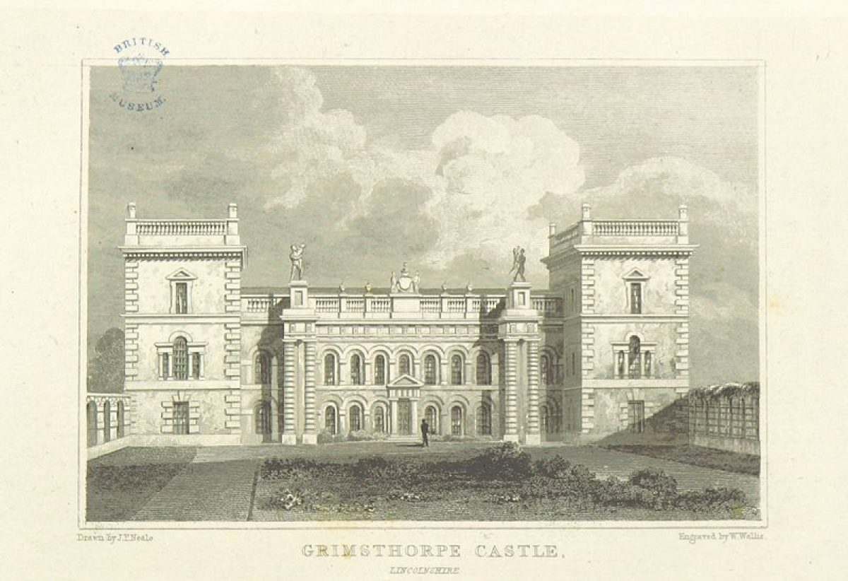
Grimsthorpe Castle (listed grade I) stands in the north-east corner of the site and is built to a quadrangular plan with angle towers of limestone ashlar with Collyweston and Welsh slate roofs. In the 1680s the fifteenth Baron Willoughby de Eresby commissioned the complete rebuilding of the north front in the Classical style, the architect possibly being William Winde or Robert Wright. Sir John Vanbrugh (1664-1726) was commissioned in 1715 to make further changes; work commenced in 1723 and was completed in 1730 by which time the north-west front had been redesigned and encased in stone. The Castle was remodelled in c 1811 and alterations were made in the early C20 by Detmar Blow (1867-1939).
The stable block, a former stables and riding school (early C17, alterations attributed to Vanbrugh, listed grade II), stands immediately north-east of the Castle. Built of ashlar and Collyweston slate, it is now (2000) converted to provide storage, two flats, and garages. The former coach house (early C18, possibly by Vanbrugh, listed grade II) stands in the estate yard c 300m north-east of the Castle, built of red brick with ashlar dressings under a pantile roof. This is now (2000) used as a conference centre and restaurant. The former laundry cottages (early C19, listed grade II) are also in the estate yard; these are now a private house and a nursery school.
Gardens and Pleasure Grounds
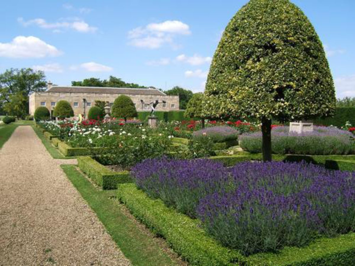
The gardens and pleasure grounds lie to the south-east, north-east, and south-west of the Castle. Below the south-east front is a paved terrace and lawn surrounded by a gravel path, along which at regular intervals stand stone ornaments (listed grade II*). Trees alongside yew hedges mark the north-east and south-west boundaries. Beyond the lawn to the south are two symmetrical topiary gardens, separated from each other by a broad grass strip and enclosed by yew hedges clipped into topiary shapes. The enclosures are laid out with cross paths of stone paving with a bust on a plinth in the centre of each garden. Half-moon beds planted with roses mark the junctions of the paths and hedges. Beyond the topiary gardens the central grass path continues south-eastwards through The Groves then turns south-westwards into Long Plantation. The layout of these gardens is mainly late C19, replacing a formal scheme designed by Stephen Switzer in the early C18 which itself represented the simplification of elaborate late C17 parterres. Elements of the early C18 gardens survive within The Groves.
The south-west gardens are entered through a gate with flanking stone gate piers set in a low stone wall abutting the west tower of the entrance court. From the gate a gravel path runs south flanked by long narrow lawns planted with Atlas cedars and a topiary yew hedge. The path continues down a short flight of stone steps. To the south-west of the path the lawn broadens out to form an upper terrace with a short flight of steps leading down to a lower terrace which is surrounded on three sides by a low stone wall. Parallel to the gravel path on the south-east side of the upper terrace is a grass path leading between low yew hedges to a bench at the south-east end. Beside the path are flower borders.
To the north-east of the Castle are gardens entered through cast-iron gates flanked by stone gate piers set in a low wall abutting the south-west end of the stables and north-east side of the forecourt. A gravel path leads south-east past a lawn, on the north-east side of which is a rectangular parterre garden with cross paths, low box hedges, roses, and standard hollies. To the south-east of the parterre is a large lawn bounded by yew hedges while to the north-east lies a rectangular walled Potager, designed by Lady Ancaster with John Fowler and input from Peter Coates between c 1960 and 1970 (Pardo 1991). To the south of the Potager a new area of garden has been established (late C20), partly incorporating some of the adjoining pasture within the garden. A lawn within yew hedges forms the north-west section of this new area and an avenue running to the south-west crosses the section to the south.
Park
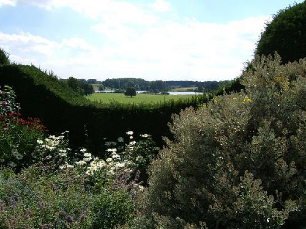
The park is made up of a series of lesser parks enclosed by woodland. North-west of the Castle is The Oaks, the site of a wilderness garden designed by Stephen Switzer and now (2000) woodland. West of the Castle is the c 80ha Home Parks, an area of undulating parkland to the south-west of which are two lakes, the Great Water and Red Bridge Pond. These are divided by Red Bridge, a causeway over the lakes. The Great Water occupies the site of seven canals illustrated on the Kip and Knyff engraving of 1715 which were still in place in 1745 (Tycho Wing map). Lancelot Brown's proposals for the park included changes to the lakes and a design for a sham bridge which was never executed but he was not responsible for the alterations to the landform and the creation of the lakes.
South-west of the lakes is Bishopshall, a piece of undulating parkland bounded to the south-west by Crow Wood and Bishopshall Wood. South of Bishopshall is a wooded valley known as the Vaudey, site of a Cistercian abbey, and beyond this lies Grimsthorpe Park which has an open aspect with a few scattered trees. To the south are areas of stone workings which have been grassed over (known as the Pots and Pans) and designated as an SSSI due to the importance of the limestone grassland habitat. Four Mile Riding and the Chestnut Avenue both run through this part of the park, continuing southwards through the scattered woodland of the c 420ha Deer Park to a rondpoint c 4.1km from the Castle where several others ridings converge. To the east of the Vaudey is a long piece of woodland known as Old Hills, beyond which lies Maize Hill, an area of parkland around several disused quarries. To the south is an area known as the New Park, which was an extension to the park designed by Lancelot Brown.
The parkland was recorded in the Domesday Book as having the greatest concentration of woodland in Lincolnshire (CL 1998). The Saxton county map of 1567 shows two parks separated by Vaudey Abbey; these were amalgamated in the mid C16 when the Duke of Suffolk purchased the Abbey. This formally designed park which was probably laid out in the early C17 for Robert, Earl of Lindsey is shown on the Kip and Knyff engraving. Lancelot Brown presented a plan for alterations to the third Duke of Ancaster in 1771, but if his proposals were implemented they were done by the estate staff (Stroud 1975).
Kitchen Garden
The square brick-walled kitchen garden lies c 300m to the south-east of the Castle and covers c 2.5ha. It is laid out with paths and beds and is now used (2000) as a tree nursery. The garden is entered by a cast-iron gate with flanking gate piers (listed grade II) beside the Gardener's Cottage (listed grade II*) which stands south-west of the kitchen garden. A further entrance lies on the Bourne Road, south-east of Grimsthorpe village, c 350m from the Castle. The walled garden first appears on Grundy's estate map of 1753. Glasshouses were erected in 1865 and a bothy in 1888.
Maps
- C Saxton, Map of Lincolnshire, 1567
- Tycho Wing, Estate map, 1745 (private collection)
- J Grundy, A plan of the house, gardens, park , waters, woods and other lands in his Grace's sum and occupation, 1753 (3 ANC 4/35A), (Lincolnshire Archives)
- Frederick Wood, Estate map, 1829-30 (private collection)
- Archibald Kennedy, Estate map, 1847 (private collection)
- OS 6" to 1 mile:
- 1st edition surveyed 1887, published 1888
- 2nd edition published 1906
- OS 25" to 1 mile: 1st edition surveyed 1886, published 1889
- 2nd edition published 1904
Illustrations
- Perspective view of the north front of Grimsthorpe House, the seat of his Grace the Duke of Ancaster (3 ANC 4/35A), (Lincolnshire Archives)
Description written: October 2000; Redrafted: May 2001 (EMP); Amended: April 2002
Register Inspector: CEB
Edited: May 2002
- Visitor Access, Directions & Contacts
Telephone
01778 591205Website
https://grimsthorpe.co.uk/Access contact details
For detailed visitor information visit the Grimsthorpe Castle website.
- History
The following is from the Register of Parks and Gardens of Special Historic Interest. For the most up-to-date Register entry, please visit the The National Heritage List for England (NHLE):
13th - 16th Century
Grimsthorpe Castle is of C13 origin and in 1516 Henry VIII granted the 'park of Grymsthorp' to William, tenth Baron Willoughby de Eresby (Chandler 1993). His daughter Katherine became eleventh Baroness in 1526 and her husband Charles Brandon, Duke of Suffolk rebuilt Grimsthorpe Castle in 1539.
17th - 19th Century
The Duchess of Suffolk's second marriage was to Richard Bertie and their grandson, Robert Bertie, became thirteenth Baron of Willoughby de Eresby and inherited the estate in 1601. He was created Earl of Lindsey by Charles I in 1626 and had the Four Mile Riding laid out in the park. His grandson, Robert Bertie, third Earl of Lindsey inherited the property in 1666 and undertook the complete rebuilding of Grimsthorpe in the classical taste and probably laid out gardens c 1680 (Pardo 1991). His son, Robert succeeded him to the estate and the title in 1701 and in 1711 commissioned Stephen Switzer (1682-1745) to lay out gardens. Robert was created Duke of Ancaster and Kesteven by George I in 1715, the same year that he commissioned Sir John Vanbrugh to aggrandise the castle.
The first Duke died in 1723 and was succeeded by his son, the second Duke, who carried out Vanbrugh's alterations between 1723 and 1730 (Knox 1996). Further alterations took place after the third Duke inherited in 1742 and in 1771 he commissioned Lancelot Brown (1716-83) to provide a design to update the park. The Duke died in 1778 and the dukedom became extinct in 1809. The baronetcy passed to Lady Priscilla Bertie who became twentieth Baroness Willoughby de Eresby (qv Gunby Hall). She married Sir Peter Burrell of Beckenham, later Baron Gwydir, and in c 1811 a thorough restoration of the Castle was undertaken.
20th Century
When Lady Priscilla's son, Peter Robert Burrell died in 1865 he was succeeded by his daughter Clementina. Her grandson, the twenty-fifth Baron Willoughby inherited the estate in 1910 and restored and modernised the Castle both before and after the First World War. During the Second World War the property was requisitioned by the army, after which further restoration work was undertaken by the twenty-sixth Baron who lived at the Castle until his death in 1982.
In 1978 he created a charitable trust to which he transferred ownership of the Castle and surrounding estate.
Period
- Post Medieval (1540 to 1901)
- Tudor (1485-1603)
- Associated People
- Features & Designations
Designations
The National Heritage List for England: Register of Parks and Gardens
- Reference: GD1976
- Grade: I
Features
- House (featured building)
- Description: The castle is a large quadrangular house set around a central courtyard. Each section of the house has a different appearance and architectural style reflecting the different periods of development and extension since the 13th century.
- Earliest Date:
- Latest Date:
- Topiary
- Lake
- Potager
- Description: Ornamental vegetable garden.
- Key Information
Type
Park
Purpose
Ornamental
Principal Building
Domestic / Residential
Period
Post Medieval (1540 to 1901)
Survival
Extant
Hectares
954
Open to the public
Yes
Civil Parish
Edenham
- References
References
- {English Heritage Register of Parks and Gardens of Special Historic Interest}, (Swindon: English Heritage, 2008) [on CD-ROM] Historic England Register of Parks and Gardens of Special Historic Interest
- Stroud, D., {Capability Brown} (London: Faber, 1975), pp. 144, 146-7 Capability Brown
- Turner, R. {Capability Brown and the Eighteenth-century English Landscape} (Chichester: Phillimore, 1999), pp. 127-30, 180 Capability Brown and the Eighteenth-century English Landscape
- Pevsner, N. and J. Harris, {The Buildings of England: Lincolnshire} (London: Penguin, 2nd edition 1989) The Buildings of England: Lincolnshire
- The Landscape Agency {Grimsthorpe Park Parkland Management Plan} (2012) Grimsthorpe Park Parkland Management Plan
- Kip, J, and Knyff, L., (1715) Nouveau Theatre de la Grande Bretagne
- Switzer S., (1718) Ichnographia rustica : or, the nobleman, gentleman, and gardener's recreation
- Young A., (1770), pp 83-6 A Six Months Tour through the North of England, volume 1
- (12 April 1924), pp 572-9; (19 April 1924), pp 614-21; (26 April 1924), pp 650-7; no 21 (21 May 1998) Country Life 55
- Thorold H, and Yates J., (1965) Lincolnshire, A Shell Guide
- Willis P (ed)., (1974), pp 24-7, pls 4a, 4b, 5a, 5b Furor Hortensis
- Pardo R., (unpub dissertation, Univ of York 1991) Grimsthorpe Castle
- Chandler J., (1993), pp 287-8 John Leland's Itinerary, Travels in Tudor England
- Knox T., (1996) Grimsthorpe Castle, a guidebook,
- Related Documents
-
CLS 1/1002/1
Parkland Managemennt Plan - Digital Copy
The Landscape Agency - 2010
-
CLS 1/1002/2
Parkland Managemennt Plan: Appendices - Digital Copy
The Landscape Agency - 2010
-
CLS 1/1002/1