

Introduction
Euston Park has gardens and pleasure grounds of 30 hectares set in a landscape park of 200 hectares. The park and gardens were originally laid out by John Evelyn for Lord Arlington in 1691. The site was modified between 1730 and 1748 by William Kent for the 2nd Duke of Grafton and again between 1767 and 1783 by Lancelot Brown for the 3rd Duke of Grafton.
There are specific opening days for the Hall Tours and Garden Access. For more details visit the Euston Hall website.
Terrain
The Hall sits on the east bank of the river just above the level of the flood plain with the pleasure ground to the south and the bulk of the park beyond it to the east.The following is from the Register of Parks and Gardens of Special Historic Interest. For the most up-to-date Register entry, please visit the The National Heritage List for England (NHLE):
A C17 pleasure ground laid out by Lord Arlington with advice from John Evelyn, with an C18 walled garden, all set in a landscaped park of medieval origins for which William Kent and Lancelot Brown produced schemes.
Location, Area, Boundaries, Landform and Setting
Euston Park lies on the A1088 Thetford to Stowmarket road which divides the west park from the rest of the site. The road follows the line of the Blackbourne river valley from which the land rises gently to east and west before flattening out on the higher ground. The landscape setting of the park comprises farmland with large fields and woodlands sitting on the edge of the Brecklands. The north boundary is made up of woodland belts with the model village of Euston in the north-west corner. To the east the registered site is bounded by the remains of the once extensive Fakenham Wood and to the south and west by arable farmland. The west lodge sits on high ground overlooking the river valley and as well as forming an eyecatcher from the Hall also offers a place to enjoy fine views west along the Duke's Ride and back across the park past the Hall and up to the continuation of the Ride to the east. The Hall sits on the east bank of the river just above the level of the flood plain with the pleasure ground to the south and the bulk of the park beyond it to the east. The Temple is the most striking eyecatcher, being seen from various points in the pleasure ground and most notably from the church, whilst other notable views include the park glimpsed between The Temple and the church, and the south park seen through the long vista down the pleasure ground.
Entrances and Approaches
There are two main approaches to the registered site today (1998). One is from Euston village in the north, through simple gates, along a drive which runs south then turns west to the stable block on the north side of the Hall. The drive continues as a grass track before turning west in front of the Hall to approach the King Charles Gate (listed grade II) - a pair of late C17 baroque gates attributed to Samwell, which were moved here from the walled garden. The Triumphal Arch and Lodge (listed grade II) are situated on the west boundary of the registered site marking the point where the Duke's Ride leaves the park. They are dated 1758 (date on the building) and are single-storey, white-brick buildings joined by a high arch with triangular pediment above curves, the design of the whole being originally Kent's, the building being remodelled during the early C19. The Arch marks the original entrance to the park and leads to a grass track down through the west park which crosses the A1088 and enters the grounds of the Hall at what is now the second main approach over a river bridge to arrive at the stables on the north side of the building.
Principal Building
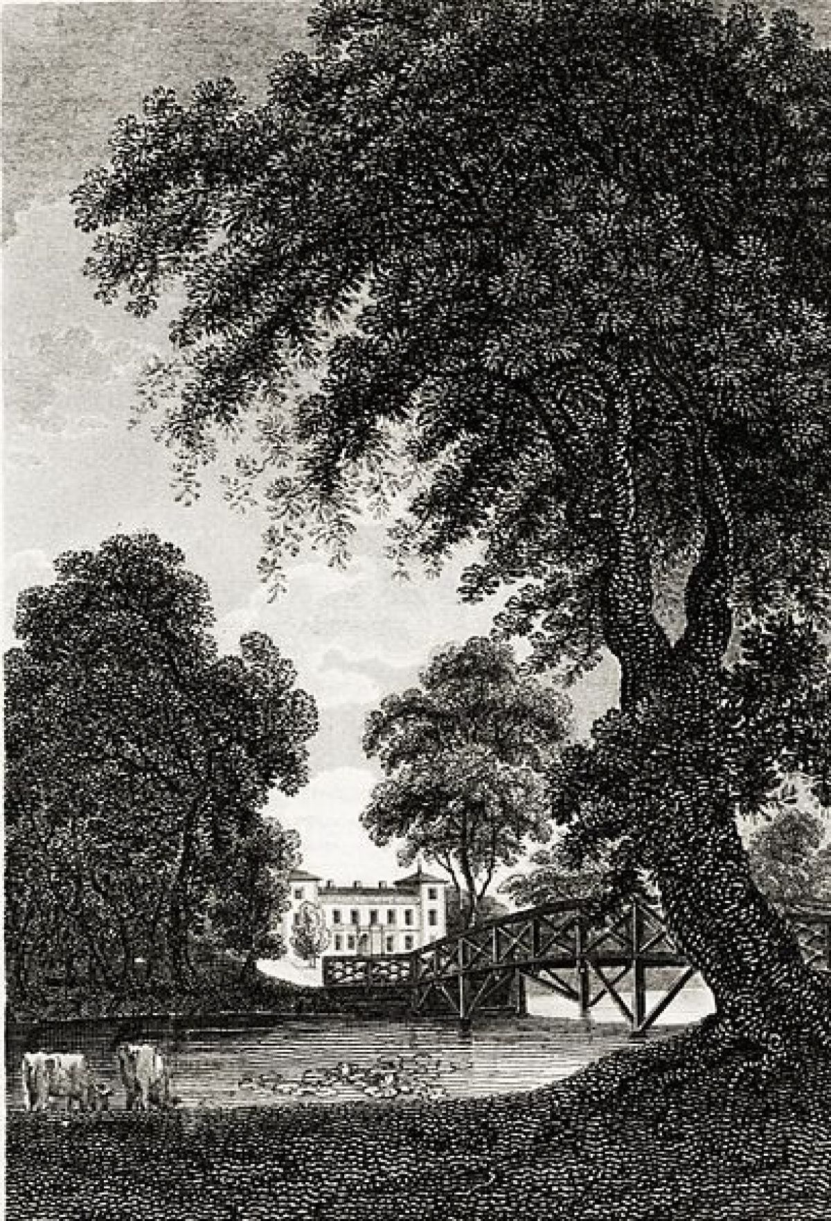
Euston Hall (listed grade II*) is a red-brick building situated c 150m from the east bank of the River Blackbourne in the north-west corner of the registered site. It has two storeys with attics and three-storey corner turrets capped by low pyramidal roofs. The north front is Georgian and has nine bays with sash windows and a central single-storey porch. What stands is all that remains of the Georgian mansion designed by Matthew Brettingham between 1750 and 1756 which incorporated Lord Arlington's 1660 mansion, itself overlaid on an earlier manor house. John Evelyn described the mansion in 1671 as 'a noble pile, consisting of four pavilions after the French' (Dymond). These pavilions were the angle turrets which Brettingham retained in his C18 remodelling, replacing their domed roofs with pyramidal ones after the style of Holkham Hall in Norfolk (qv). A fire in 1902 destroyed all but the north wing and a proportion of the west wing, and although the damaged wings were rebuilt in 1905, the rebuilt sections lasted only fifty years, being demolished in 1952 leaving the remains of the Brettingham house as the present Euston Hall.
To the north of the Hall is the stable block (listed grade II*). This range is of late C17 origin and has red-brick walls with steeply hipped slate roofs. The roof has a cupola with clock faces to north and south and an open upper storey with tented ogee roof. An open archway leads through the building from north to south and the whole looks north over an area of lawn planted with specimen trees.
Gardens and Pleasure Grounds
The garden and pleasure ground attached to the Hall lie to the south and east and cover c 31ha. The garden comprises a small terrace to the south with herbaceous borders. To the east are lawns with specimen trees between the Hall and King Charles Gate. The wooded pleasure grounds are contained by a ha-ha and lie to the south of the Hall. Grass rides and vistas are cut between the trees which include many species and varieties of deciduous trees planted together with pines, cedars and yew. The layout is the work of John Evelyn who stayed at Euston for two weeks in the year 1671 and recorded the event in his diary. To the west of the woods a weir directs water from the river into the 2km long Broadwater with its central island, said to have been created by Lancelot Brown in c 1761 (Popham 1995). The island is linked by a vista through the trees back to the Hall. The grass to the west, between the Hall and the river, contains earthwork traces of the late C17 canal, which had been abandoned by 1731 (Dymond 1995). At the north end of the river, c 50m beyond the bridge which carries the west drive, is a castellated late C18 water mill sitting on the east bank. The mill (listed grade II) is built of red brick with a black-glazed pantile roof and gothic windows and it is thought to have replaced an earlier C17 water mill on the same site.
Park
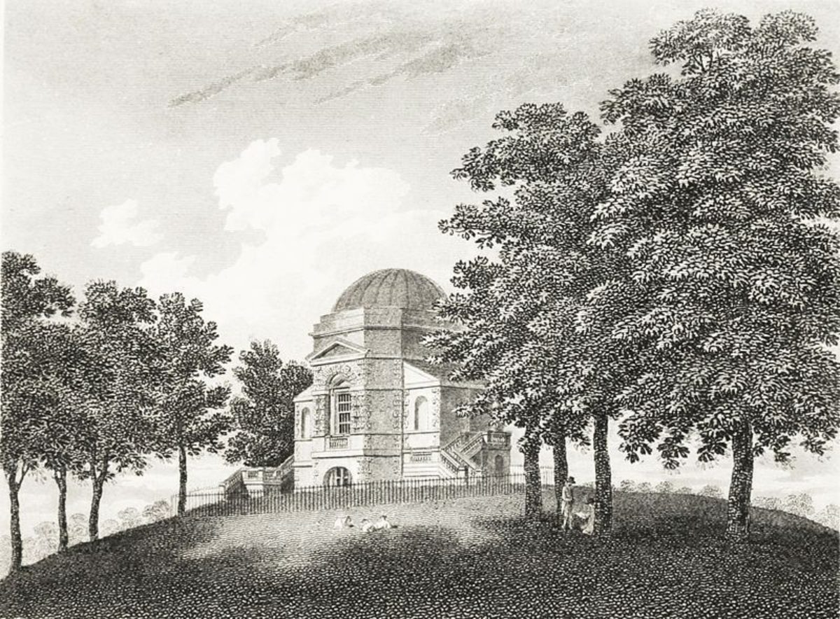
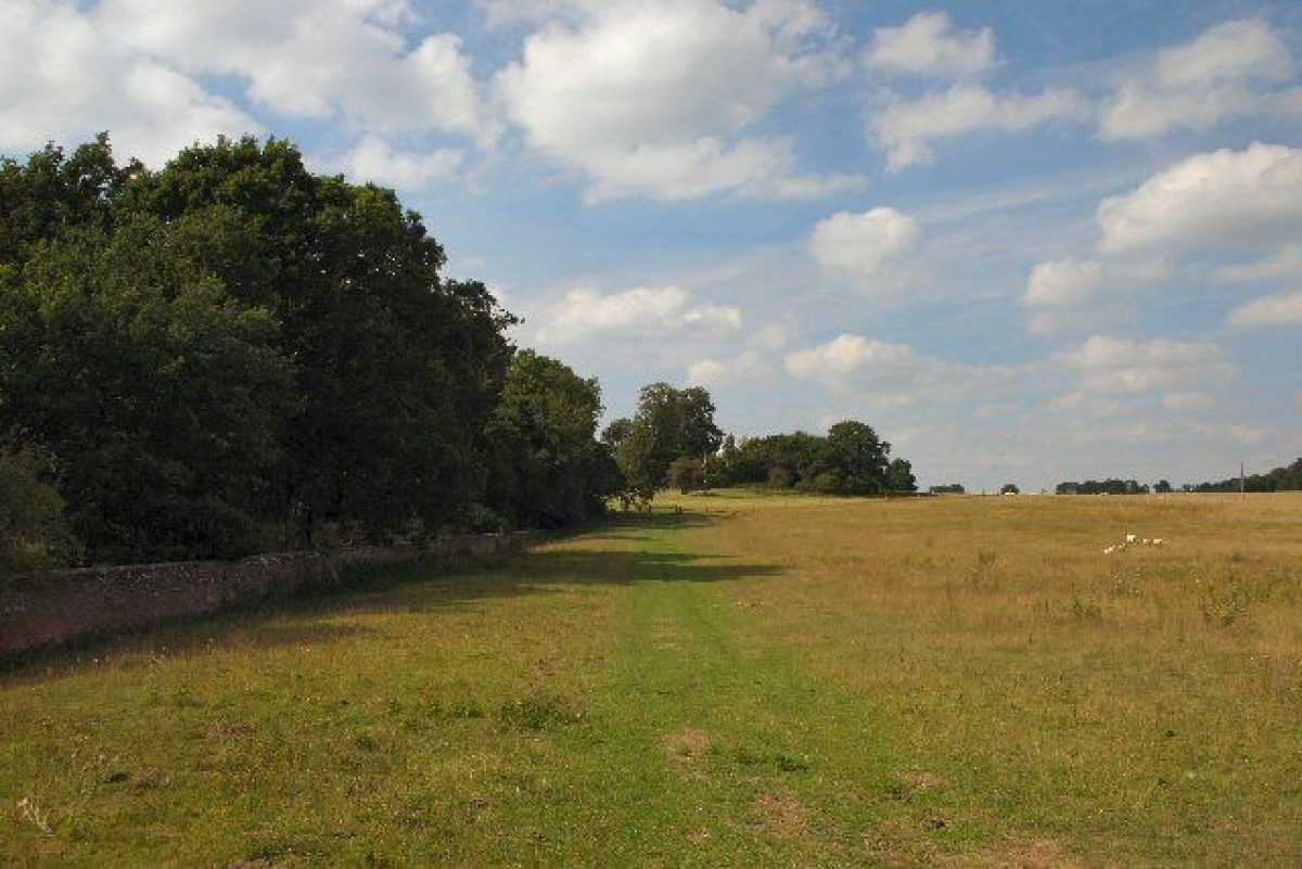
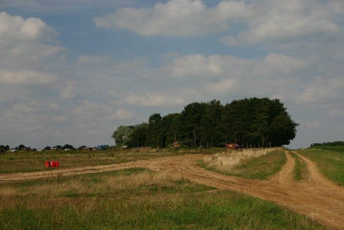
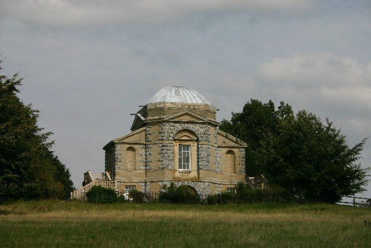
The park covers c 512ha, the area being divided by the road into the west or New park and the main east and south park. The west park is laid to grass scattered with a few individual trees and two clumps of beech and lime, the remains of clumps originally proposed by Kent. The tree planting around the lodges on the western boundary is by Brown and beyond the Arch lies the western section of Lord Arlington's C17 Duke's Ride which marches out across the landscape as a grass ride lined by lime trees. The east park is now (1998) arable beyond Rubbinghouse Spinney to the east and below Temple Bottom to the south. In these arable areas tree clumps from the Kent period have been retained. The remainder of the east park on the rolling slopes down towards the pleasure grounds is under pasture, scattered with individual trees and some clumps, also mostly dating from the Kent period. The area is now (1998) defined by a series of linear tree belts planted in the mid C20. The Duke's Ride continues 500m east of the Hall, out through the park and across the wider landscape. Approximately 700m south-east of the Hall, on high ground, stands The Temple (listed grade II*). It is built of white brick with stone dressing, cornice and pediment, with a domed roof over a triangular pediment and was designed in 1746 by William Kent in the Palladian style for the second Duke of Grafton. The Temple is framed by tree clumps designed to enhance the size and style of The Temple and to manipulate the view to and past it into the south park. Approximately 200m south-east of the Hall on the edge of the pleasure ground lies St Genevieve's church (listed grade I), rebuilt by Lord Arlington in 1676 on the foundations of a medieval church. It has a rendered exterior with stone quoins and dressings and a slate roof. The classical style of the building is used to effect as a feature in the park, being surrounded only by a low brick wall to allow views to and from the building back to the Hall, up to The Temple and out across the park.
Kitchen Garden
The walled kitchen garden lies c 100m north of the Hall and in all covers c 2ha. It comprises the remains of several walled enclosures of red-brick sited around the early C17 picturesque gardener's house (listed grade II). Extending south from the north-east corner of the gardener's house is a high C18 brick garden wall with an opening to the west where the King Charles Gate once stood. From this wall further walls run west towards the river, creating garden compartments open on the river side which are now grass but which once housed flower and rose gardens. To the north and north-east of the gardener's house is a further walled enclosure, divided into three compartments, the westernmost of which is also open to the river. These compartments are mostly used for the growing of fruit and vegetables and partly for sheep grazing (1998). The glass is modern and there are no remains of earlier plantings. Beyond the kitchen garden wall to the north is a c 2.5ha grass paddock.
Maps
- Mr Brown and J Parker, Map of lands in Euston, Fakenham and Reymer, 1772 (Estate office)
- J Hodskinson, The County of Suffolk, 1783 (West Suffolk Record Office)
- J Lenny, Survey of Euston Hall estate, 1828, (Estate office)
- J Lenny and G Croft, Map of Euston with Lt Fakenham and Reymer, 1836 (373/27B), (West Suffolk Record Office)
- Tithe map, 1837 (T86/1 & 2), (West Suffolk Record Office)
- OS 6" to 1 mile:
- 1st edition published 1887
- 2nd edition published 1905
- OS 25" to 1 mile: 2nd edition published 1905
Archival items
- Pridaux drawings of the gardens, c 1716 (private collection)
- The majority of the Euston estate archives are held in a private collection.
Description written: December 1998 Amended: May 1999; February 2004
Register Inspector: EMP
Edited: December 1999
- Visitor Access, Directions & Contacts
Telephone
01842 766 366Website
https://www.eustonhall.co.uk/Access contact details
There are specific opening days for the Hall Tours and Garden Access. For more details visit the Euston Hall website.
- History
The following is from the Register of Parks and Gardens of Special Historic Interest. For the most up-to-date Register entry, please visit The National Heritage List for England (NHLE):
11th Century
In 1087 Euston appears in Domesday as a manor belonging to the abbey of Bury St Edmunds and the manor house stood on the site of the present Hall.
17th Century
In 1666, Henry Bennet, later Earl of Arlington, purchased the estate and remodelled the Elizabethan hall into a grand mansion in the French style (guidebook). With his wealth and power he not only built a house of palace proportions, but also developed a 33ha pleasure ground with the help of John Evelyn (1620-1705) comprising walks, clipped hedges, radiating allées and a canal between the mansion and the River Blackbourne (Dymond 1995). In 1671, Arlington received a licence to impark 2000 acres (c 830ha) and again with Evelyn he developed the park for hunting and growing trees. He planted a huge straight avenue known as The Duke's Ride running west to the gates of Euston Hall.
18th Century
Lord Arlington's daughter married Henry FitzRoy, first Duke of Grafton, and during the 1730s and 1740s their son, the second Duke, commissioned William Kent to prepare designs to remodel the mansion and to embellish the park in the new style. In the event it was Matthew Brettingham's designs for the mansion which were carried out between 1750 and 1756, but Kent's schemes for the park were followed, including the building of The Temple in the east park and the Triumphal Arch or West Lodge in the newly extended west park. Kent also provided planting proposals for the east, west and south sections of the park. The third Duke brought in Lancelot Brown (1716-83) between 1767 and 1769 to further improve the landscape. Although Brown's work is not precisely recorded he is thought to have been responsible for the serpentine Broadwater in the pleasure grounds.
19th Century
During the C19 the park was further modified by successive dukes - new clumps were planted in the south park in 1837 and 1841 and the perimeter belts were strengthened.
19th - 21st Century
In 1902, during the time of the seventh Duke, a fire destroyed the west and south wings of the mansion. These were rebuilt in 1905 but the house was ultimately reduced in 1952, leaving only the north, and part of the west, wings. The tenth Duke succeeded in 1936 and the site remains in private ownership.
- Associated People
- Features & Designations
Designations
The National Heritage List for England: Register of Parks and Gardens
- Reference: GD1068
- Grade: II*
Features
- Temple
- Description: The Temple, situated in the East Park and forming an eyecatcher from many areas of the estate.
- Earliest Date:
- Latest Date:
- Folly
- Description: The Triumphal Arch or West Lodge situated on high ground in the West Park.
- Earliest Date:
- Latest Date:
- House (featured building)
- Description: The house was re-modelled in the 1750s and partly re-built in 1905 after a fire in 1902. The size of the house was reduced in 1952.
- Earliest Date:
- Key Information
Type
Park
Purpose
Ornamental
Principal Building
Domestic / Residential
Survival
Extant
Hectares
200
Open to the public
Yes
Civil Parish
Euston
- References
References
- {English Heritage Register of Parks and Gardens of Special Historic Interest}, (Swindon: English Heritage, 2008) [on CD-ROM] Historic England Register of Parks and Gardens of Special Historic Interest
- Stroud, D., {Capability Brown} (London: Faber, 3rd edition 1984), p. 224 Capability Brown
- Harris, J., {The Artist and the Country House} {London: Russell Chambers, 1979), p. 36 The Artist and the Country House
- Pevsner, N. and E. Radcliffe, {The Buildings of England: Suffolk} (Harmondsworth: Penguin, 1975), p. 202 The Buildings of England: Suffolk
- Historic Land Management {Euston Park and Garden Conservation Management Plan} (2011) Euston Park and Garden Conservation Management Plan
- (10 January 1957), p 58; (17 January 1957), p 102; (24 January 1957), p 148 Country Life, 121
- Hussey, C., (1957) English gardens and landscapes 1700-1750
- Hunt, J D., (1987), pp 135, 164 William Kent: landscape garden designer
- Popham, J., (3 vols), (1995) Euston Estate Landscape Management Plan
- Dymond, D., (in Popham 1995) Euston Park, guidebook, (nd) The history of the evolution of Euston Park
- Related Documents