
Introduction
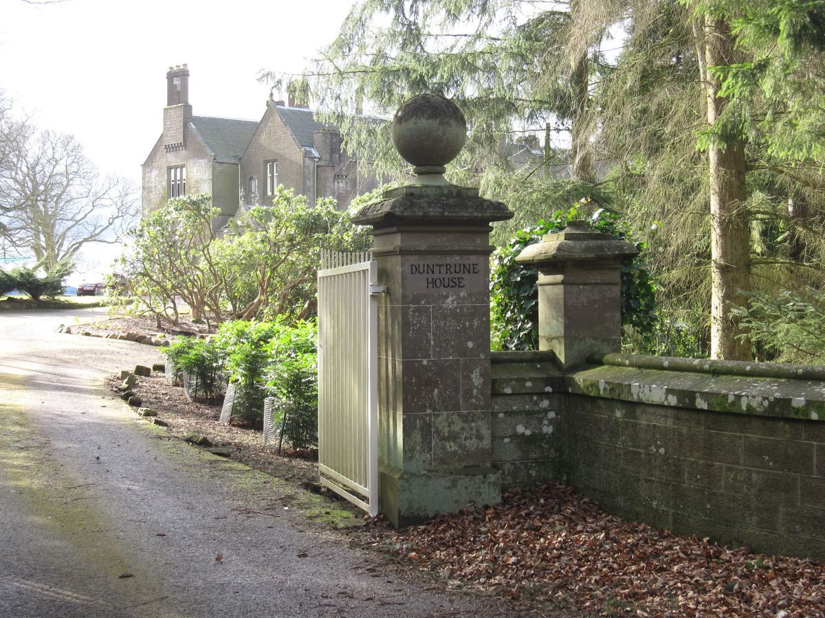
Duntrune House is situated about 15 kilometres north east of Dundee with panoramic views over the Tay Estuary and Fife Hills.
Further details about Duntrune House are available on the Royal Commission on the Ancient and Historic Monuments of Scotland website http://canmore.rcahms.gov.uk/en/site/338573/details/duntrune+house/
REFERENCES
1. MAPPED SOURCES
Timothy Pont (Pont 26) Lower Angus and Perthshire east of the Tay, imprint 1583-96 Duntrune appears as ‘Duntruyn Lds Ogilvy'
1678 Robert Edward Angusia Provincia Scotiae sive The Shire of Angus
1732 Herman Moll The Shire of Angus or Forfar
1747 - 55 Roy Military Survey of Scotland (Highland)
1776 George Taylor and Andrew Skinner, Survey and Maps of the Roads of North Britain or Scotland
1974 John Ainslie, Map of the County of Forfar or Shire of Angus (South East Section)
1832 John Thomson, Northern Part of Angus Shire. Southern Part from John Thomson's Atlas of Scotland
1850 James Knox, Map of the Basin of the Tay, including the greater part of Perth Shire, Strathmore and the Braes of Angus or Forfar
Ordnance Survey 25 inch First Edition, Forfarshire Sheet L15 (and L11), Surveyed 1857-62 Published 1865
Ordnance Survey 6 inch First Edition, Forfarshire Sheet L Survey 1858 Published 1865
Ordnance Survey One-inch to the Mile Maps of Scotland 1st Edition 1856-1891Sheet 49 Arbroath, published 1888
Ordnance Survey 1 inch Second Edition Sheet 49 Arbroath Revised 1894 Published 1896
Ordnance Survey 25 inch Second Edition & Subsequent Editions ForfarshireSheets 050.11 & 050.15 Revised 1900 Published 1902Sheets 050.11 & 050.15 Revised 1921 Published 1922
Ordnance Survey 1 inch Second Edition Sheet 49 Arbroath with Coloured Parishes Published 1904
Ordnance Survey 6 inch Second and Later Editions Forfarshire Sheet L.SE Revised 1900 Published 1903Sheet L.SE Revised 1921 Published 1923
Ordnance Survey 1 inch Third Edition Sheet 49 Arbroath Revised 1904-5 Published 1907
1912 John Bartholomew Plate 36 DunkeldFrom the ‘Survey Atlas of Scotland'
Ordnance Survey 1 inch "Popular" Edition Sheet 57 Forfar and Dundee Revised 1925-6, Published 1927. With National Grid 1945-47
Ordnance Survey 1 inch Seventh Series Sheet 50 Forfar Revised 1954, Published 1961
2. PRIMARY & DOCUMENTARY SOURCES
Charter of Robert I King of Scots to Walter de Morthington, in Lost Rolls VIII, (undated but probably around 1324 or later). This charter is indexed in the Registrum Magni Sigilli Regum Scotorum, AD 1306-1424 (New edition, Ed J.M.Thomson, printed Clark Constable, Edinburgh 1984) in Appendix 2, Index A, number 447 and in Index B, number 71. Bond by Alexander of Ogilby of Duntrone to David of Ogilby of Inchmartyne 18 May 1462. National Archives of Scotland (NAS) GD 26/3/999
Bond of renunciation by Silvester de Rettray of that ilk. and Margaret de Ogilvy sister of deceased Alexander to David Ogilby of Inchmartyne of lands of Duntroon 18 Mar 1475. NAS GD 26/3/1002. Instrument of ratification by Alexander Ogilby son and apparent heir of David Ogilvie….of disposition to his natural son David Ogilvy of the lands of Duntrone 6 August 1480. NAS GD 26/3/1006. Extract Contract, John Scrymgeour of Glasswell..and Henry Ogilvie of Duntrone to sell to Henry Ogilvie a tenement of land in Seagate. 29 Sep 1586. NAS GD 30/323.
Henry Ogilvy, son of Henry Ogilvy of Duntrune sells the Seagate tenement to Captain Alexander Wishart 18 Dec 1591-1592. NAS GD 30/329. Marriage contract between Sir William Graham of Claverhouse, George his eldest son and Walter of Duntrune, his second son, on the one hand, and David Guthrie of that Ilk, Alexander Guthrie of Kincaldronne, his eldest son, and Elizabeth, or Bessie, his daughter, on the other 27 Apr 1630. University of Dundee (UoD) Archives MS 57/1/2/2. Contract of Sale by Sir John Scrymgeour of Dudop to Sir William Graham of Claverhouse, Mr George Graham fiear thereof and Walter Graham fiear of Duntrune his son of the lands of Mylntoun of Craigie..also the tiends of Duntrune in the parish of Dundee. 1633. (NAS) GD 137/873. Assignation by James Viscount Dudhope to Walter Graham of Duntrune of all tacks or tiend sheaves granted to him or his late father ..and of the teind sheaves or parsonage sheaves of the lands of Duntrune. 12 and 20 Jan 1644. NAS GD 137/3995 and/3996. Registered tack by James Viscount Dudhope to Walter Graham of Duntrune of the teind sheaves of Duntrune. 20 Jan 1644, copied 1735. UoD Archives MS 57/1/5. Charter of James Fairweather in favour of James Graham of the lands of Duntrune 7 July 1735 (in Latin) mentions houses, grain mill, gardens, apple orchards, dovecots, crofts and pendicles. UoD Archives MS 57/1/15. Captain Alex Graham 13 Sep 1757/1758 UoD Archives MS 57/1/8. David Graham and son Alexander 28 Oct 1758. UoD Archives MS 57/1/9.
Plan of Duntrune Estate, 1760. Title “A plan of the estate of Duntroon the property of Captain Alexander Graham” by John Holden Scale 1” = 5 chs. Estate plan coloured to show field boundaries. Names of adjacent lands. Table of contents giving names of fields and acreages. Elevations of (?) Duntrune House and of cottages at Muirhouses. NAS RHP 141329. http://www.scotlandsplaces.gov.uk/record/nrs/RHP141329/plan-duntrune-estate-angus/nrs Renunciation of the Mill of Duntrune with the land by Andrew Butchart of Duntrune in favour of Alexander Graham Esquire.1776. UoD Archives MS 57/1/4/6. Mrs Amelia Stirling Graham 26 July 1805 UoD Archives MS 57/1/10. Estate plan of Duntrune by William Ireland, Landsurveyor 1805 scale 1”= 5 chs. Dimensions 790x250. Title ‘Plan The Estate of Duntrune The property of (Blank) Surveyed and planned by William Ireland landsurveyor 1805’. Annotated ‘Dundee 9th October 1812. This is the plan referred to in the Decreet Arbitical pronounced by us for dividing the Estate of Duntrune and figured from (?) of this date’. UoD Archives MS 57P/5. Inventory of Writs referred to in the Disposition of the Fourth Part of the Land of Duntrune and others by Mrs Clementina Graham or Drummond to Miss Alison Graham, 1812. UoD Archives MS 57/1/4 (1).
Extract of Decreed Division of the Valued rent of Duntrune 1816. Estate divided between Mrs Amelia Stirling Graham and her son William Stirling Graham, Miss Alison Graham and David Blair. The farm of Craighill became the possession of David Blair. UoD Archives MS 57/1/4/3. Rental of the Estate of Duntrune exclusive of mansion house, garden, woods and shootings, 1892. Lists rentals of farms, pendicles, houses, cottages, shop, smithy, quarries, grass parks. Gives an idea of the extent of the estate at this date. UoD Archives MS 57/1/5(11). Letter to Mr Ogilvie about the planting scheme at Duntrune, 9 November, 1911. Gives details of choice of trees for different locations around the mansion house. UoD Archives MS57/1/8/6. Photocopied Hand drawn tracing of map featuring Duntrune House, Hill and sawmill. N.d. Digital image. UoD Archives MS 57/1/8/28. National Library of Scotland Inventory Acc.10742 Royal and historical autographs, has an entry number 13, ‘Volume of papers, 1587-1823, of the Grahams of Duntrune, including documents concerning John Graham of Claverhouse, 1st Viscount Dundee’. This acquisition is the collection of papers which was made by J.E.Lacon and shown to A.J.Warden when he visited Duntrune during the writing of his history of Forfarshire (reference in Bibliography section B4). Note: a. The on-line index to University of Dundee (UoD) Archives lists 9 pages of manuscript material relating to Duntrune. Many entries contain several manuscripts. Only those which seemed relevant to the estate of Duntrune and the succession of owners have been listed above http://www.dundee.ac.uk/archives/
The National Archives of Scotland (NAS) or National Records of Scotland (NRS) also contain around 40 entries under ‘Duntrune’ http://www.nas.gov.uk/ Note b: The Estate Plan of Duntrune held in the National Archives of Scotland (entry 14, above) has been digitized and can be seen online on the ‘Scotland’s Places’ website http://www.scotlandsplaces.gov.uk/record/nrs/RHP141329/plan-duntrune-estate-angus/nrs
3. HISTORICAL ILLUSTRATIONS & PICTORIAL SOURCES
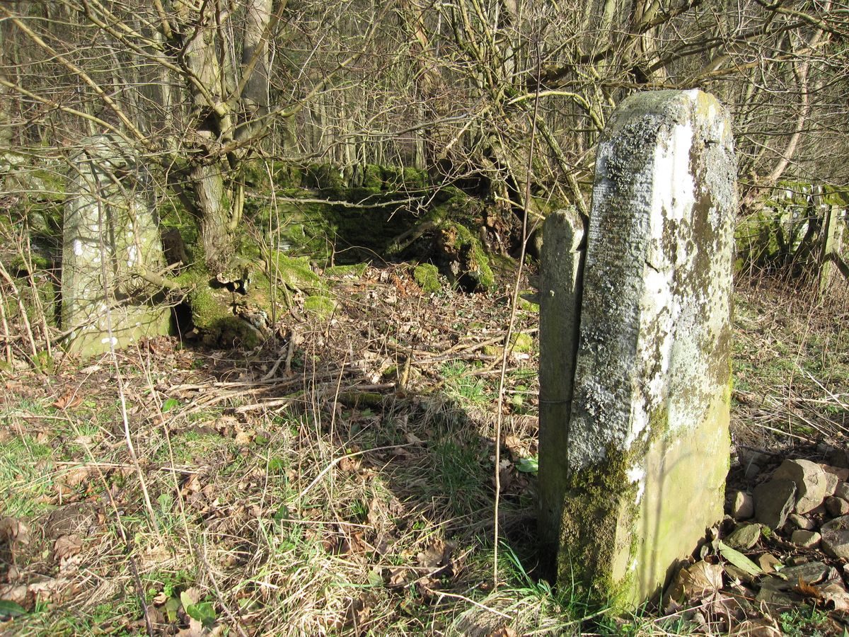
Gershom Cumming ‘Forfarshire Illustrated being views of Gentlemen’s seats, antiquities and scenery in Forfarshire with descriptive and historical notices’, end papers at back of book. Published Gershom Cumming Engravers 37 Reform Street Dundee, 1843 and 1848, with similar title. RCAHMS Canmore ID 159489, Burnside of Duntrune Mill Dam, digital image available
on-line http://canmore.rcahms.gov.uk/en/details/502383/RCAHMS Canmore ID 159492, do. Sluice, digital image available on-line http://canmore.rcahms.gov.uk/en/details/502384/
RCAHMS C12704 : Duntrune House, modern copy of historic photograph 16.6.1894RCAHMS AND 15/1 to AND 15/10P : Photographic copies of William Burn floor plans of Duntrune House (1826) Charles McKean and David Walker ‘Dundee, an Illustrated Architectural Guide’, 155.
The owners of the main wing own a copyright aerial photograph which shows the mansion house, garden and steading in 1967, when the walled garden was under cultivation and the steading was in use.
Google images contain several pictures of Duntrune House.
Duntrune House has its own website http://duntrunehouse.co.uk/
4. BIBLIOGRAPHY OF PUBLISHED SOURCES
Connachan-Holmes, J.R.A. 1995 Country Houses of Scotland Isle of Colonsay, Argyll PA16 7YP, House of Lochar, 160.
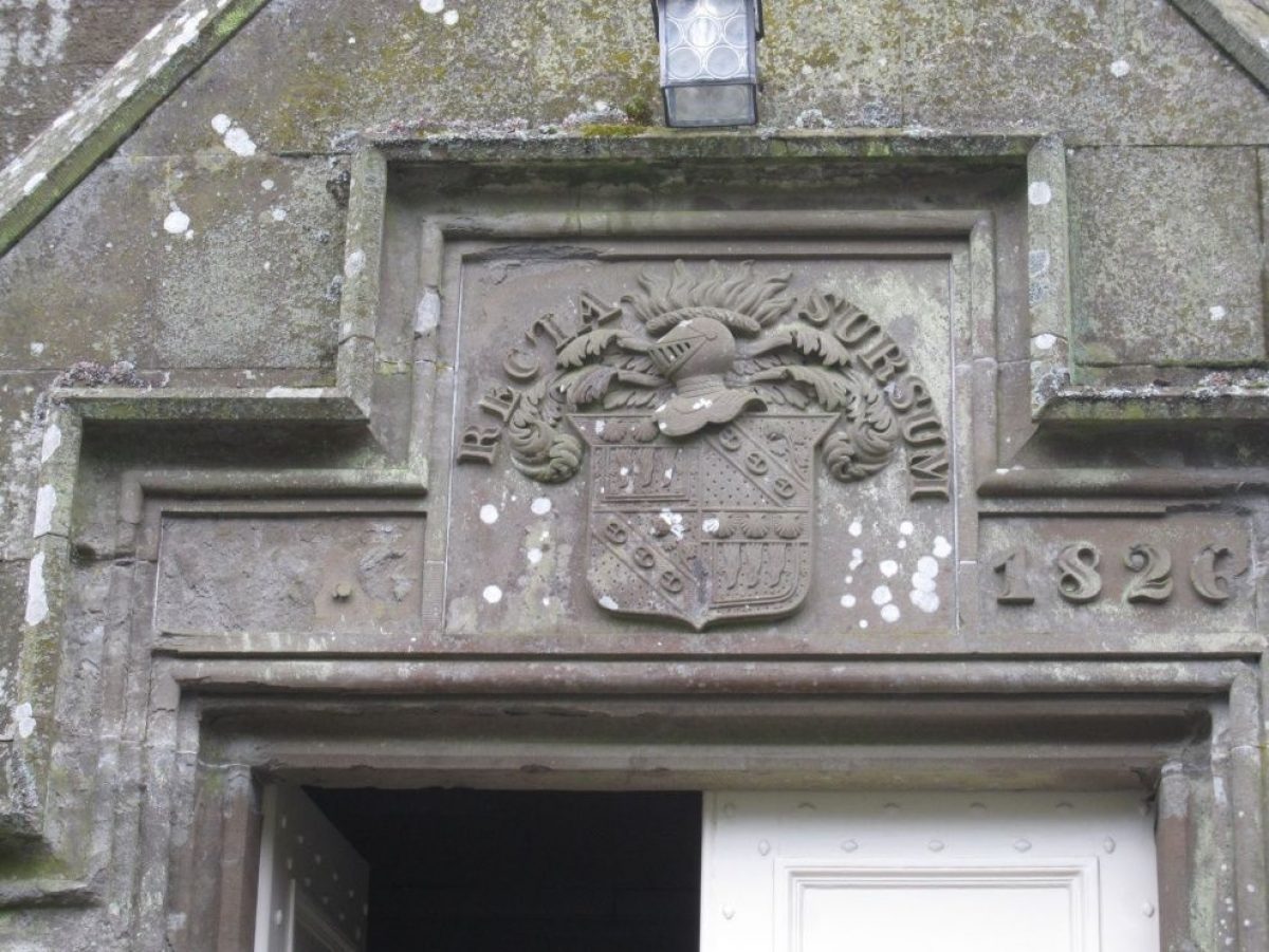
Cumming, G. 1843 Forfarshire Illustrated being views of Gentlemen’s seats, antiquities and scenery in Forfarshire with descriptive and historical notices Dundee, 37 Reform Street, Gershom Cumming Engravers, Duntrune House engraving in back end pages. MacGregor, P. D. 1856 The Baronage of Angus and Mearns Edinburgh, Oliver & Boyd. Translates the motto of William Stirling Graham, Recta Sursum, as ‘Things are right which are above”. An alternative translation is “Heaven’s way is right”.
M’Laughlan, The Rev A. et al 1834-45 The New Statistical Account of Scotland, Dundee, On-line edition, Vol 11, 15.
Malcolm, D. 1910 The Parish of Monifieth in ancient and modern times, with a history of the landed estates and lives of eminent men Edinburgh, William Green, 69-78. Description of the assistance given by David Graham of Duntrune in the escape of the Chevalier de Johnstone after the Battle of Culloden (a highly entertaining account).
Matthew, D. 2009 Murroes Wellbank Past and Present 8th edition, 39. History of the lands of Duntrune probably derived from A.J. Warden. Also describes the village of Burnside of Duntrune and its flax mill.
Matthew, D. 2009 Stone Getters of Angus 2nd edition, 27. Mentions Duntrune Quarry and the Stirling Graham memorial stone in the Howff, Dundee, from the quarry.
McKean, C and Walker, D. 1993 Dundee An Illustrated Architectural Guide Edinburgh, Royal Incorporation of Architects in Scotland, 155.
Ochterlony of Guynd, J. 1682 Account of the Shire of Forfar, 18. ‘Duntroone, Grahame, a pleasant place with fine parks and meadows about it’. Described in the Parish of Dundie.
Regesta regum scottorum Vol V. The Acts of Robert I, King of Scots, 1306-1329, 1988, A.A.M. Duncan (Ed) Edinburgh, Edinburgh University Press.
Scotland’s Places website: www.scottish-places.info/features/featurefirst8872.html. Description of Duntrune House from Francis Groome’s Ordnance Gazetteer of Scotland, with links to relevant entries on the Historic Scotland and the RCAHMS websites.
Small, The Rev. R. 1791-99 Old Statistical Account of Scotland, Dundee, On-line edition, Vol. 8, 194, 197. ‘None of these (estates) except Duntroon and Douglas, have been above 100 years in possession of the family of its present proprietors’; ‘the south bank of Duntroon is also fertile’.
Valentine, E.S. 1912 Forfarshire, 87. ‘Forfarshire in 1715 was strongly Jacobite’ and ‘The Magistrates of Dundee being for James, the Old Pretender, although most of the citizens were Hanoverian, Graham of Duntrune proclaimed him king there’.
Warden, A.J. 1884 Angus or Forfarshire The land and its people, descriptive and historical Vol 4, 146-155. Very detailed account of the history of the Estate of Duntrune and the Grahams from the reign of King Robert I (1305-1329) to just before the publication date. Note: Several of the above books which relate to Angus or Forfarshire, may be found on the website http://archive.org by searching with keyword Forfarshire. The section of Warden, A.J. 1884 referred to above has also been reproduced on the Monikie, Scotland Website http://www.monikie.org.uk/
- Visitor Access, Directions & Contacts
- History
The lands of Duntrune are recorded first as the gift of Robert the Bruce to Sir Walter Mordington or Mordintoun, a landowner in the Scottish Borders, for ‘constancy in loyal and dutiful service', to quote from an existing charter of property gifted to him by the king. The Charter recording the gift of Duntrune was part of one of the ‘lost rolls 'of Royal Charters, possibly a ‘geographical roll' signed in Forfar, but the record remains in the Index to the Charters, Registrum Magni Sigilli. The date of the gift was probably around 1325.
The sequence of later owners has been traced by A J Warden, from documents held at Duntrune House when he was writing his history of Angus or Forfarshire in 1884. Documentary evidence confirming Warden's line of proprietors can be found among the Duntrune papers held in the University of Dundee archives (Section B2), and also from Timothy Pont's manuscript map of Angus of around 1583 (Section B1). The 18th and 19th century maps of John Ainslie (1794), John Thomson (1832) and James Knox (1850), and the Ordnance Survey maps of the 19th and early-20th century consistently record the estate of Duntrune as a Detached Part of the Parish of Dundee, and this may be a relic of the Royal origins of the estate.
The earliest description of the surroundings of Duntrune House comes from John Ochterlony of the Guynd (Section B4), writing in 1682 ‘Duntroone, Grahame, a pleasant place with fine parks and meadows about it'. Ainslie's map of 1794 shows tree plantations to the north of Duntrune House, on Duntrune Hill and to the west, above Duntrune Mill (here labelled ‘Ark Mill'), areas which are still wooded today although the current plantings are no more than 50 to 100 years old.
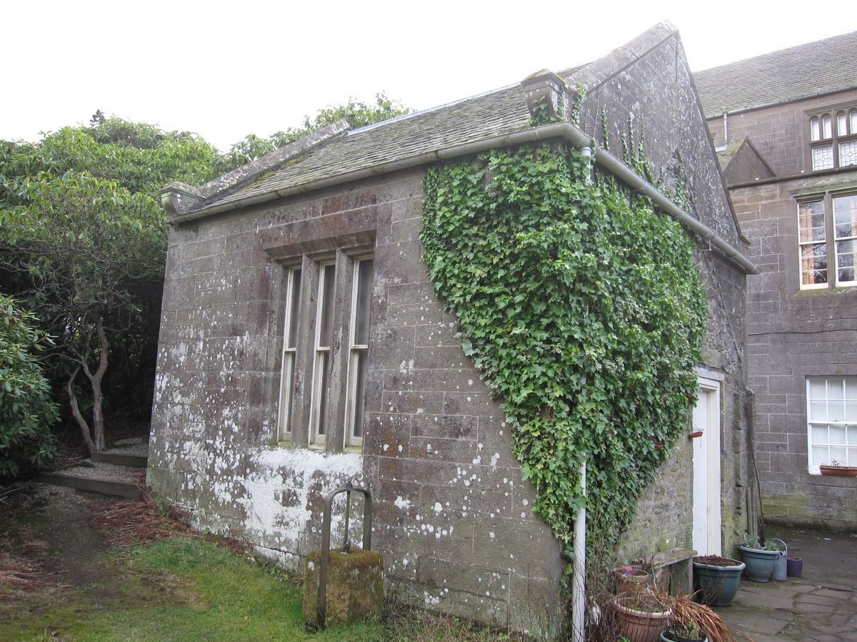
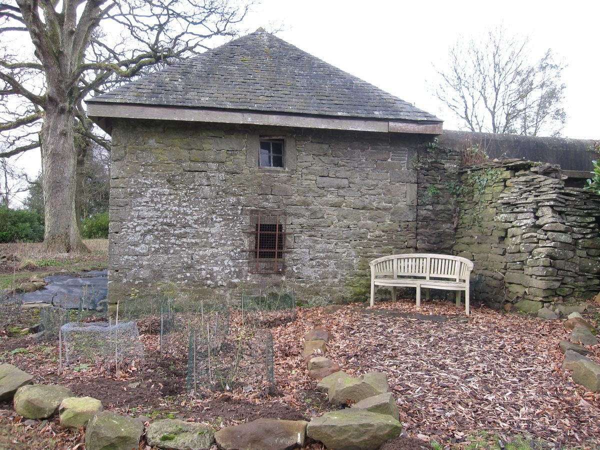
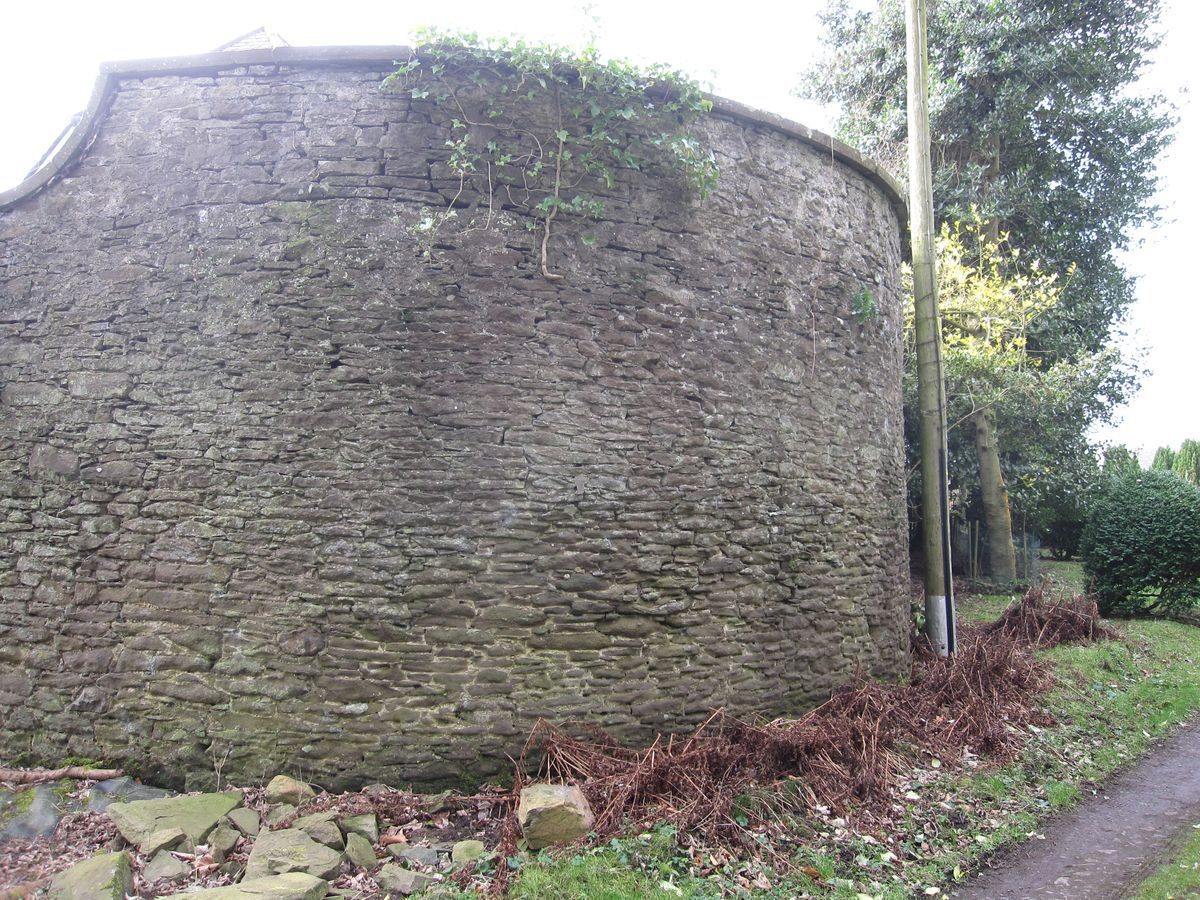
Two estate maps of 1750 and 1805 (Section B2) cover the period of greatest change in the policies of Duntrune House itself. The 1750 map, drawn when the owner was Captain Alexander Graham, shows a modest 2-storey house surrounded by four walled enclosures labelled ‘Gardens' and ‘Barnyaird'. No buildings are shown in the present position of the steading. A heavy line on the map passing through the barnyard and one of the garden enclosures shows at least part of the current position of the ha-ha, which would imply a date between 1750 and 1805 for its construction, and for that of the present walled garden, the main drive to the house and the steading, all of which are shown in their present positions in 1805. This is the period when ‘landscape gardening' developed in Scotland and when the noted landscape gardener James Abercrombie Junior was ‘improving' Glamis Castle and The Guynd. The house shown on the 1750 map may have been built in 1664, since a gable of the steading, raised in height from the original, has a dormer pediment with that date built in.
The ‘tower house' depicted on Pont 26 (c. 1583) might imply an even earlier house, as suggested by A. J. Warden. Between 1805 and 1815, the estate of Duntrune passed from the Grahams to the Stirling Grahams. Most of the estate remained intact, with the exception of the farm of Craighill.
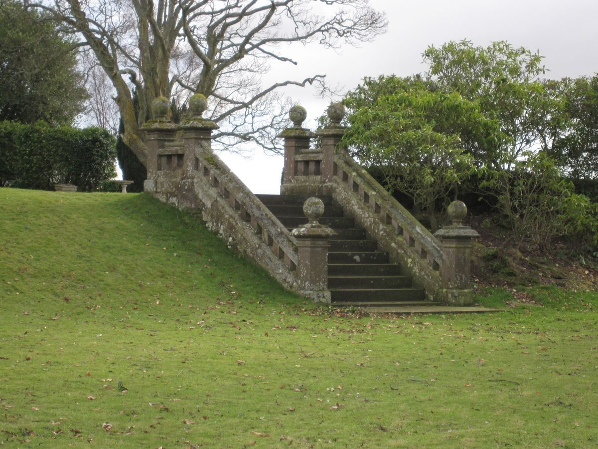
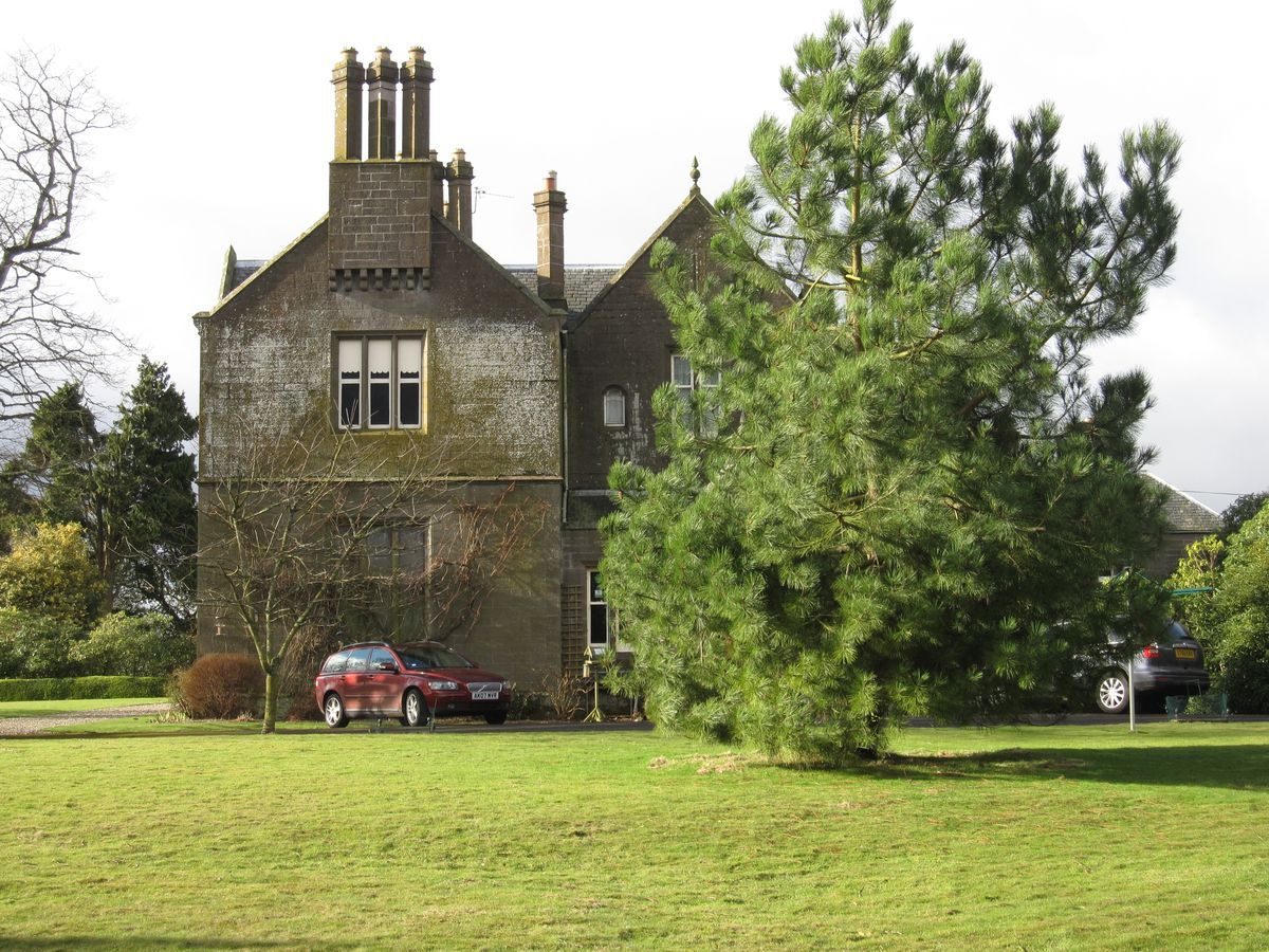
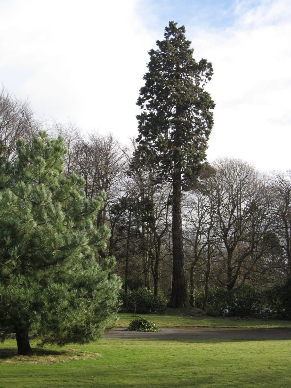
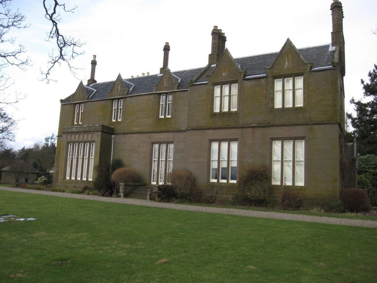
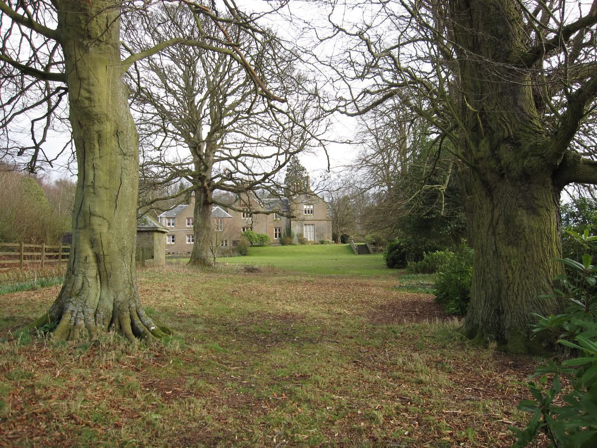
William Stirling Graham inherited from his mother Amelia Graham, and built the present mansion house of Duntrune in 1826, presumably with money inherited from his Stirling forebears. The house is a fine example of the architect William Burn's ‘neo-Jacobean' or ‘Tudor' style. The elegant sets of terrace steps and the entrance gateposts and returns, all of ashlar, are contemporary with the house. The mature trees to the east and west of the house, and the sycamore and lime on the south lawn were probably planted in the second half of the 19th century. It is difficult to date the ornamental planting of holly and yew along the line of the ha-ha, but it almost certainly post-dates the construction of the mansion house.
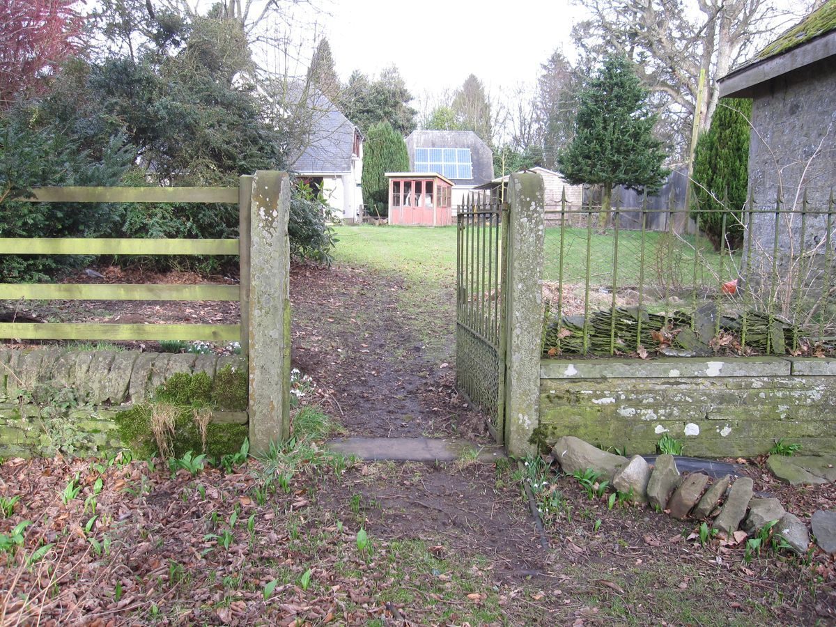
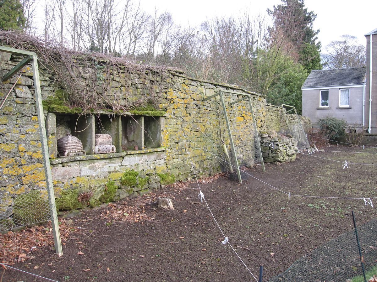
The earliest Ordnance Survey maps, the 6-inch and 25-inch maps published in 1865 show considerable detail both within and around the walled garden. Two distinct shrub-lined paths meeting in a circular area divide the interior of the garden into four sectors, all of which have regular planting. Along the outer west face of the walled garden a narrow ‘slip' garden is shown, possibly with a glass house at the north end and two rectangular planted beds to the south. The remains of plant supports can still be seen on the outer west wall of the walled garden where the slip garden was situated. Later editions of the Ordnance Survey maps of the same scale, published in 1902 and 1922, show no detail at all within the walled garden, although the slip garden is still evident. This may not imply that the walled garden fell out of use, since an aerial photograph of 1967 belonging to the present owners of Duntrune House, shows the walled garden in full production as a market garden. The east-west path of the Ordnance Survey map can still be seen. These early OS maps also show roundels and groups of trees as well as individual trees in the park which slopes south from the front of the mansion house, which probably were planted to enhance the park. A single group of trees still survives among the cultivation.
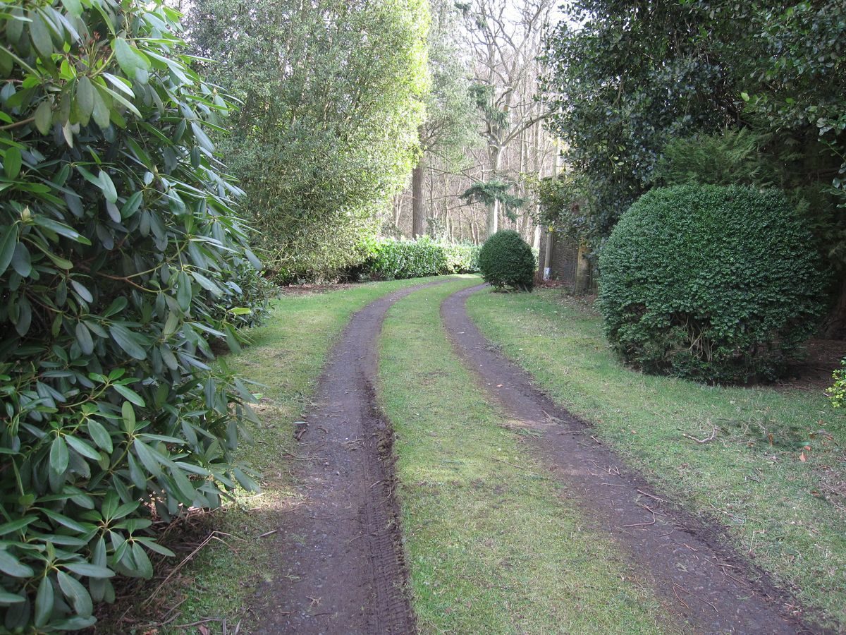
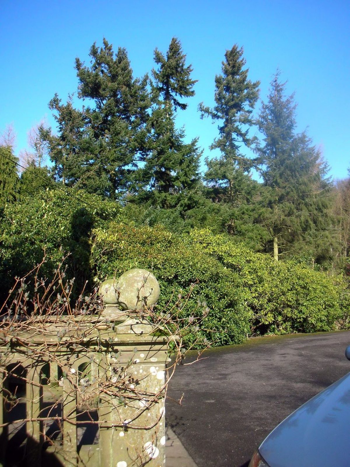
The policies of Duntrune House remained in the ownership of the Ovenstone family for most of the 20th century. The fine rhododendron plantings which are a feature of the early summer garden were planted by the present owners, who replaced many R.ponticum bushes. These species may have overgrown Victorian plantings of rarer rhododendrons made by the last Stirling Grahams, Clementina or her nephew John Edmond Lacon. Other features of the 20th-century garden, no longer in existence, are tennis courts to the west of the house (shown as a rectangular enclosure on the Second Edition Ordnance Survey maps), and a rustic summerhouse on the ha-ha, shown in a photograph album of the Ovenstone family. The walled garden now contains two modern houses, one with attractive maturing plantings of native and other species of trees and shrubs. Extensive lawns surround the mansion house, with herbaceous planting at the foot of the house walls and climbing shrubs on the walls themselves. A new orchard of old Scots varieties of apples has been planted. The panoramic view from the ha-ha continues to be an outstanding feature of the garden. The policies of Duntrune House might well still be described as Ochterlony wrote, a fine place with parks and meadows about it, despite the evident agricultural developments and the urban sprawl of the city of Dundee.
- Features & Designations
Plant Environment
- Plant Type
- Rhododendron Garden
Features
- Country House (featured building)
- Description: Tudor style country house
- Earliest Date:
- Latest Date:
- Key Information
Type
Estate
Plant Environment
Plant Type
Principal Building
Domestic / Residential
Survival
Extant
Hectares
9
Open to the public
Yes
Electoral Ward
Sidlaw East and Ashludie
- References
Contributors
Jean Harthill, Angus Landscape Survey Group