Introduction
Duncombe Park is a landscape park with the remnants of a medieval deer park. Half of the park is now a nature reserve.
Terrain
The site is on land in the valley of the River Rye. The land rises to an escarpment on the western edge of the valley which follows the line of the river. The western side of the registered area is a plateau which rises slightly to the north.The following is from the Register of Parks and Gardens of Special Historic Interest. For the most up-to-date Register entry, please visit The National Heritage List for England (NHLE):
Pleasure grounds of around 1718-30 with a curving terrace, blocks of woodland with curving paths leading through them and a serpentine ha-ha which have been described as 'a landmark in the development of the English natural style (Jellicoe et al 1986). The park was probably created in the early 18th century and early to mid-19th century partially on the site of a medieval deer park associated with Helmsley Castle.
Location, Area, Boundaries, Landform and Setting
Duncombe Park lies immediately south-west of Helmsley. The c 285 ha site is on land in the valley of the River Rye which enters the south-west side of the site and runs north-east before circling around to the west and curving again to the north-east. The land rises to an escarpment on the western edge of the valley which follows the line of the river. The western side of the registered area is a plateau which rises slightly to the north. Walls and fences divide the site from agricultural land, while the precincts of Helmsley Castle divide the site from the town of Helmsley.
Entrances and Approaches
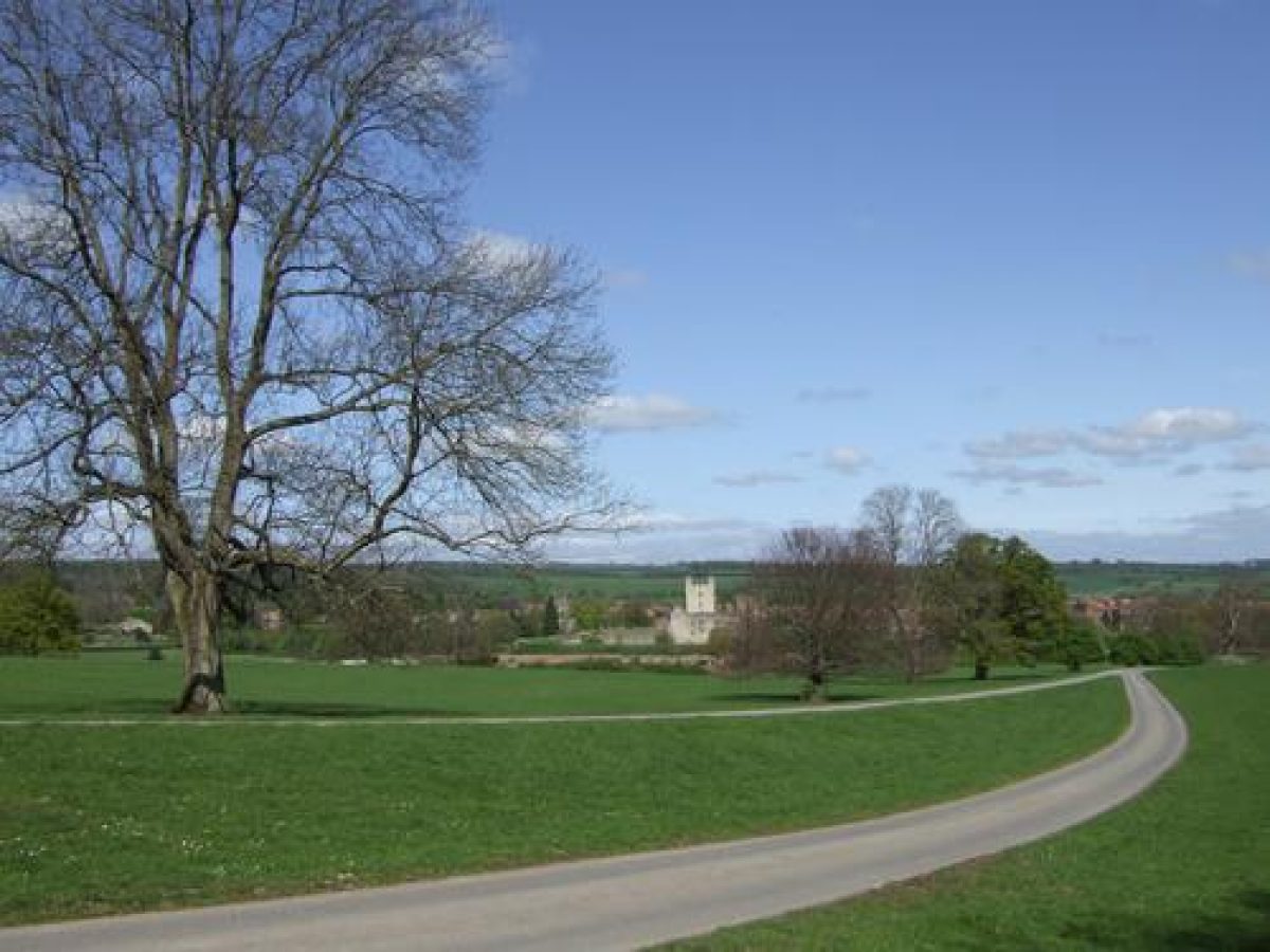
The principal entrance to Duncombe Park is from the north-east in Helmsley where there is a lodge (Charles Barry 1843, listed grade II) and gates at the west end of Buckingham Square. The drive runs south-west through the park to the forecourt of the west front of the House and is shown as the principal entrance on a county map of 1771. An entrance at the south-east tip of the site from the A170 has a gateway in the form of a triumphal arch called Nelson Gate (1806, listed grade II) and an early C19 lodge (listed grade II) from which a drive leads north-west, crossing the Rye via Mill Bridge (mid C18, listed grade II). The route continues west and north through Park Hill Wood before running north to the west front of the House. There is a third entrance with a C19 lodge called Griff Lodge at the north-west tip of the site from which a drive runs south-east to the House, giving views of the west front framed by trees across the expanse of Park Plain. This was the route used to reach Rievaulx Terrace, c 3 km north-west of Duncombe Park.
Principal Building
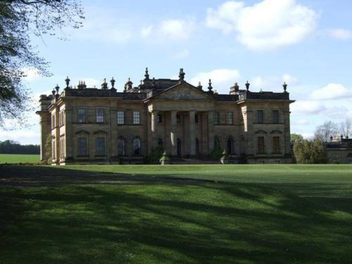
Duncombe Park House (listed grade I) lies in the centre of the park. The plans of the building were illustrated in Vitruvius Britannicus (1725) which attributes it to William Wakefield although Sir John Vanbrugh (1664-1726) may have advised on the design, which has some similarities with his broadly contemporary first design for Eastbury. The House is linked on the north and south sides to two stable blocks or pavilions (both by Charles Barry 1843, listed grade I) by quadrant walls. The forecourt formed by the House and wings is closed by a screen with railings linked by stone piers flanking central gate piers (listed grade I). The building is notable for the choice of a site close to the edge of the natural escarpment above the River Rye where advantage could be taken of views of the valley and the rising land beyond with the ruins of Helmsley Castle (see below) in the middle ground.
The House was badly damaged by fire in 1879 and rebuilt by William Young in 1895. In 1924 it was leased to the Woodard Trust which occupied it for sixty years as a girls' boarding school until it reverted to being a private residence in 1986, in which use it remains (1998).
Some 200 m north-west of the House the Parkland Centre (listed grade II*) is a building of c 1730 which probably originated as kennels and was partially converted to a laundry in the late C19. The south front has a central door beneath a radial fanlight flanked by Tuscan pilasters with a shallow stepped pediment. The building acts as an incident in views of the north-west part of the park. It is in use as a tea room, shop and visitor centre (1998).
The ruined remains of Helmsley Castle (listed grade I; scheduled ancient monument) lie on a platform at the western edge of Helmsley c 1 km north-east of the House. The building originated in the C12 and was successively modified and altered. A mansion was built within the site during the C16 and this was the principal residence for owners of the Helmsley Estate until Duncombe Park was built. It was taken into state guardianship in 1921 and subsequently passed into the care of English Heritage who are responsible for it today (1998).
Gardens and Pleasure Grounds
On each side of the east front of the House there are sunken parterres which were set out in c 1843, possibly to designs by W A Nesfield (1793-1881), when Barry's wings were being added. They were originally planted with curving shapes outlined by box hedging and these have been renovated in the late C20. Stone steps lead up from the parterres on each side to a grass ride called the Broad Walk which runs in front of the House, stretching north and south through blocks of woodland for the full extent of the gardens.
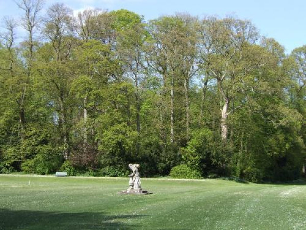
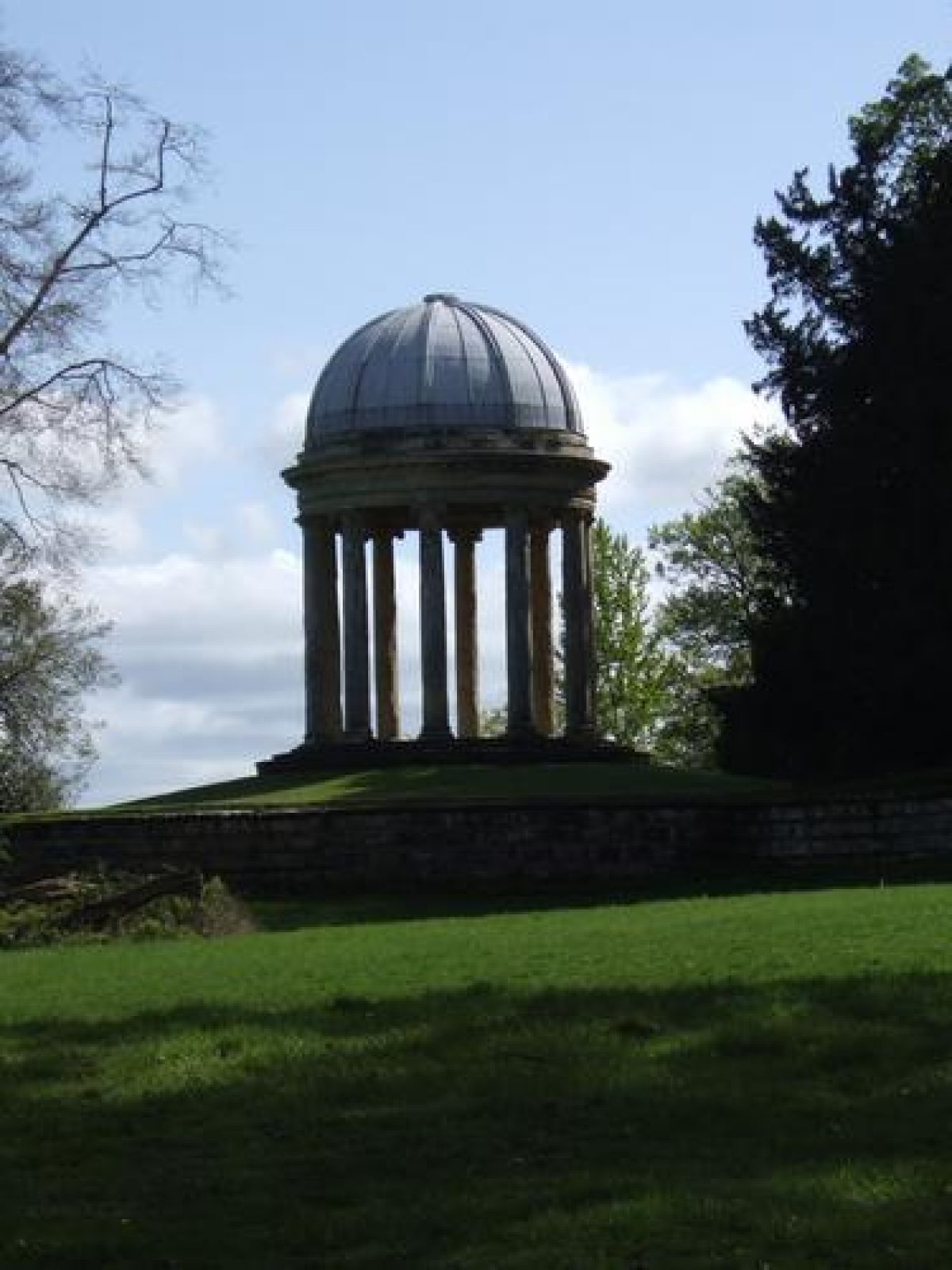
East of the Broad Walk the House is fronted by the levelled and slightly sunken lawn which is flanked by blocks of woodland to the north and south. At the centre of the eastern edge of the lawn there is a Father Time sundial (c 1715, attributed to Van Nost, listed grade II) and from this point there are views, partially obscured by trees, across the valley to a cascade in the Rye, with tree-clad slopes rising beyond to the east. The lawn opens to the East Terrace, c 120 m east of the House, which runs along the edge of the wooded escarpment above the Rye. It is grassed and extends for a distance of c 600 m, following a curving route and backed (on the west side) by blocks of woodland which flank the lawn. At the north end the Ionic Temple (c 1730, attributed to Vanbrugh, listed grade I), c 200 m from the sundial and visible from it, is a domed rotunda from which there are long-distance views to Helmsley Castle and beyond to the north-east, over the valley of the Rye to the east and along the curving line of the Terrace to the south.
The route from the Ionic Temple along the Terrace gives continually changing views of the Rye valley below. The Tuscan Temple (c 1730, attributed to Sir Thomas Robinson, listed grade I), c 400 m south of the sundial, is on a circular bastion with views over the valley and the Vale of Pickering to the east and south, along the curve of the Terrace to the north, and along the South Terrace to the west. This Terrace runs along the edge of the scarp at the base of the southern block of woodland. There are views across the valley partially obscured by trees, and the Terrace follows a straight route westwards to the south end of the Broad Walk. A grassed walk half way along the Terrace runs north-west and gives views of the arcaded front of the Orangery or Conservatory (Banks and Barry 1851, listed grade II), c 300 m south-east of the House, as the building is approached. Roofless wings are set back and attached to the east and west sides of the building. It is thought that the clearing in which the Conservatory stands may have been part of the original garden plan (guidebook 1994). A system of paths from the clearing leads through the woodland, with some branches leading to the Broad Walk and others to the East Terrace, South Terrace and to the lawn.
The Broad Walk cuts through the western edge of the woodland, runs north from the South Terrace in front of the House, and continues through the northern block of woodland, which also has curving paths leading through it. At the north end of the woodland there is a walk lined by yews, the branches of which have naturally grown towards the light to form a tunnel, which leads eastwards to the Ionic Temple. To the north of the yew tunnel there is a walk along the edge of a massive rusticated serpentine ha-ha wall (listed grade II*) which stretches in a series of curved projections from the north pavilion to the northern end of the East Terrace, dividing the northern part of the gardens from the park and the north entrance drive. The yews were probably planted as a hedge marking the edge of the walk along the top of the ha-ha wall which is thought to be one of the earliest examples in the country, and for which a date range of 1718-23 has been suggested (Hussey 1967).
It is not known who designed the gardens, but it has been suggested that Vanbrugh may have supplied an outline plan (ibid), a suggestion which is supported by evidence for his involvement in the design of the House and by the fact that he was working in Yorkshire in the years 1718, 1721 and 1724 when it would have been possible for him to visit and advise on the layout. It has also been suggested that Charles Bridgeman (d 1738) may have been involved, being influenced by Steven Switzer (1682-1745) (guidebook 1994).
Kitchen Garden
The rectangular walled kitchen garden lies c 800 m north-east of the House immediately west of Helmsley Castle. Bothies, sheds and ancillary buildings along the outer north wall are in use as craft workshops and a café (1998) and the entrance is in the centre of the north wall through a late C20 conservatory. On the inner face of the north wall the remains of a range of glasshouses in varying conditions survive. A large free-standing glasshouse lies south of the entrance, possibly representing or incorporating part of a glasshouse shown in this position on the 1856 OS map. The garden is laid out with a grid of paths and a central circular pond which are in the process of being restored (1998).
The garden is shown from the west in a mid C19 engraving which shows that there was a path across the park to it from the west, and that the outer wall was covered with climbing plants or espaliers. The garden continued in partial use until 1987 after which it fell into disrepair. The Helmsley Walled Garden Restoration Project began a programme of restoration in 1994 which is still in progress (1998).
Park
The parkland north and west of the River Rye is open to the public during the season. The east side of the park is sheltered by Plockwoods Bank Wood, which lies on rising ground on the east bank of the Rye. The north-east part of the park is dominated by the ruins of Helmsley Castle overlooking open grassland with scattered trees. Grassland with scattered trees lies in the curve of the river while the south-east side of the park is under arable cultivation. In 1994, 103 ha were declared a National Nature Reserve and are managed jointly with English Nature to conserve some of England's oldest and tallest trees and their associated wildlife. It is considered the most important parkland in the north of England for dead-wood insects (1998).
The western part of the park, called Park Plain (the former Fallow Deer Park) is on level land sloping slightly to the north. This part of the park is pasture and largely treeless. Blackdale Howl Wood shelters the north boundary and Spring Bank Wood the west side. Broad metalled drives, tank emplacements and Nissen hut bases date from the Second World War when the park was occupied by the 30th Armoured Brigade.
Maps
- T Jefferys, County Map, 1771
- OS 6" to 1 mile: 1st edition published 1856
- Additional information from Mark Sayers
Description written: November 1998
Amended: March 1999
Edited: October 1999
- Visitor Access, Directions & Contacts
Telephone
441439770213Website
http://www.duncombepark.comAccess contact details
http://www.duncombepark.com/opening_times.shtml
Directions
http://www.duncombepark.com/how_to_find_us.shtml
- History
The following is from the Register of Parks and Gardens of Special Historic Interest. For the most up-to-date Register entry, please visit The National Heritage List for England (NHLE):
12th - 16th Century
The estate was owned by Walter de L'Espec in 1120 and it passed through his sister to the de Ros family and subsequently through the female line to the Manners family, Earls of Rutland in 1508.
17th - 18th Century
In 1632 the estate passed to George Villiers, first Duke of Buckingham, who married the heiress Katherine Manners. After the death of the second Duke of Buckingham in 1687 the 40,000 acre (about 16,500 hectares) estate was sold to Sir Charles Duncombe, the City of London goldsmith/banker who bequeathed it at his death in 1711 to his nephew Thomas Duncombe. Work on the house and garden was initiated in about 1713 and completed around 1730, with his son Thomas laying out the Rievaulx Terrace (see description of this site elsewhere in the Register) on an adjoining estate in about 1758. This was on lands originally given to the Cistercians by Walter de L'Espec for the founding of Rievaulx Abbey, and purchased from the King by Thomas Manners at the Dissolution of the Monasteries in 1538.
19th - 20th Century
The estate continues in the Duncombe family, who were created earls of Feversham in 1868, with Duncombe Park being the home of the present owner, the sixth Baron Feversham (1998).
- Associated People
- Features & Designations
Designations
The National Heritage List for England: Register of Parks and Gardens
- Reference: GD2063
- Grade: I
Nature Reserve
Features
- House (featured building)
- Earliest Date:
- Latest Date:
- Terrace
- Temple
- Key Information
Type
Park
Purpose
Ornamental
Principal Building
Domestic / Residential
Survival
Extant
Hectares
285
Open to the public
Yes
Civil Parish
Helmsley
- References
References
- {English Heritage Register of Parks and Gardens of Special Historic Interest}, (Swindon: English Heritage, 2008) [on CD-ROM] Historic England Register of Parks and Gardens of Special Historic Interest
- Jellicoe, Sir G. et al (eds), {The Oxford Companion to Gardens} (Oxford: Oxford University Press, 1986), p. 149 The Oxford Companion to Gardens
- Pevsner, N., {The Buildings of England: Yorkshire The North Riding} (Harmondsworth: Penguin, 1966), pp. 139-42 The Buildings of England: Yorkshire The North Riding
- pp 140-6 English gardens and landscapes 1700-1750
- The Rievaulx Terrace, guidebook
- Duncombe Park, guidebook
- Helmsley Walled Garden Restoration Project, guiebook
- Related Documents