
Introduction
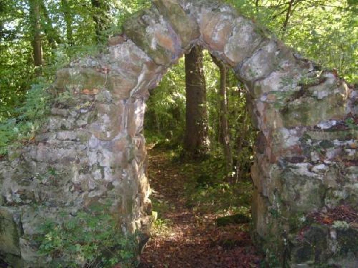
The early-19th-century designed landscape at Valleyfield was the only Scottish commission of Humphry Repton. The structure of the original landscape survives with a ha-ha and a walled garden sited above the burn that runs through the park. Restoration work is currently being carried out on the walled garden, rustic bridges, stone arch and paths.
http://portal.historic-scotland.gov.uk/designations
Location and Setting
Valleyfield is situated to the north of the Firth of Forth about 5 miles (8 km) west of Dunfermline. The original estate has been bisected by the A985(T) and most of the southern part of the estate has been developed for housing related to the local coal mining industry. The soil, a rich brownearth, has been noted for its fertility and the resulting fast growth-rate of trees planted here. The house has been demolished but was sited to take advantage of the fine views across the Firth.
The designed landscape is today enclosed by the Pitsoulie Plantation to the north and east and by the north and west drives to the west. The southern third of the park has been largely built over and cut off from the rest of the estate by the A985(T). The east drive put in by Repton continues southwards under the new road following the course of the Bluther Burn in its deep wooded valley to the East lodge at Newmills. The house was sited south of the Bluther Burn and facing south-eastwards across the parks to the Firth. The design of the landscape of High Valleyfield has remained substantially as Repton suggested, although parts have been replanted. The designed landscape today extends for 255 acres (103ha).
Landscape Components
Architectural Features
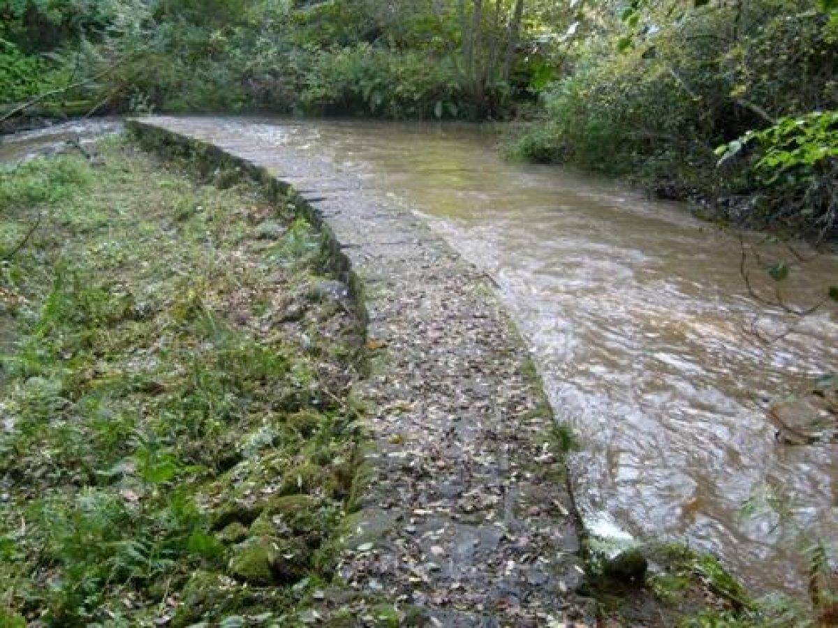
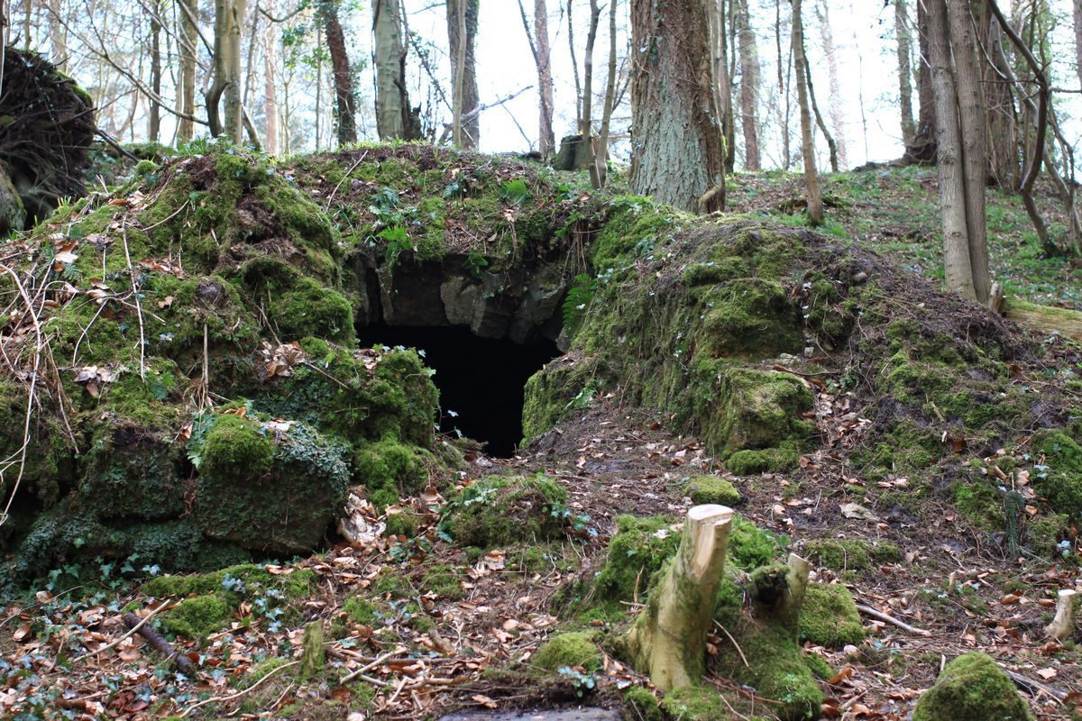
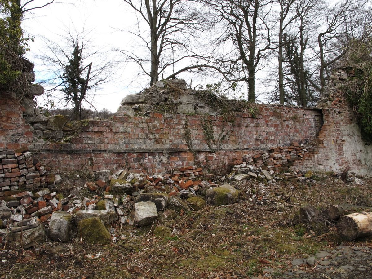
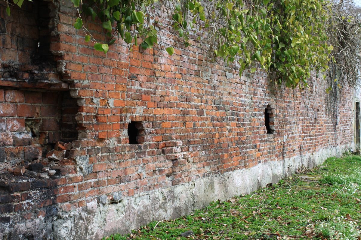
Little remains today of the architectural features at Valleyfield. The house was demolished after its roof had been removed and the farm buildings, doocot, and North Lodge have also been destroyed. The West and East Lodges remain and the West Lodge is listed B. A former Lodge on the west drive was described by Repton as the 'bald, naked, ugly lodge in the middle of the valley ... a disgrace to the Scenery' and it has also been demolished. There are remains of walls and possibly a cottage to the west of the North Drive and this area is shown as an enclosure on the 1st edition map of c.1850. The main kitchen garden is referred to by Repton as having been near the Firth, and is shown on the 1850 map on the north shore of the Firth; it had a summerhouse and well. The walled flower garden gateway and ornamental pond remain to the north of the Bluther Burn, and remains of the Ice House exist to the south of the Bluther Burn. There are several rustic-style bridges across the Burn.
Parkland
The southern area of parks has disappeared under new roads and housing. The Deer and Cow Parks remain but are undermanaged, although there is an agricultural tenancy, and many of the parkland trees have been lost. The East Drive put in by Repton along the course of the Bluther Burn still exists although the rustic bridges are in need of repair and some are badly vandalised.
Woodland
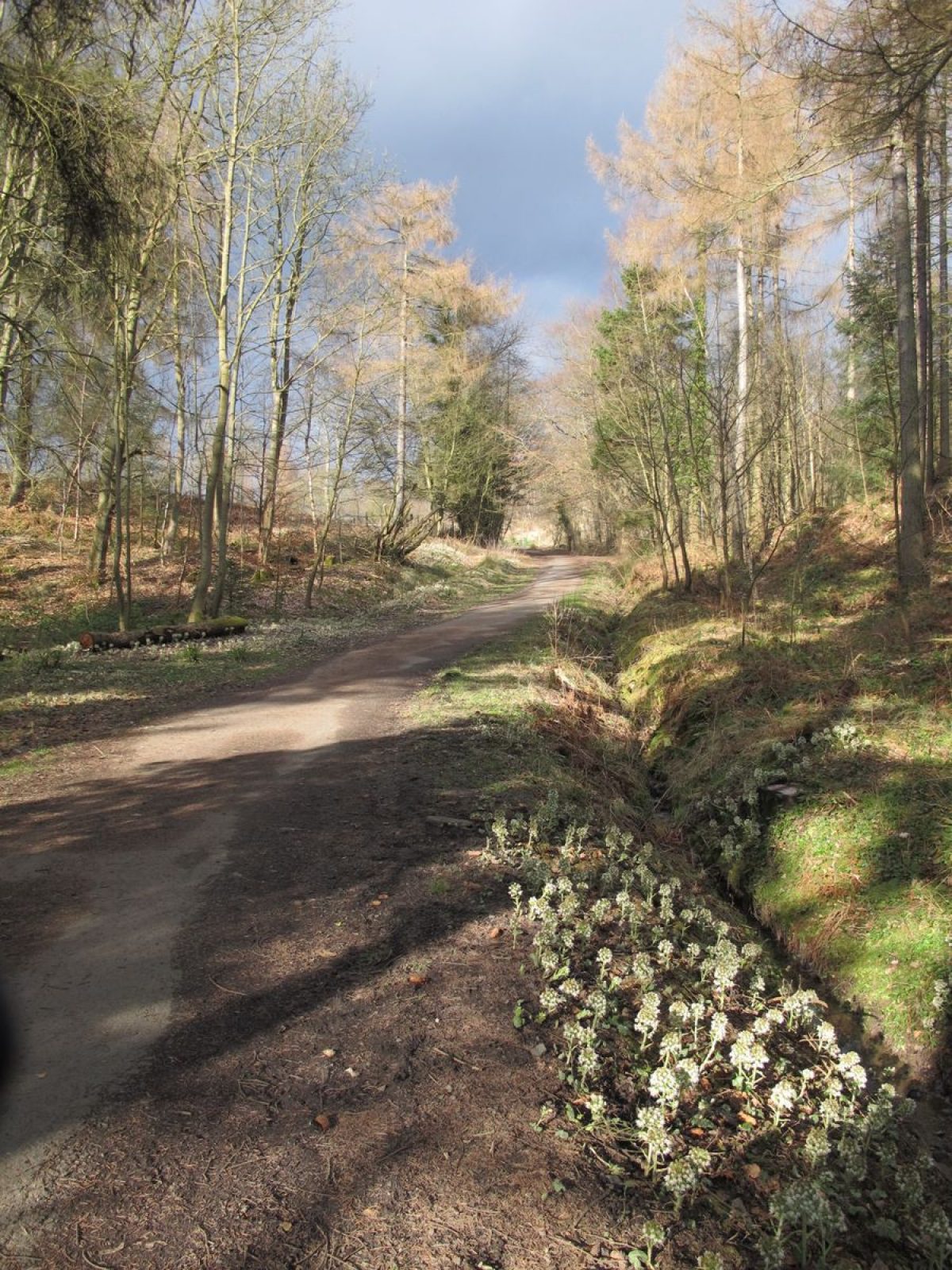
The woodlands have been largely replanted by the Forestry Commission from 1932 and consist of Scots pine, larch, spruce, beech and birch. The climate and soil of Valleyfield were said to produce unusual rates of tree growth and the Gardeners' Magazine of 1842 records that Black Italian poplars planted in 1805 had reached 100' in height and 3' in trunk diameter. Other species had also grown well. The Burn valley and more ornamental areas have had a long continuous cover of mixed deciduous species and have been left, as Repton suggested, to the management of nature.
The Gardens
The formal Flower Garden is situated to the north of the house on the south- facing slope above the Burn and is enclosed by walls on all but the south side. Repton wrote that he considered it 'an essential circumstance of comfort to have a succession fruit garden to the house' (than the kitchen garden at the Firth) and that this should not be visible from the roads and paths about the place. Beyond the walls, a ha-ha surrounds the whole garden and this is bounded by an overgrown beech hedge. An entrance on the west side is formed by a stone gateway. The gardens were terraced in three tiers down the steep bank with walls 0.8m thick and a raised outlook terrace at each end. A near central north/south path crossed the garden, and the garden was laid out with fruit trees and ornamental borders.
By 1842 the gardens were recorded as being in disrepair. The main feature of the garden was the canal, 147m x 10m in size, to the south of the terraces fed at its western end from the Burn and emptying through a sluice at its east end. It was designed to retain a smooth reflecting surface and to be stocked with fish. Repton suggested 'the entrance to be under a covered passage of hoops on which may be trained all kinds of creeping plants and the further (west) end may be decorated by an Architectural building, which I suppose to consist of a covered seat between two aviaries'. It is not known whether these entrances were built although they are shown in an illustration of the canal at Valleyfield in Repton's 'Theory and Practice of Landscape Gardening' in 1803. The following excerpt from his Red Book for Valleyfield is 'concerning the Flower Garden at Valleyfield':
'Altho' I have never seen the place myself, yet I am flattered to learn that under the direction of my two sons, by taking advantage of the romantic glen and wooded banks of the river, an approach has been made which for variety, interest, and picturesque scenery may vie with any thing of the kind in England while it remains a specimen of the powers of Landscape Gardening in that part of Scotland, where the Art had only been introduced by the imitators of Wm. Brown's manner, since Mr. Brown himself had never travelled out of England. To common observers, the most obvious difference between his stile and that of the Antient Gardens, was the change from straight, to waving or serpentine lines. Hence many of his followers have supposed good taste in Gardening to consist in avoiding all that is straight or paralel, and in adopting forms which they deem more consonant to Nature, without considering what objects were natural, and what were artificial. This explanation is necessary to justify the plan which I recommend for the canal in the Flower garden. For while I should condemn a long straight line of Water, in an open park where every thing else is natural, I should equally object to a meandering canal or walk where every thing else is artificial.'
- Visitor Access, Directions & Contacts
Access contact details
Valleyfield Woodland Park is a public park.
Directions
Valleyfield Woodland Park is about one mile north-east of Culross. There is a southern entrance at Newmills and a northern one near Shiresmill.
Owners
Dunfermline District Council
The National Coal Board
- History
The following is from the Historic Environment Scotland Gardens and Designed Landscapes Inventory. For the most up-to-date Inventory entry, please visit the Historic Environment Scotland website:
http://portal.historic-scotland.gov.uk/designations
Reason for Inclusion
Valleyfield is the only Scottish example of early 19th century landscape designer Humphry Repton's work. Unfortunately, only a little remains of the designed landscape today.
Site History
The present designed landscape was laid out in the early 19th century to the designs of Humphry Repton.
Information on Valleyfield before the 1800s has not been readily accessible. General Roy's map of c.1750 indicates the existence of a settlement there at that time, but nothing of the scale which was to follow. The house was a classical mansion, architect unknown. Its owner, Sir Robert Preston, commissioned Humphry Repton to undertake improvements to the landscape in the early 1800s and Repton produced a Red Book for Sir Robert. It was Repton's only Scottish commission and the surveying and later supervision of works was carried out by Repton's sons John Adey and George. Among Repton's suggestions was the addition of an East Wing to the house to match the West Wing and this was carried out by Samuel Butler Ltd. before 1811. The East Drive and Lodge were added; a West Lodge removed; the farm buildings were screened from the house by extensive new plantings; a pleasure ground was introduced around the house; the view south was opened out and the ornamental walled garden created. William Cobbett in his 'Rural Rides' refers to the 'very beautiful house and park of Sir Robert Preston'. David Douglas, later a famous plant collector, was gardener here for Sir Robert in his youth.
After Sir Robert's death, Valleyfield belonged in 1885 to the Rt Hon William P.C. Campbell-Preston Esq. of Valleyfield and Ardchattan in Argyll. By 1918, the estate had been abandoned by its subsequent owners, the East of Fife Coal Company, who had stripped the copper from the roof of the house and started the High Valleyfield Mine in 1912. Housing development serving the mines began around the Low Valleyfield mine from the early 1900's. In 1932 the Forestry Commission bought the High Valleyfield woodlands felling and replanting Repton's plantations. The 70 acres of woodlands have recently been sold to Dunfermline District Council. The ownership of High Valleyfield is now split, the two major owners being the District Council and the National Coal Board.
- Associated People
- Features & Designations
Designations
Historic Environment Scotland An Inventory of Gardens and Designed Landscapes in Scotland
Features
- Icehouse
- Key Information
Type
Park
Purpose
Recreational/sport
Principal Building
Parks, Gardens And Urban Spaces
Survival
Extant
Hectares
103
Open to the public
Yes
- References
References
-
Historic Scotland, 'Valleyfield', {Gardens and Designed Landscapes},
- Peter McGowan Associates {Valleyfield Wood Restoration Management Plan} (1992) Valleyfield Wood Restoration Management Plan
Contributors
Historic Scotland
-
Historic Scotland, 'Valleyfield', {Gardens and Designed Landscapes},