Introduction
The grounds at Stonyhurst College include a park and formal gardens, probably originating in the 17th century but much altered in the 19th and 20th centuries. At its most extensive the site covered about 100 hectares.
Terrain
The site is situated on land which slopes down gently southwards.www.historicengland.org.uk/listing/the-list
Gardens and parkland with late 17th-century origins, including a well-preserved formal garden dating from around 1700 and an avenue and water features of similar date.
DESCRIPTION
LOCATION, AREA, BOUNDARIES, LANDFORM, SETTING
Stonyhurst is situated immediately north-east of the village of Hurst Green in an area which is predominantly rural and agricultural. The c 75ha site is situated on land which slopes down gently southwards. The boundary on the south-west side of the site is formed by fencing along the edge of woodland and the walls of a burial ground which is excluded from the registered area. The southern boundary is formed by the south side of The Avenue and the line of the garden walls around the formal garden and the kitchen garden. On the north-eastern side of the building the boundary is on the line of a track which swings eastwards and then joins a drive which runs to the eastern lodge. The boundary then follows the line of a by-road and returns along the line of the north-west drive. The eastern boundary of the park is formed by a stone wall, while the boundary along the northern and western sides of the parkland is formed by a stream and to the south of this a stone wall.
ENTRANCES AND APPROACHES
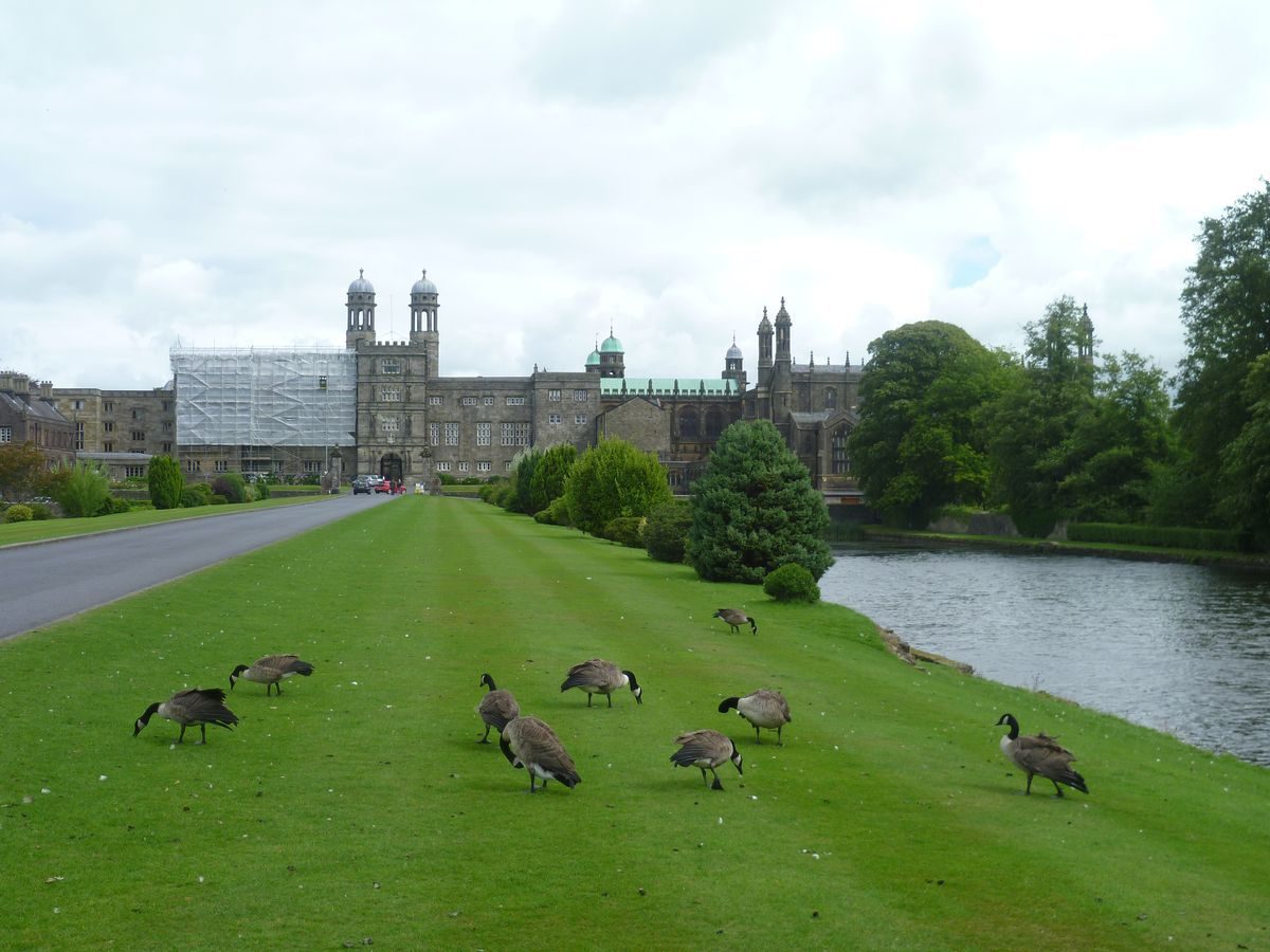
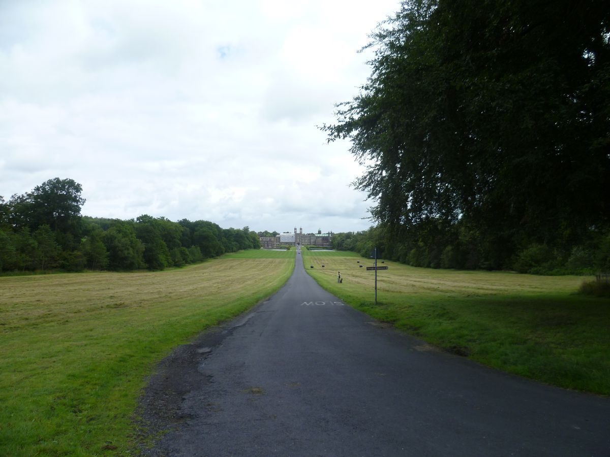
The principal entrance to the site is from Hurst Green. At the northern end of the village a drive, which is a public road, leads north through a pair of low stone piers and continues through woodland for c 200m. At this point it turns through almost 90 degrees and leads eastwards down an avenue, called The Avenue, to a forecourt on the west front of the house.
There are three other entrances, all on the north side of the site off the by-road between Woodfields and Stock Bridge. At the north-east corner of the site there is a stone lodge and gate piers leading to a drive running south-west to the College. Some 500m to the west another stone lodge with gate piers is situated at the head of a drive which runs south to the College, continues across the west front, and then leads southwards, with the walled precinct of St Peter's church on its east side. It then divides, with one branch leading east to the garden (south) front of the building and the other continuing south around the edge of the walled formal gardens to the kitchen garden area. At the north-west corner of the site a drive which is a public road leads south-west, with a line of mature lime trees running along its inner (eastern) edge. Some 350m west of the College a path branches off the drive and leads west to the deer park; at this point the drive turns southwards and joins The Avenue drive at a point immediately west of the canals. This arrangement is shown on Greenwood's county map of 1818. Other entrances to the site are via farm tracks and footpaths.
PRINCIPAL BUILDING
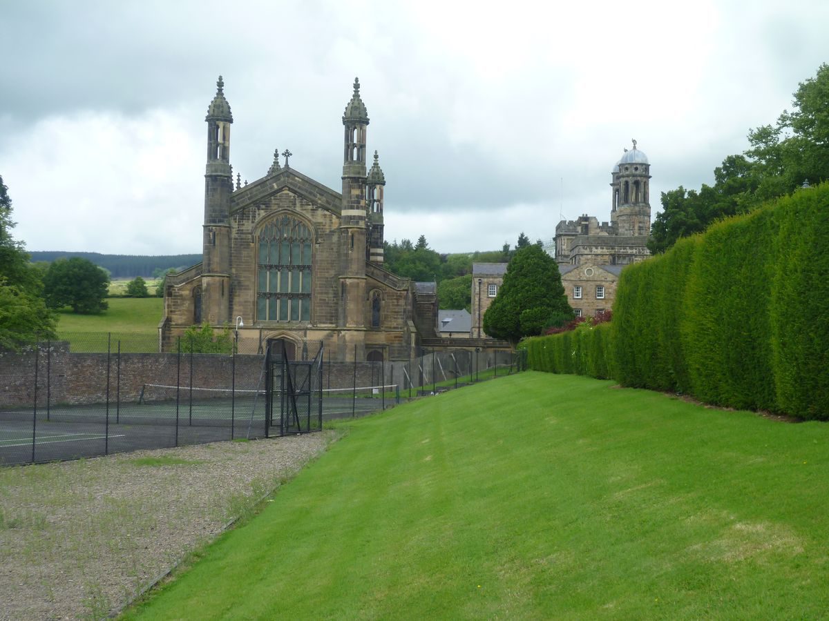
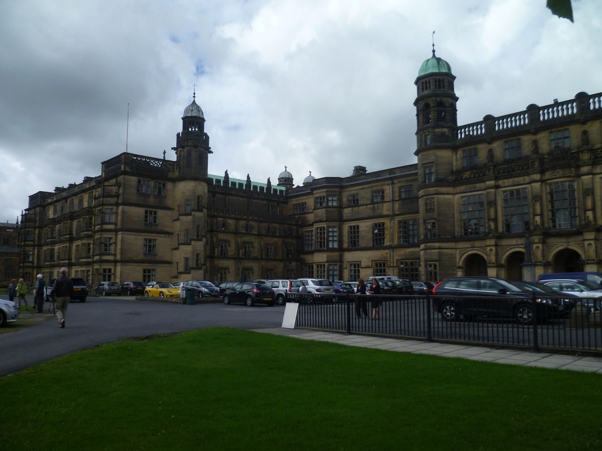
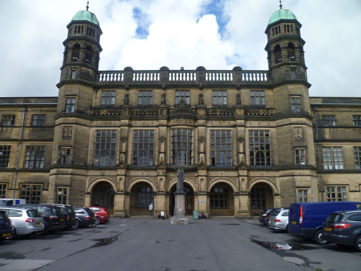
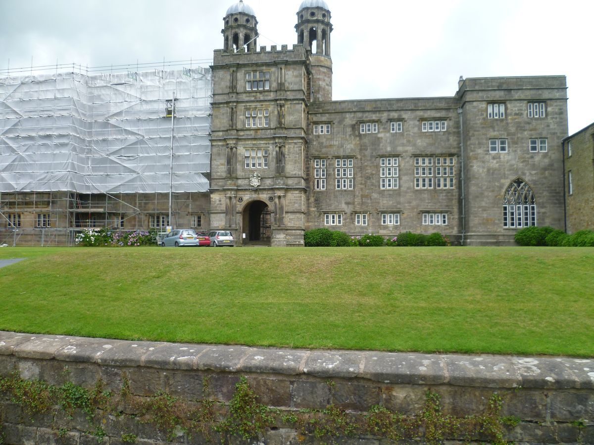
Stonyhurst College (listed grade I) is on the site of a building of late C14 or C15 date. A gatehouse on the west front of the house leads to a courtyard with buildings on each side. This phase of building was started by Sir Richard Shireburn in 1592 and was continued by his grandson, Nicholas Shireburn, in the late C17 and early C18. Additions were made in 1799 when the Society of Jesus took over the house, and three campaigns of building during the C19 greatly enlarged the house on the north and east sides. Other additions in connection with the buiding's use as a school were made in the C20. Attached to the south-west tip of the house is St Peter's church which was designed in 1832 by J J Scoles.
GARDENS AND PLEASURE GROUNDS
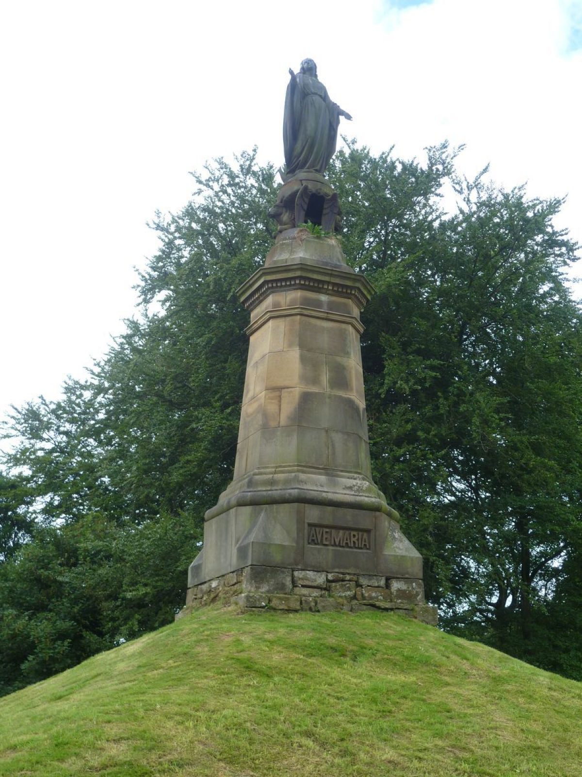
Before the west front of the College, at the end of The Avenue, there is a walled forecourt, entered through stone gate piers with broken pediments and urns (c 1700, listed grade II). The piers were moved to this position, probably from the south side of the house, and are not shown on an engraving of 1801 (Whitaker 1801). The forecourt overlooks the main drive which is aligned with the front of the house and flanked by stone-lined canals. The view west along The Avenue is terminated by a C19 statue on a mound. Sir Nicholas Shireburn laid out The Avenue and canals in 1696 and the latter were enlarged to their present length, of c 200m, in 1710.
The gardens of the south front consist of a large rectangular area of lawns and playing fields bordered by a low stone wall punctuated by low piers (C19, listed grade II). Both the east wall and part of the south wall retain a range of evenly spaced cast-iron baluster-like piers with railings between. The piers are copied from C17 originals in the formal garden (see below). This area is used for sports activities and was levelled in the early C19, removing terraces, water features and a maze. The only features which seem to survive from the pre C19 garden are two sections of walling, aligned north/south, c 30m from the building and c 50m apart. They are c 6m in height.
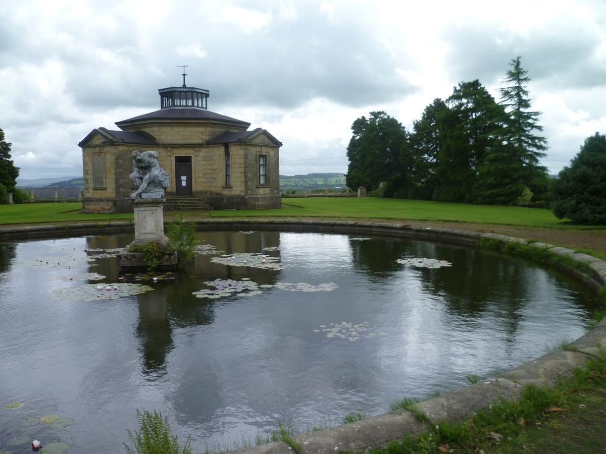
To the south of the south lawns there is a formal garden which is enclosed by walls. A gateway (c 1700, reset, listed grade II) is set into the C19 walls of the lawns, c 100m south of the College. It has gate piers capped with broken pediments and is aligned with the western of the two wall sections. This leads to a path running east/west which forms the northern edge of the formal gardens. These consist of two subdivided rectangular areas of equal size, flanked on the east and west sides by irregularly shaped areas. On the west side the area is triangular in shape and walled on the west and south sides. It was laid out as tennis courts in the late C20. The 1st edition OS map surveyed 1844 shows a perimeter path and tree- or shrub-lined axial paths. Set into the south wall is a domed observatory, and at the north-west corner there is a stone doorway, probably of early C18 date (walls and doorway listed grade II). Steps lead up from the centre of the east side of this area to the western of the two rectangular gardens, which consists of a raised platform with ramped sides. On the east and west sides of the ramp allées lead directly south and terminate with pavilions (both listed grade I) of c 1700. These are of identical design, with ogee pyramidal roofs and paired windows giving views north over the gardens and long-distance views southwards over the Pennines. They are linked by a clairvoie which consists of a stone wall punctuated by balusters with alternating acorn and cone finials. Some of these are of stone and some are cast-iron replicas of the type used for the walls around the south lawns. Photographs show that they were linked by barley-twist railings, said to have been made of wood (CL 1910).
In the centre of the raised platform is a circular lily pond (c 1700, retaining wall listed grade II), with a stone basin and central plinth. Around the pond are a number of plinths which formerly supported statuary. Between the pond and the clairvoie is an octagonal stone observatory (1838, listed grade II), called the Old Weather Station and used as a cafe.
The pond has quartering paths leading from it, those to the east and west with flights of stone steps (both listed grade II, repositioned mid C19) leading down to the allées. That on the east side links with a path leading through to the neighbouring garden. This consists of an area divided into two compartments of unequal size by a path flanked by yew hedges which bow out at the mid-point to form a circular area. On the north side the smaller of the two areas consists of a parterre with geometrical beds, probably of C20 date. On the south side there is a large sunken circular lawn, called the Bowling Green. This is surrounded by clipped hedges of yew on all but the east side, where the circle is completed by a number of yew trees. Immediately to the south of the Bowling Green, south of the yew hedge, a path leads eastwards through the garden from the clairvoie.
To the east of this garden there is a terrace with three sets of stone steps leading down from the three axial paths of the formal garden; these lead to an area of irregular rhombic shape with walls on the east and south sides splaying at an angle to the axis of the gardens. On the west side there is a yew walk, called the Dark Walk, which runs north/south along the edge of the terrace. On the east side there is a centrally positioned doorway in the wall, aligned with the path leading from the lily pond, and on the south side there is an offset opening leading to the kitchen gardens.
Elements of these gardens were described by the poet Gerard Manley Hopkins, who taught at Stonyhurst during the 1870s, in a letter to Robert Bridges of c 1873: 'There is a garden with a bowling green, walled in by massive yew hedges, a bowered yew walk with two real Queen Anne summerhouses, observatories...' (Martin 1991).
PARK
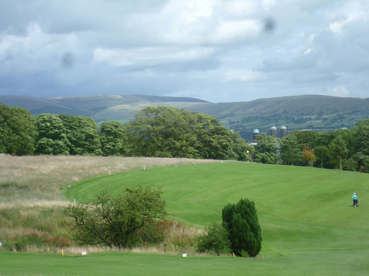
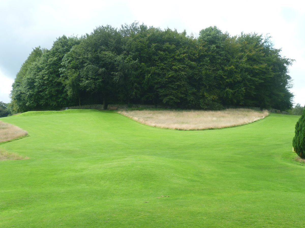
Parkland is situated to the north and west of the College. To the north there is open land with a tree belt to the north and an area of woodland, called Crow Wood, to the north-west. West of this, on the east side of the north-west drive, there is open grassland scattered with mature trees. Immediately north of The Avenue there is open grassland with sports pitches. The remaining parkland, in the area north of The Avenue, is part of a former deer park which is now (1997) used as a golf course. This area is open grassland, walled on the south and east sides, with scattered mature trees and clumps, including a large circular walled clump, called Park Clump. A belt of trees called Park Wood planted on the steep sides of a stream, as shown on the 1818 county map, shelters the northern boundaries, and beyond this, to the north and outside the registered area, is Higher Stonyhurst Park, which is largely walled and represents the extent of the deer park shown on the 1818 map.
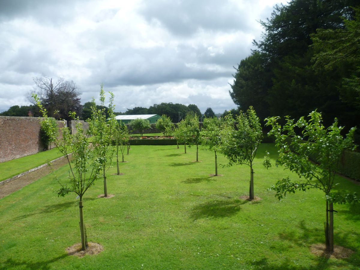
KITCHEN GARDEN
The kitchen garden is situated c 300m south of the house, south-east of the formal garden. It is walled on the east and south sides; the northern wall is shared with the formal gardens while the western wall, which is shown on the 1932 OS map, has been taken down. A gardener's house is situated at the west end of the south wall. A range of glasshouses running from east to west divides the garden into two areas. The garden is not shown on the 1844 OS map; it is probably the site of 'orchards, vineries, greenhouses..' described c 1873 by Gerard Manley Hopkins (Martin 1991), and is shown in approximately its present form on the 1932 OS map.
REFERENCES
Whitaker, History of the Parish of Whalley (1801)
Country Life, 28 (15 October 1910), pp 534-42; (22 October 1910), pp 574-82; 84 (16 July 1938), pp 60-5; (23 July 1938), pp 84-8
The Victoria History of the County of Lancashire 7, (1912), pp 7-14
N Pevsner, The Buildings of England: North Lancashire (1969), pp 239-42
R B Martin, Gerard Manley Hopkins (1991), pp 199-223
Maps
C Greenwood, Map of the County Palatine of Lancaster, 1818
OS 6" to 1 mile: Lancashire sheet LIV, 1st edition surveyed 1844; 2nd edition published 1913; 1932 edition
Archival items
W Turner, Stonyhurst, engraving, around 1801 (reproduced in Whitaker (1801))
A Symondson (SJ), Stonyhurst College Lancashire, (typescript tour notes 1996 (EH file))
Description written: August 1997
Edited: March 1999
- Visitor Access, Directions & Contacts
Telephone
01254 826345Website
http://www.hha.org.ukAccess contact details
The gardens are open between July and mid-August, daily except Fridays, between 1pm and 4.30pm. Please check before travelling.
Directions
5 miles south of Clitheroe on the B6243
- History
The following is from the Register of Parks and Gardens of Special Historic Interest. For the most up-to-date Register entry, please visit the The National Heritage List for England (NHLE):
www.historicengland.org.uk/listing/the-list
HISTORIC DEVELOPMENT
The estate passed to the Shireburne family in 1377 and remained in the family until 1754 when it passed, through marriage, to the Weld family. After this it was abandoned until Thomas Weld handed it to Jesuit refugees from Liege in 1794, who established the college of St Omers there. This school had been set up originally in the Spanish Netherlands in 1593 for the education of the sons of the English Catholic nobility, and members of the Shireburn and Weld families had been educated there. Stonyhurst was initially seen as a place of temporary asylum, but new stability followed the passing of the Roman Catholic Emancipation Act in 1829, and the establishment, which still occupies the building today (1997), had the dual function of being both a school and the headquarters of the English Province of the Society of Jesus.
- Associated People
- Features & Designations
Designations
The National Heritage List for England: Register of Parks and Gardens
- Reference: GD1951
- Grade: II*
Features
- Sculpture
- Pool
- Lawn
- Flower Bed
- Kitchen Garden
- Tree Avenue
- Manor House (featured building)
- Now School
- Earliest Date:
- Latest Date:
- Key Information
Type
Garden
Purpose
Ornamental
Principal Building
Education
Survival
Extant
Hectares
75
Open to the public
Yes
Civil Parish
Clitheroe
- References
References
- {English Heritage Register of Parks and Gardens of Special Historic Interest}, (Swindon: English Heritage, 2008) [on CD-ROM] Historic England Register of Parks and Gardens of Special Historic Interest
- Hartwell, Clare and Pevsner, Nikolaus {The Buildings of England: Lancashire : North} (London: Yale University Press, 2009) The Buildings of England: Lancashire : North
- Farrer, W and Brownbill, J. {Victoria County History: Lancaster, Volume 7} ([n.p.]: [n.pub.], 1912), pp. 7-14 Victoria County History: Lancaster, Volume 7
- Architectural History Practice; Chris Burnett Associates; Oxford Archaeology {Stonyhurst College Conservation Management Plan} (2014) Stonyhurst College Conservation Management Plan