Introduction
Spetchley Park is a house of the early-19th century in a 17th-century deer park, landscaped in the 19th century. Extensive flower gardens dating from the early-20th century surround the house.
www.historicengland.org.uk/listing/the-list
A deer park, 19th-century landscape park, and 19th-century and early 20th-century gardens associated with a country house.
DESCRIPTION
LOCATION, AREA, BOUNDARIES, LANDFORM, SETTING
Spetchley lies c 5km east of Worcester, separated from it by the M5 motorway. The main A422 road to Alcester bounds the greater part of the site to the north. Otherwise the park boundary is largely formed by field edges; the curving pale around the deer park was presumably defined when the deer park was established. Adjoining the house is the parish church of All Saints (in the care of the Redundant Churches Fund). The registered area is c 136ha.
ENTRANCES AND APPROACHES
Spetchley Park is approached along a curving drive from the east, which enters the grounds north of the kitchen garden. The main approach drive eastwards through the park, from early C19 stone gate piers near Mill Farm, was no longer used in the late C20.
PRINCIPAL BUILDING
The present house (listed grade II*) was rebuilt to a design by John Tasker (d 1816) in 1811 to replace an older moated building, that moat being incorporated into the north-eastern spur of the Garden Pool. Of Bath stone and two storeys, Spetchley Park has a long south front and a shorter west one, the latter with a giant portico of four unfluted Ionic columns. On the south front is a central semicircular projection with unfluted Ionic pilasters. Overall the building is sparely ornamented and somewhat severe.
To the north of the house is the early C19 Stable Yard and the medieval and later parish church of All Saints (church listed grade B; churchyard wall grade II). Home Farm, outside the registered area, lies north of the A422. About 50m east of the house, in a yew grove, is a brick boghouse.
GARDENS AND PLEASURE GROUNDS
The pleasure grounds and Garden Pool are contained within a brick ha-ha. To the west, across the gravelled drive, and especially to the south, those grounds are laid to lawns. The south, or Front Lawn runs on a slight downward slope for c 150m to the Garden Pool, an irregular small lake c 250m long from east to west and c 100m wide and with a small island. Beyond, the view from the house takes in the fishpond in the deer park and the high ground of the Malverns 8km to the south-east. The Garden Pool is fed by a stone-lined canal-like channel which, with the narrower Moat channel, carries water from the Horse Pool, also stone-lined, which lies south-east of the Stable Yard. Other lawns lie north-east (Cork Lawn, Rose Lawn) and east (New Lawn) of the Garden Pool. The Rose Lawn has symmetrically arranged rose beds. A late C19 iron footbridge carries the Long Walk from the house, via the Front Lawn, across the channel from the Horse Pool, to the Rose Lawn.
Since being laid out, probably in the early C19, the pleasure grounds have included the walks or borders around the perimeter of the walled kitchen garden, while in the 1990s a new Millennium pleasure garden was begun within the walled area itself (see below). Opening off the South Walk around the kitchen garden, opposite the Alcove, is the Fountain Garden. The plan of the Fountain Garden, attributed to Ellen Willmott, consists of a central fountain, the basin supported by the tails of four fish, surrounded by four gardens each surrounded by metre-high clipped yew hedges. Within each enclosure is a series of further beds, thirty-six in all, separated by flagged paths. The original planting scheme, with a discrete botanical group to each bed, was no longer followed in the late C20.
Immediately south of the Fountain Garden is a conservatory, built against a brick wall with a decorative stone top rising above the glasshouse's roof. A building in this position is shown on the OS maps of the early 1880s, and an early C19 date would be plausible on architectural grounds. It may be, however, that the conservatory dates from the 1890s as suggested by the present owner.
The eastern side of the pleasure grounds is given over to the Copse, woodland with specimen trees and shrubs, cut through with walks with flower beds to either side. On one of those walks, towards the southern edge of the Copse, is the Root House (listed grade II), a rustick summerhouse of the 1820s or 1830s, with a conical thatched roof, four gnarled elm posts to the front, and decorative panels of hazel withies to the interior. Jones (1974, 180) says the root house is identical to the one which appears as the centrepiece of Plate M of Thomas Wright's Universal Architecture (1755-8).
A second late C19 decorative iron footbridge (listed grade II) crosses the A422 west of the parish church to a further area of pleasure grounds north of the road known as the Round Hill. A rustick summerhouse similar to that in the main part of the grounds survived until demolished in the late C20. At the north end of the Round Hill is a late C18 or early C19 house, historically occupied by the agent.
The pleasure grounds are believed to have been laid out soon after 1811 (not on OS drawing of that date), at the time the house was rebuilt. J P Neale (1822) described the grounds as newly laid out in 1822. The earlier formal gardens are shown on a C18 painting of the house at Spetchley. Planting of trees probably continued for some time. Disentangling the development of the gardens between 1891 and 1934 is difficult.
PARK
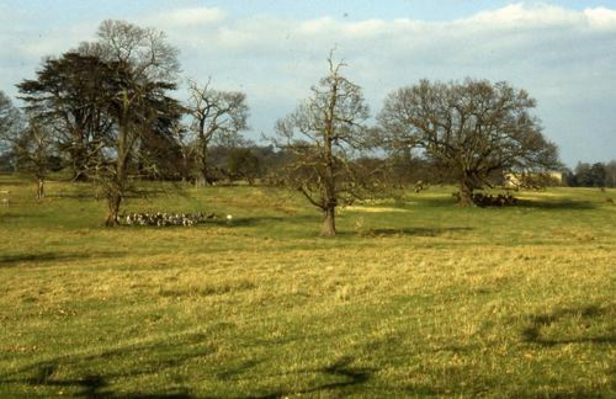
The landscape park lies mainly west of the pleasure grounds, while the deer park extends as a lobe to the south. South of the pleasure grounds, between them and the deer park, is a one-field wide zone of arable land. East and west of the pleasure grounds, however, is permanent pasture with parkland oaks. Here there is extensive and well-preserved ridge and furrow.
Within the deer park itself, bounded with a ditch and iron paling, virtually the whole landscape is ridge and furrow, a notable survival. The other immediately notable features of the deer park are the large numbers of mature, and over-mature oaks. The ground rises gradually from north to south onto a slight knoll, on top of which is a weatherboarded shelter. Footings nearby mark the position of other buildings. In the eastern part of the deer park is a roughly circular pond c 250m in diameter with a boathouse on the west side. Between this and the knoll is a 100m long T-plan pond, perhaps for watering stock.
Licence to impark any part of the parish for deer, rabbits and pheasants was granted in 1625. The deer park is shown on Nash's county map of 1781. In 1892 Whitaker said the park was of 116 acres (48ha), fenced with cleaved oak, and contained 200 fallow deer. Within was an oak with a summerhouse [not extant 1997] in its branches large enough to hold twenty people. In the later C19 the park extended upto the ha-ha along the south side of the Garden Pool. Its present (1997) north boundary, 250m south of that, was apparently established by 1903.
KITCHEN GARDEN
The early C19 brick-walled kitchen garden lies c 150m east of the house. The main compartment, mostly still gardened and with some low box hedges, splays outwards to the south, and internally is divided into quarters with a circular basin in the centre. The western part of the garden is enclosed within a tall yew hedge; inside, through a C19 wrought-iron gate, is an early C20 vinery and the Millennium Garden laid out in the mid 1990s with sunken rectangular pools, a pergola, and a wheel-like arrangement of beds around a Victorian fountain (imported to Spetchley in the 1990s).
Around the perimeter of the walled garden are broad walks with shrubs, to the east, west and south bounded on the outside by a ha-ha and a tall yew hedge. The North Border is bounded externally by a tall brick wall, the south wall of the compartment (with curvilinear glasshouse) to the north (see below). Built against the outside of the south wall of the kitchen garden, and looking across the South Border walk and into the Fountain Garden (and probably of much the same date as the latter; certainly present by 1916) is the Alcove, a Bath stone temple or seat whose frieze is inscribed with words from the Rubaiyat of Omar Khayyam.
North of the North Border is the brick-walled Melon Yard, with three pits. Flower beds and climbers have been introduced. In an enclosure to the east of the Melon Yard are single-storey brick sheds and shelters, and a mid to late C19 curvilinear glasshouse. Garden Cottage, a substantial pebbledashed house superficially of the later C19, lies on the north-east corner of the kitchen garden complex.
REFERENCES
T Nash, Collections for a History of Worcester I, (1781)
J P Neale, Views of the Seats of Noblemen & Gentlemen in England, Wales, Scotland and Ireland 5, (1822), (published in 6 vols, 1818-23)
J Whitaker, A Descriptive List of the Deer Parks and Paddocks of England (1892)
The Victoria History of the County of Worcester 3, (1913), pp 524-6
Country Life, 40 (8 July 1916), pp 42-8; (15 July 1916), pp 70-5
N Pevsner, The Buildings of England: Worcestershire (1968), p 262
B Jones, Follies & Grottoes (1974)
R Sidwell, West Midland Gardens (1981), pp 85-7
R J Berkeley, Spetchley Park Garden (1993)
R Lockett, A Survey of Historic Parks and Gardens in Worcestershire, (Hereford & Worcester Gardens Trust 1997)
Maps
OS 6" to 1 mile: Worcestershire sheet 34 NW, 1st edition published 1884
Worcestershire sheet 34 SW, 1st edition published 1884
Worcestershire sheet 34 NW, 2nd edition published 1905
Worcestershire sheet 34 SW, 2nd edition published 1905
OS 25" to 1 mile: Worcestershire sheet 34.5, 1st edition published 1885
Archival items
Map of Spetchley estate, 1838-9 (BA 4383 (f 970.5:119)), (Worcestershire Record Office) Maps
- Visitor Access, Directions & Contacts
Telephone
020 7259 5688Website
http://www.hha.org.ukAccess contact details
The site is open from 11 am, Wednesdays to Sundays, between March and September. It is open at weekends only in October. http://www.spetchleygardens.co.uk/visit.php
Directions
Three miles south-east of Worcester via the A422.
- History
The following is from the Register of Parks and Gardens of Special Historic Interest. For the most up-to-date Register entry, please visit the The National Heritage List for England (NHLE):
www.historicengland.org.uk/listing/the-list
The Spetchley estate was purchased by Rowland Berkeley, a wealthy wool merchant and banker, in 1606, and has been in the family ever since. Sir Robert Berkeley (died 1656), who inherited the estate in 1611, received licence in 1625 to impark at Spetchley. The house was burnt in the aftermath of the Battle of Worcester in 1651. In 1683 the diarist John Evelyn noted that the owner Sir Robert Berkeley was 'most ingenious, virtuous and religious ... and very curious in gardening.' A major phase of alterations began at Spetchley following Robert Berkeley's succession in 1804, with the house being rebuilt from 1811 and the surrounding landscape reordered. The gardens owe much of their detailed form in the late 20th century to the activities of Rose Willmott, who married Robert Berkeley of Spetchley in 1891 and who lived here until her death in 1922. Her younger sister, Ellen Willmott (died 1934), one of the most famous gardeners of her time, also had a considerable input. After Rose's death, responsibility for the garden passed to Captain R G W Berkeley, who added considerably to the plant collections. In the later 1990s Major R J Berkeley added a Millennium Garden within the kitchen garden.
- Associated People
- Features & Designations
Designations
The National Heritage List for England: Register of Parks and Gardens
- Reference: GD1892
- Grade: II*
Features
- Kitchen Garden
- Root House
- Conservatory
- Pool
- Herbaceous Border
- Fountain
- House (featured building)
- Earliest Date:
- Latest Date:
- Key Information
Type
Garden
Purpose
Ornamental
Principal Building
Domestic / Residential
Survival
Extant
Hectares
136
Open to the public
Yes
Civil Parish
Spetchley
- References
References
- {English Heritage Register of Parks and Gardens of Special Historic Interest}, (Swindon: English Heritage, 2008) [on CD-ROM] Historic England Register of Parks and Gardens of Special Historic Interest
- Jones, B {Follies & Grottoes} (London: Constable & Co., 1953) Follies & Grottoes
- Pevsner, N., {The Buildings of England: Worcestershire} (Harmondsworth: Penguin, 1968), p. 262 The Buildings of England: Worcestershire
- Lockett, R., {A Survey of Historic Parks and Gardens in Worcestershire} (Hereford and Worcester: Hereford and Worcester Gardens Trust, 1977) A Survey of Historic Parks and Gardens in Worcestershire
- Sidwell, R., {West Midland Gardens: the gardens of Hereford & Worcester, Shropshire, Staffordshire, Warwickshire and West Midlands} (Gloucester: Sutton, 1981), pp. 85-7 West Midland Gardens: the gardens of Hereford & Worcester, Shropshire, Staffordshire, Warwickshire and West Midlands
- Willis-Bund, J. W. {Victoria County History: Worcester, Volume 3} (London: Constable, 1913), pp. 524-6 Victoria County History: Worcester, Volume 3
- Related Documents
-
CLS 1/913
Conservation Management Plan - Digital copy
Nick Owen (Debois Landsdcape Survey Group) - 2006
-
CLS 1/913