Introduction
Savill Garden is a landscaped wild and woodland garden of some 14 hectares.
Terrain
Undulating.www.historicengland.org.uk/listing/the-list
Landscaped woodland gardens created within Windsor Great Park by Sir Eric Savill 1932-9, extended 1950s and 1977.
NOTE
This site is part of the Royal Estate, Windsor, together with the following six related park or garden areas which are given separate entries within the Register: within Berkshire, Windsor Great Park (within which The Savill Garden and Valley Gardens lie), Frogmore Gardens, Windsor Castle and Home Park, Cumberland Lodge, Royal Lodge; within Surrey, Virginia Water.
DESCRIPTION
LOCATION, AREA, BOUNDARIES, LANDFORM, SETTING
The 14ha Savill Garden lies at the eastern boundary of, and is enclosed by, the Great Park, separated from Wick Lane and Egham Wick to the east by a belt of mature trees, and bounded to the north by a brick wall built in the 1940s. The Savill Garden is separated from the surrounding Great Park by fencing. To the west and south-west lie Smith's Lawn and Obelisk Pond. To the south, connected by a drive east of Obelisk Pond, lie the c 120ha Valley Gardens, bounded to the west, south and east by Virginia Water, and to the north largely by Smith's Lawn. The undulating gardens are set in the rural Great Park, with the Cumberland Lodge estate adjacent to the west and Royal Lodge set in its own grounds to the north.
ENTRANCES AND APPROACHES
The main entrance to The Savill Garden lies on the east boundary, approached directly off Wick Lane to the east, via a car park set in woodland. The Valley Gardens are approached from both west and east off the perimeter path around Virginia Water, and from the north via a drive serving Smith's Lawn, and a further drive south from The Savill Garden lying 1km to the north.
PLEASURE GROUNDS
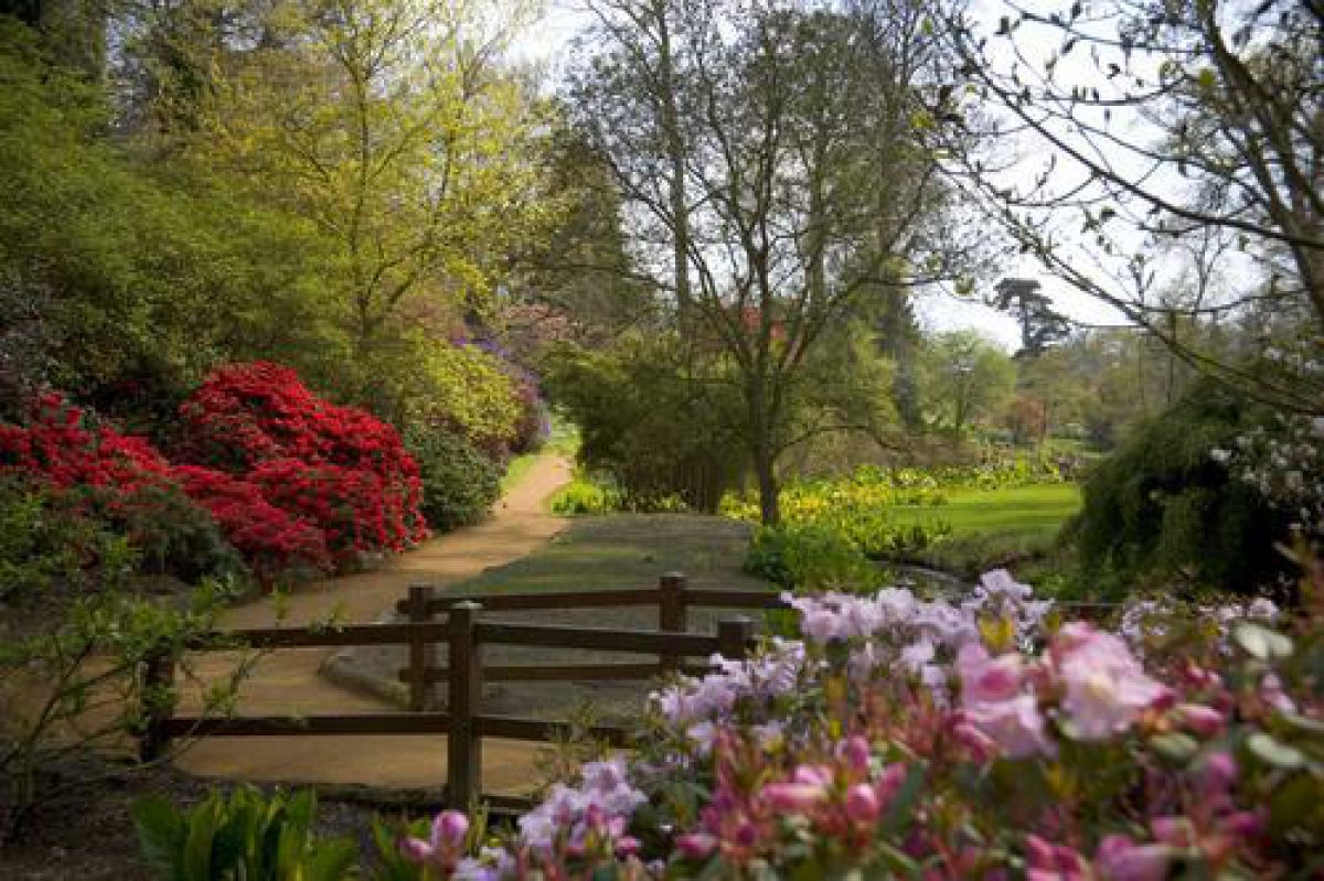
The Savill Garden is laid out largely informally, with the axial Main Ride extending north-west across the Garden from the main entrance. The site is bisected by the Upper and Lower Ponds, which are fed by a stream entering the site at the north-east corner and linking the two ponds which extend south-west across the Garden to Obelisk Ride, emptying beneath Stone Bridge, which carries Obelisk Ride, into Obelisk Pond lying at the southern tip. A further stream runs south-east parallel with the east boundary, emptying via a further small pond into Lower Pond adjacent to Jubilee Bridge.
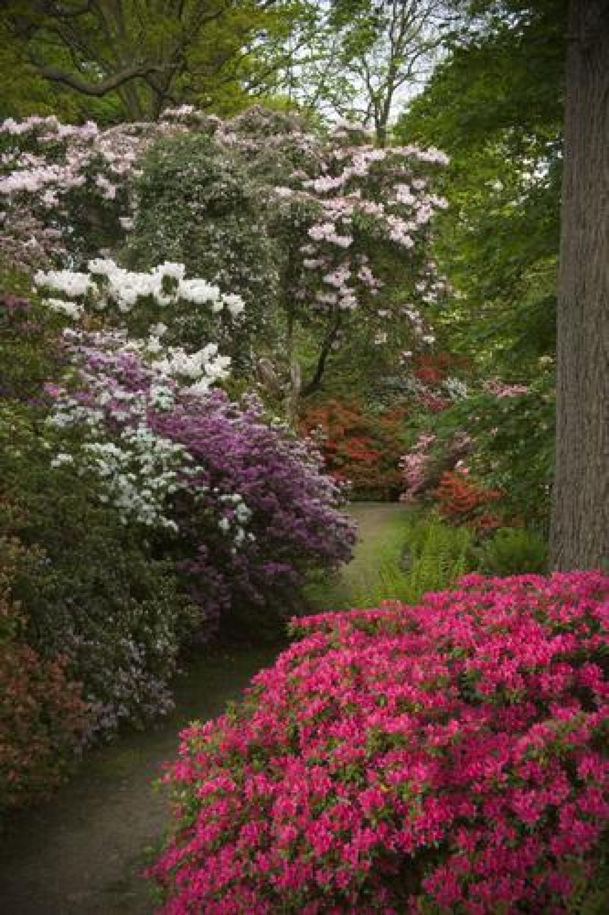
To either side of Main Ride lie areas of woodland separated by open informal lawns. At the north-west corner a summerhouse overlooks an open lawn flanked to the west by Top Wood and to the east, beyond the curving Main Ride, by Home Wood, each area crossed by a network of paths between shrubby planting and trees. Within Top Wood lies a collection of hydrangeas, and Home Wood encloses collections of rhododendrons, camellias and magnolias. The lawn extends south-east, flanked to the west by an alpine meadow and to the east by Middle Wood, terminating at the north end of Lower Pond. A bog garden and peat beds have been created around the stream linking Upper and Lower Ponds. From the lawn, Jubilee Bridge (designed in 1977 by Sir Hugh Casson to mark H M the Queen's Silver Jubilee) extends south across Lower Pond, giving access to Jubilee Garden (an area of autumn colouring subjects) and the arboretum lying at the southern corner of the garden.
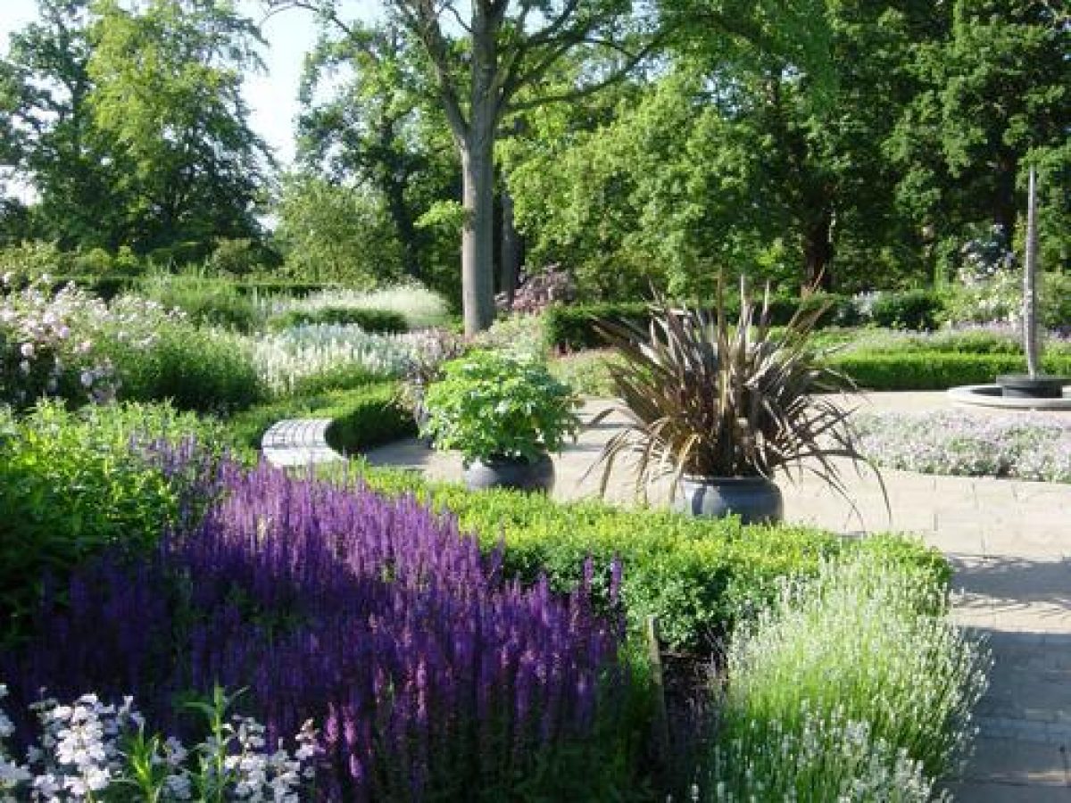
North-east of Main Ride lies a more formal area, developed from 1950, containing themed areas, including a Summer Garden, Dry Garden (1977), c 50m long herbaceous borders, raised alpine beds and a rose feature, enclosed and crossed by a network of paths. At the north-east corner of this area lies a service area, and adjacent to this to the east the Temperate House (rebuilt late C20).
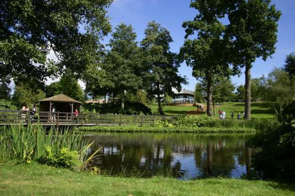
The Valley Gardens, lying c 1km south of The Savill Garden, occupy a site above Virginia Water lake. A series of parallel valleys lead south to the north bank of Virginia Water lake, with dramatic changes in level, the most spectacular valley (in terms both of planting and topography) being the Punch Bowl. The area is laid out around a structure of mature woodland trees, interspersed with ornamental trees and overlaid with a network of informal woodland paths. The area accommodates various collections of particular genera, with sections running from west to east including the Holly Collection, J B Stevenson's Rhododendron Species Collection (1950-6), Hydrangea Garden (1963-4), Pinetum Valley (established 1935, before the Valley Gardens proper; Bisgrove 1978) with a notable Metasequoia grove (1954), Azalea Valley, Heather Garden (1954 and later) lying around a pre-1918 gravel pit, and a camellia collection. The Punch Bowl and Valley Garden lie adjacent at the heart of the area, designed to take full advantage of the dramatic valleys running down to the lake below. At the north end of the Punch Bowl stands a wooden pavilion in classical temple style (designed by Sir Hugh Casson 1979, in memory of Lord Plunket, d 1975). This building overlooks the large, natural semicircular amphitheatre which is planted with thousands of brilliant, early-May-flowering Japanese Kurume azalea plants, the species chosen from a group known as the 'Wilson Fifty' in honour of E H Wilson who introduced them to Britain from Japan. The Valley Garden proper consists of two valleys of azaleas and rhododendrons curving down to the lakeside.
REFERENCES
R Bisgrove, The Gardens of Britain, Berkshire, Oxfordshire, Buckinghamshire, Bedfordshire and Hertfordshire 3, (1978), pp 191-3
G Plumptre, Royal Gardens (1981), pp 68-85
R Strong, Royal Gardens (1992), p 142
D Lambert and T Longstaffe-Gowan, Report on Windsor Home and Great Parks (1996)
J Roberts, Royal Landscape, The Gardens and Parks of Windsor, (1997) pp 383-90
Maps
J Norden, A description of the honour of Windesor, 1607 (British Library and Royal Collection)
H Wise, An Accurate Plan of Windsor Parks and Part of the Forrest, around 1712 (Royal Collection)
J Vardy, Plan of Windsor Great Park, 1750 (Public Record Office)
J Rocque, Map of Berkshire, 1761
W Faden, Plan of Windsor Great Park, 1789-91 (Public Record Office)
W J Smith, Plan of Windsor Great Park, around 1830 (Royal Collection)
OS 6" to 1 mile: 1st edition published 1881
Description written: May 1999
Amended: September 1999
Edited: April 2000
- Visitor Access, Directions & Contacts
Access contact details
The garden is open daily throughout the year, with shorter hours in the winter season and on Sundays. http://www.windsorgreatpark.co.uk/en/visit/opening-times-charges
Directions
The gardens are close to junction 13 of the M25. Please see: http://www.windsorgreatpark.co.uk/en/visit/how-to-find-us
Owners
The Crown
The Crown Estate Office, The Great Park, Windsor, Berkshire,, SL4 2HT
- History
The following is from the Register of Parks and Gardens of Special Historic Interest. For the most up-to-date Register entry, please visit the The National Heritage List for England (NHLE):
www.historicengland.org.uk/listing/the-list
HISTORIC DEVELOPMENT
In 1931 Sir Eric Savill was made Deputy Surveyor of Windsor Great Park (see description of this site elsewhere in the Register), and in 1932, with encouragement from George V and Queen Mary, began to clear about 10 hectares of rough woodland on the eastern boundary of the Great Park, taking in parts of Chapel and Plainfields woods and Parkside Tree Nursery (laid out as a nursery by Nathaniel Kent in the 1790s). From 1932 to 1939 Savill created a woodland and bog garden amongst the remaining canopy of mature woodland trees, forming streams and ponds from the surrounding springs. Following a visit by George V and Queen Mary in 1934, further ground was taken into the gardens, with plants being provided from all over Britain. After a period of some neglect during the Second World War, the gardens continued to be expanded and developed with the acquisition of collections of various botanical groups of plants, being named in honour of Sir Eric by George VI in 1951. The adjacent Valley Gardens were developed in tandem from the late 1940s as an extension woodland garden between The Savill Garden and Virginia Water lake (see description of this site elsewhere in the Register). The area took in the gentle slopes down to the lake from the higher ground to the north which formerly (18th-19th centuries) had been the open setting for the north bank of the 18th-century lake, being planted up with large numbers of ericaceous plants, including the acquisition (1950-6) of J B Stevenson's notable species rhododendron collection from nearby Tower Court near Ascot, and a collection of Japanese Kurume azaleas. Both areas remain (1999) in the ownership of the Crown, managed by the Crown Estate, and are open to the public.
- Associated People
- Features & Designations
Designations
The National Heritage List for England: Register of Parks and Gardens
- Reference: GD2181
- Grade: I
Plant Environment
- Plant Type
- Wild Garden
Style
Informal
Features
- Visitor Centre (featured building)
- Description: The Savill Building, a leaf-shaped construction using contemporary engineering techniques.
- Earliest Date:
- Latest Date:
- Walk
- Description: Azalea walk.
- Planting
- Description: New Zealand garden.
- Rose Garden
- Lake
- Description: Virginia water.
- Key Information
Type
Garden
Purpose
Ornamental
Plant Environment
Plant Type
Principal Building
Recreational
Survival
Extant
Hectares
14
Open to the public
Yes
Civil Parish
Old Windsor
- References
References
- {English Heritage Register of Parks and Gardens of Special Historic Interest}, (Swindon: English Heritage, 2008) [on CD-ROM] Historic England Register of Parks and Gardens of Special Historic Interest
- Strong, R., {Royal Gardens} (London: BBC, 1992), p. 142 Royal Gardens