Introduction
Magdalen College has gardens, pleasure grounds and a deer park covering about 12 hectares. There is also a large wildflower meadow and a riverside walk. The gardens originated at the foundation of the college in 1458 and have continued to developed since that date.
Terrain
On level ground bisected north to south by an arm of the River Cherwell.www.historicengland.org.uk/listing/the-list
Sixteenth-century and later college gardens, pleasure grounds and small park.
DESCRIPTION
LOCATION, AREA, BOUNDARIES, LANDFORM, SETTING
Magdalen College lies close to the centre of Oxford at the bottom, east end of the High Street, occupying the land on the east side of Longwall Street. The c 12ha college and its grounds lie on level ground bisected north to south by an arm of the River Cherwell. The college is bounded to the west by a 4m high, castellated stone wall (late C15, listed grade II*), with an embattled tower, Gallows Bastion, at the junction of Holywell Street with Longwall Street. The wall continues along the north side of the Grove, bounded to the north by a lane giving access to Holywell Mill and ford, also reached from the Grove 150m north of New Building through an arched and castellated gateway with iron gates (1879). The east half of the north boundary abuts partly onto St Catherine's College (1960s) and partly Merton Sports Ground, the east boundary being formed by the main arm of the river and beyond this Angel and Greyhound Meadow (part of the historic college estate), and the south boundary by the High Street and Botanic Garden (qv) beyond. The college is set within a group of colleges, the closest of which include St Catherine's to the north, New College (qv) to the west and Merton (qv) to the south-west.
ENTRANCES, APPROACHES AND QUADRANGLES
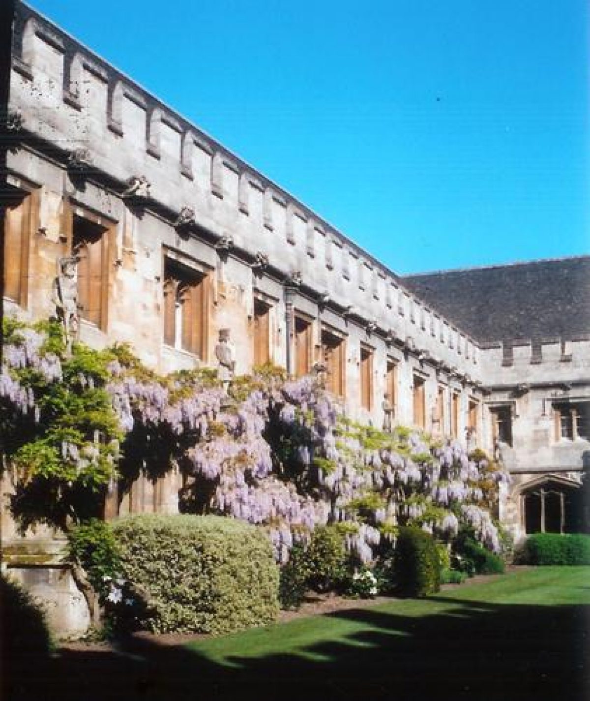
The main approach, off the High Street, opposite the Botanic Garden, enters through a short passageway into St John's Quadrangle, largely laid to lawn, with straight paths crossing at irregular angles. An arched, stone gateway (A W Pugin 1845, listed grade II) with a stepped gable and wooden double doors, standing adjacent to the west and seldom used, gives vehicular access to the Quadrangle. From St John's Quadrangle a doorway leads east through and under the Founder's Tower into the cloister (late C15) surrounding the grassed Cloister Quadrangle, dominated by the bell tower (1490s) to the south. Passages through the north range give onto the unfinished quadrangle south of the Palladian New Building (William Townesend 1730s, listed grade I). This consists largely of four rectangular panels of lawn separated by straight gravel paths leading south from the New Building, joined at the south end by a cross path giving access to the Meadow to the east and the Grove to the north-west. The lawn is overlooked to the north by the three-storey New Building, the lower floor being punctuated by the arches of an open loggia, and to the south by the north range of Cloister Quadrangle. The west boundary of the lawn is formed by a stone ha-ha dividing it from the Grove, and the east is formed by a low stone wall with an herbaceous border in front, the river behind to the east, and the Meadow beyond this.
Several further entrances give access from Longwall Street through the west wall. The two southern ones open onto a straight, paved terrace along the bottom of the wall within the C19 Longwall Quadrangle, the terrace returning east at the south end, along the north side of the New Library (J C Buckler 1850, listed grade II, formerly Magdalen College school room). Longwall Quadrangle is otherwise largely laid to lawn, with perimeter paths on the north and east sides, and access through the east range to St Swithun's Quadrangle (Bodley and Garner 1880(4). This last is bounded to the west and south by St Swithun's buildings, and to the east by the President's Garden, from which there is access, from the south-east corner, to St John's Quadrangle. The north boundary of the Quadrangle is formed by a raised grass terrace against a stone wall to the north, overlooking the Grove beyond.
GARDENS
The college gardens include the President's Garden, lying at the north-east corner of St Swithun's Quadrangle, separated from the Grove to the north by a stone wall, with a low terrace running along the base. It is laid largely to lawn, separated from St Swithun's Quadrangle by a stone wall with an iron pedestrian gate towards the south end, and entered from the President's Lodgings at the south-east corner via a gateway set into the stone wall, with an ornate iron gate with overthrow. The President's Garden was laid out 1826(9, and romanticised in 1859 with irregular borders, curving paths and shrubberies. It was truncated to about two-thirds of its former length when the Bodley and Garner extensions were made to form St Swithun's Quad.
On the south side of the High Street lies the Penicillin Memorial Rose Garden, a formal rose garden designed for the college by Dame Sylvia Crowe in 1953 to commemorate the development of penicillin as an antibiotic in Oxford during the 1940s. Its rectangular rose beds, surrounded by low, clipped box hedges, are enclosed by clipped yew hedges, with stone seats at the west end under a row of pleached copper beech.
PARK AND PLEASURE GROUND
The park, known as the Grove, is divided north to south from the pleasure ground, known as the Meadow, by an arm of the River Cherwell.
The Meadow consists of a triangular island flood meadow bounded by arms of the river, reached from the college buildings to the south-west via New Building lawn and a three-arched stone bridge (C17 or earlier, listed grade II), and from the north-west by the bridge from the Grove. At the west side of the three-arched bridge stands an elaborate wrought-iron gateway, with iron piers and overthrow flanked by stone screens curving down to the low flanking walls. The path at the south side of New Building lawn continues east across the bridge, meeting the west arm of the C16 gravel Water Walks. These are now known (since the early C19) as Addison's Walk and consist of a main perimeter path raised significantly above the inner Meadow ground level, from which it is separated by an inner ditch, together with an iron fence separating ditch from pasture. The open pasture, periodically grazed by deer, is densely planted around the perimeter with trees and shrubs which flank the path, and retains a rare and famous plantation of the snake's-head fritillary (Fritillaria meleagris). An iron gateway flanked by stone piers stands at the north-east corner of the Meadow, brought from Joseph Addison's home at Bilton, and bearing his initials, J A, and those of his wife, C W. Views out over the river include that to Holywell Mill to the north, Angel and Greyhound Meadow to the east and Magdalen Bridge to the south; to the west the Walk overlooks the college buildings and Grove, with further university buildings beyond. To the north-east of the Meadow, reached by a wooden bridge over the river (first erected 1867), lies the Fellows' Garden (early C20), an informal area of lawn running along the east bank of the river laid out to connect with the college's playing fields. It is planted with exotic specimen trees, and surrounded by a circuit walk, with a circular pool at the north end.
The Walks have existed since at least the C16 (Agas, 1578), shown flanked by trees on C16-C18 mapping, and reinforced during the Civil War (1640s). Their rural layout influenced the poet, essayist and statesman Joseph Addison (1672-1719), who as a Fellow knew the college precincts well and took daily walks around the Meadow. Through his Spectator essays of 1711-13 Addison exerted considerable influence on the evolution of the English garden by advocating that 'a whole Estate be thrown into a kind of Garden by frequent Plantations that may turn as much to the Profit as the Pleasure of the Owner', and the circuit (completed in the C19) still exhibits the 'pleasing variety of scenes and landscapes' (Batey 1982) which Addison knew.
The Grove lies immediately north of the college buildings, a small park laid to pasture with trees informally planted throughout, containing a herd of around forty deer. The deer are first mentioned in college records 1706-7. It is bounded to the west and north by the C15, castellated stone boundary wall, to the east by an iron fence standing immediately above the stone-walled west bank of the river, and to the south by an iron fence and the ha-ha adjacent to New Building lawn, together with the New Building itself. Pedestrian access from New Building lawn was gained via a passage through the centre of the New Building, at the north end of which is an ornamented wrought-iron gate and grille (now, 1997, sealed shut) giving onto the adjacent terrace, and the Grove beyond. Several gateways punctuate the boundary, including one standing 125m north of New Building, giving access east from the Grove into the Meadow. The gate standing at the north-east end of the college boundary wall, flanked by stone piers and iron gates, provides an entrance to the meadow via a small, stone bridge standing close to where Holywell Mill stream enters the river.
The New Building stands in the south-east corner of the Grove, covering an area previously laid out as gardens (probably kitchen gardens and orchards ( Agas, 1578; Loggan, 1675. These the subject of a resistivity survey published in the Magdalen College Record 1997 and an article by J Steane in Oxoniensa 1998.) A narrow terrace adjacent to the north (Professor Tansley, 1934) is bounded by a low stone retaining wall with broad steps down to the adjacent pasture. The stone Grove Buildings (D Porphyrios late C20), erected in the south-west corner, overlook the Grove. Mapping of the C16 to the late C18 (Agas, 1578 to Davis, 1797) shows that the Grove contained a central north/south avenue of trees, crossed at right-angles by two further avenues, the whole area surrounded by a line of trees, with a bowling green c 50m north of the site of the New Building. By the late C19 (OS) the formal planting and perimeter trees were still discernible amongst dense additional tree planting.
REFERENCES
Country Life, 20 (3 November 1906), pp 621-9; 37 (26 June 1915), pp 897-900; 64 (13 October 1928), pp 502-10; (20 October 1928), pp 550-3
Victoria History of the County of Oxfordshire 3, (1954), pp 202-6
D Stroud, Humphry Repton (1962), pp 121, 171
N Pevsner and J Sherwood, The Buildings of England: Oxfordshire (1974), pp 150-5
Garden History 9, no 2 (1981), pp 110-17
M Batey, Oxford Gardens (1982), pp 91-103
Maps
Agas/Bereblock, Map of Oxford, engraved 1728 from 1578 original
Hollar, Map of Oxford, 1643
Loggan, Map of Oxford, 1675
R Davis, A New Map of the County of Oxford ..., 1797
Hoggar, Map of Oxford, 1850
OS 25" to 1 mile: 2nd edition published 1900; 1921 edition
OS 1:500 1st edition published 1880
Description written: November 1997
Amended: March 1999
Edited: March 2000
- Visitor Access, Directions & Contacts
Website
https://www.magd.ox.ac.ukDirections
Oxford City centre.
- History
The following is from the Register of Parks and Gardens of Special Historic Interest. For the most up-to-date Register entry, please visit the The National Heritage List for England (NHLE):
www.historicengland.org.uk/listing/the-list
HISTORIC DEVELOPMENT
Magdalen College was founded by Bishop Waynflete, Bishop of Winchester, in 1458, the buildings being erected outside the city walls, partly over the site of St John's Hospital. Much of the college building, including the Cloister Quadrangle, was completed by 1510, bounded to the north by open spaces. By 1578 (Agas) the Meadow, surrounded by arms of the River Cherwell, was encircled with informal, tree-lined Water Walks, reached by a bridge from the college buildings, and the Grove was laid out with formal allées, an arrangement which survived into the 20th century. In 1733/4 the New Building was erected, to designs by William Townesend, in the south-east corner of the Grove, forming the north side of a projected new quadrangle north of the Cloister Quadrangle, which was never completed. Humphry Repton's advice was sought in 1801. Repton produced a 'Red Book' relating to a projected new quadrangle for which John Nash produced plans for gothicising, but their ideas were rejected. Further quadrangles were created in the 19th century, and informal tree planting carried out in the Grove amongst the remains of the formal allées. The site remains (1997) in college use.
Period
- Post Medieval (1540 to 1901)
- Tudor (1485-1603)
- Associated People
- Features & Designations
Designations
The National Heritage List for England: Register of Parks and Gardens
- Reference: GD1403
- Grade: I
Features
- Lawn
- Walk
- Tennis Lawn
- Pond
- Shrub Border
- Herbaceous Border
- College (featured building)
- Earliest Date:
- Latest Date:
- Boundary Wall
- Description: The college is bounded to the west by a 4 metre high, castellated stone wall.
- Earliest Date:
- Latest Date:
- Tower
- Description: Embattled tower, Gallows Bastion, at the junction of Holywell Street with Longwall Street.
- Entrance
- Description: An arched and castellated gateway with iron gates.
- Earliest Date:
- Latest Date:
- River
- Riverside Walk
- Flood meadow
- Ditch
- Stream
- Description: Holywell Mill Stream
- Pool
- Description: Circular Pool
- Key Information
Type
Garden
Purpose
Ornamental
Principal Building
Education
Period
Post Medieval (1540 to 1901)
Survival
Extant
Hectares
12
Open to the public
Yes
- References
References
- {English Heritage Register of Parks and Gardens of Special Historic Interest}, (Swindon: English Heritage, 2008) [on CD-ROM] Historic England Register of Parks and Gardens of Special Historic Interest
- Pevsner, N. and J. Sherwood, {The Buildings of England: Oxfordshire} (Harmondsworth: Penguin, 1974), pp. 150-5 The Buildings of England: Oxfordshire
- Batey, M., {Oxford Gardens} (Amersham: Avebury, 1982), pp. 91-103 Oxford Gardens: The University's Influence on Garden History