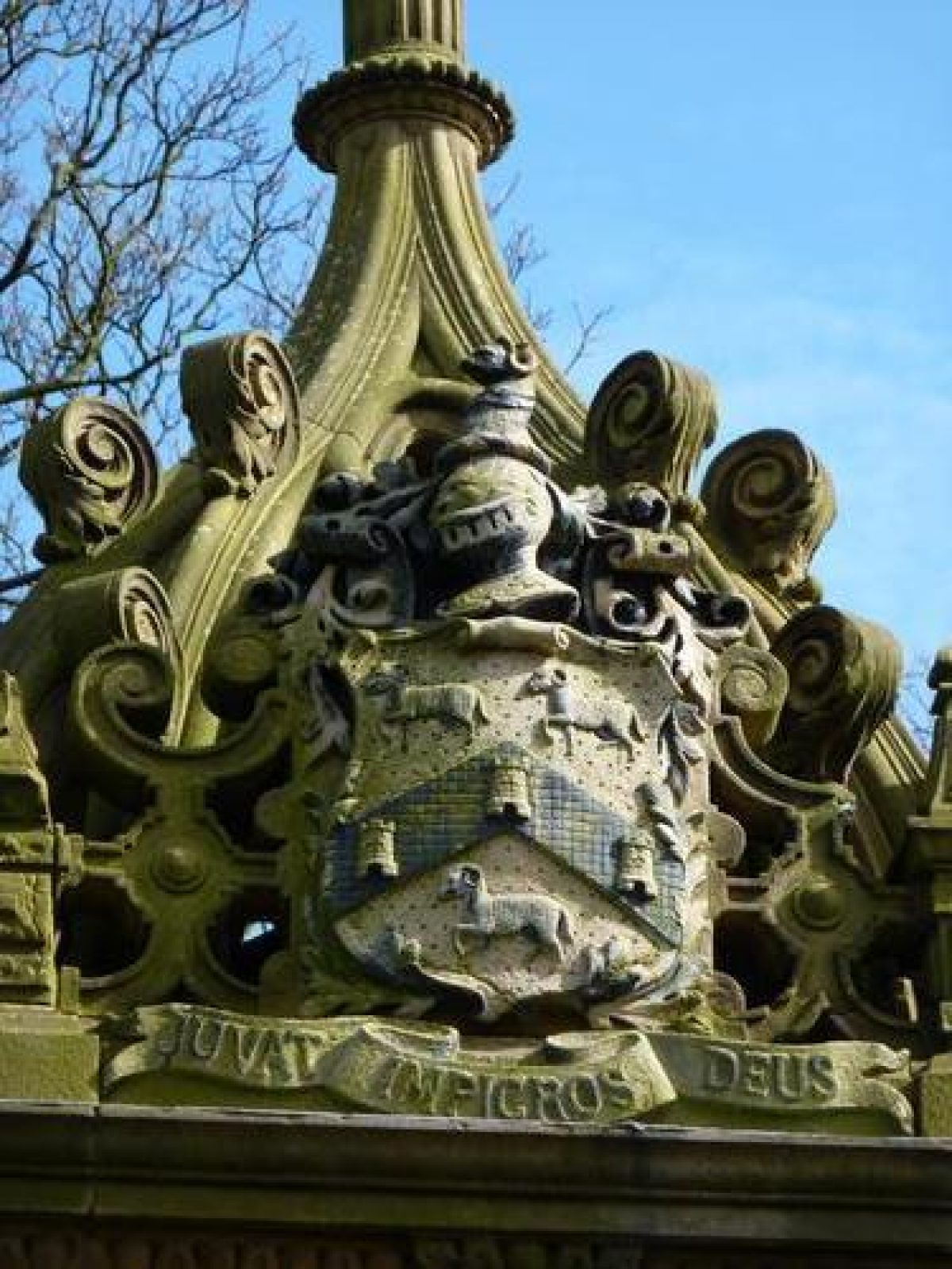
Introduction
Greenhead Park is a virtually intact late-Victorian public park with accompanying villas.
Terrain
The ground slopes from a high point in the north-west down to the south-east towards the lodge, east gate, and town centre.www.historicengland.org.uk/listing/the-list
A public park laid out in 1883 by the Borough Surveyor, Mr Dugdales, set in a contemporary estate development.
DESCRIPTION
LOCATION, AREA, BOUNDARIES, LANDFORM, SETTING
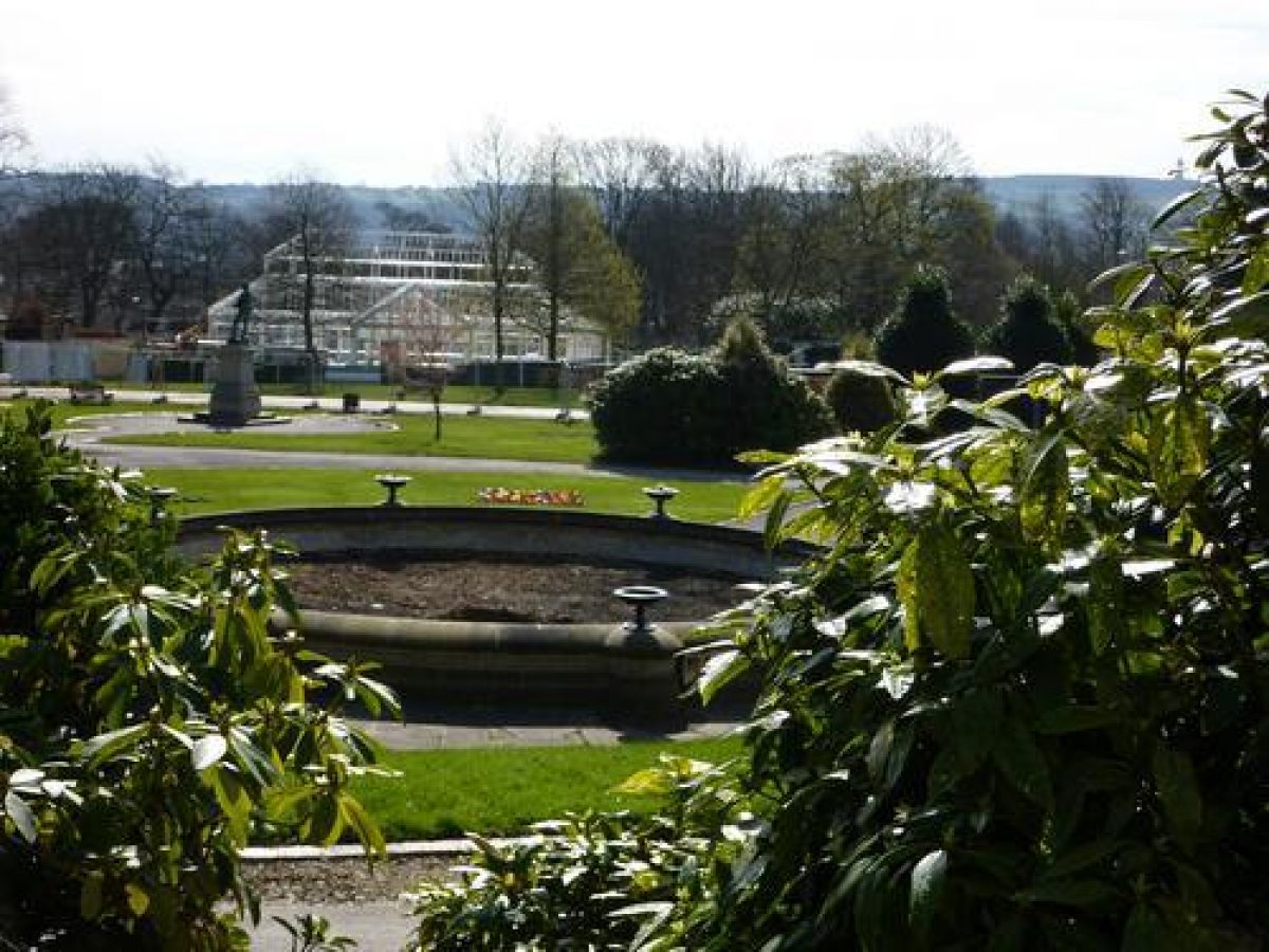
The park is c 13.5ha in area and is located c 800m north-west of Huddersfield Town Hall. The site is irregular in shape. The park is bordered on the north-east and south by Park Drive. On the north of the park, Park Drive runs parallel to Trinity Street which continues to form the southern end of the park's north-east boundary. The short east boundary is against Park Avenue and the west boundary is marked by Gledholt Road. The addition of the tennis and bowling facilities in 1927 necessitated the integration of the west length of Park Drive into the park's internal circulation and the west boundary was moved to Gledholt Road. The boundary between the park and the perimeter roads is marked by a low stone wall, the top of which shows evidence of railings that are now (2000) missing.
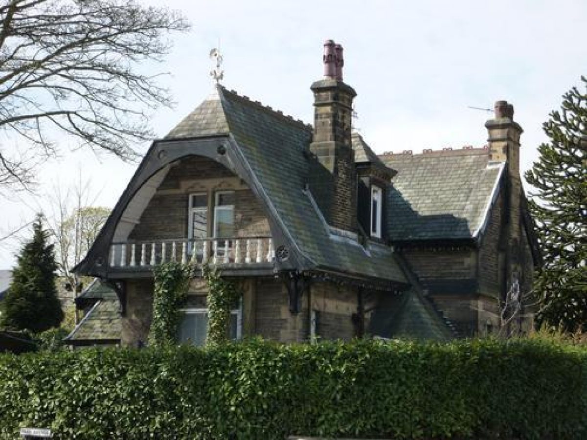
The ground slopes from a high point in the north-west down to the south-east towards the lodge, east gate, and town centre. The north-east boundary is set on a bank which hides Park Drive from the park. This allows an exchange of views between the park and substantial stone-built villas on Park Drive whose fronts overlook the park.
ENTRANCES AND APPROACHES
The park has one principal entrance. This is situated at the east end of the west to east promenade and is c 15m from the junction between Trinity Street and Park Avenue. Stone gate piers remain although the gates are missing. The stone-built lodge, in Swiss style, is situated c 10m to the south of the entrance.
Vehicular access is also provided at the north-west corner of the site. This entrance is marked by stone gate piers that are similar in design to those at the east entrance, although they were erected after the west extension was added in 1927. The original gates are missing from this entrance also. Pedestrian access to the north of the park is gained via an entrance on Park Drive, opposite Vernon Avenue.
GARDENS AND PLEASURE GROUNDS
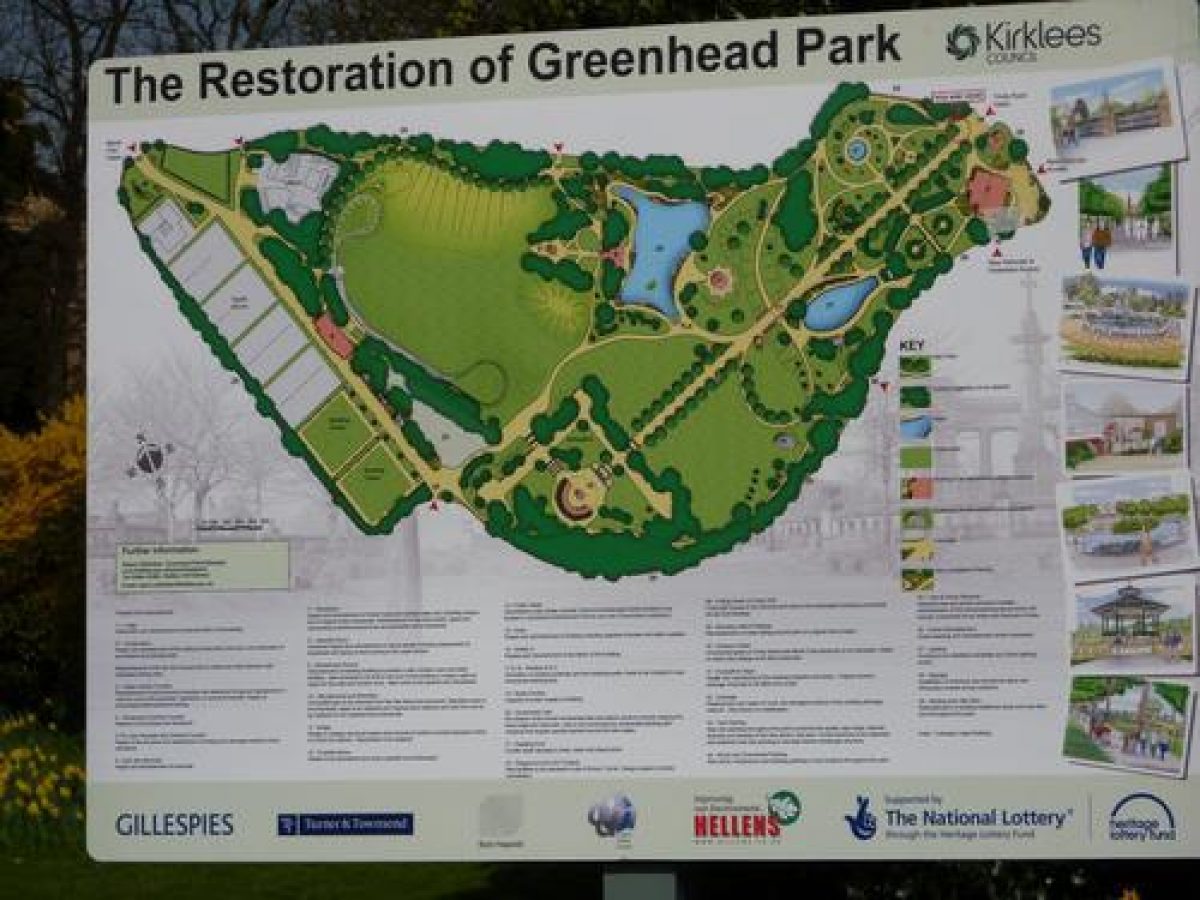
The park is divided into two main sections, to the north and the south. The south of the park is laid out with ornamental landscape features whilst the north is open and provides space for games and other uses.
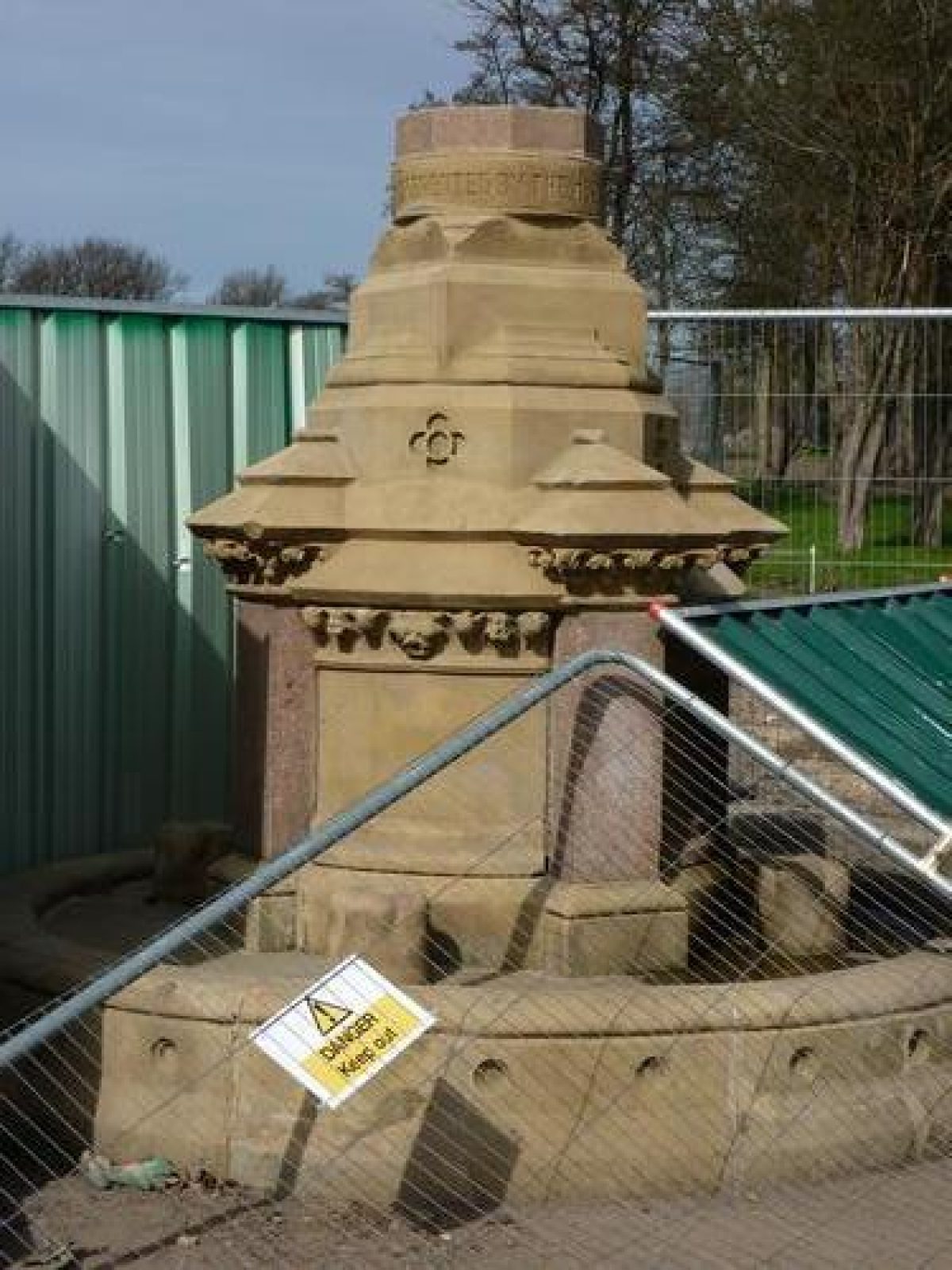
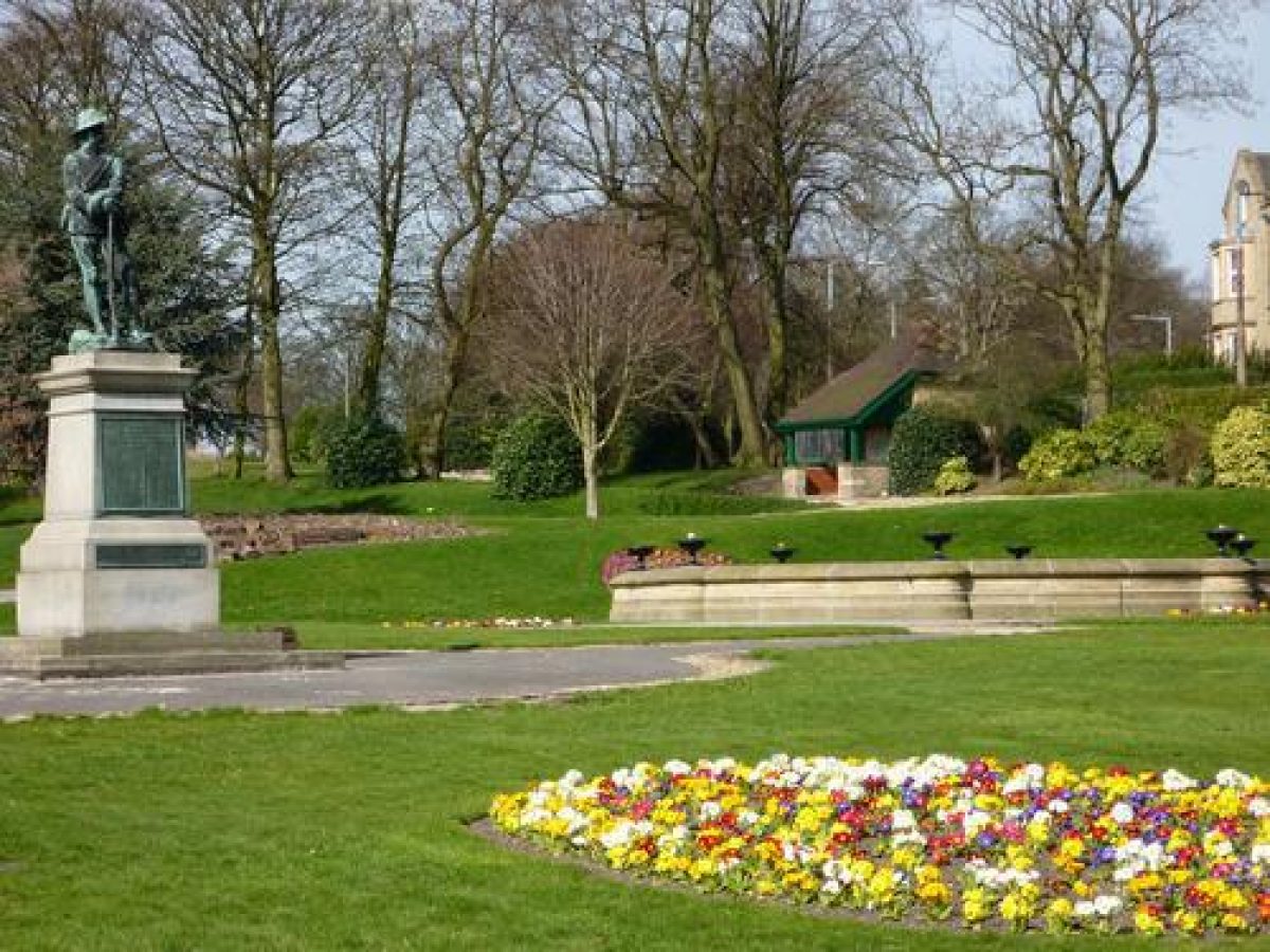
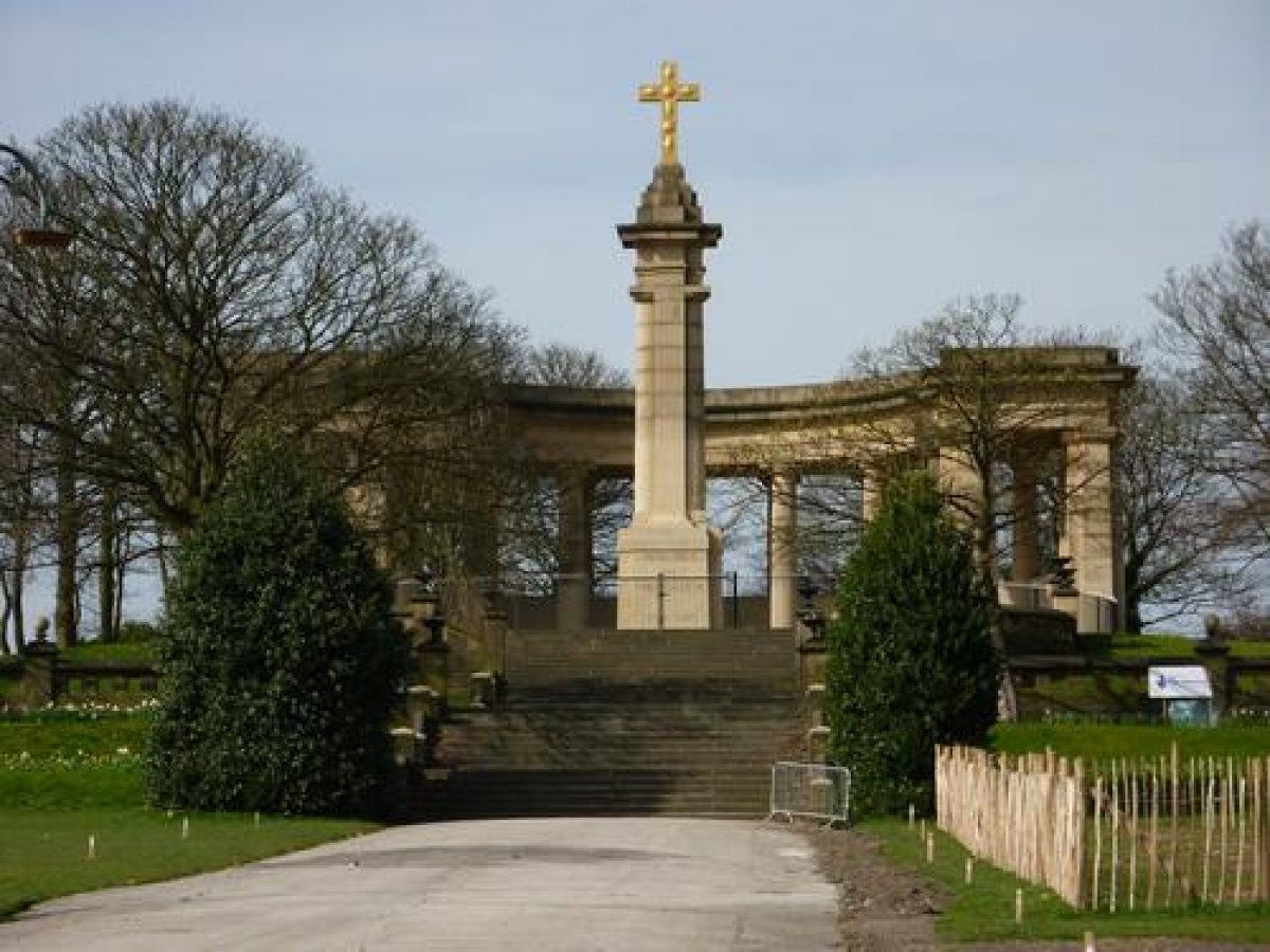
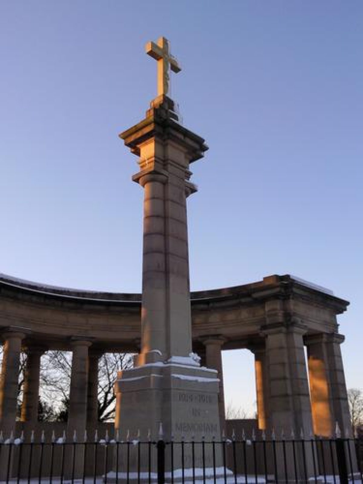
The south section of the park is arranged around a central axis which runs west from the lodge gates at the east corner of Trinity Street and terminates at the monumental terrace c 320m to the west-south-west. The terrace's impact on the park is emphasised by the war memorial. Views extend eastwards from the terrace towards the town. The central axis is complemented by a serpentine circulation system which links together various features to north and south of the broad path. Some 180m south-west of the lodge the central path is carried over the serpentine path by a bridge; the roughcast balustrade remains although the arch is now filled in (2000). A serpentine perimeter path extends around the park c 10(20m in from Park Drive.
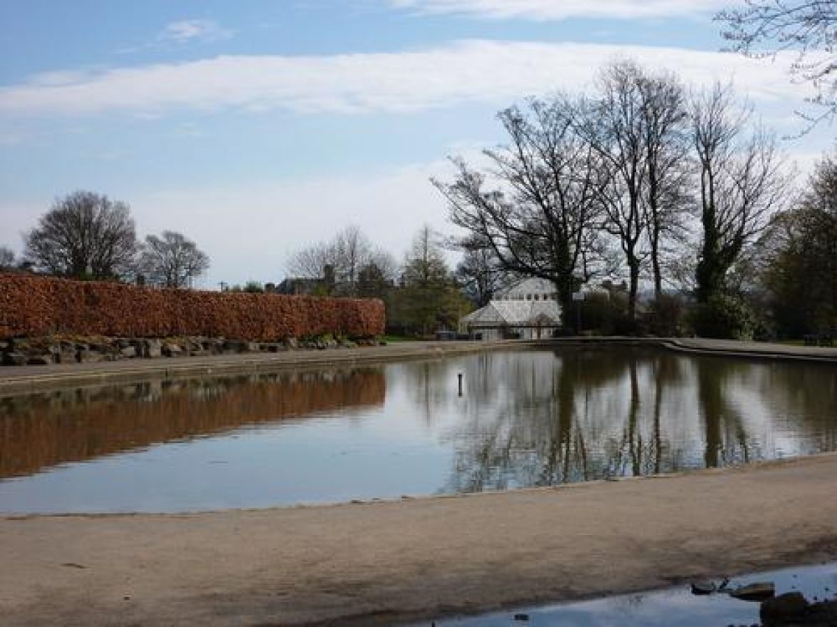
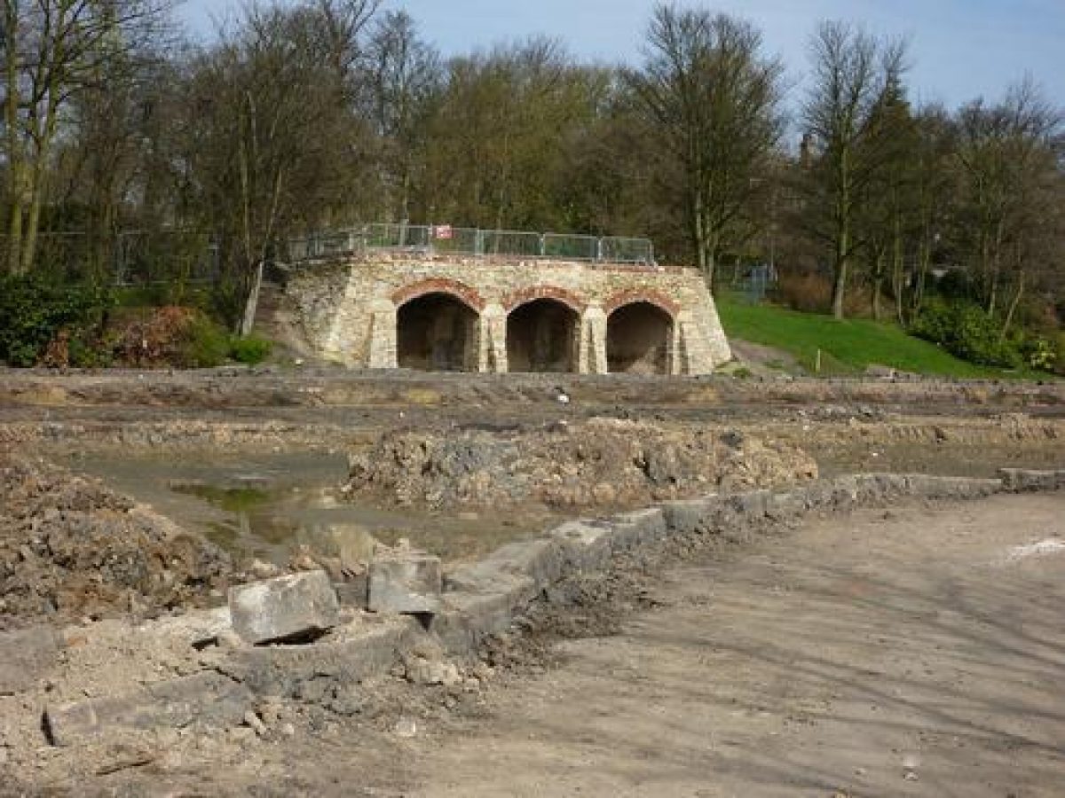
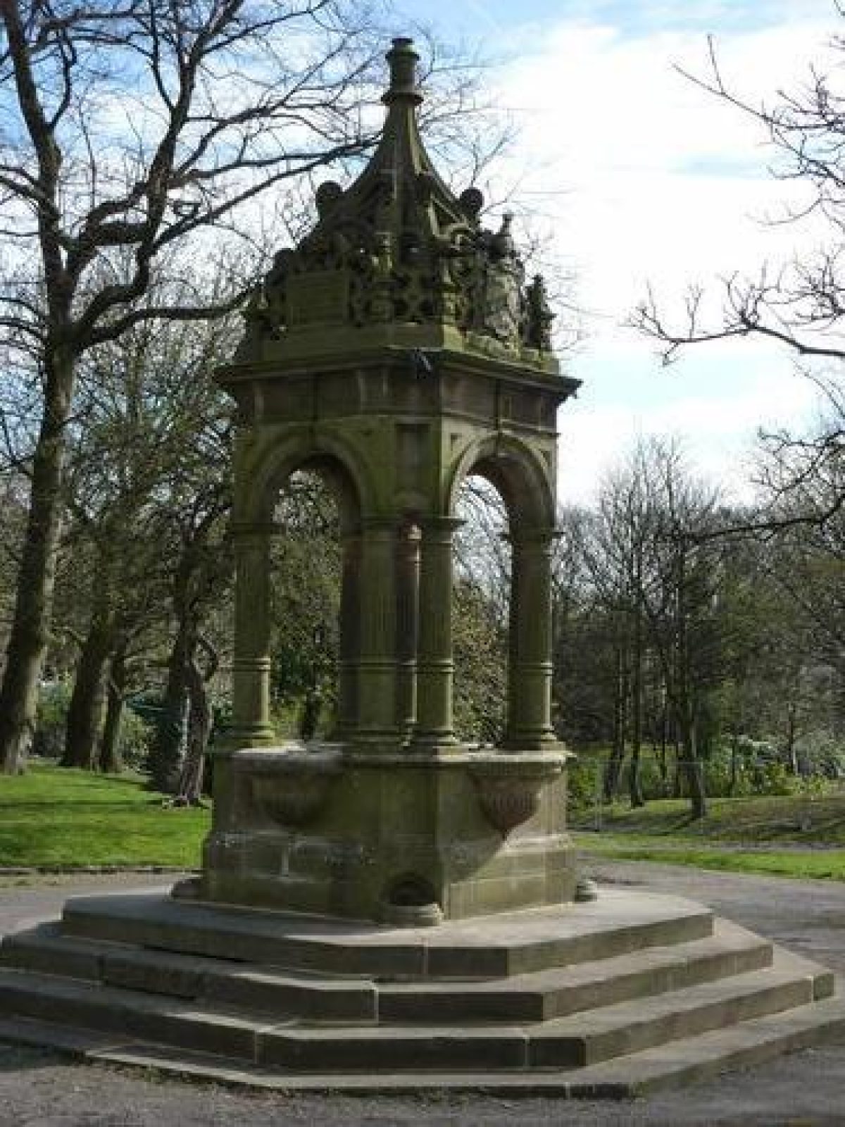
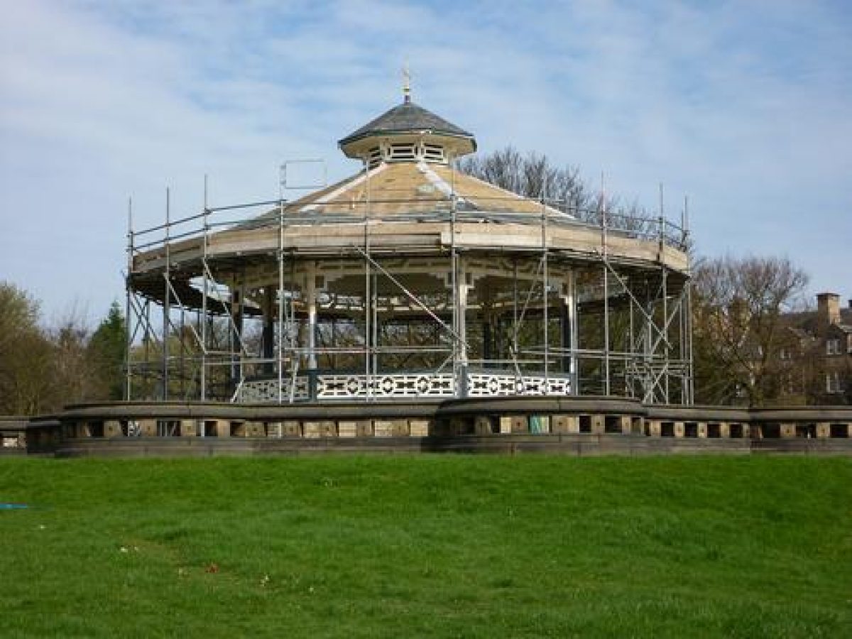
In the south section of the park, the majority of the historic features are retained in the area north of the central axis. A stone fountain basin surrounded by banked bedding out displays lies c 100m north-west of the lodge. A Boer War memorial statue, unveiled in 1905, stands c 60m north-west of the lodge. The timber bandstand, in Japanese style, is set on a stone apron c 210m west of the lodge and the remains of an arbour and viewing platform stand c 80m north-west of the bandstand. The Temperance Drinking Fountain, presented by the Huddersfield Temperance Society in 1885, is c 40m to the south-west of the bandstand. The largest fishpond, located between the bandstand and the arbour, is now (2000) filled in.
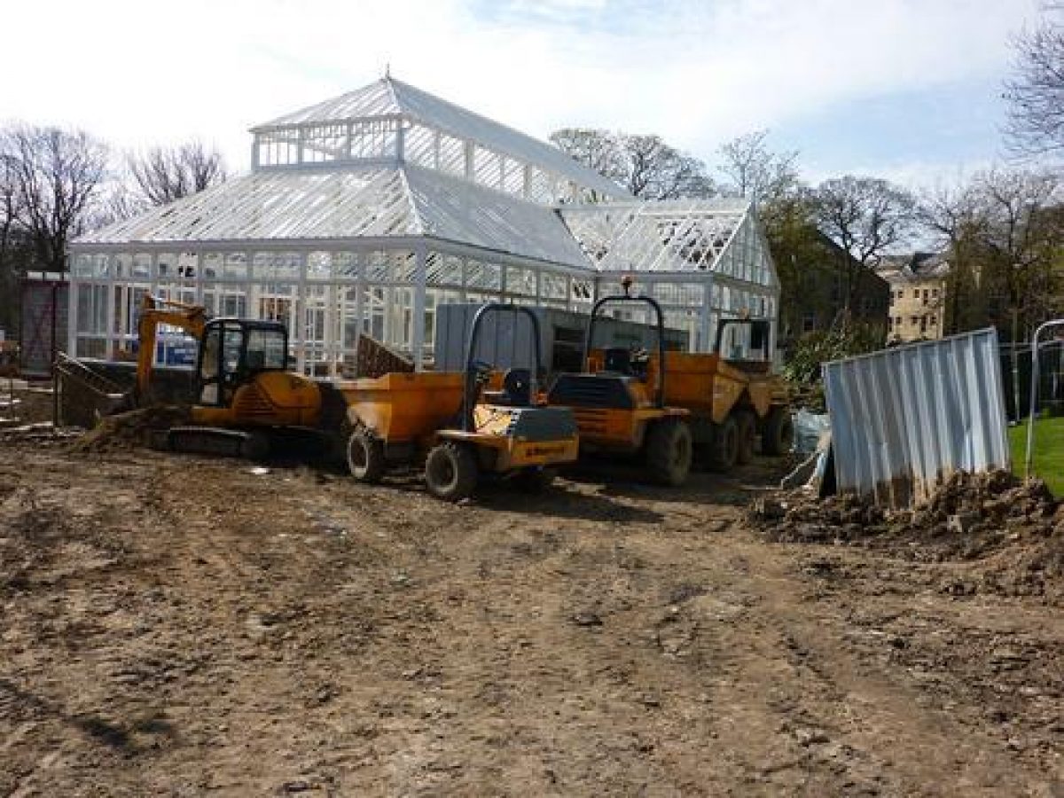
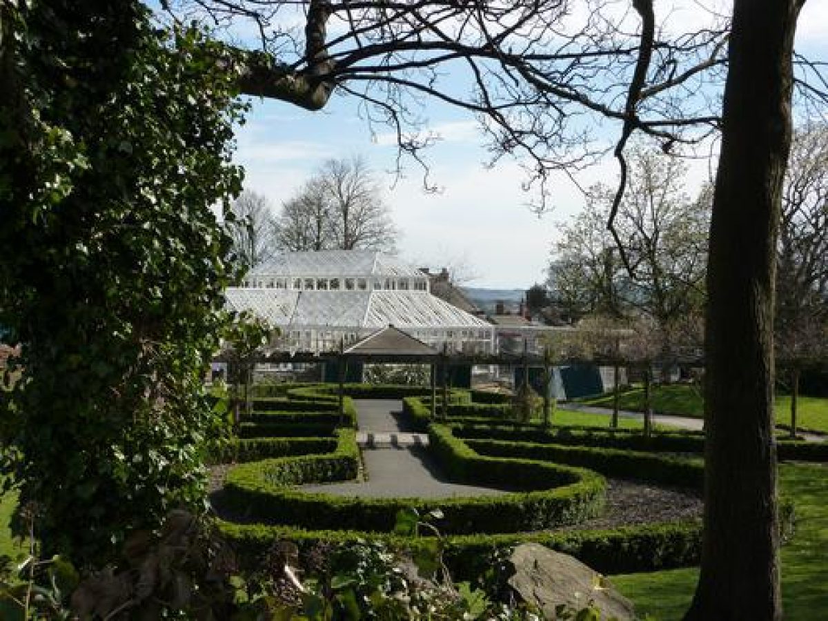
One pool remains in the south section of the park, c 25m south of the central axis. On the pool's southern perimeter stands an arbour and viewing platform which has been largely reconstructed in brick. South of the central axis and c 90m south-west of the lodge a rose garden now (2000) stands on the site of the third largest fishpond. A conservatory and three attached glasshouses are located c 30m to the south of the lodge. These were erected on the site of the two smallest fishponds in c 1930(1.
South of the central axis the rockwork and fantastic castellated arbours and viewing platforms depicted in late C19 and early C20 photographs and postcards (HCLA) are now (2000) missing.
The north section of the park is open and is set aside for informal games and events. The most distinctive feature is the games pavilion and refreshment rooms. This building stands on the broad north/south path that was originally Park Drive before the park was extended in 1927.
REFERENCES
'The Weekly News', Huddersfield Weekly News, 4 October 1894, p 5
Aspects of Culture and Recreation in the 19th and early 20th Century in Huddersfield, (Bretton Hall 1979), pp 79-83
Greenhead Park, Huddersfield Feasibility Study, (Kirklees Metropolitan Council 1997)
Maps
Huddersfield County Borough, 1898-9 (Huddersfield Central Library Archives)
OS 1:500: surveyed 1889, published 1890
OS 25" to 1 mile: 2nd edition published 1907; 3rd edition published 1918; 1932 edition
Archival items
Late 19th-century and early to mid-20th-century photographs and postcards of Greenhead Park, Huddersfield (Huddersfield Central Library Archives)
Description written: December 2000
Edited: May 2001
- Visitor Access, Directions & Contacts
Telephone
44 1484 225555Access contact details
This is a municipal park for general public use.
Owners
Kirklees Council
Civic Centre 3, Market Street , Huddersfield, HD1 1WGKirklees Council
Civic Centre 3, Market Street , Huddersfield, HD1 1WG
- History
The following is from the Register of Parks and Gardens of Special Historic Interest. For the most up-to-date Register entry, please visit the The National Heritage List for England (NHLE):
www.historicengland.org.uk/listing/the-list
HISTORIC DEVELOPMENT
Discussions concerning Huddersfield's need for a public park appear to have taken place as early as 1858 when Sir John William Ramsden proposed the establishment of a park on the Springwood estate. The conditions which accompanied the offer were deemed unacceptable and little further action took place until shortly after the town had been incorporated into a Borough in 1868 when the arguments for a public park were revived. These were primarily instigated by the Alderman and JP, Thomas Denham, who, having viewed the housing developments proposed by the Ramsden Estate for the parkland of Greenhead Hall (standing north-west of the centre of Hudderfield), recommended that the Corporation should buy the land for use as a public park.
Concerns over the cost and conditions delayed the purchase from Sir John Ramsden. From 1870 to 1873 however Denham rented the land, provided rustic seats and a concert platform, and opened it to the public for recreational use. The Corporation took over the tenancy in 1873 and in 1884 bought an area of around 12 hectares comprising the current park with the exception of the tennis courts and bowling greens, which were added in 1927.
In 1882, the perimeter road around the park, Park Drive, was set out. Work began in 1883 on the laying out of the park itself under the direction of the Borough Surveyor, Mr Dugdales, and it was formally opened to the public in September 1884. By 1890 (OS) most of the site had been laid out and the majority of the park's distinctive elements had been established. Prominent features included the principal east/west path, which terminated in the monumental, two-sided promenade terrace, and the five fishponds, bridges, and arbours. The timber bandstand on its stone platform, and the stone fountain basin in the Italian Gardens were also in place.
The park was extended westwards in 1927 to include an open strip of land between Park Drive and Gledholt Road. As a result, the north-west stretch of Park Drive was absorbed into the circulation of the park. A pavilion was constructed to the east of what had been Park Drive to serve new tennis courts and bowling greens. The park remains (2000) in public ownership.
- Features & Designations
Designations
The National Heritage List for England: Register of Parks and Gardens
- Reference: GD4754
- Grade: II
Features
- Bandstand
- Fountain
- Cenotaph
- Lake
- Description: There were five ornamental lakes, of which four have been filled in.
- Bowling Green
- Designed Route
- Description: Miniature steam railway.
- Drive
- Description: Park Drive
- Key Information
Type
Park
Purpose
Recreational/sport
Principal Building
Parks, Gardens And Urban Spaces
Survival
Extant
Hectares
13.5
Open to the public
Yes
Civil Parish
Holme Valley
- References
References
- {English Heritage Register of Parks and Gardens of Special Historic Interest}, (Swindon: English Heritage, 2008) [on CD-ROM] Historic England Register of Parks and Gardens of Special Historic Interest
- {Greenhead Park Conservation Management Plan} (2006) Greenhead Park Conservation Management Plan