Introduction
Ditton Park dates from before 1086, although the present grounds were laid out in the 18th century by Lancelot Brown. The estate covers about 80 hectares, and is designed in the English Landscape style. The park was shortened by the construction of the M4 motorway to the south.
The following is from the Register of Parks and Gardens of Special Historic Interest. For the most up-to-date Register entry, please visit the The National Heritage List for England (NHLE):
www.historicengland.org.uk/lis...
Location, Area, Boundaries, Landform and Setting
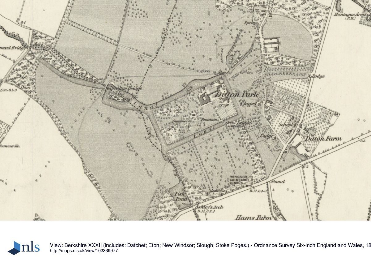
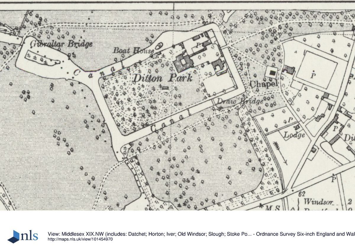
Ditton Park lies to the south-east of Slough in the hamlet of Ditton. The site is defined by residential development to the north, open farmland to the west, Ditton Park Road to the east, and to the south by Riding Court Road and Farm, the adjacent research station (built on part of the former parkland) and the M4. The construction of the motorway in the early 1970s caused the loss of the south-west corner of the park and the lodge associated with the south drive.
Entrances and Approaches
The main approach to the house is the drive through the double lime avenue which leads west from the lodge on Ditton Park Road. It crosses the iron-railed bridge (listed grade II) over the east arm of the moat and runs through the stuccoed, turreted and crenellated gatehouse (C18, listed grade II) leading to the rectangular walled forecourt (walls listed grade II, those to north and south C17, brick), a remnant of the early C18 layout, on the east front of the house. The stable block and offices (C18, listed grade II), and a number of new buildings, stand to the north and south of the forecourt. The circle of elms which led to the bridge across the east arm of the moat, first shown on the 1718 survey, was lost to Dutch Elm disease in the early 1970s. A second drive, Conduit Lane, leads in from the northern boundary; the line of the drive from Windsor and Datchet has been obscured.
Principal Building
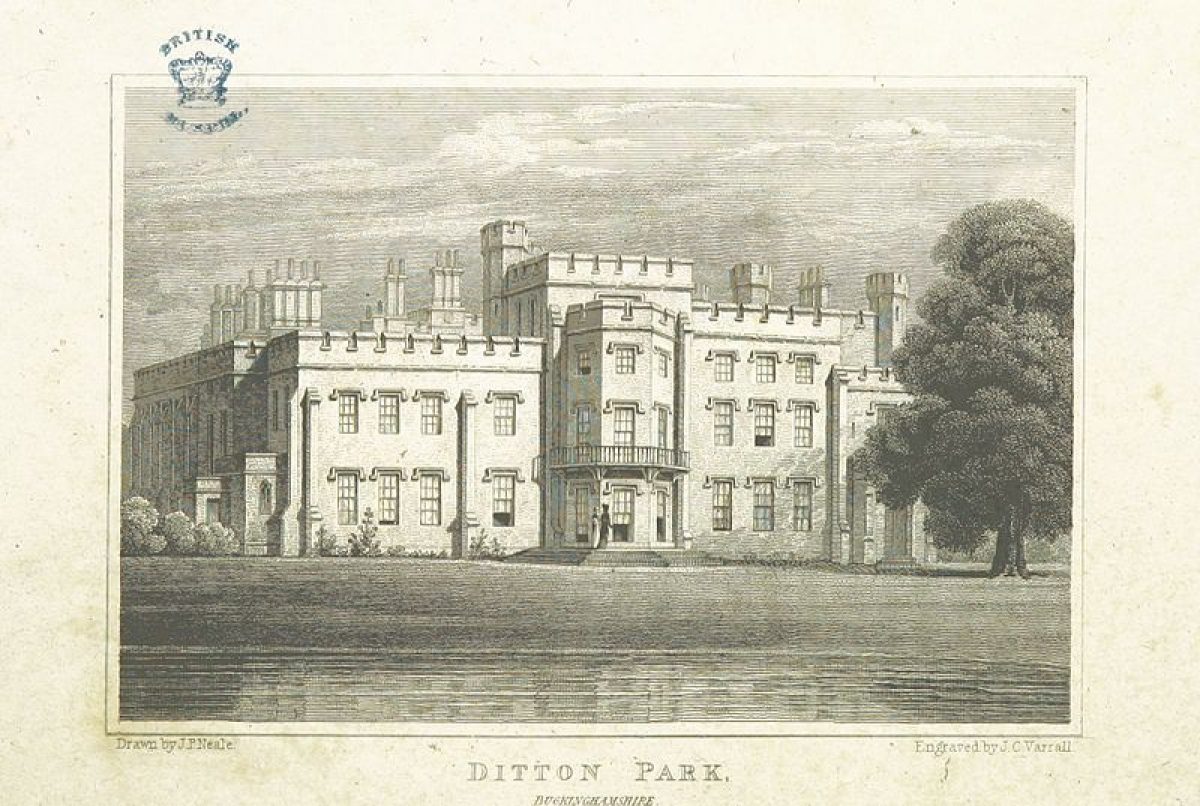
Ditton Park house (William Atkinson 1813-17, listed grade II) stands towards the centre of the site. It is built in early Gothic Revival style, of cement rendered over brick, with turrets and crenellations, and retains some remnants of the earlier house destroyed by fire (1812). The south, garden front has a full height octagonal bay window, with a gothic cast-iron balustrade around a balcony on the first floor.
Gardens and Pleasure Grounds
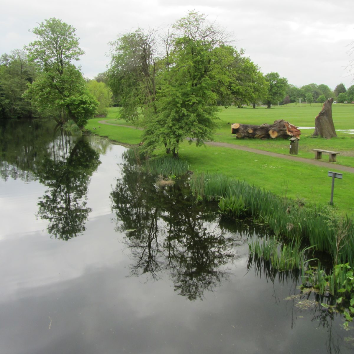
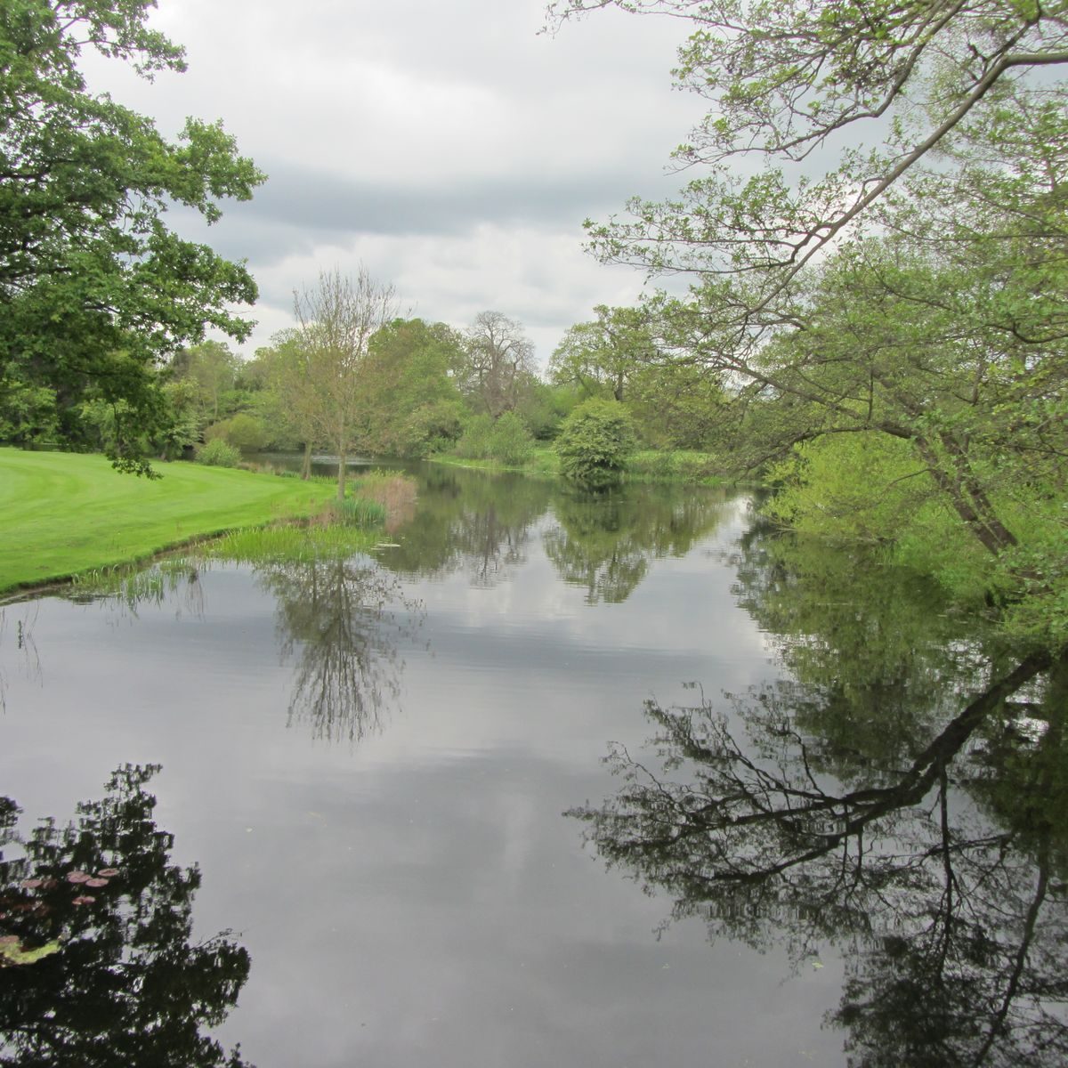
The house stands set within a 6ha rectangle of pleasure grounds enclosed by a moat. The present moat is first shown on the 1718 survey, at which date the land within was laid out with complex formal gardens. At its north-west corner the moat is extended as a pool with an island, formed between 1718 and 1725 from an earlier fishpond. This is dammed at Gibraltar Bridge, perhaps named in commemoration of the end of the Siege of Gibraltar in 1783, west of which is a long informal canal extending across the park to Longmead Bridge.
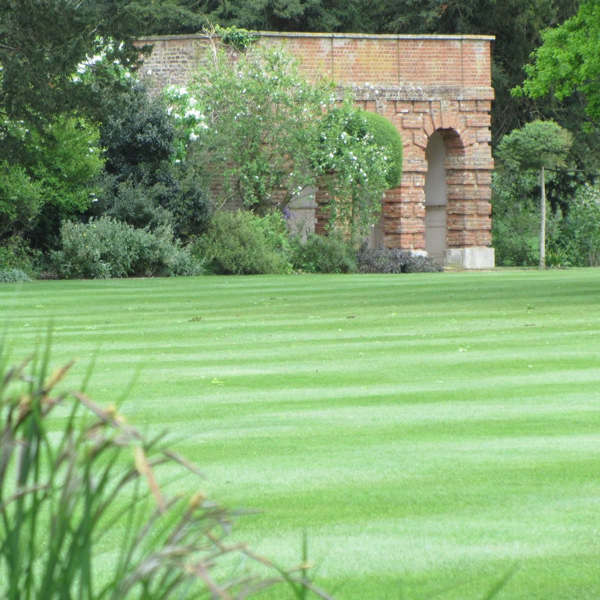
Below the south front of the house is a lawn, while the western half of the area is laid out with wooded walks. A brick-walled garden which survives from the early C18 scheme (walls listed grade II) occupies the south-east corner of the moated enclosure. On the outer face of its west wall is a brick-built summerhouse (listed grade II).
Park
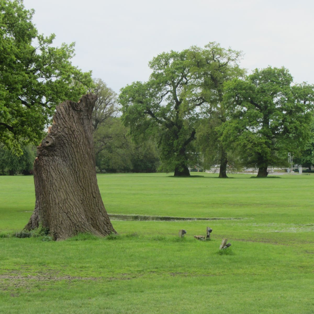
Until the late C18, when the area was enclosed by a system of perimeter belts, the park was divided into a number of closes. The south park, occupying the area between the moat and the motorway, is now an open area dotted with park trees including some survivors from the early C18 avenue; this is the site of the early C18 wilderness. The southern shelter belt has been replanted following damage during the 1987 storm. An icehouse, now ruinous, is situated on the walk around the southern perimeter, at a point roughly south of the house.
The western edge of the south park is defined by a fishpond, which would appear to date from the early C19; to the west of this is a late C20 industrial complex. Otherwise, like the north park from which it is divided by the extension to the moat, this area is level, open parkland. An open area in the north park, between Conduit Lane and the east drive, is associated with the old dairy, and is now used as a sports ground.
The area to the east of the moated enclosure currently houses (1999) new development including a car park, temporary huts and hard standings, and new buildings. The south-west corner of the park and a lodge were lost through the construction, in 1965, of the Chiswick to Langley Special Road Scheme, later (early 1970s) upgraded to the M4.
Kitchen Garden
The kitchen garden lies to the east of the house, outside the moat and adjacent to Ditton Park Road. It presumably dates from the mid to late C18 when this area was taken in as part of the grounds.
REFERENCES
Heritage Survey: Ditton Park, (Nicholas Pearson Associates, August 1994)
N Pevsner and E Williamson, The Buildings of England: Buckinghamshire (1994), p 279
Maps
J Norden, A description of the honour of Windesor, 1607 (British Library and Royal Collection)
Estate surveys, 1718, 1725, 1742, 1834
John Rocque, Map of Berkshire, 1761
A Bryant, Map of Buckinghamshire, 1824
OS 1" to 1 mile: 1st edition published 1811
OS 6" to 1 mile:
1st edition published 1886
2nd edition published 1894
3rd edition published 1920
Description written: February 1999
Register Inspector: SR
Edited: March 2000
- Visitor Access, Directions & Contacts
Telephone
01753 255444Website
https://dittonmanor.comDirections
North of the M4, between junctions 5 and 6, south of Slough.
- History
The following is from the Register of Parks and Gardens of Special Historic Interest. For the most up-to-date Register entry, please visit the The National Heritage List for England (NHLE):
www.historicengland.org.uk/lis...
HISTORIC DEVELOPMENT
Sir John Moleyns, treasurer to King Edward III, inherited the manor of Ditton c 1330. The following year he was granted permission to embattle his house and, in 1335, was given licence to impark c 17ha. In the mid C15, the estate reverted to the Crown, Princess Mary, later Queen Mary I, spending part of her early life at Ditton (1517-21), Cardinal Wolsey residing there in the late 1520s, and it being one of the emoluments granted to Anne Boleyn.
In 1607, when surveyed by John Norden, the park occupied c 90ha, had little timber, and was stocked with deer. On his map, the house is shown as being moated with a formal garden laid out to the south. In 1615, the estate was granted to Sir Ralph Winwood, then Secretary of State, who rebuilt the mansion using the existing site. Sir Ralph died in 1617 and work presumably continued under his wife Elizabeth, and son Richard (d 1688). The park was enlarged at this time and by 1630 occupied c 100ha. The estate passed to the nephew of Sir Ralph, Ralph, Earl Montagu of Boughton, cr Duke of Montagu in 1705 (d 1709), then to his son, John, whose wife was Lady Mary Churchill, daughter of John Churchill, first Duke of Marlborough.
Between 1762 and 1774, Lancelot Brown (1716-83) was involved at Ditton, at a cost of some £3450, using Cornelius Dickinson as foreman and working for 'Lord Vist. Montague', the estate then being in the joint ownership of Sir Edward Hussey Montagu, created Lord, and later Earl, Beaulieu, and George, Duke of Marlborough, fourth Earl of Cardigan. Brown had previously (1763) been employed by the fourth Duke of Marlborough at nearby Langley Park (qv), prior to his involvement at Blenheim (qv).
Ditton was inherited by George's daughter, Lady Elizabeth Montagu, who married Henry Scott, Duke of Buccleugh (d 1812). In 1812, the house was almost completely destroyed by fire, and the following year a new house was started to the designs of William Atkinson. It was completed 1817. Ditton Park remained in the Montagu family until 1917 when it was sold by Baron Montagu of Beaulieu to the Admiralty. In 1993 the Admiralty left the place, which in 1999 was in the process of becoming a company headquarters.
Period
18th Century (1701 to 1800)
- Associated People
- Features & Designations
Designations
The National Heritage List for England: Register of Parks and Gardens
- Reference: GD 2312
- Grade: II
The National Heritage List for England: Listed Building
- Reference: brick walled garden & brick-built summerhouse
- Grade: II
The National Heritage List for England: Listed Building
- Reference: Ditton Park
- Grade: II
The National Heritage List for England: Listed Building
- Reference: Iron railed bridge, gatehouse & stable block & offices
- Grade: II
Style
English Landscape Garden
Features
- Moat
- House (featured building)
- Earliest Date:
- Latest Date:
- Parkland
- Key Information
Type
Park
Purpose
Ornamental
Principal Building
Commercial
Period
18th Century (1701 to 1800)
Survival
Part: ground/below ground level remains
Hectares
80
Open to the public
Yes
Civil Parish
Datchet
- References
References
- {English Heritage Register of Parks and Gardens of Special Historic Interest} (Swindon: English Heritage 2008) [on CD-ROM] Historic England Register of Parks and Gardens of Special Historic Interest
- Pevsner, N and Williamson, E {The Buildings of England: Buckinghamshire} (1994) p 279 The Buildings of England: Buckinghamshire