Introduction
Croxteth Country Park was formed from the pleasure grounds and park of 230 hectares, dating mainly from the early and mid-19th century, which formed the setting for a country house. It is also the site of a 12th-century deer park.
Terrain
Level.www.historicengland.org.uk/listing/the-list/
Pleasure grounds and a park dating mainly from the early and mid C19 which form the setting for a country house. It is also the site of a C12 park.
DESCRIPTION
LOCATION, AREA, BOUNDARIES, LANDFORM, SETTING
Croxteth Hall and its surrounding park of c 230ha lie directly to the north of the village of West Derby. The park is on level ground and is set within recently developed residential areas but with small areas of open ground remaining to the west, and in the far north and far east corners. The park boundaries are marked by houses and gardens on the south-west, south, south-east, north-east and north-west. Croxteth Hall Lane runs from north to south through the centre of the park and forms part of the west boundary.
ENTRANCES AND APPROACHES
The main approach to the Hall is from the south-west. The drive enters the park at the south side of St Mary's church, and crosses the parkland to Croxteth Lodge. From here it enters a plantation, passes under Hall Road via a bridge (listed grade II) dated 1845 and decorated with the Molyneux arms on the keystone, and so to the south-west front of the Hall. The line of the drive was established in the 1840s, at which date it was known as the New Road. A second drive leads in from the south continuing the line of Mab Lane. The entrance to the park is marked by Finch Lodge (early C19, listed grade II) on Deysbrook Lane, from where the drive passes through Finch Wood to travel north across the park. There is also an entrance from the east which leads through Little Wood, past a lodge, emerging into the park which it traverses in the form of an avenue. To the north of the Hall is a back drive, constructed in the mid to late C19. A track leads from Gilmoss Lodge (c 1860s, probably by J Douglas, listed grade II and outside the boundary here registered) to Dam Wood Lodge (1.3km north of Croxteth Hall), then south through Dam Wood, and on to the Hall. At the north-west corner of the estate, where Oak Lane joins Croxteth Hall Lane, is Aintree Lodge (early C19, listed grade II), from where a drive leads southwards through woodland to the Hall.
PRINCIPAL BUILDING
Croxteth Hall (listed grade II*) dates from the C16, with alterations and additions from the C18, C19 and C20. The house is of brick with stone dressings and is of two storeys except for the west facade, which is three storeys. The southern end of the east range dates from c 1575, the south range from c 1702, the north range and northern end of the east range from 1874-7 (by T H Wyatt), and the west range and range behind the south range from 1902 (by J McVicar Anderson).
To the south of the Hall are the outbuildings, stable block and farm complex. Early C18 gate piers (listed grade II) lead into the north side of stable yard, to the stable block (dated 1676 on the south facade, and 1706 on the east facade, listed grade II*). The other buildings in the stable yard include the riding school (listed grade II), the mid C19 carriage washing shelter (listed grade II), and a row of early C19 cottages to the east side of the yard (listed grade II). South of the stables stands Home Farmhouse (early C19 with extension of 1860s, listed grade II) with, to the west, the dairy (1861-70 by William Eden Nesfield (1835-88), listed grade II*) and to the east, a paddock with a bull box (early C19, listed grade II). At the south-west corner of the complex, on the opposite (west) side of Croxteth Hall Lane, stands Farm Lodge (early to mid C19, listed grade II). Further to the east is the laundry and laundry cottage (W E Nesfield 1864-5, listed grade II*).
GARDENS AND PLEASURE GROUNDS
Croxteth Hall stands at the centre of the site, surrounded by pleasure grounds and lawns, set within the park. The pleasure grounds, which consist of lawns scattered with trees and shrubs, lie primarily between the Hall and the lane to the west, as they did in the C18. The lane was moved in the second half of the C19, from a line immediately west of the Statue Pond to its present alignment further to the west, which also encompasses Home Farm. Apart from this extension, the area in its present form dates from the early C19 and includes the Statue Pond, a long, narrow canal 50m to the west of the Hall, and the Long Pond, 130m to the north-west of the Hall. In an area of parkland north of this water is the icehouse. A length of park bank is visible in woodland to the north-west of the Hall.
North of the Hall walks lead through ornamental woodland, the site of the C18 Wilderness, north to Dam Wood (so named from the mill pond which formerly lay at the northern end of the site occupied by the plantation), and still further to the north, Craven Wood. To the east of the Hall a broad expanse of lawn stretches to a lane which acts as a ha-ha, dividing the gardens from the park. In the C18 part of this area was occupied by the Statue Gardens, with an old orchard to the south-west.
PARK
The main areas of parkland lie to the east and to the south-west of the Hall. The east park is defined by a belt and ride, the Eighteen Acre Plantation, and along the southern edge, the woodland known as Ewens Park. At the north side of the park, backed by Mull Wood, stand the head gamekeeper's cottage and the kennels (both J Douglas 1870s, listed grade II), and the pheasantry. The park has several large clumps, including the Ten Acres Clump. South of the east drive is further parkland, again delimited by an enclosing plantation plus ride, here called The Belts. The Hall Brook flows eastwards through this part of the park, crossed by the perimeter drive via the Hall Brook Bridge. The brook joins with the River Alt which flows from south to north through the park, passing 150m to the north-east of the Hall. South-west of the Hall the drive from West Derby crosses a broad strip of land imparked in the mid C19, planted up with a belt along its southern edge and several clumps.
KITCHEN GARDEN
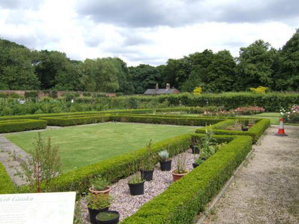
The mid C18 brick-walled kitchen garden and its associated buildings stand 20m to the north of the Hall. The garden is still in use as productive land and many of the buildings have been restored. In the grounds to the north of the garden walls is a bantam house (listed grade II).
REFERENCES
Journal Horticulture and Cottage Gardener 62, (1879), pp 368-70
Journal Horticulture and Cottage Gardener 12 (New Series), (1886), pp 510-11
Gardeners' Chronicle II, (1891), pp 545-6
The Victoria History of the County of Lancashire 3, (1907), pp 15-17, 182
R W Cowell, Liverpool Urban Fringes Survey Report (1983)
Maps
John Speed 'Map of Lancashire', 1610
Molyneux estate map, 1767 (Lancashire Record Office)
William Yates and George Perry, 'Map of Environs of Liverpool', 1768 (Liverpool Record Office)
William Yates, The County Palatine of Lancaster, 1786 (Lancashire Record Office)
T Robinson, Plan of Croxteth Hall and Outbuildings (drainage details), 1795 (Lancashire Record Office)
James Sherriff, Map of the Environs of Liverpool, 1816 (Liverpool Record Office)
Tithe map, Croxteth Park, 1838 (Lancashire Record Office)
Tithe map, West Derby, 1838 (Lancashire Record Office)
OS 25" to 1 mile:
1st edition published 1850-1
2nd edition published 1894
3rd edition published 1909
1928 edition
1938-9 edition
Description written: February 1999
Register Inspector: CB
Edited: April 1999
- Visitor Access, Directions & Contacts
Telephone
0151 233 3020Website
https://liverpool.gov.uk/leisure-parks-and-wellbeing/parks-and-greenspaces/croxteth-country-park/Access contact details
http://www.croxteth.co.uk Country Park open all year, daily, 7am to 7pm.
Directions
West of the M57, 6 miles north-east of Liverpool city centre.
- History
The following is from the Register of Parks and Gardens of Special Historic Interest. For the most up-to-date Register entry, please visit the The National Heritage List for England (NHLE):
www.historicengland.org.uk/listing/the-list/
HISTORIC DEVELOPMENT
Croxteth was a pre-conquest thegnland, which was afforested and put into the royal forest of Toxteth by the early C13. The office of keeper and forester of Toxteth Park was united with that of Croxteth Park and the chase of Simonswood (VCH). Croxteth Park remained part of the forest and was part of the demesne of West Derby, having been taken out of the parish of Knowsley. In the mid C15 the park, from which much of the timber had been cleared, was granted to Sir Richard Molyneux of Sefton and his son Richard. The park was then granted to William Molyneux and his heirs by the Duke of Gloucester, high steward of the duchy of Lancaster. The park was ruinous and Molyneux was required to ditch the park, set wood, and save sufficient pasturage for the king's deer. This grant probably lapsed for the park was given to William Molyneux of Sefton in 1507 and Croxteth then became their main residence (ibid). The property descended with the Molyneux family (later earls of Sefton) until the C20.
The park is shown as a fenced enclosure of modest dimensions on Speed's map of 1610, and again on Morden's map of the county of 1695, but by Yates' map of 1768 had been divided into small enclosed fields. The eastern edge of the park was presumably the Croxteth Brook, which forms the district boundary, and on which stands Stand Lodge (listed grade II, outside the area here registered). To the north and west the park pale presumably coincided with the parish boundary, and to the south the River Alt.
The Molyneux estate map of 1767 depicting Croxteth Park and Demesne shows the land within the old deer park pale. The estate is divided into numerous small fields and none of the structure of the new park has yet been instated. Yates' map of 1786 marks the park boundary to the east of the Hall, the Hall lying beyond it. The pale encompassed the C17 Stand House (now known as Stand Farm (listed grade II), 1km north-east of Croxteth Hall and outside the boundary here registered) and two ponds, a little to the south of Gill Moss. The ponds were formed along a branch of the main river and both ran south through the park before merging at the southern end of the enclosure. Sherriff's map of 1816 indicates significant stands of woodland within the area of the modern park, but is schematic rather than detailed. The present form of the park however is little changed from that shown on the Tithe maps for West Derby and Croxteth Park, both drawn in 1838.
A c 17ha piece of land between Hall Brook and Finch Wood has been developed as a private housing estate. The remaining land is owned by Knowsley Borough Council and the parkland is managed as Croxteth Hall and Country Park.
- Associated People
- Features & Designations
Designations
The National Heritage List for England: Register of Parks and Gardens
- Reference: GD 2349
- Grade: II
The National Heritage List for England: Listed Building
- Reference: Aintree Lodge
- Grade: II
The National Heritage List for England: Listed Building
- Reference: Croxteth Hall
- Grade: II*
The National Heritage List for England: Listed Building
- Reference: Finch Lodge
- Grade: II
The National Heritage List for England: Listed Building
- Reference: Gilmoss Lodge
- Grade: II
The National Heritage List for England: Listed Building
- Reference: stable block
- Grade: II*
Features
- Kitchen Garden
- Greenhouse
- House (featured building)
- Earliest Date:
- Parkland
- Deer Park
- Key Information
Type
Park
Purpose
Recreational/sport
Principal Building
Parks, Gardens And Urban Spaces
Survival
Extant
Hectares
230
Open to the public
Yes
- References
References
- {English Heritage Register of Parks and Gardens of Special Historic Interest}, (Swindon: English Heritage, 2008) [on CD-ROM] Historic England Register of Parks and Gardens of Special Historic Interest
- {Victoria History of the County of Lancashire} ([n.p.]: [n.pub.], Volume 3, 1907), pp. 15-7, 182 Victoria County History: Lancaster, Volume 1