Introduction
Anfield is a mid-19th-century cemetery laid out by Edward Kemp. The site covers approximately 44 hectares. Elements include axial and circular paths, two chapels and a gothic style catacomb.
Terrain
The land rises slightly towards the south-east..www.historicengland.org.uk/listing/the-list/
A municipal cemetery designed by Edward Kemp with buildings by Lucy & Littler which was laid out 1856-63.
DESCRIPTION
LOCATION, AREA, BOUNDARIES, LANDFORM, SETTING
The cemetery is situated c 3km north-east of Liverpool city centre on land which rises slightly towards the south-east. The c 57ha site is on a diamond-shaped piece of land lying north-west/south-east. The setting is generally residential with a railway line to the north. To the south of the site, on the other side of Priory Road, Stanley Park (qv), also designed by Kemp, forms part of the setting. The site is bounded by a railway embankment along the north side, private gardens to houses on Ince Avenue on the east side, Priory Road on the south side and Walton Lane on the west side. The boundary is generally formed by a red sandstone wall which is treated decoratively along Priory Road and more simply elsewhere. There is fencing instead of a wall in the north-east corner of the site extending for some 200m west from the Cherry Lane entrance.
ENTRANCES AND APPROACHES
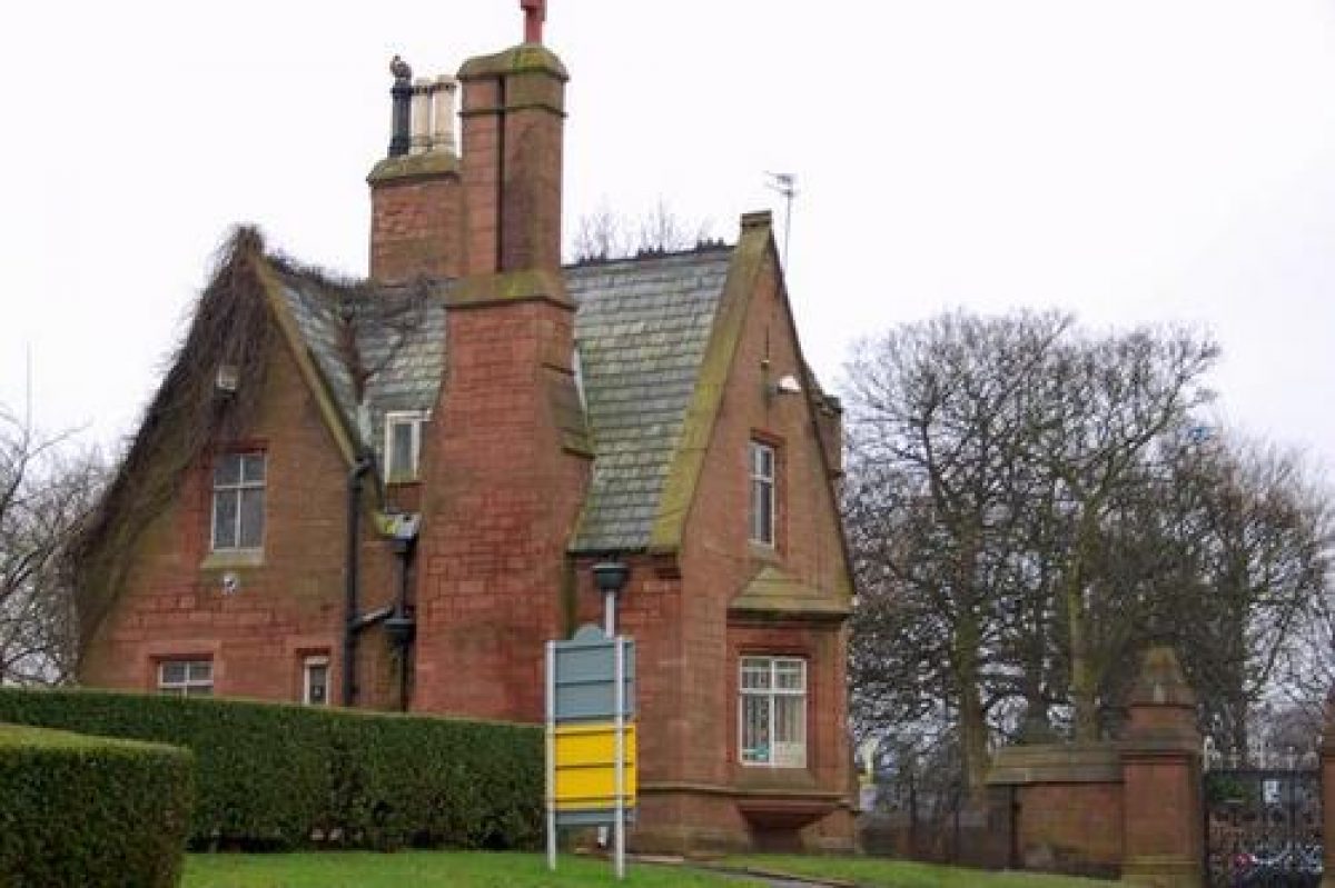
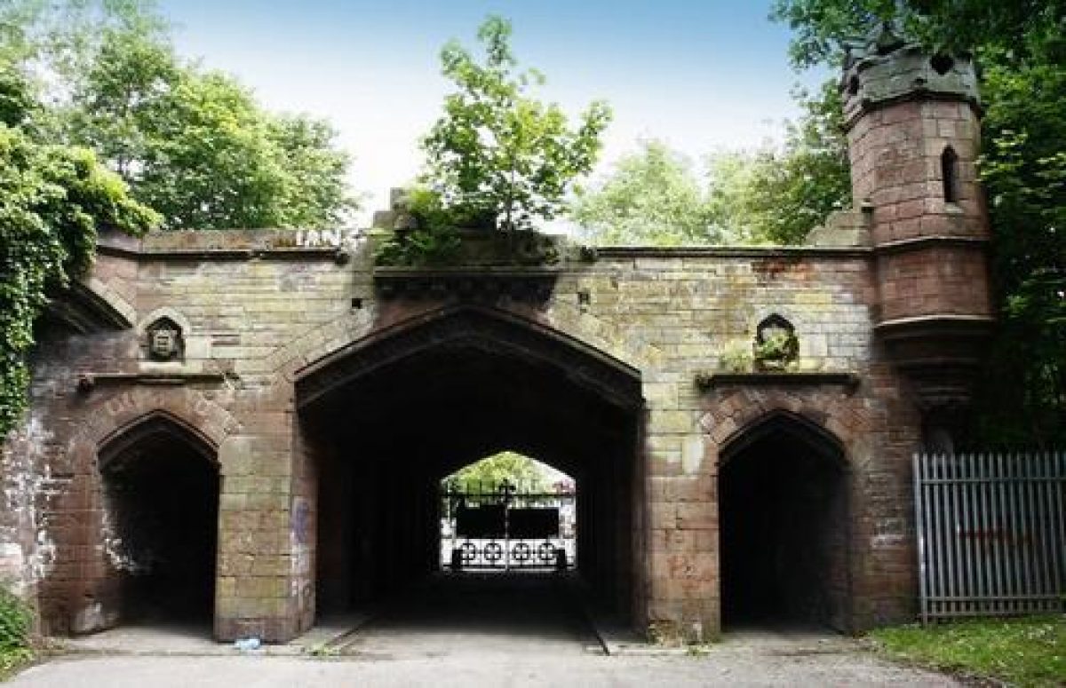
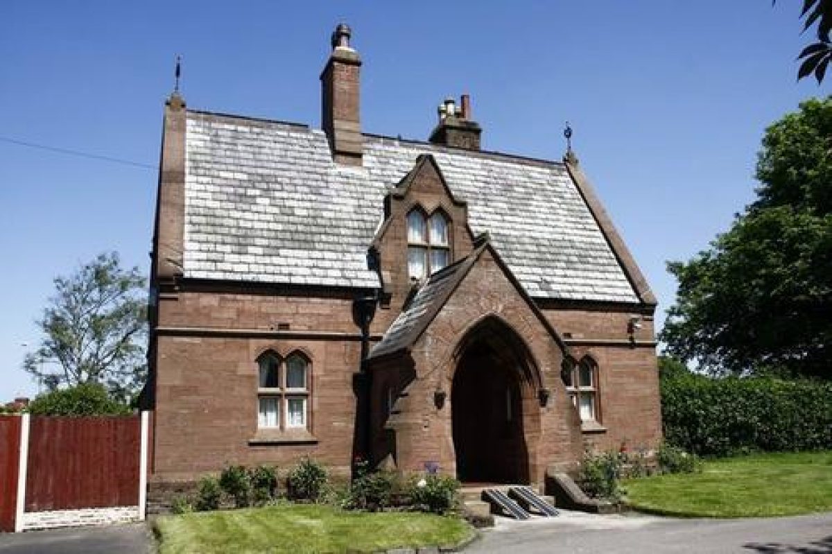
There are four entrances to the cemetery. The main entrance (listed grade II) is situated on the corner of Priory Road and Walton Lane and consists of a pair of stone lodges and a screen with ornate cast-iron gates on either side of a tall clock tower. To the north on Walton Lane is another stone lodge (listed grade II) and there is a third lodge (listed grade II) of similar design on Priory Road. All these buildings are in Gothic Revival style. The entrance at the north-east corner of the site is formed by an elaborate bridge carrying the railway line and has a central arched tunnel flanked by subsidiary tunnels, all with ornate cast-iron gates (listed grade II). This is known as the Cherry Lane entrance after the road with which it connects. A lodge formerly situated at this entrance has been demolished.
There is a separate entrance to the crematorium, also with a lodge, on Priory Road. A former Registrar's Office on Priory Road has its own entrance as does a works yard on Walton Lane.
OTHER LAND
The layout of the cemetery is based on a system of interlocking circular and curved paths arranged about an east/west axial path running between the Cherry Lane entrance and the main entrance. This is crossed by a north/south axial path at a point close to the centre of the site. Although the system of paths is near-symmetrical about these axes, the crossing point, and therefore the central emphasis of the design, is to the north-west of the centre of the site. The north side of the site was designated for Roman Catholic burials, and the south-east side for Nonconformist, with the remainder for Episcopalians or Anglicans. The areas are now treated as interdenominational though the older memorials preserve the distinctions.
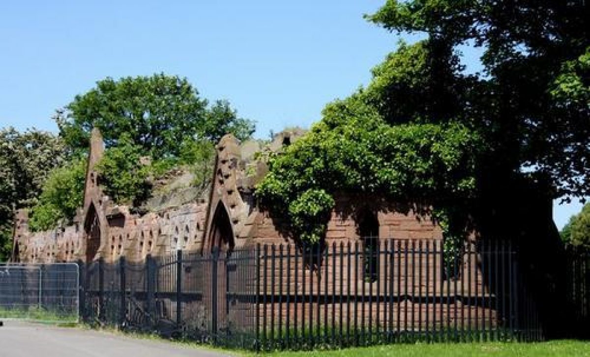
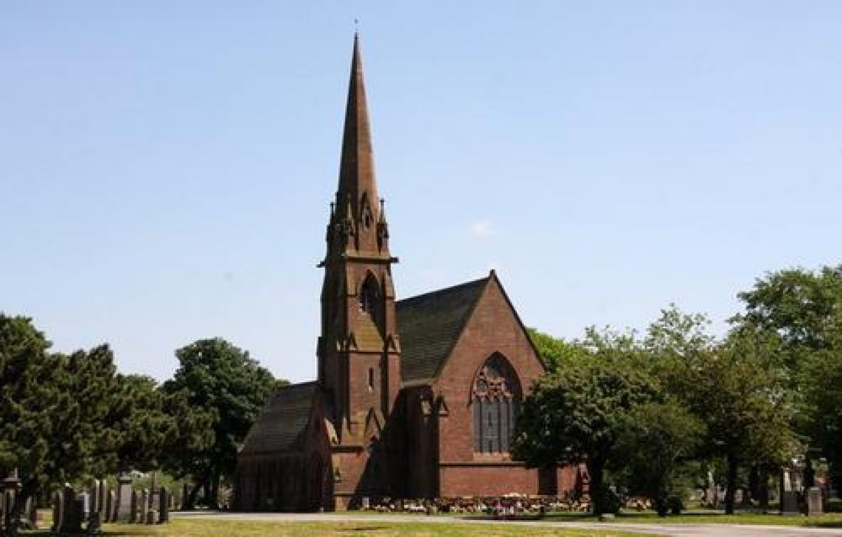
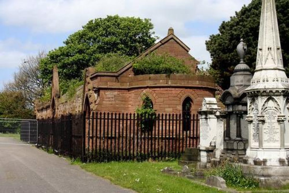
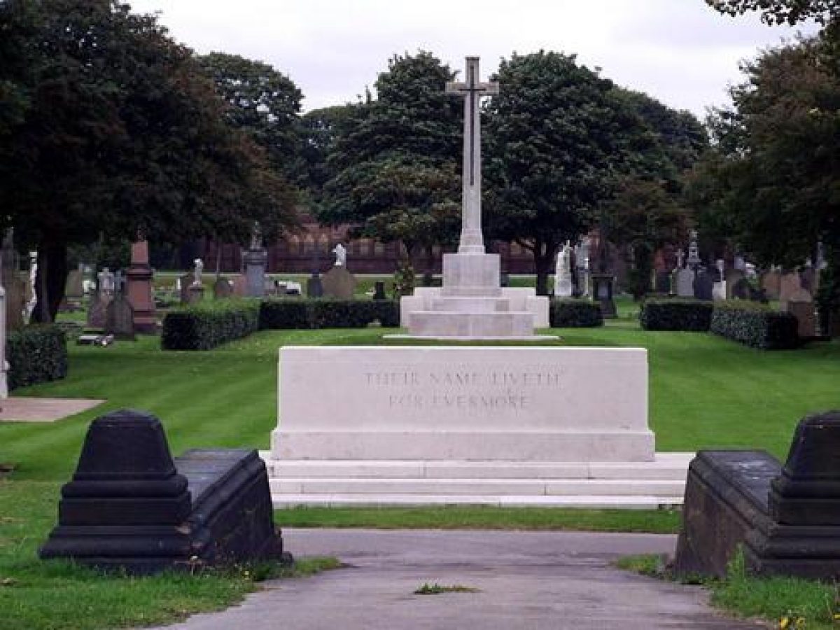
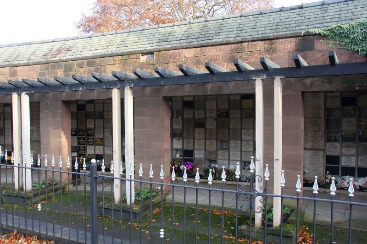
The focus of the site, where the axial paths cross, is a sunken rectangular area with apsidal ends to north and south. Ramps and steps with stone balustrades lead down to this area which has low stone bollards marking the intersections of the paths. The three cemetery chapels were positioned overlooking this feature, at the centre of the north side (Roman Catholic), the east side (Anglican) and the south side (Nonconformist), but only the latter survives (listed grade II). Buildings situated on each side of the site of the Anglican chapel are called the North Catacomb and the South Catacomb respectively (both listed grade II). They are of identical Gothic Revival design with memorial plaques set into blind arcading in the walls. Inside them steps, now blocked, led down to the crypts below.
There are internal views along the axial paths to the clock tower at the main entrance on the western side of the site.
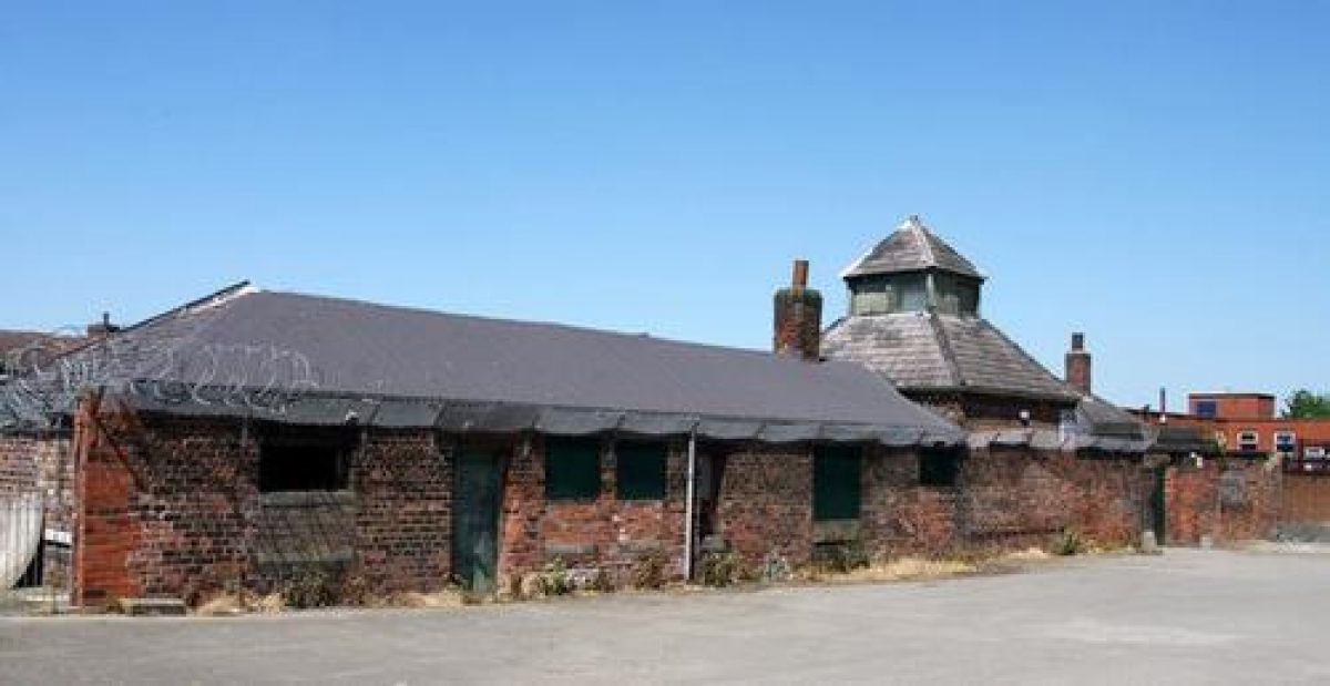
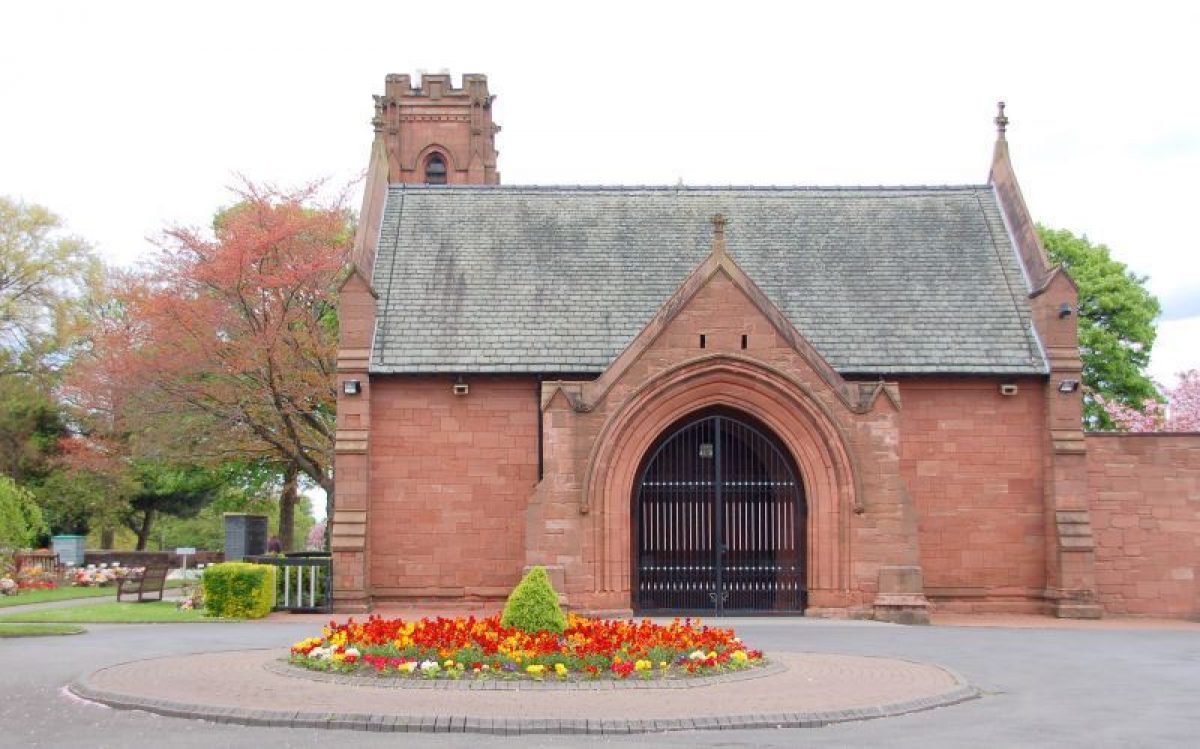
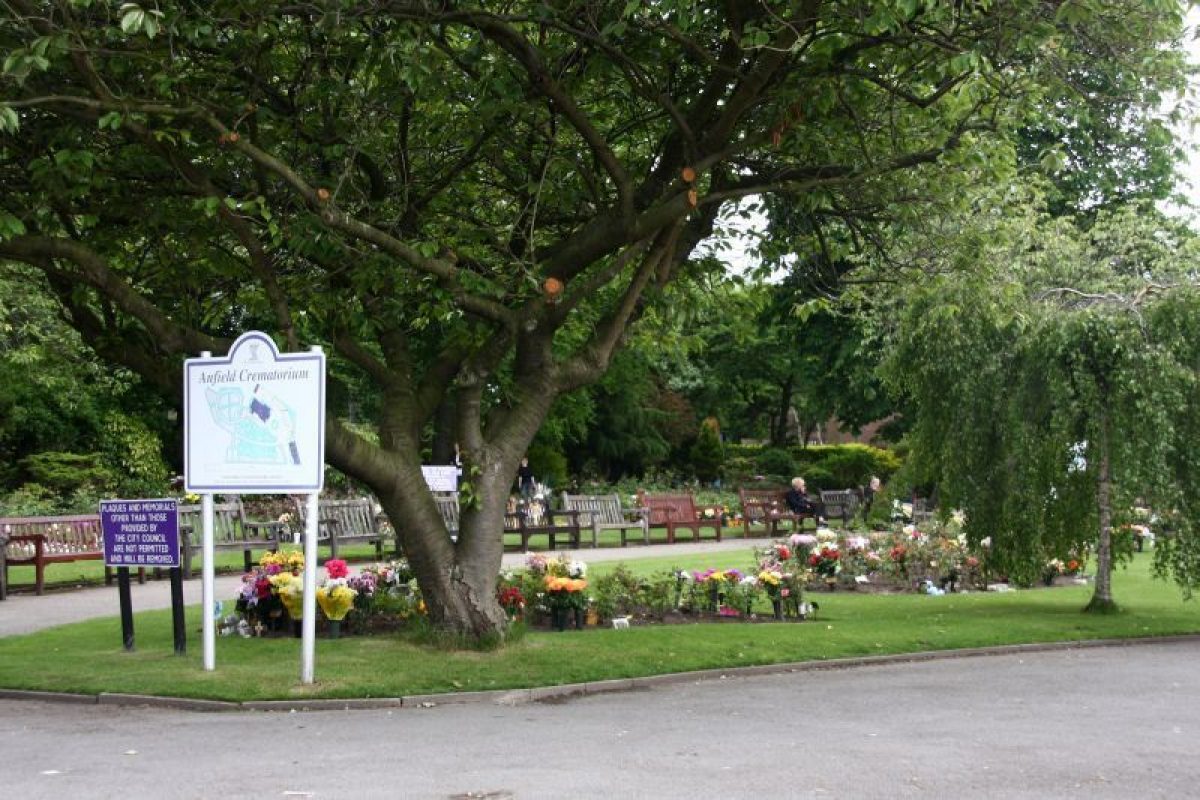
The neo-Perpendicular crematorium buildings (listed grade II) are thought to have been designed by James Rhind (Pevsner 1969) and are a particularly early example of this building type. They are situated in a walled area off Priory Road near the south-east end of the site; the forecourt to the west of the buildings is used as a garden of remembrance. The former Registrar's Office (listed grade II), now used as offices and known as Lansdowne House, is situated on Priory Road and there is a small car park next to it. The works yard consists of a number of buildings around a courtyard near the north-west end of the site, off Walton Lane. Immediately to the north of the yard but outside the site boundary a brick wall encloses a late C20 police station which has encroached into the north-west corner of the cemetery.
REFERENCES
J A Picton, Memorials of Liverpool (1906), pp 414-16
N Pevsner, The Buildings of England: South Lancashire (1969), pp 212-13
C Brooks, Mortal Remains (1989), pp 53-4, 58
MAPS
OS 6" to 1 mile:1st edition surveyed 1845-9, published 1850
Archival items
Typescript historical notes, nd ( Liverpool City Council Planning Department file)
Map of the site, nd (Manager's office, Lansdowne House, Priory Road, Anfield, Liverpool)
REASONS FOR DESIGNATION
Anfield Cemetery is included on the Register of Parks and Gardens of Special Historic Interest at Grade II* for the following principal reasons:
*An outstanding example of an extensive, early High Victorian (1856-63) public cemetery for a provincial city.
*It was designed by a prolific and renowned designer, Edward Kemp, based at nearby Birkenhead Park, who contributed to several other cemeteries including Flaybrick (Birkenhead).
*The extensive layout makes unusual use of a geometric path pattern to enclose sunken central panels, giving subtle relief to an otherwise level site.
*The ensemble of grand buildings by noted Liverpool cemetery architects Lucy & Littler was widely spaced across the site with many forming focal points for the landscape design, included three chapels (two of which have been demolished), four gateways (one including a clock tower) and single and pairs of lodges, two ranges of catacombs, Registrar's office and boundary wall and railings. This was complemented by a 1930s crematorium in similar style. All were built in the rich red local sandstone.
*The two striking free-standing ranges of catacombs are of unusually late date (1856-63) and are used as focal points for axial paths, although these are in poor condition.
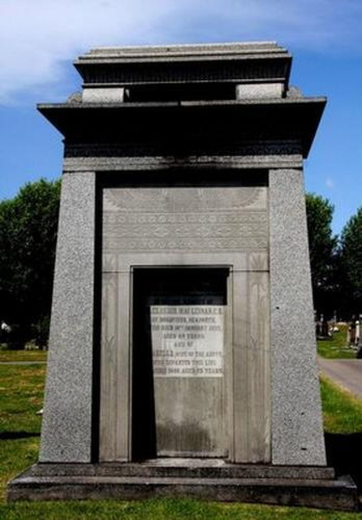
*It has an artistically rich variety of C19 monuments including for many Liverpool worthies.
*The cemetery layout survives relatively intact despite the loss of two of the original three chapels and much C19 planting.
Description written: May 1997
Edited: March 1999
Upgraded: 2009
- Visitor Access, Directions & Contacts
Access contact details
This is a municipal site for general public use.
Directions
On the south-east side of the A5058, north of Liverpool city centre.
- History
The following is from the Register of Parks and Gardens of Special Historic Interest. For the most up-to-date Register entry, please visit the The National Heritage List for England (NHLE):
www.historicengland.org.uk/listing/the-list/
HISTORIC DEVELOPMENT
In 1854 Liverpool Corporation issued an order prohibiting any further burials in the city's overcrowded cemeteries. Land was subsequently obtained so that a new cemetery could be formed. The total cost, including the purchase of the land, came to more than £150,000 and the first interment in Anfield Cemetery, sometimes known as Liverpool Cemetery, took place in 1863. The layout was designed by Edward Kemp (1817-91), though T D Barry won the original competition. A crematorium was built near the southern edge of the site 1894-6. Two of the three original cemetery chapels have been demolished and one of the pair of Priory Road Lodges has also been lost.
Period
- Post Medieval (1540 to 1901)
- Victorian (1837-1901)
- Associated People
- Features & Designations
Designations
The National Heritage List for England: Register of Parks and Gardens
- Reference: GD1991
- Grade: II*
The National Heritage List for England: Listed Building
- Reference: Main entrance, lodges, gates, chapel and catacomb buildings
- Grade: II
Features
- Chapel
- Description: Of the three original chapels, only the Nonconformist chapel survives.
- Path
- Description: The layout of the cemetery is based on a system of interlocking circular and curved paths arranged about an east/west axial path running between the Cherry Lane entrance and the main entrance.
- Gate Lodge
- Description: One of the pair of Priory Road Lodges has been lost.
- Gate
- Description: Ornate cast iron gates
- Entrance
- Description: The main entrance is situated on the corner of Priory Road and Walton Lane and consists of a pair of stone lodges and a screen with ornate cast-iron gates on either side of a tall clock tower.
- Ornamental Bridge
- Description: The entrance at the north-east corner of the site is formed by an elaborate bridge carrying the railway line.
- Garden Feature
- Description: The focus of the site, where the axial paths cross, is a sunken rectangular area with apsidal ends to north and south. The three cemetery chapels were positioned overlooking this feature.
- Building
- Description: Buildings situated on each side of the site of the Anglican chapel are called the North Catacomb and the South Catacomb respectively. They are of identical Gothic Revival design with memorial plaques set into blind arcading in the walls.
- Building
- Description: The neo-Perpendicular crematorium buildings are thought to have been designed by James Rhind.
- Building
- Description: The former Registrar's Office is now used as offices and known as Lansdowne House.
- Cemetery
- Catacombs
- Key Information
Type
Funerary Site
Purpose
Sacred / Ritual / Funerary
Principal Building
Religious Ritual And Funerary
Period
Post Medieval (1540 to 1901)
Survival
Extant
Hectares
44
Open to the public
Yes
- References
References
- {English Heritage Register of Parks and Gardens of Special Historic Interest}, (Swindon: English Heritage, 2008) [on CD-ROM] Historic England Register of Parks and Gardens of Special Historic Interest
- Brooks, C. {Mortal Remains} (Exeter: Wheaton, 1989), pp. 53-4, 58 Mortal Remains: the history and present state of the Victorian and Edwardian cemetery
- Pollard, Richard and others {The Buildings of England: Lancashire: Liverpool and the South-West} (London: Yale University Press, 2006) The Buildings of England: Lancashire: Liverpool and the South-West