Introduction
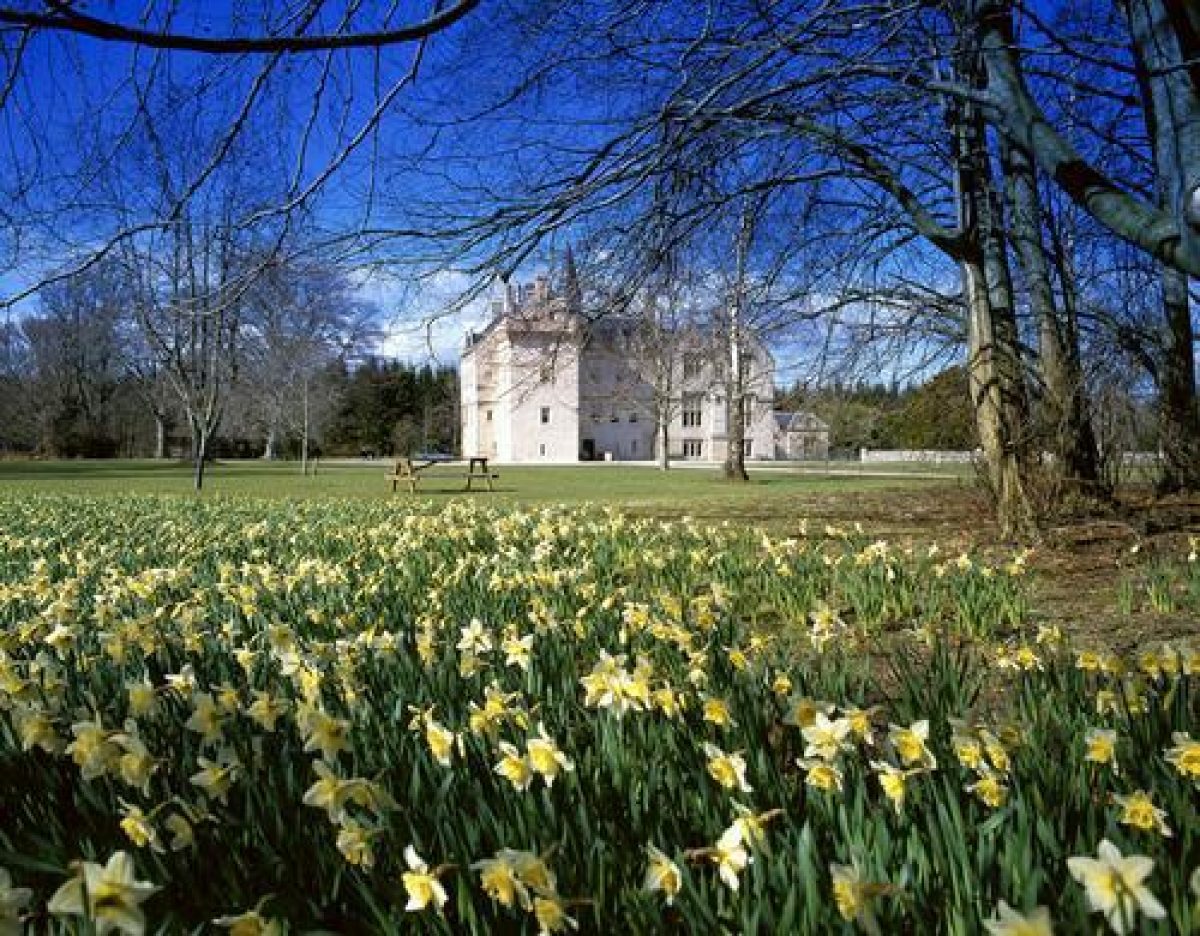
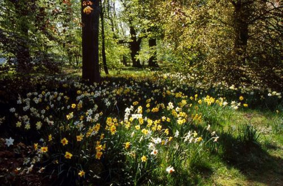
The structure of the original early-18th-century designed landscape with its radiating avenues is well-preserved. The early-18th-century lake survives although it has lost its formal shape. There is an early-18th-century walled garden, a mid-19th-century shubbery and woodland walks with a renowned collection of daffodils that was started in the late-19th century.
http://portal.historic-scotland.gov.uk/hes/web/f?p=PORTAL:DESIGNATIONS:0
Type of Site
The formal character of the early 18th century designed landscape remains evident through surviving features such as parkland, tree avenues and walled garden, framed by enclosing woodland dating from the mid-19th-century, with shrubberies and gardens dating from the early 20th century.
Location and Setting
Brodie Castle is situated on the north side of the A96 approximately 6 miles (10km) east of the town of Nairn. The south-east boundary of the property is formed by the road linking the village of Dyke to the A96, while the main railway line linking Nairn with Elgin forms the south-west boundary. The Castle and its policies lie on the coastal plain which slopes very gently to the Moray Firth in the north. The surrounding landscape is largely agricultural with blocks of woodland scattered throughout it. Brodie station, now disused, lies on the southern boundary. Extensive views are gained from the top of the house to Caithness in the north and to the Monadliath and Grampian mountains in the south. The flat nature of the site and the woodlands which enclose it restrict views to the surrounding landscape from ground- level. The woodlands are significant in the surrounding landscape.
Brodie Castle is situated within 287 acres (116ha) of designed landscape which are enclosed by woodland on all sides. Historically, the designed landscape extended further to the south-west as part of a layout created in the 1730s. The estate was reduced in size c.1755 when some of the land was sold. In 1856, the Highland Railway dissected the 18th century designed landscape and formed a new southern boundary to the policies which remains in effect today. Documentary evidence is provided by General Roy's map of c.1750, a survey plan of c.1770 by George Brown now displayed in the Castle, the 1st edition OS map surveyed between 1868-70 and the 2nd edition OS map of c.1910.
Part of the 1730s design incorporated a straight avenue from the Castle to the south- west, parallel with the present A96. This avenue remains today as far as the Highland Railway although it once continued through Hardmuir Wood. To the north-west, woodland walks were created leading to Macbeth's Hill, where Macbeth is reputed to have seen the witches.
Landscape Components
Architectural Features
Brodie Castle, listed category B, dates from the 16th & 17th centuries. Additions were made c.1824 to the design of William Burn, and further alterations were made in 1846. Station Lodge, East Lodge and West Lodge are now privately owned. The Stables are situated to the west of the Castle. They date from the 18th century and are, at present, in a derelict condition. The NTS intends to restore them. The Head Gardener's House & Garden Bothy in the walled garden have been renovated for use by the NTS for holiday letting.
There are two sundials in the walled garden: one is Victorian, the other earlier, and both have been moved from their original positions. The Rodney Stone, listed B, stands next to the east drive; of Pictish origin, it was discovered while digging the foundations of the present church in the village of Dyke and subsequently erected at Brodie.
Parkland
In the 1770 survey plan, the parkland lies mainly to the south west of the Castle. An additional area, the Cow Park, lay to the north of the Castle beyond the walled garden. The main parkland was divided into three areas, separated by a Grand Avenue, replanted c.1850 with alternate copper and green beech in the shape of a wine-glass which lay on the main south-west axis and enclosed an area known as the Green. To the north lay the Dovecot Park and to the south, Charles Park and the Turnip Park. By c.1870 a sinuous drive, now a footpath, had been laid through this area of the park linking the Castle with West Lodge. Another broad double avenue separates the park with the woodland in the south-east which was a fruit orchard on the 1770's plan. The sinuous drive shown extending along the avenue on this plan had been replaced by 1870 with a straight drive, which returned towards the West Lodge along the southern boundary of the park. The original layout plan indicates few trees in the park, some of which remain today. The clumps of trees indicated on the 1st edition OS map were planted c.1830. Many were lost in the gales of 1953. Species include Scots pine, beech, lime, sweet chestnut and horse chestnut. Some fine specimen trees stand on the lawn to the south of the Castle and were measured by Alan Mitchell in 1984.
Woodland
The woodlands of Brodie Castle enclose the designed landscape. Most have been replanted with conifers, mainly Norway and Sitka spruce, since the 1950s. Broadleaved trees have been planted in the outer fringes. Some original, 18th century beech trees remain in the wood next to the adventure play area. The avenue which ran to the south-west beyond the pond through Hardmuir Wood has gone. The railway dissected Raffpark wood to the south of the pond in 1856, and by 1870 the radiating paths within it also appear to have been lost. The fruit orchard and Cow Park and the wilderness area south of the walled garden have been planted with conifers. Some Monkey puzzle and other ornamental conifers remain in Cow Park. The original radiating avenues and some of the woodland at the east end of the site have been lost.
Water Features
The thermometer-shaped pond was part of the original 1730s layout. It formed a key feature in the view down the avenue to the south-west. By 1870, the formality had been lost by the amalgamation of the main pond with four others along the avenue. The original formal shape can still be seen although it has silted up at the edges. The NTS plans to clear the pond but not to return it to its original formal shape.
The Gardens
An informal shrubbery has replaced the formal garden, established by William Brodie in the mid-19th century. It consisted of a variety of shrubs and conifers, some of which were measured by Alan Mitchell in 1984. The majority of the existing planting was done by Ian Brodie in the late 19th century and early 20th century. It became overgrown after the war. The NTS has cleared much of the overgrowth and new tree planting has begun. Some of the yews, laid out in circles, remain. The base of the gravel paths of the Victorian layout remain although neither this nor the original layout are being used as the basis of the restoration. A tennis court was built on the lawn between the shrubbery and Cathedral Walk in 1958.
Walled Garden
The Walled Garden lies to the north-east of the Castle, as indicated on the survey plan of 1770. The outer walls possibly date from c.1730. Comparison of this plan with the 1st edition OS map of 1870 indicates that the internal layout had been altered, probably during the Victorian renovations. By 1870 two areas had been formed, separated by a yew hedge dividing the functional and aesthetic uses of the garden which is shown more clearly in the 2nd edition OS map of c.1900. The area further from the house was the kitchen garden. The cross paths of the garden have gone since the last war. It is now mainly used for game cover with a small area maintained by the NTS for cut flowers. Only the frame remains of one of the glasshouses. In the area nearest the Castle lies the formal garden. The Cathedral Avenue which extended along the edge of the northern boundary was largely lost in the gales of 1953 but has been replanted recently with lime and horse chestnut specimen trees.
- Visitor Access, Directions & Contacts
Telephone
01309 641700Access contact details
The grounds are open daily all year. Opening times for the castle vary seasonally.
Directions
Brodie Castle is off the A96 four and a half miles west of Forres. It can be reached by Stagecoach Bluebird (01343 544222) and is on National Cycle Route 1. For details see: http://www.nts.org.uk/Property/Brodie-Castle/Getting-there/
Owners
The National Trust for Scotland
- History
The following is from the Historic Environment Scotland Gardens and Designed Landscapes Inventory. For the most up-to-date Inventory entry, please visit the Historic Environment Scotland website:
http://portal.historic-scotland.gov.uk/hes/web/f?p=PORTAL:DESIGNATIONS:0
Reason for Inclusion
A rare example of a relatively intact early 18th-century formal design. The Brodie family has been associated with the castle for more than 700 years and the gardens boast a famous daffodil collection.
Main Phases of Landscape Development
c.1730-50 with embellishments made c.1830 and c.1900.
Site History
The original designed landscape was laid out c.1730-50 with a series of radiating avenues. Little has been overlaid on this and the present structure is similar to the original design, although embellishments where made c.1830 and c.1900.
The name of the family and lands was known, prior to the 16th century, as 'Brothie', which means mire or ditch, and in Saxon, dyke. The latter, which runs to the village of Dyke 0.75 miles to the north-east, may have been the origin of the name of Brodie which was first used by the 10th Laird, Alexander. It is thought that his predecessors were granted the lands of Brodie in return for their loyalty to Malcolm IV c.1160. Alexander built the core of the present house c.1566 after the lands were returned to him, having been confiscated as punishment for his opposition to Mary, Queen of Scots. He commissioned the fine plaster ceilings in the building, which survived the sacking of the house in 1645 by Lord Lewis Gordon. The family sided with the Government during the 1715 rebellion.
Alexander, the 19th Laird was appointed Lord Lyon in 1727. His wife, Mary Sleigh, was responsible for the formal landscape which was laid out between 1730-50. It included a Baroque Garden which has now gone. Alexander died in 1754 leaving substantial debts. His son died 5 years later, at the age of 18, and the estate passed to a cousin, James Brodie of Spynie, the 21st Laird. At that time, there were still considerable debts and the estate was sold to the Earl of Fife, James' brother-in-law. He returned the policies to the family, retaining the bulk of the lands for himself. The heir, James, went to India and amassed a fortune which was partly used to build a Brodie House in Madras. He died prematurely in 1802 and his son, William, succeeded as 22nd Laird in 1824 by which time, much of the detail of the formal scheme had probably been lost. He commissioned William Burn to design substantial alterations to the House but again, the improvements resulted in debts, the work was never completed, and some of the house contents had to be sold.
The family fortunes improved in 1837 when William married Miss Elizabeth Bailley of Redcastle. The Burn additions were remodelled by James Wylson in c.1840. Their grandson Ian Ashley, the 24th Laird, was born in 1868 and succeeded in 1889. He was a keen gardener and established a notable collection of daffodils within the policies. His son, Ninian, the present and 25th Laird of Brodie entered into an agreement with the National Trust for Scotland in 1978 and has retained part of the Castle for his own use.
- Associated People
- Features & Designations
Designations
Historic Environment Scotland An Inventory of Gardens and Designed Landscapes in Scotland
Features
- Castle (featured building)
- Description: Brodie Castle, C16 and C17 is listed category B, dates from the 16th & 17th centuries. c.1824 , and further alterations were made in 1846.
- Earliest Date:
- Lake
- Description: Thermometer-shaped pond, part of the original 1730s layout
- Earliest Date:
- Avenue
- Description: The Great Avenue, part of the early-18th-century design, replanted with beech in 1850 and underplanted with lime in the late-20th century.
- Artefact
- Description: A Pictish stone known as the Rodney Stone.
- Stables
- Description: Stables a date from the 18th century and are in a derelict condition
- House
- Description: The Head Gardener's House & Garden Bothy in the walled garden
- Walled Garden
- Description: The Walled Garden lies to the north-east of the Castle,The outer walls possibly date from c.1730.
- Woodland
- Description: The woodlands enclose the designed landscape. Most replanted with conifers since the 1950s. Broadleaved trees have been planted in the outer fringes. Some original, 18th century beech trees remain
- Parkland
- Key Information
Type
Estate
Purpose
Ornamental
Principal Building
Domestic / Residential
Survival
Extant
Hectares
111.7
Open to the public
Yes
- References
References
- Historic Scotland {Historic Scotland An Inventory of Gardens and Designed Landscapes} Historic Environment Scotland Gardens & Designed Landscapes Inventory
Contributors
Historic Scotland
- Related Documents
-
CLS 1/923
Historic Landscape Survey - Digital copy
Peter McGowan Associates - 2014
-
CLS 1/923