Introduction
Queen's Park, Bolton, is a public park designed by William Henderson and opened in 1866. Although many of the built structures have been lost, most of the principal design elements have survived. The park covers 22 hectares.
Terrain
The site slopes down to the River Croal from the north.Queens Park is a public park. It was originally called Bolton Park. It was the second of Bolton's public parks, created on meadow and pasture land between Chorley New Road and Spa Road. The scheme for the park had been included in the Bolton Improvement Act of 1864. Land for the park was purchased from the Earl of Bradford and the cost of enclosure and planting was estimated to be about £90,000. The park was opened in 1864.
The site is roughly circular, with an entrance lodge and main entrance from Chorley New Road. The River Croal is to the south and west of the site and there are a number of irregularly shaped ponds or lakes as a feature of the site. There is a central walk with pavilion, and a system of interconnecting straight and serpentine walks around the site. The park included a museum in 1895.
The following is from the Register of Parks and Gardens of Special Historic Interest. For the most up-to-date Register entry, please visit the The National Heritage List for England (NHLE):
www.historicengland.org.uk/listing/the-list
A public park designed by William Henderson and opened in 1866 which, although many of the built structures have been lost, retains most of the principal design elements as shown on a map of 1882.
DESCRIPTION
LOCATION, AREA, BOUNDARIES, LANDFORM, SETTING
Queen's Park is situated c 0.7km north-west of Bolton town centre in an area which is residential on the north and west sides. To the east is the site of Bolton Royal Infirmary (demolished) and there are playing fields and a gasworks to the south. The boundaries are formed by Chorley New Road to the north, Westgate Avenue and private gardens backing from Park Road to the west, Park Road and the River Croal to the south and the perimeter of the former hospital grounds and private dwellings to the east. The c 22ha site slopes down to the River Croal from the north.
ENTRANCES AND APPROACHES
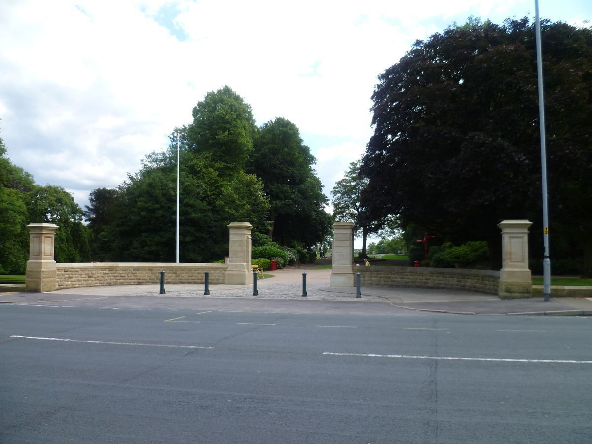
There are two principal entrances to the park, one on Chorley New Road shown in an early C20 photograph with a lodge with gates and gate piers, and also on the 1882 OS map when the boundary with the road was sheltered by trees. These entrance structures were demolished in the mid to late C20. On the south-west side there is an entrance with a lodge and stone gate piers with splayed flanking walls surmounted by railings on Park Road. There are various other informal entrances to the park including one at the south-east corner via a footbridge over the Croal.
PRINCIPAL BUILDING
The principal building was a large arcaded pavilion situated in the centre of the park at the centre of an axial terraced walk. This was demolished during the mid C20 and was replaced by a building positioned a few metres to the north and east, off the focus of the axis, which has also been demolished (1998). Another principal building was the Chadwick Museum situated in the south-west corner of the park. This was also demolished during the mid C20.
GARDENS AND PLEASURE GROUNDS
The park consists of a formal core surrounded by less formal areas of woodland, grassland and lakes. A roughly oval path encloses the more formal inner area and connects with sinuous paths leading through the remainder of the site.
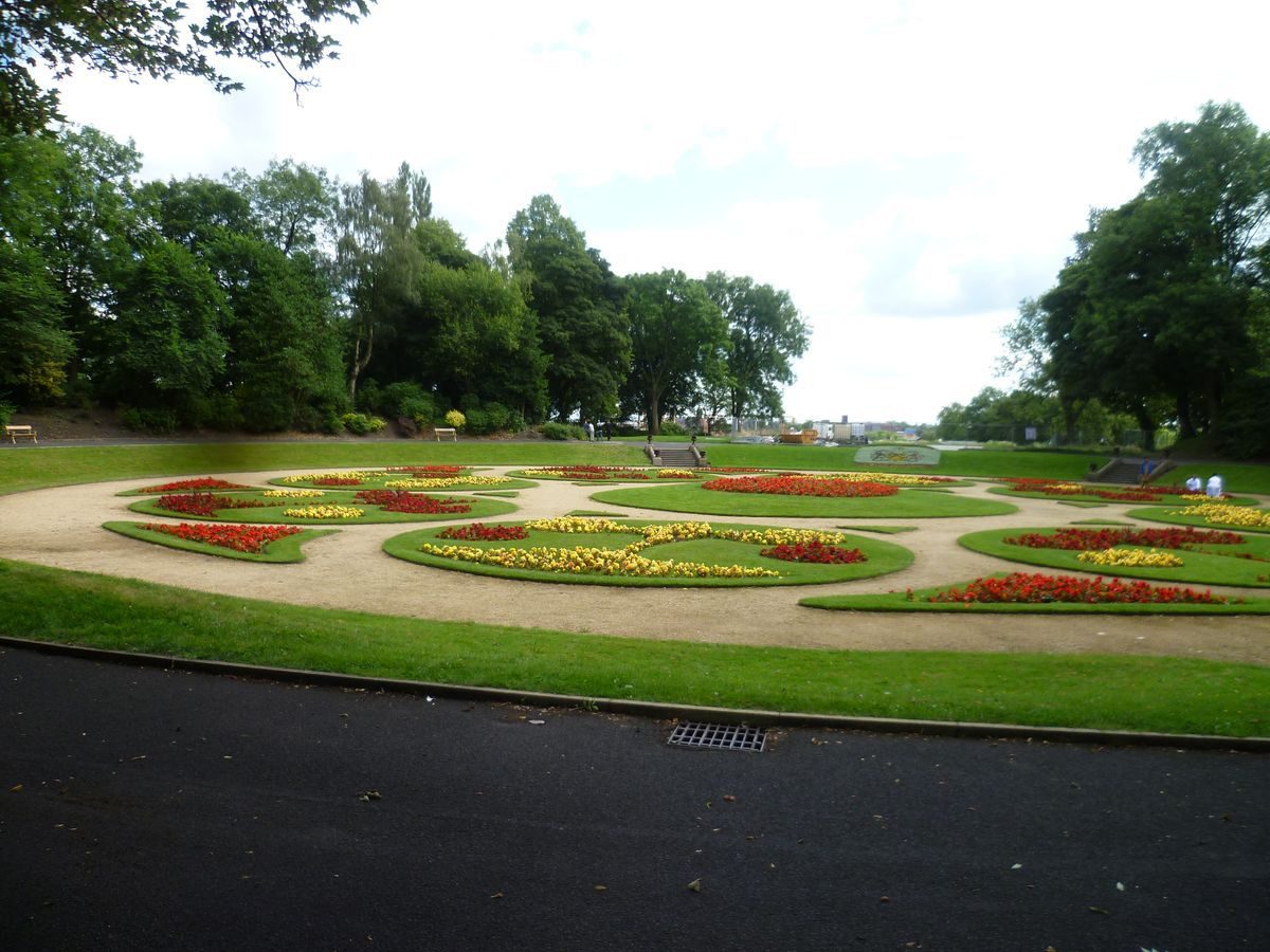
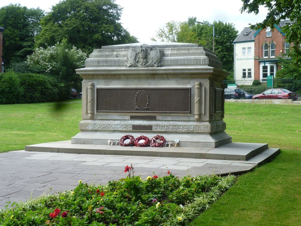
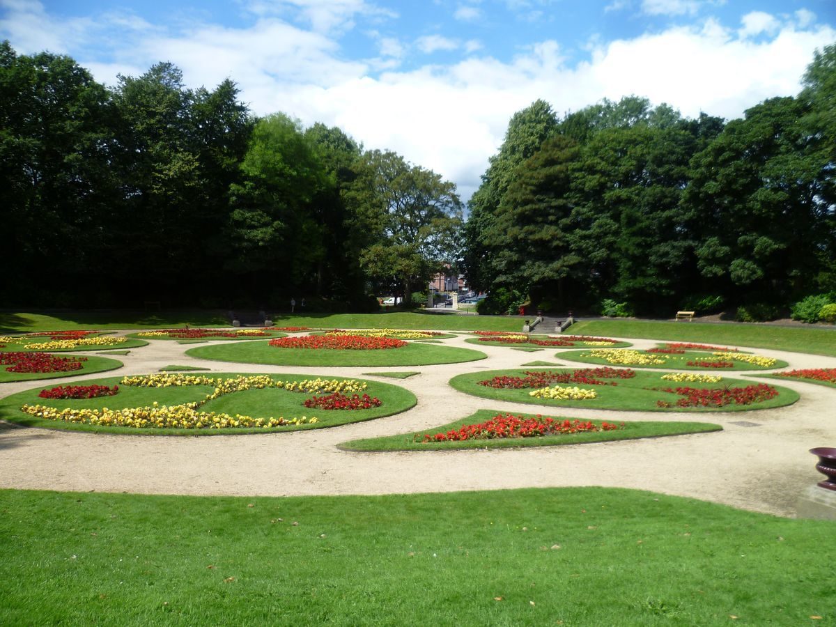
The Chorley New Road entrance leads to lawns immediately south of the road, where a Cenotaph is situated c 75m south-west of the entrance. A path leads south from the entrance between elongated rectangular beds, as shown on the 1882 map, to a sunken circular parterre with a system of circular beds, laid out as shown on the 1882 map, reached by sets of stone steps leading down from a circular perimeter path. At the south end of the garden, set into the slope between sets of steps, the bank is planted with mass bedding to form the name of Bolton's current mayor, following a tradition which began when the park opened.
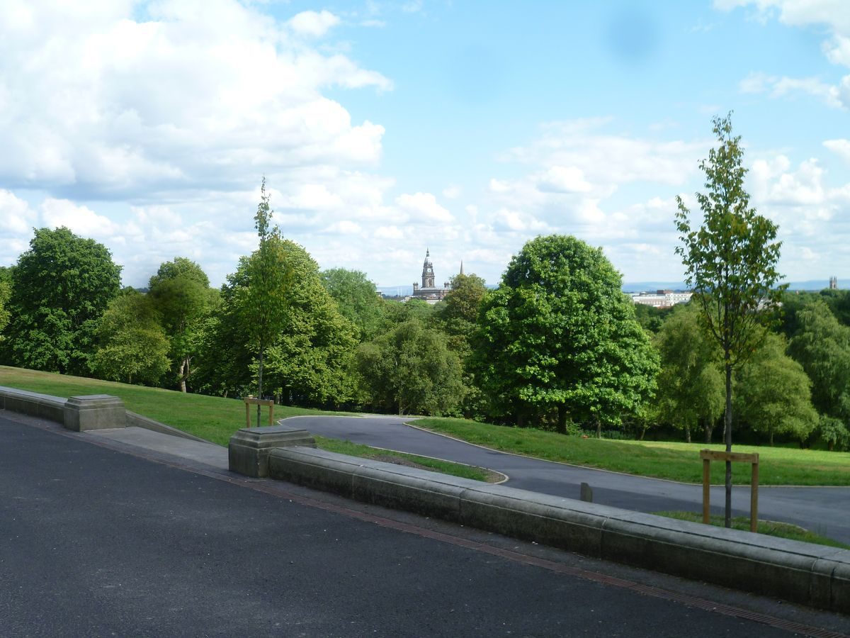
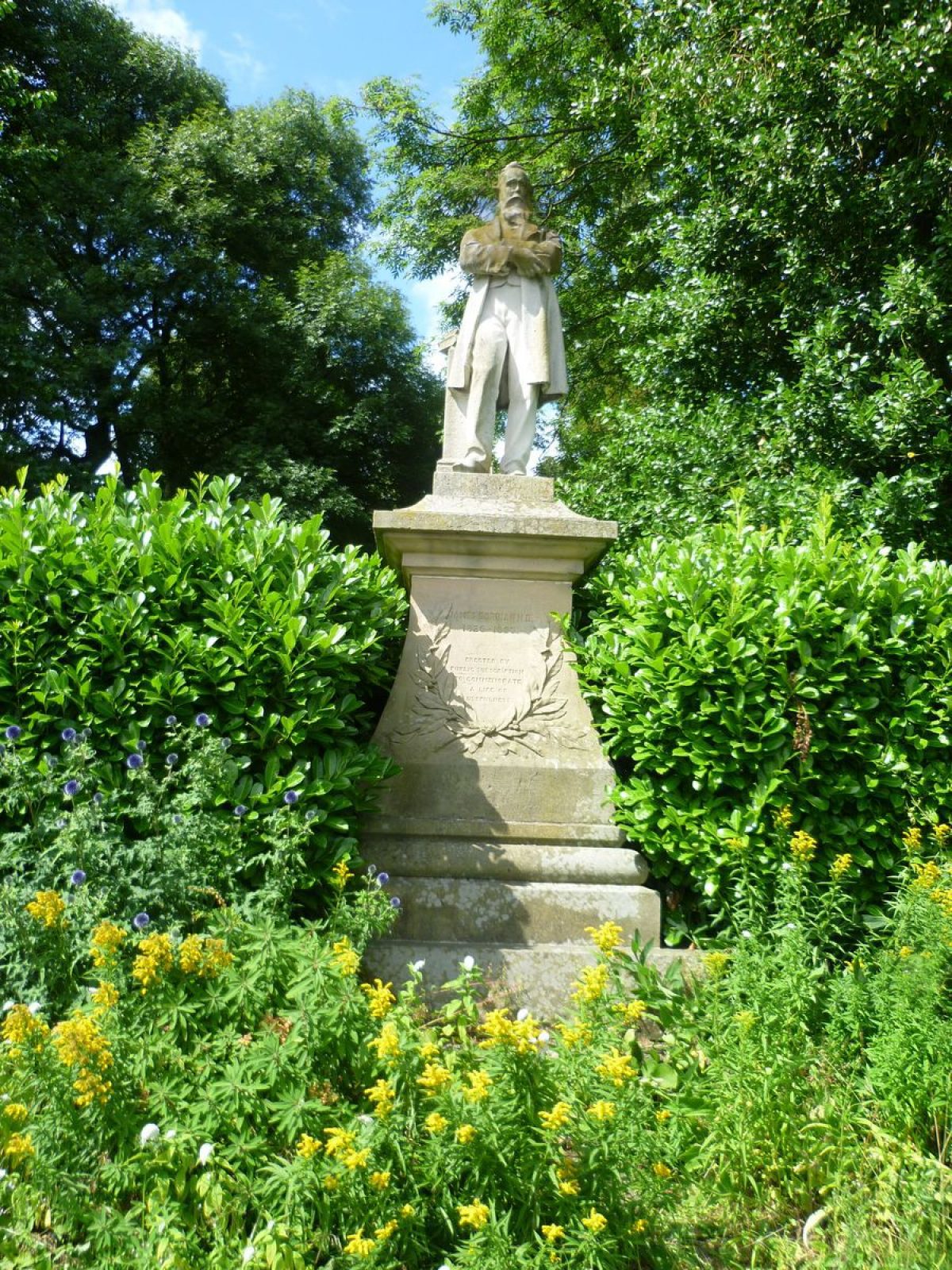
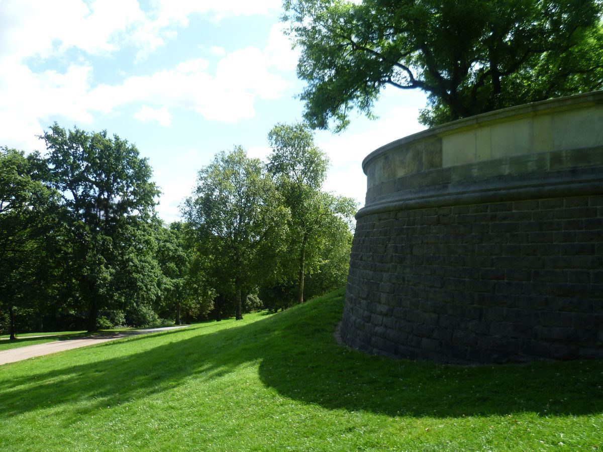
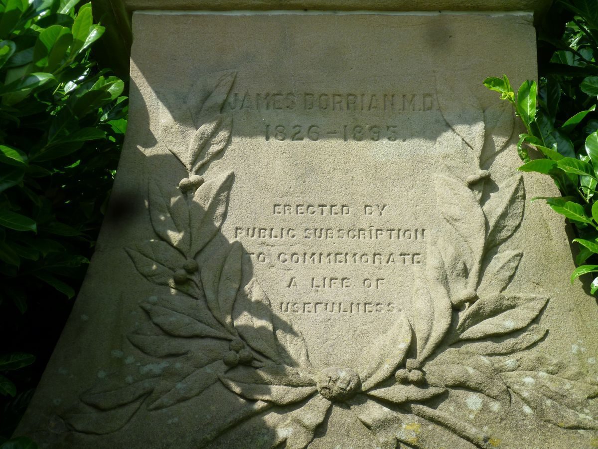
A path leads south from the formal garden to an area of informal beds which was the site of a bandstand shown on the 1893 OS map but not on that of 1927/8. The path continues to a terraced walk running east/west which gives views over falling ground to the south and east. The walk is backed (on the north side) by beds and a shrubbery, and there are three statues (all listed grade II) on tall plinths positioned within the beds. From west to east they represent: J T Fielding, erected in 1896; Benjamin Disraeli in Garter robes, shown on the 1882 map; and James Dorrian, MP, shown on the 1907/8 OS map. An early C20 photograph shows the statues on a grassed bank backed by a shrubbery. The east end of the walk terminates with a semicircular bastion which acts as a viewing point from which Bolton?s Town Hall (1866-73, listed grade II) and other buildings are partially visible through a screen of mature trees. This view is shown on a photograph of c 1910. At the west end of the walk steps lead down to connect with curving paths around the site.
In the centre of the walk stone steps link with an axial path running southwards down a grassed slope. The path is shown as an avenue on the 1882 and later maps and it has been partially replanted in the late C20. At the south end of the path more stone steps lead down to a circular flower bed with a stone kerb which was the site of a fountain shown on maps up until 1907/8 and on early C20 photographs. These photographs show the (demolished) arcaded pavilion at the top of the slope forming a terminus to the view up the avenue.
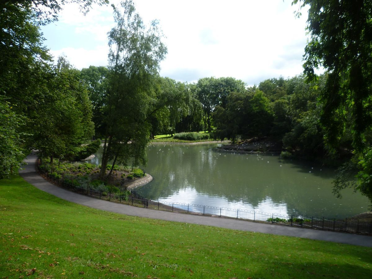
The west side of the park consists of curving walks leading between banks planted with trees. In the north-west corner of the park is the infilled site of a small serpentine lake, shown on the 1882 map and the 1927/8 OS, which connected with a second lake of serpentine shape, still extant, which has the remains of a cascade at its west end leading to a larger lake with two islands and an irregular shoreline. This was connected by a culverted stream to a series of three more lakes and ponds, all with irregular outlines, curving around the western and southern sides of the site, which are shown on the 1882 map and the 1927/8 OS map and have since been filled in. Immediately south of the west end of the terraced walk there is an area with tiered seating set into the slope which is shown on the 1927/8 OS map but not on that of 1907/8. This was accompanied by a bandstand, shown in an early C20 photograph, which was situated at the base of the slope and divided from the seating by one of the smaller (infilled) lakes.
The east side of the park has a system of curved walks through banks planted with trees, as on the west side, but the planting is not as dense and there are areas of open grassland. An area c100m north-east of the former cafe is shown as tennis courts on the 1927/8 OS map and is now (1998) in use as tennis courts and as a car park. Some 70m east of this is a late C20 bowling green with a pavilion at its north end.
REFERENCES
N Pevsner, The Buildings of England: South Lancashire (1969), p 82
H Conway, People's Parks (1991), p 230
A Survey of Historic Parks and Gardens in Greater Manchester: Bolton, (Greater Manchester Archaeological Unit and Centre for the Conservation of
Historic Parks and Gardens, IoAAS, University of York 19??, p 25)
J Roberts, Greater Manchester, (English Heritage Register Review Exercise 1994)
Maps
Map of Bolton, 1882
OS 6" to 1 mile: 1927/8 edition
OS 25" to 1 mile: 2nd edition published 1893; 1907/8 edition
Archival items
Collection of early 20th-century photographs held by Bolton Metro Landscape Section
Description amended: September 1998Edited: October 1999
- Visitor Access, Directions & Contacts
Telephone
441204336632Access contact details
This is a municipal park, open daily for general public use. Please see: http://www.bolton.gov.uk/website/pages/Parksinformation.aspx
Directions
The site is north-west of Bolton town centre.
Owners
Bolton Council
The Town Hall, Victoria Square, Bolton, BL1 1RU
- History
The following is from the Register of Parks and Gardens of Special Historic Interest. For the most up-to-date Register entry, please visit the The National Heritage List for England (NHLE):
www.historicengland.org.uk/listing/the-list
HISTORIC DEVELOPMENT
The park was created from meadow and pasture land which was purchased from the Earl of Bradford under a scheme which was included in the Bolton Improvement Act of 1864. The cost of enclosure and planting was estimated to be about £90,000. The park opened in 1866 and the executed design is shown on a map of 1882.
Period
Victorian (1837-1901)
- Features & Designations
Designations
The National Heritage List for England: Register of Parks and Gardens
- Reference: GD4048
- Grade: II
Features
- Lake
- Pond
- Statue
- Garden Terrace
- Flower Bed
- Pavilion
- Walk
- Description: There is a central walk with pavilion, and a system of interconnecting straight and serpentine walks around the site.
- River
- Description: The River Croal is to the south and west of the site.
- Rose Garden
- Key Information
Type
Park
Purpose
Recreational/sport
Principal Building
Parks, Gardens And Urban Spaces
Period
Victorian (1837-1901)
Survival
Extant
Hectares
22
Open to the public
Yes
Civil Parish
Horwich
- References
References
- {English Heritage Register of Parks and Gardens of Special Historic Interest}, (Swindon: English Heritage, 2008) [on CD-ROM] Historic England Register of Parks and Gardens of Special Historic Interest
- Conway, H., {People's Parks: The Design and Development of Victorian Parks} (Cambridge: Cambridge University Press, 1991), p. 230 People's Parks: The Design and Development of Victorian Parks in Britain
- University of Manchester and University of York, {A Survey of Historic Parks and Gardens in Greater Manchester}, York, 1994 A Survey of Historic Parks and Gardens in Greater Manchester
- Hartwell, Clare and others {The Buildings of England: Lancashire : Manchester and the South-East} (London: Yale University Press, 2004) The Buildings of England: Lancashire : Manchester and the South-East
Contributors
Lancashire Gardens Trust
Greater Manchester Archaeological Unit